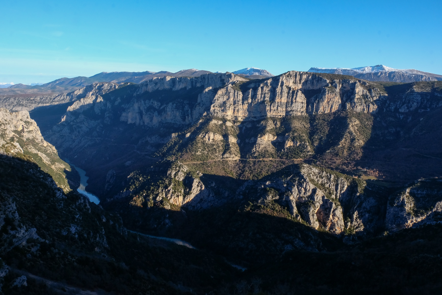
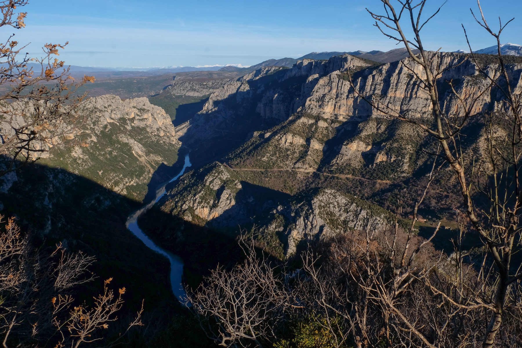
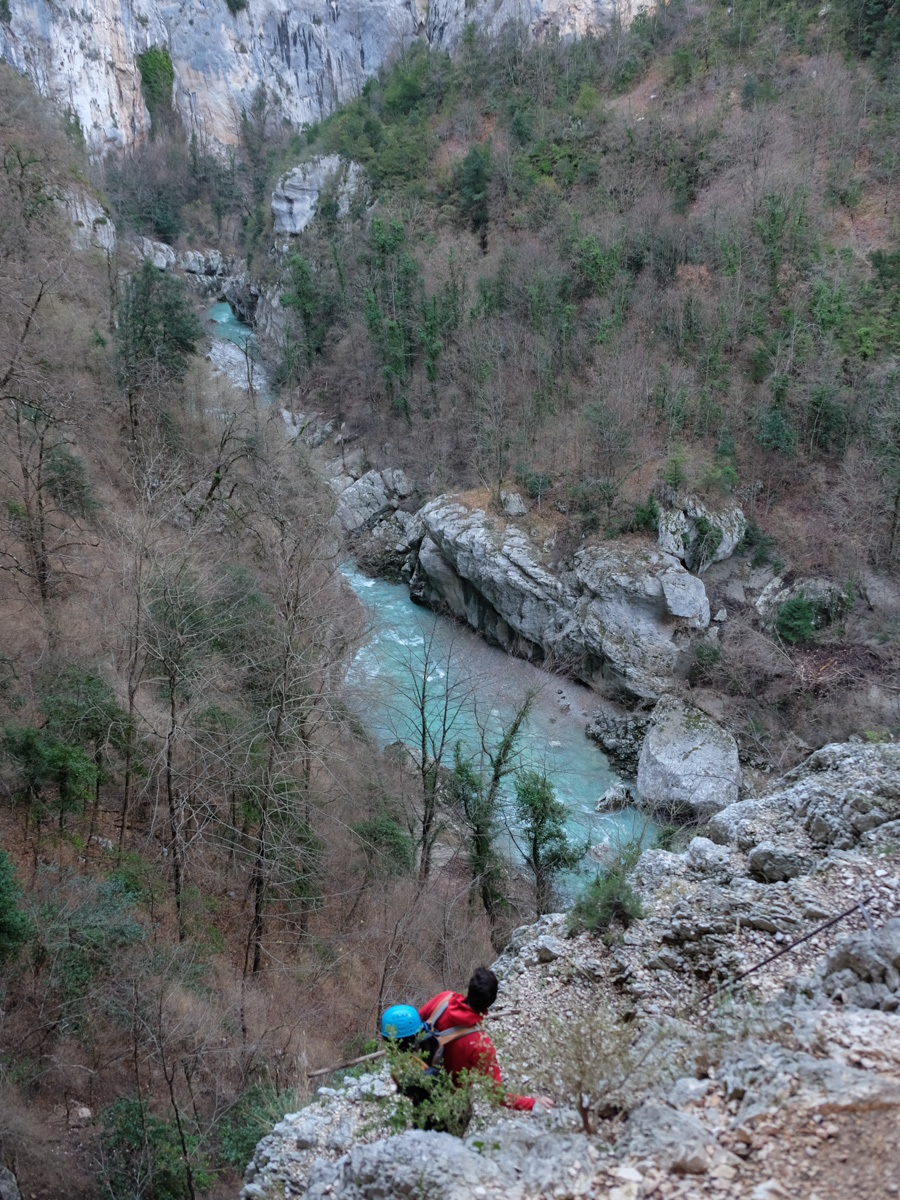
Diving into the heart of the Gorges du Verdon, a little above Lac de Sainte Croix, we follow the Imbut trail to the narrow confines of Baou Beni. Sumptuous scenery from the crests before discovering the wild atmosphere of the canyon and its exceptional limestone cliffs, so dear to Patrick Edlinger. The climb back up via the Vidal trail takes you out of the depths of the gorge on an aerial path carved into the rock and equipped with metal bars. It's a beautiful, demanding hike, the difficulty of which lies mainly in the numerous exposed aerial passages. You should also check the weather conditions, as sudden rises in water levels can make the route very dangerous. All in all, an ideal way to discover the Verdon Gorge.
Technical summary
Type ✦ Equipped hike
Location ✦ Aiguines
Region ✦ Gorges du Verdon, Var
Country ✦ France
Length ✦ 9,5kms
Vertical drop ✦ 650m
Difficulty ✦ D
Duration ✦ 5h to 5h30
Interest ✦ ★★★
Access to the place
Go to Aiguines, just above Les Salles-sur-Verdon. Continue up the D71, which joins the ridges on the south side of the Verdon. Once past the lookout point, follow the road for a short while until you reach the Hôtel des Cavaliers parking lot.
Itinerary description
Hiking to the start 2'
From the parking lot, walk back along the road to the west and turn right to find the starting path in the woods. Information panels at the start.
Course 4h à 4h30
The itinerary takes in several marked trails. No technical difficulties, but many equipped passages, including the aerial and exposed start of the Vidal trail. The danger can come from a sudden rise in the water level of the Verdon, over several meters. Avoid periods of high water or thunderstorms.
Ideally, you should wear a helmet to protect you from falling rocks. For maximum safety, bring a harness and lanyard to protect yourself on equipped and exposed passages.
On the return trip to Baou Beni, there are a few climbing or de-escalation steps in a chaos of boulders, requiring a little technical skill. This part can be avoided.
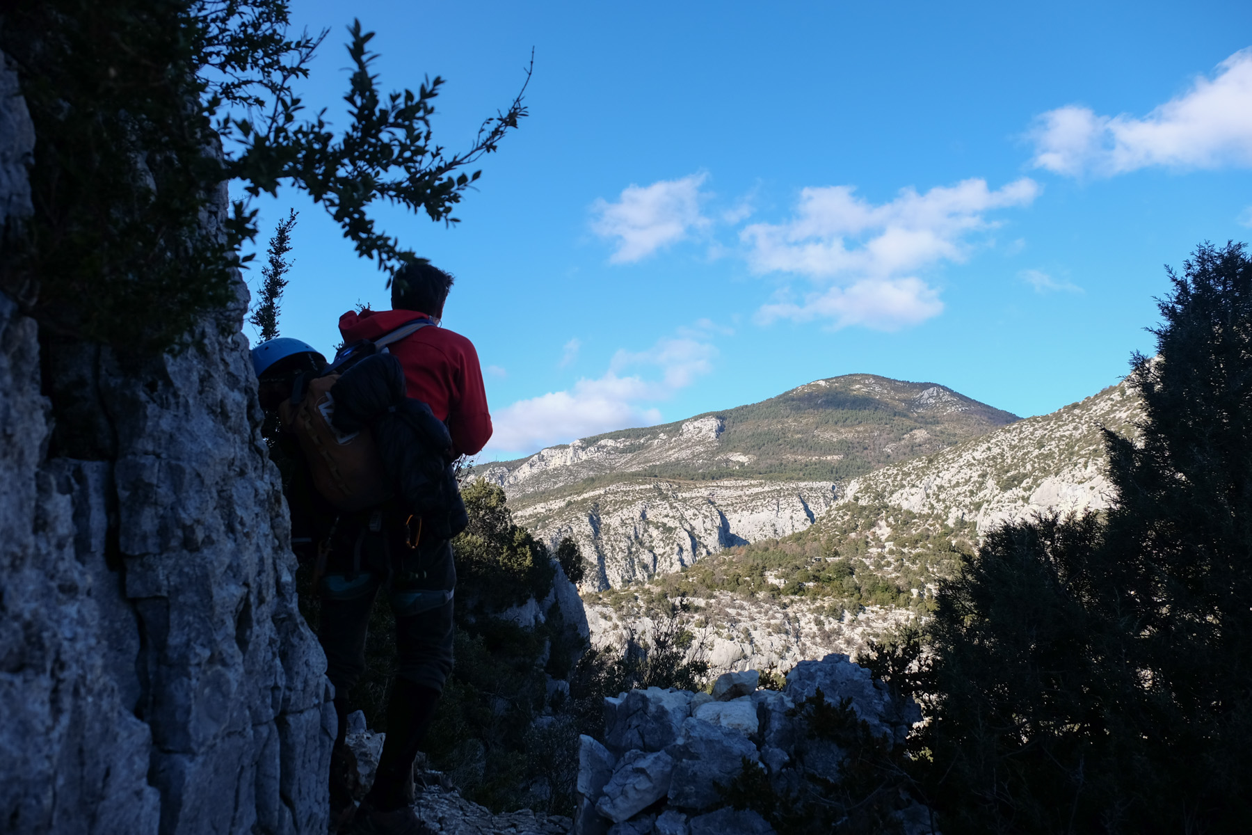
Part 1: La paroi des Cavaliers (30′)
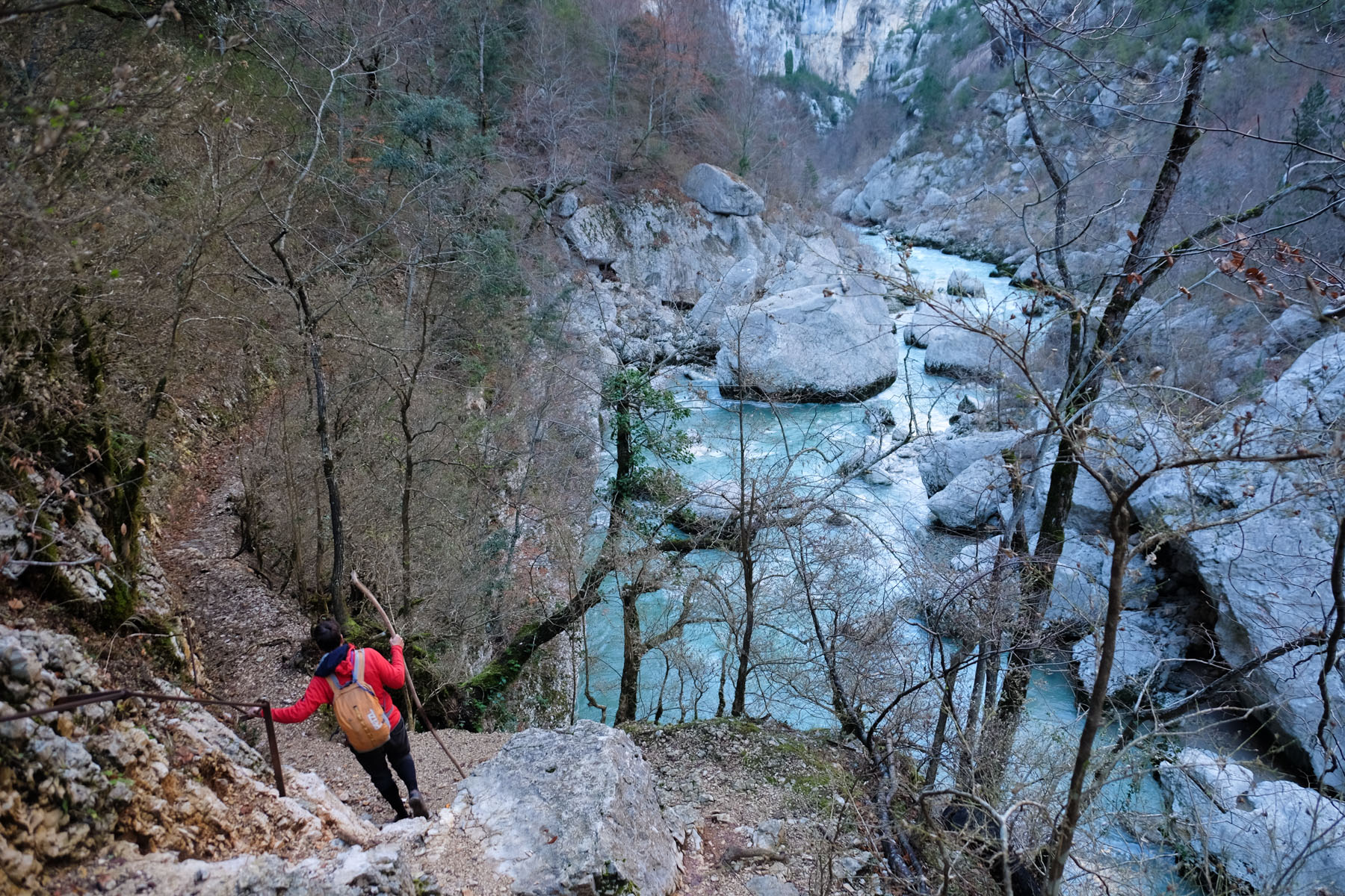
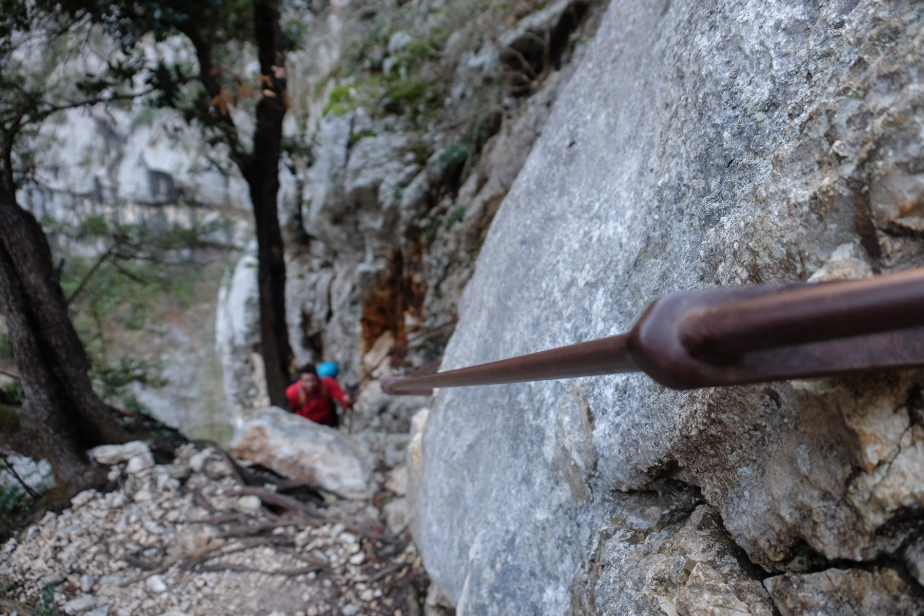
The GR 99 path soon descends steeply into the gorge, with a few passages equipped with metal bars. The polished rock is slippery, even more so in wet weather. At the bottom, at the Verdon, go left to reach the Estellier footbridge fairly quickly.
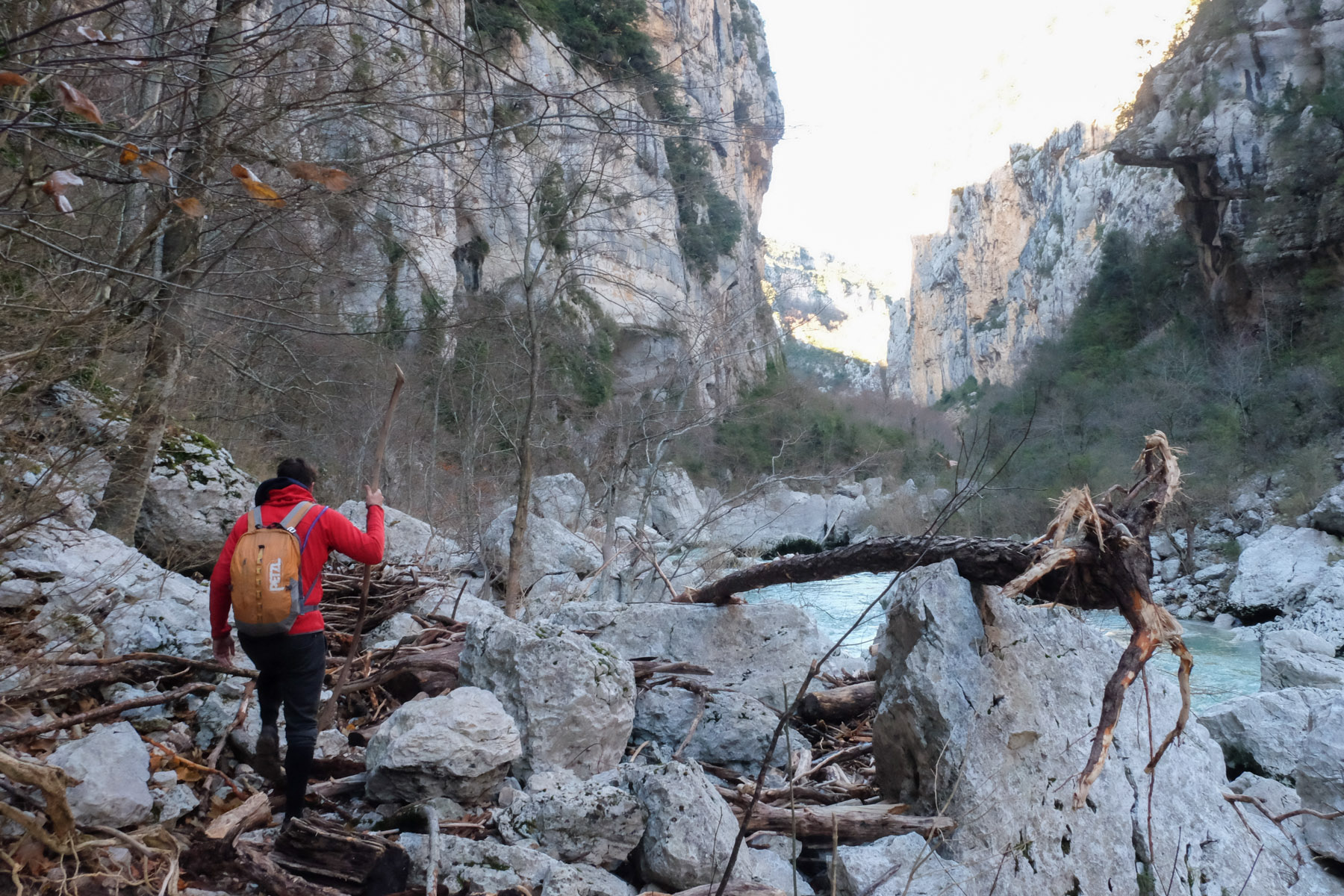
Part 2: The Imbut trail (1h30)
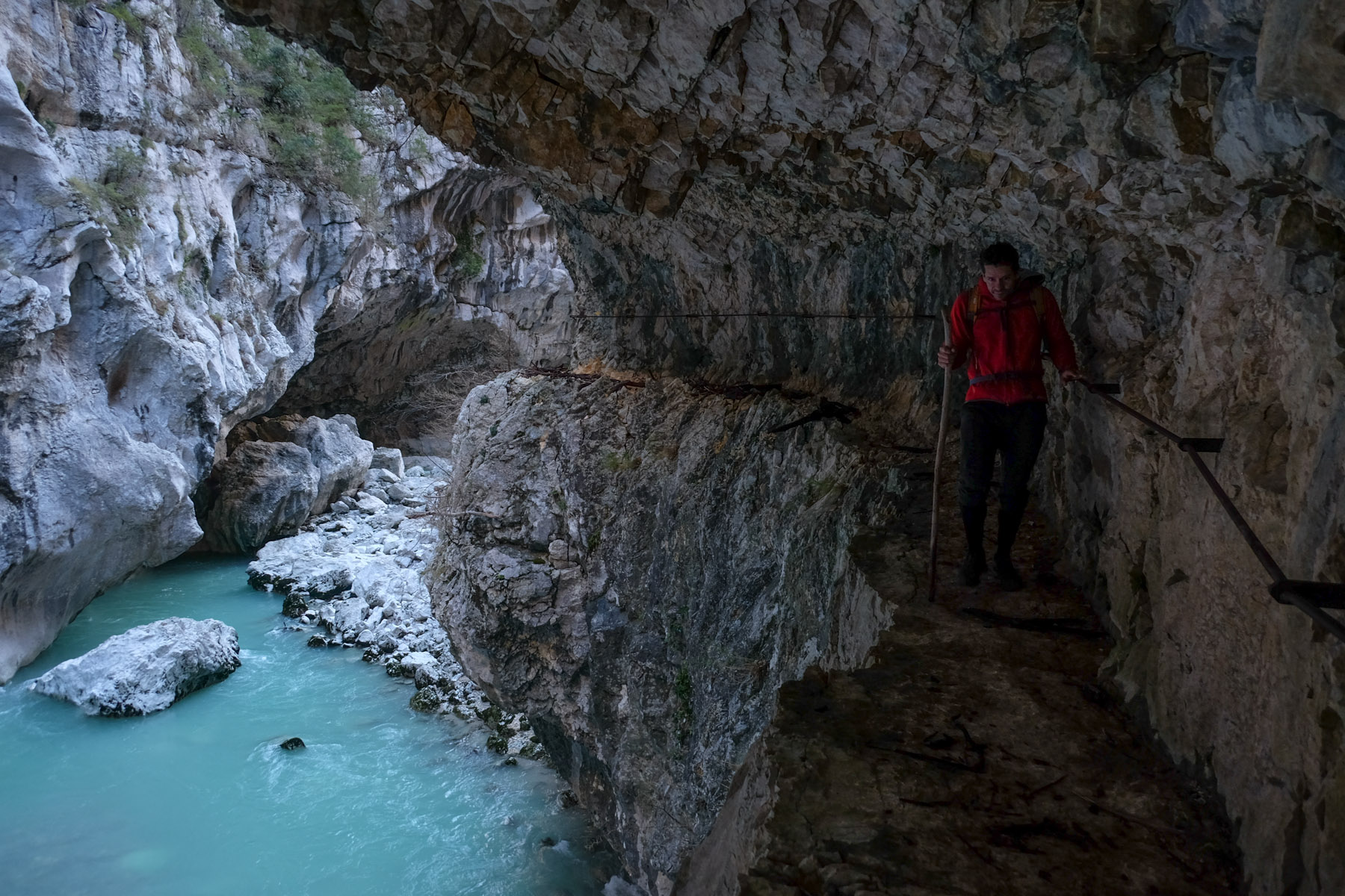
Stay on the left bank of the Verdon and follow the narrow path along the river for a long stretch. In places, the path climbs a little to avoid an obstacle before descending to the water's edge. Along the way, there are a number of equipped passages: ladders, staircases, ledges with safety bars. Nothing difficult, but a few narrow passages require vigilance to avoid ending up in the waters of the Verdon.
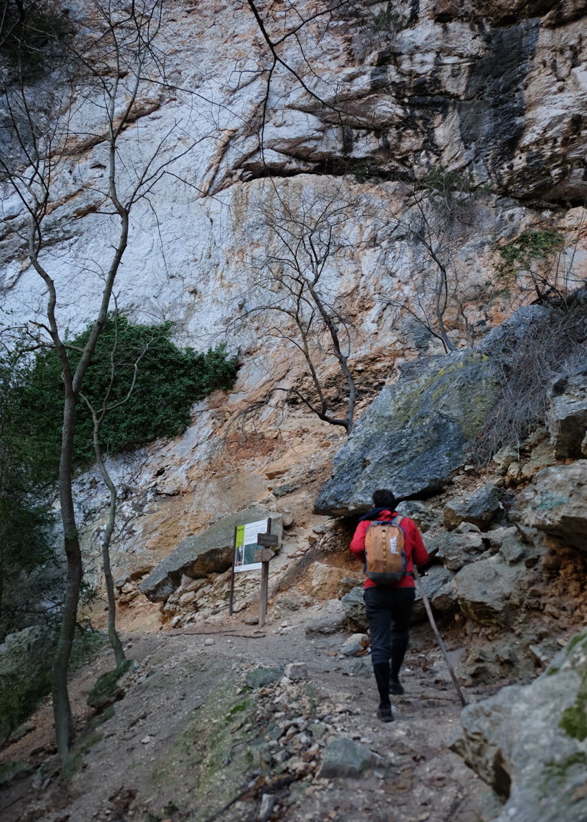
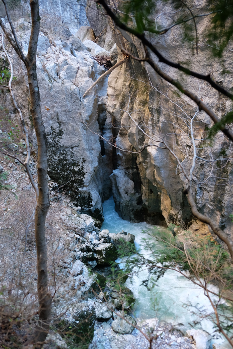
In the final section, the canyon narrows to form the Styx, a narrow limestone gorge carved above the turquoise waters of the Verdon. Continue on, passing new equipped passages including 2 ledges carved out of the cliff, before climbing slightly to reach the start of the Vidal trail. Information panel at this point.
Part 3: Baou Beni (1h to 1h30)
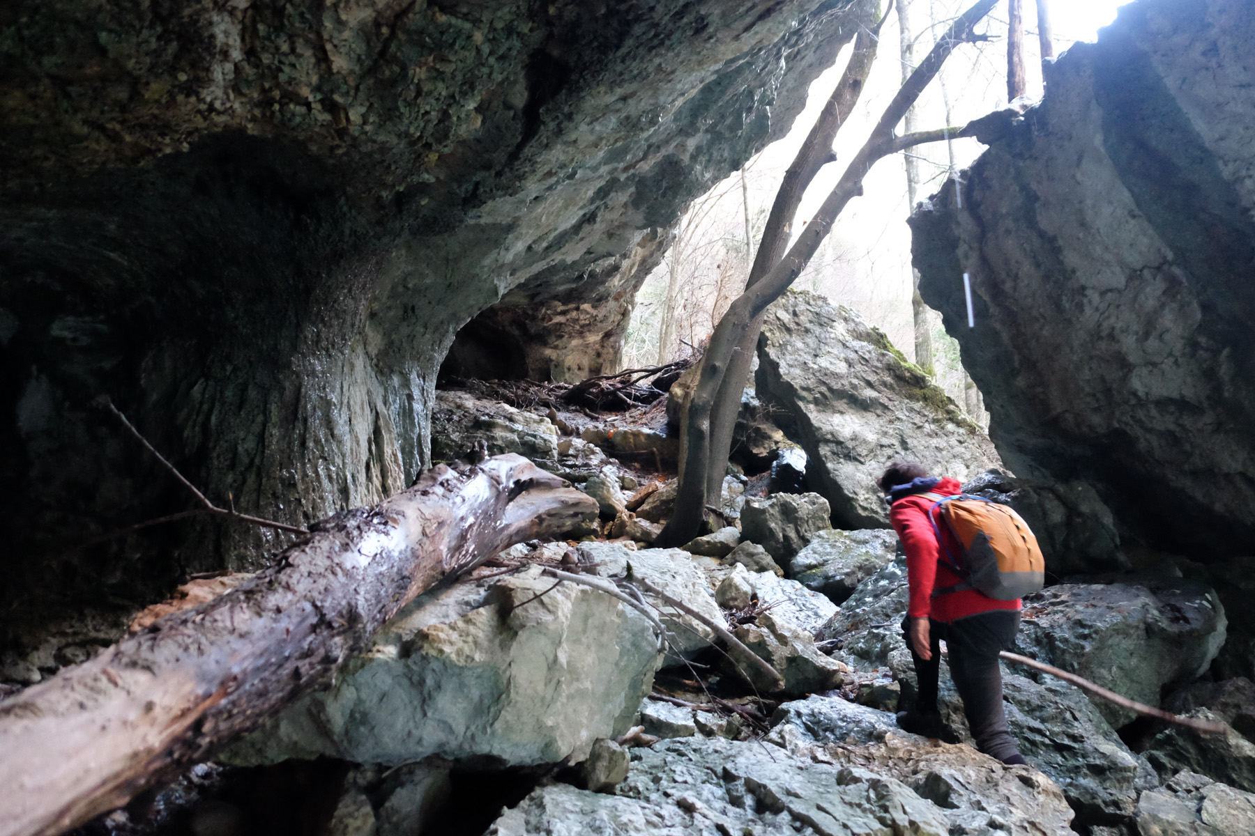
This is an optional round trip. From the Vidal trailhead, continue along the left bank to go deeper. It climbs a little before descending again. You pass a 1st right-hand bend at the foot of an impressive pillar. Then a chaos of boulders to climb over before continuing further, improvising.
A final, fairly wide left-hand bend under a huge arch. Finally, we reach the Baou Beni narrows. To go any further, you'd have to go into the water. In short, turn around and return to the Vidal trailhead.
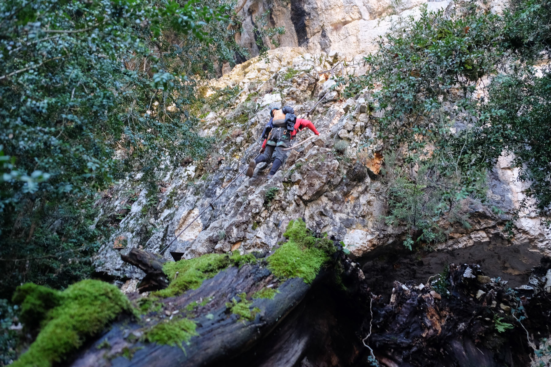
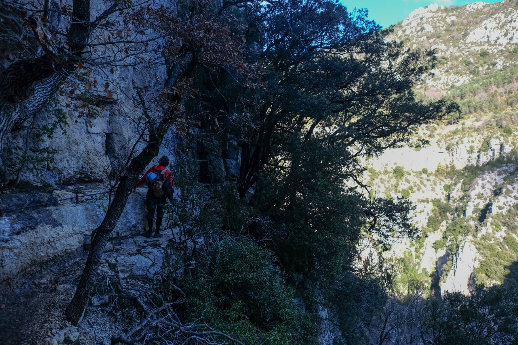
Part 4: The Vidal trail (45′ to 1h)
This is, in the first part, an equipped trail carved into the wall with a series of metal bars to hold on to. It climbs steeply, winding its way literally out of the gorge. Not difficult, just impressive.
Further up, it continues to climb steeply through the forest, then again a few equipped passages to exit onto the ridge and rejoin the D71. Nothing difficult, but a very physical climb!
Back
Cross over and walk a little further to find the signposted path back to the Cavaliers parking lot. Climb through the forest until you reach a wider path. Follow it due east until you reach the road just before the parking lot.
Gorges de Gouleyrous, Tautavel 25 July 2015 Just 2 minutes from the Corbières prehistoric site, between the villages of Vingrau and Tautavel, the Gorges…
Amsafrane, Tilouguite 30 April 2019 In the foothills of the Atlas mountains, in the Ahansal valley, a gigantic rock cathedral dominates the…
Discover more from Climbing7
Subscribe now to keep reading and get access to the full archive.


![2017-07-31_13-36-23 [Sentier des douaniers]](https://climbing7.com/wp-content/uploads/2017/08/2017-07-31_13-36-23-sentier-des-douaniers-e1580119292668-1024x683.jpg "Macinaggio to Bargaggio, customs path, Cap Corse")


Leave a Reply