SECTION 3.0 - Durham County Council
SECTION 3.0 - Durham County Council
SECTION 3.0 - Durham County Council

Create successful ePaper yourself
Turn your PDF publications into a flip-book with our unique Google optimized e-Paper software.
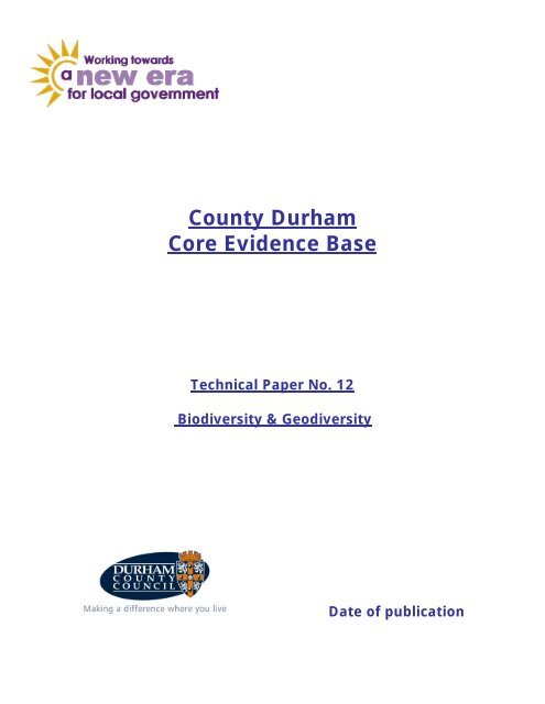
<strong>County</strong> <strong>Durham</strong><br />
Core Evidence Base<br />
Technical Paper No. 12<br />
Biodiversity & Geodiversity<br />
Date of publication
Contents<br />
Section 1.0<br />
Page<br />
1.1 Introduction 3<br />
1.2 Purpose of Technical Paper 5<br />
1.3 Overview of Technical Paper<br />
6<br />
Section 2.0 – Policy Context<br />
2.1 European/International Context<br />
2.2 National Context 13<br />
2.3 Regional Context<br />
2.4 <strong>County</strong> Context 26<br />
2.5 Local Context 29<br />
Section <strong>3.0</strong> – Current Situation<br />
3.1 Baseline 30<br />
3.2 Evidence Base Summary<br />
Section 4 – Golden Threads<br />
4.1 Sustainable Development 64<br />
4.2 Regeneration 64<br />
4.3 Climate Change 65<br />
4.4 Emerging Issues 66<br />
Section 5 – Conclusion and recommendation 68<br />
Appendices<br />
Appendix A – Designations by character area 70<br />
Appendix B – European Sites (SPA’s & SAC’s)<br />
Appendix C – Sites of Special Scientific Interest (SSSI)<br />
90<br />
Appendix D – National Nature Reserves (NNR) 95<br />
Appendix E – Local Nature Reserves (LNR) 97<br />
Appendix F – Local Wildlife Sites (LWS)<br />
Appendix G – <strong>County</strong> Geological Sites (CGS) 117<br />
Appendix H – Summary of protection afforded to species found 122<br />
in the <strong>County</strong><br />
Appendix I – Habitats<br />
and species of principle importance found 124<br />
in the <strong>County</strong><br />
References 127<br />
8<br />
22<br />
62<br />
81<br />
98<br />
Page 2 4/15/2009
<strong>SECTION</strong> 1.0<br />
1. Introduction<br />
1.1 The new unitary <strong>Council</strong> was established on 1 st April 2009 to replace the<br />
existing <strong>County</strong> <strong>Council</strong> and all of the seven District <strong>Council</strong>s in <strong>County</strong><br />
<strong>Durham</strong>. <strong>Council</strong>s have new responsibilities, powers and opportunities to<br />
coordinate expenditure and investment in their local areas to achieve the<br />
goals enshrined within their Sustainable Community Strategies. The<br />
<strong>Council</strong> needs to determine local priorities for the area based on a robust<br />
understanding of the key drivers of physical, economic, and environmental<br />
change. This series of technical papers is intended to provide a shared<br />
evidence base necessary to support the strategies and plans the <strong>Council</strong><br />
will put in place to deliver these priorities and shape how the county of<br />
<strong>Durham</strong> will develop in the future.<br />
1.2 The <strong>Council</strong>, working in partnership across all the different agencies and<br />
sectors involved in the area, will support economic recovery and<br />
effectively create a place in which people want to live, work and invest.<br />
This common approach to place-shaping requires a common evidence<br />
base. Robust local data and analysis and a shared understanding of its<br />
spatial implications are vital for planning and service delivery. This series<br />
of technical papers take full account of national and regional policies and<br />
plans and incorporate all relevant local plans, to bring planning and<br />
strategic departments together to work in an integrated way and to provide<br />
a platform for local engagement.<br />
1.3 Each technical paper identifies the scope of emerging issues on each<br />
topic for which co-ordinated actions will be critical to address and deliver<br />
sustainable development. The papers consequently provide vital evidence<br />
for the preparation of a new Local Development Framework for <strong>Durham</strong>,<br />
and for the new duties to prepare an economic assessment and strategic<br />
housing market assessment, as well as strengthening the collaboration<br />
required to deliver regeneration, transport, social and community<br />
infrastructure, new housing and other services or investment to tackle<br />
climate change and to meet corporate priorities.<br />
1.4 The Local Development Framework will provide the planning framework<br />
necessary to deliver the <strong>County</strong>’s vision for economic prosperity and an<br />
improved quality of life as identified in the Sustainable Community<br />
Strategy. On 20 th November 2008, the <strong>Council</strong> approved a timetable for<br />
preparation of documents that will make up this plan – the Local<br />
Development Scheme - for which the first priorities are:
• Core Strategy – contains the overarching strategy for the future<br />
development of the county, including Minerals and Waste provision,<br />
up to 2026;<br />
• South and East <strong>Durham</strong> Growth Point Action Area Plans – separate<br />
but co-ordinated plans covering growth in Bishop Auckland,<br />
Spennymoor and Peterlee;<br />
• Design and Sustainability Supplementary Planning Document – to<br />
provide guidance on how new development should be designed<br />
and constructed.<br />
1.5 This series of technical papers provide a summary of baseline information<br />
and set out the context for the policy approach to be adopted in the<br />
<strong>Council</strong>s strategies and plans. The topics covered are:<br />
No. 1: Housing<br />
No. 2: Tourism<br />
No. 3: Design and Local Distinctiveness<br />
No. 4: Heritage and Archaeology<br />
No. 5: Open Space, Recreation, Leisure and Play<br />
No. 6: Settlements & Green Belt<br />
No. 7: Community & Cultural Facilities<br />
No. 8: Diversity<br />
No 9: Retail & Town Centres<br />
No. 10: Water<br />
No. 11: Community Involvement<br />
No. 12: Bio and Geodiversity<br />
No. 13: Energy Efficiency<br />
No 14: Contamination and Pollution<br />
No. 15: Delivery & Infrastructure<br />
No. 16: Employment, Education & Skills<br />
No. 17: Deprivation (inc. Health, Community Safety, Neighbourhood<br />
Quality, Income, Crime & Disorder)<br />
No. 18: Rural Dimension (Rural Proofing)<br />
No. 19: Waste<br />
No. 20: Minerals<br />
No. 21: Transport and Accessibility<br />
No. 22: Landscape<br />
No. 23: Population and Demographics
1.6 Executive Summary of emerging issues:<br />
A number of issues and possibilities have come out of this paper which can and<br />
need to be addressed by the LDF.<br />
• Development should be designed so as to ensure that there is no net loss<br />
to biodiversity or geodiversity value, and should incorporate biodiversity<br />
enhancements into the design;<br />
• PPS9 states that LDF’s should indicate the location of designated sites of<br />
importance for biodiversity and geodiversity, making clear distinctions<br />
between the hierarchy of international, national, regional and locally<br />
designated sites. It is thought that other sites including Wildlife Trust and<br />
Woodland Trust land should also be included within this. The LDF should<br />
also identify any areas or sites for the restoration or creation of new<br />
priority habitats which contribute to regional targets, and support this<br />
restoration or creation through appropriate policies;<br />
• Planning authorities and development agencies must take account of<br />
WFD objectives when developing LDF plans;<br />
• Planning gain must be used effectively to achieve the aims of the GI<br />
strategy, this may involve the inclusion of green roofs and living walls into<br />
developments where the provision of terrestrial greenspace is not<br />
possible;<br />
• Planning guidance must be given to developers on how climate change<br />
adaptation should be built into new development through planting<br />
schemes, shading and cooling for buildings and outdoor spaces, green<br />
roofs, living walls, wild areas and phasing;<br />
• The East <strong>Durham</strong> Limestone Plateau and the West <strong>Durham</strong> Coalfields<br />
landscape character areas are most sensitive to loss of habitat due to a<br />
number of land-use pressures. It must be recognised that species and<br />
habitats of importance for biodiversity are found across the <strong>County</strong>, and<br />
are not necessarily located within designated sites. Development must<br />
always consider whether protected or priority species and habitats could<br />
be present on site, and hence affected by the proposed development;<br />
• Databases holding protected and priority species and habitat data is<br />
patchy across the <strong>County</strong>. Funding needs be made available to enable<br />
more conclusive and standardised means of data collection (surveys) and<br />
storage;<br />
• Woodland cover in the <strong>County</strong> is low, with semi-natural ancient woodland<br />
covering only 1.3% of the <strong>County</strong> surface area. The small areas of ancient<br />
woodland are of great nature conservation significance. They are<br />
extremely biodiverse and support a range of species with special habitat<br />
requirements and often poor powers of dispersal. These sites should be<br />
given strong protection from change of use, and polices should include<br />
buffering and enhancement (extension) of sites to ensure their<br />
sustainability;
• The Northumbrian River Basin District Management Plan expressed<br />
concerns with respect to groundwater contamination and abstraction<br />
pressures with particular reference to the Chilton and Mainsforth<br />
Magnesian Limestone aquifer. This must be taken into consideration when<br />
developing LDF plans and policies;<br />
• PPS9 requires that planning authorities identify networks of semi-natural<br />
habitats and opportunities for their conservation and enhancement.<br />
Natural England has produced a habitats network database, however<br />
further work is required to refine the boundaries of those networks at a<br />
local level and to identify opportunities for habitat creation and restoration<br />
to improve the condition and connectivity of those important habitats at a<br />
landscape scale.
<strong>SECTION</strong> 2.0 - POLICY CONTEXT<br />
2.1 International Policy Context<br />
2.1.1 Global Context<br />
• Sustainable Development and the Convention on Biological Diversity<br />
In 1987, the World Commission on Environment and Development, in its report,<br />
“Our Common Future”, called for a new era of environmentally and socially sound<br />
form of economic development. The report stated: “Humanity has the ability to<br />
make development sustainable – to ensure that it meets the needs of the present<br />
without compromising the ability of future generations to meet their own needs”<br />
(WCED, 1987).<br />
The global commitment to sustainable development - Agenda 21, was signed by<br />
over 150 world leaders at the Earth Summit, Rio de Janeiro, in 1992 and included<br />
the adoption of the Convention of Biological Diversity (CBD). Ratified by the<br />
United Nations in 1993, the CBD seeks to ensure the conservation and<br />
sustainable<br />
use of the diversity of species, habitats and ecosystems on the planet.<br />
The Convention recognises that plants, animals, micro organisms and their<br />
ecosystems are not just to be preserved for their own intrinsic value, but also<br />
to<br />
maintain sources of food, medicines, fresh air and water, shelter and a clean<br />
and<br />
healthy environment that are required to sustain humankind and a decent<br />
quality of<br />
life. Concern for biodiversity is therefore integral to sustainable development and<br />
underpins competitively, growth and employment and improved livelihoods.<br />
• The RAMSAR Convention on<br />
Wetlands of International Importance,<br />
United Nations, (1971).<br />
The Convention on Wetlands of International Importance is an inter-governmental<br />
treaty which provides<br />
the framework for national action and international cooperation<br />
for the conservation and intelligent use of wetlands and their resources.<br />
Within the UK a series of Ramsar sites have been designated under the Ramsar<br />
Convention. Together with sites designated under the EU Wild Birds and Habitats<br />
Directives,<br />
Ramsar sites are the most important nature conservation sites in the<br />
UK.<br />
All Ramsar sites are also designated as Sites of Special Scientific Interest,<br />
(SSSIs). Planning Policy Statement 9 (PPS9) Biodiversity & Geological<br />
Conservation advises that Local planning authorities<br />
should identify these sites on<br />
proposals maps and may need to cross-refer to the statutory protection given to<br />
these sites in the explanatory texts in local development documents. However,<br />
since they enjoy statutory protection specific polices in respect of these sites<br />
should not be included in local development documents (see also Part I of<br />
ODPM/DEFRA Circular ODPM 06/2005, DEFRA 01/2005).<br />
Page 8 4/15/2009
2.1.2 European Context<br />
•<br />
European Biodiversity Strategy<br />
The above Convention is strongly reinforced by the EU Pan-European Biological<br />
and<br />
Landscape Diversity Strategy (1994) and European Community Biodiversity<br />
Strategy<br />
(1998). Moreover, the EU Sustainable Development Strategy (2001) set<br />
a landmark target: “…to protect and restore habitats and natural systems and<br />
halt the loss of biodiversity by 2010…” This target was subsequently adopted<br />
by the Commission on Biological Diversity in 2001 and over 170 world leaders at<br />
the World Summit on Sustainable Development, Johannesburg in 2002; in<br />
recognition of the critical role of biodiversity in addressing environmental<br />
degradation<br />
and global poverty. The 2010 Biodiversity Target is now also fully<br />
integrated<br />
into the UN Millennium Development Goals.<br />
The<br />
EU 2006 Biodiversity Communication and associated Action Plan set out a<br />
detailed agenda to halt the loss of biodiversity by 2010. The ten priority objectives<br />
address, inter alia: habitats and species; actions in the wider<br />
countryside; reducing impacts of invasive alien species; reducing the Comment:<br />
1<br />
negative impacts of international trade ; adaptation to climate change; Links<br />
to<br />
and strengthening the knowledge base for biodiversity. Better planning sustainable<br />
procurement<br />
within the Member States is underlined with the aim to reconcile spatial<br />
and<br />
planning and built development with biodiversity. Moreover, the need to sustainable<br />
take biodiversity into account ‘further upstream’ in the decision-making<br />
construction<br />
process<br />
is emphasized. Key actions include: effective treatment of<br />
biodiversity in Strategic Environmental Assessment (SEA) and Environmental<br />
Impact Assessment (EIA); ensuring development does not damage biodiversity<br />
and<br />
building partnerships between planners, developers and biodiversity interests<br />
(Commission of the EC, 2006).<br />
An emphasis on adequate financing for biodiversity projects along with promoting<br />
public-participation, awareness raising and education is contained within the<br />
objectives.<br />
Aims to safeguard the most important habitats and species are furthered through<br />
the implementation of the Birds 2 and Habitats 3 Directives outlined below.<br />
• The Bern Convention on the Conservation of European Wildlife and<br />
Natural Habitats, United Nations, (1979).<br />
The Bern Convention on the Conservation of European Wildlife and Habitats was<br />
agreed by 45 European and African States as well as the European Community.<br />
It’s objectives are threefold: (a) to conserve wild flora and fauna and their natural<br />
habitats; (b) to promote co-operation between states; and (c) to give particular<br />
1 Regarding trade, measures to address tropical deforestation are particularly urgent (EC, 2006). Sustainable<br />
procurement and construction principles should be promoted and encouraged to address the detrimental<br />
impacts caused by construction to biodiversity in the global sense.<br />
2 Directive 79/409/EC, OJ L 103, 25.4 1979, p.1<br />
3 Directive 92/43/EEC, OJ L 206, 206, 22.7.1992<br />
Page 9 4/15/2009
emphasis to endangered and vulnerable species, including endangered and<br />
vulnerable migratory species.<br />
• The Bonn Convention on the Conservation of Migratory Species of Wild<br />
Animals, United Nations, (1979).<br />
This convention aims to conserve terrestrial, marine and avian migratory species<br />
throughout<br />
their range. As such, it is concerned with the conservation of wildlife<br />
an d wildlife habitats<br />
on a global scale. Parties should endeavor to provide<br />
immediate protection for specified migratory species and conclude Agreements<br />
covering the conservation and management of specified migratory species.<br />
• Birds Directive (1979)<br />
The<br />
European Birds Directive (1979) offers protection to all wild bird species<br />
naturally<br />
occurring in the EU (including migratory species). The emphasis is on the<br />
protection of habitats<br />
for endangered and migratory species which are listed in<br />
Annex I of the directive. The role of a coherent network of Special Protection<br />
Areas (SPA – see below) in achieving this goal is also emphasised. The<br />
Directive<br />
bans all activities that directly threaten birds, e.g. the deliberate killing or capturing<br />
of birds, the destruction of nests or taking of eggs. Scientific research into<br />
migratory birds is also promoted under this Directive.<br />
•<br />
European Commission Directive 92/43/EEC on the Conservation of<br />
Natural Habitats and of Wild Fauna and Flora, European Union, (1992).<br />
The Habitats<br />
Directive (1992) sets out a strict system of protection for over 1000<br />
animals<br />
and plant species and over 200 habitat types of European importance. It<br />
recognises the importance of ecological coherence within the Natura 2000 network<br />
(see below) as well as habitat quality being essential for sustaining biodiversity.<br />
Ecological connectivity between habitats is of particular relevance when<br />
considering the impacts of climate change. As such the directive promotes the<br />
designation of green corridors, flyways, buffer zones, stepping stones and other<br />
landscape features that connect important habitats for wild flora and fauna.<br />
The Habitats Directive aims to contribute towards protecting the most important<br />
natural habitats and species of wild flora and fauna in the European Union and<br />
complements the EU Wild Birds Directive. The Directive has a number of key<br />
elements it provides for the creation of a network of Special Areas of Conservation<br />
(SACs) to protect flora and fauna; identifies a range of European protected<br />
species; creates the Natura 2000 site network comprising SACs designated under<br />
the EU Habitats Directive to protect flora and fauna and SPAs designated under<br />
the EU Wild Birds Directive to protect avian species; requires that all plans,<br />
projects and programmes need to be ‘screened’ to determine whether they are<br />
likely to affect the integrity of a Natura 2000 site. If it is decided that this might be<br />
the case an Appropriate Assessment is required. The Directive is transposed into<br />
the UK by the Conservation (Natural Habitats etc) Regulations 1994. Planning<br />
Page 10 4/15/2009
Policy Statement 9 (PPS9) Biodiversity & Geological Conservation advises that<br />
Local planning authorities should identify these sites on proposals maps and may<br />
need to cross-refer to the statutory protection given to these sites in the<br />
explanatory texts in local development documents. However, since they enjoy<br />
statutory protection specific polices in respect of these sites should not be included<br />
in local development documents (see also Part I of ODPM/DEFRA Circular ODPM<br />
06/2005,<br />
DEFRA 01/2005).<br />
• Natura<br />
2000<br />
Natura 2000 comprises an EU wide network of nature protection areas established<br />
under the 1992 Habitats Directive. It consists of Special Areas of Conservation<br />
(SAC) and also Special Protection<br />
Areas (SPA) designated under the Birds<br />
Directive. The emphasis is on promoting the sustainable management<br />
of these<br />
sites in order to ensure the survival of Europe’s most valuable and threatened<br />
species and habitats.<br />
• EIA Directive<br />
The above nature directives along with the Environmental Impact<br />
Assessment<br />
(EIA) Directive n<br />
n of<br />
f the<br />
o late or is of poor quality (EC, 2006).<br />
4 require the assessment of potential impacts of certai<br />
developments. This includes consideration of alternatives and the desig<br />
measures to prevent and reduce negative impacts. The Commission o<br />
European Communities (2006) highlights the need for careful assessments to be<br />
carried out early on in the decision-making process. Too often EIA is conducted<br />
to<br />
•<br />
European Commission Directive 79/409/EEC on the Conservation of Wild<br />
Birds, European Union, (1979).<br />
The<br />
EU Wild Birds Directive has created a protection scheme for all of Europe's<br />
wild<br />
birds. It identifies 194 species and sub-species (listed in Annex I) among them<br />
as<br />
particularly threatened and in need of special conservation measures. In<br />
addition<br />
member states are also required to designate Special Protection Areas<br />
(SPAs)<br />
for the 194 threatened species and all migratory bird species. SPAs are<br />
scientifically<br />
identified areas critical for the survival of the targeted species, such as<br />
wetlands.<br />
The designation of an area as a SPA gives it a high level of protection<br />
from<br />
potentially damaging developments. All SPAs in the UK are also nationally<br />
designated<br />
as Sites of Special Scientific Interest, (SSSIs). The Directive is<br />
transposed<br />
into the UK by the Conservation (Natural Habitats etc) Regulations<br />
1994.<br />
Planning Policy Statement 9 (PPS9) Biodiversity & Geological Conservation<br />
advises<br />
that Local planning authorities should identify these sites on proposals<br />
maps<br />
and may need to cross-refer to the statutory protection given to these sites in<br />
the<br />
explanatory texts in local development documents. However, since they enjoy<br />
statutory<br />
protection specific polices in respect of these sites should not be included<br />
in local development documents (see also Part I of ODPM/DEFRA Circular ODPM<br />
06/2005,<br />
DEFRA 01/2005).<br />
4 Directive 85/337/EEC as amended by Directive 97/11/EC, OJ L 073, 14.3.1997, p.5<br />
Page 11 4/15/2009
• SEA / SA / AA<br />
Strategic Environmental Assessments (SEA)<br />
nd<br />
5 apply to certain plans and<br />
programmes with the aim of assisting in the reconciliation of conservation a<br />
development needs by ensuring the consideration of impacts early on in the<br />
planning process.<br />
• Control of Invasive Species<br />
vasive alien species were identified in the 6<br />
AND NATURAL HABITATS produced the European Strategy on<br />
Invasive Alien Species (IAS). The Strategy is primarily targeted at Link with<br />
governments of Contracting Parties to the Bern Convention and of<br />
Landscape<br />
Technical<br />
other European States. It is a comprehensive document addressed to Paper (No.23)<br />
nature conservation agencies and all other sectoral agencies with and Open<br />
responsibility for activities relevant to IAS prevention or management. Space,<br />
The Strategy promotes the development and implementation of<br />
Recreation,<br />
coordinated measures and cooperative efforts throughout<br />
Leisure and<br />
Play Technical<br />
Paper (No.5)<br />
th In<br />
Environmental Action Programme<br />
as a priority for action. In 2003 the CONVENTION<br />
ON THE CONSERVATION OF<br />
EUROPEAN WILDLIFE<br />
Europe to<br />
prevent<br />
or minimise adverse impacts of invasive alien species (IAS) on<br />
Europe’s<br />
biodiversity, as well as their consequences for the economy<br />
and human health and well-being. It puts forward<br />
a number of actions to develop<br />
inventories and seek more effective collaboration with other European countries.<br />
5 Directive 2001/42/EC, OJ L 197, 21.7.2001, p.30<br />
Page 12 4/15/2009
2.2 National Policy Context<br />
The UN Convention on Biological Diversity commits<br />
each contracting party to<br />
developing<br />
national strategies for the conservation and sustainable use of<br />
biodiversity<br />
and to integrate these ambitions into relevant plans, programmes and<br />
policies. As such, contracting parties are required to implement the 46 Articles<br />
of<br />
the Convention which include the promotion of public engagement, education and<br />
awareness raising and implementing EIA of projects in order to avoid / minimise<br />
effects to biodiversity.<br />
•<br />
This is the main UK legislation relating to the protection of named floral and fauna<br />
species and the network of nationally protected wildlife areas: Sites of Special<br />
Scientific Interest (SSSI). It transposes the Bern Convention on the Conservation<br />
of European Wildlife and Natural Habitats (1979) and the EU Birds Directive (1979)<br />
into national law and has been amended by the Countryside and Rights of Way Act<br />
(2000) . It provides for the notification of Sites of Special Scientific Interest (SSSIs)<br />
and measures for their protection and management. It sets out the legal offences<br />
/<br />
penalties<br />
for killing or harming species listed in annexes.<br />
•<br />
Countryside & Rights of Way Act, 2000.<br />
This Act<br />
increased the duty for provision of public access to the<br />
countryside and strengthened legislation relating to Sites of Special<br />
Scientific<br />
Interest (SSSIs). In particular, it requires Local Authorities to<br />
furthe r the conservation and enhancement of SSSIs both in carrying<br />
out their<br />
operations, and in exercising their decision making functions.<br />
• Biodiversity<br />
- The UK Action Plan, DOE, (1994).<br />
Page 13 4/15/2009<br />
Link with<br />
Open Space,<br />
Recreation,<br />
Leisure and<br />
Play Technical<br />
Paper<br />
(No.5)<br />
The UK<br />
BAP was published in response to the requirements of the Convention on<br />
Biological<br />
Diversity signed at the Earth Summit in 1992. It has the overall goal of<br />
conserving and enhancing biological diversity within the UK and contributing to the<br />
conservation of global diversity through all appropriate mechanisms. It also sets<br />
out the Government’s plans for protecting and enhancing habitats and species<br />
of<br />
national<br />
conservation concern.<br />
•<br />
Wildlife and Countryside Act 1981<br />
‘Working with the grain of nature’, A biodiversity Strategy for England,<br />
DEFRA, (2002).<br />
This strategy seeks to ensure that biodiversity is embedded in all areas of UK<br />
Government<br />
policy and sets out a programme to make the changes necessary to<br />
conserve,<br />
enhance and work with the grain of nature rather than against them. It<br />
sets out<br />
a series of actions for Government and its partners to make biodiversity a<br />
fundamental consideration. The<br />
strategy sets out a number of indicators for
iodiversity which are to be monitored by DEFRA, including the condition of SSSIs,<br />
populations of wild birds and progress with implementing biodiversity<br />
action plans<br />
(BAPs).<br />
It does not contain any formal targets.<br />
•<br />
Planning Policy Statement 9 (PPS9) Biodiversity and Geological<br />
Conservation, ODPM, (2005).<br />
PPS9 sets out the Government’s planning policies on protection of biodiversity and<br />
geological conservation through the planning system. In relation to biodiversity and<br />
geo-diversity it indicates that the Government’s objectives are:<br />
1. to promote sustainable development;<br />
2. conserve enhance and restore the diversity of England’s wildlife and<br />
geology;<br />
3. contribute to urban renaissance and to contribute to rural renewal.<br />
PPS9 also sets out the Governments key principles to ensure that potential<br />
impacts of planning decisions are fully considered. Key paragraphs include:<br />
• Paragraph 1 - Proposals that aim to conserve or enhance biodiversity and<br />
geological conservation should be permitted. The aim of planning decisions<br />
should be to prevent harm to biodiversity and geological interest. Where<br />
developments<br />
may result in harm local authorities should ensure that<br />
mitigation methods are in place before permitting the development and<br />
compensation methods should be sought.<br />
• Paragraph 4 - When identifying sites of importance for biodiversity and<br />
geodiversity on the proposals map clear distinctions should be made<br />
between the hierarchy of international, national, regional and local sites.<br />
• Paragraph 5 - Biodiversity objectives that reflect both national and local<br />
priorities should be reflected in policies in local development documents.<br />
• Paragraph 6 - International sites should be identified on Proposals Maps,<br />
but policies should not be included in DPDs because these sites enjoy<br />
statutory protection.<br />
• Paragraph 7/8 - Biological and geological SSSIs should<br />
be given a high<br />
degree of protection. Development within or outside a SSSI which is likely to<br />
have an adverse effect on an SSSI should not be granted. An exception<br />
should only be made where the benefits of development, at the site, clearly<br />
outweigh both the impacts that it is likely to have on the features of the site<br />
that make it of special scientific interest and any broader impacts on the<br />
national network of SSSIs. Exceptions should only be made in certain<br />
limited circumstances. Where exceptions are made LPA’s should use<br />
conditions and/or planning obligations to mitigate the harmful aspects of the<br />
development and where possible to ensure the protection or enhancement<br />
of the sites biodiversity or geological interest.<br />
• Paragraph 9 – Regional and local sites - Criteria based policies should be<br />
established in local development documents against which proposals for<br />
any development on or affecting such sites will be judged.<br />
• Paragraph 10 - Areas of ancient woodland which do not have statutory<br />
protection should be identified. Planning permission should<br />
not be granted<br />
for any developments that would result in its loss or deterioration unless the<br />
need for, and benefits<br />
of, the development in that location outweigh the loss<br />
of the woodland habitat.<br />
Page 14 4/15/2009
• Paragraph 14 Species protection - Local planning authorities should take<br />
measures to protect species from further decline.<br />
• Natural Areas in the North East Region, English Nature, (1999).<br />
This document promotes<br />
the conservation of wildlife and natural features<br />
throughout the North East of England. It highlights how England is divided into a<br />
series of Natural Areas based upon the distribution of wildlife and natural features,<br />
land use patterns and the human history of each area. Natural Areas are based<br />
upon j oint work with the former Countryside Agency into the characterisation of the<br />
countryside into locally distinctive units called character<br />
areas. The document<br />
indicates that natural areas offer a more effective framework for the planning and<br />
achievement of nature conservation objectives<br />
than administrative boundaries and<br />
are recognised in planning policy. <strong>County</strong> <strong>Durham</strong> contains parts of several Natural<br />
Areas including the North Pennines, Northumbria<br />
Coal Measures, Tees Lowlands<br />
and the <strong>Durham</strong> Magnesian Limestone Plateau Natural Areas. For key themes<br />
including earth heritage, freshwater, inland rock, bog fen and swamp, woodland,<br />
lowland grassland and heath, upland grassland and heath, maritime areas<br />
the<br />
document describes key features of each area and includes key issues and<br />
objectives. • North Pennines<br />
Area of Outstanding Natural Beauty (AONB), Geo-<br />
diversity Audit and Action Plan, 2004-2009, North Pennines AONB<br />
Partnership, (2004).<br />
The<br />
principal aim of this plan is to guide the conservation and interpretation of the<br />
geological features of this world renowned area for the study of earth science. It<br />
is<br />
also<br />
intended to support the development of sustainable ‘geo-tourism’ in the North<br />
Pennines, as part of the North Pennines AONB Partnership Staff Unit’s work as<br />
managers of the European Geo-Park status for the AONB.<br />
The Action Plan sets out a vision, “By 2014, the variety of geological features<br />
and<br />
processes that underpin and influence the landscape, biodiversity and culture<br />
of<br />
the North Pennines AONB will be well protected and well managed. This means<br />
that the most important and typical sites and features are recognised<br />
and<br />
conservation measures are in place. Those sites and features that<br />
have played the<br />
most important roles in the development of geological science or in the cultural<br />
heritage of the North Pennines have been consolidated and interpreted.<br />
Management plans for these features are in place and are working<br />
well. The way<br />
the geology of the North Pennines is reflected in its buildings and walls is well<br />
understood and appreciated. Through caring for the area’s geology and realising<br />
its potential for tourism, education and lifelong learning, the AONB has<br />
successfully maintained its status as a European Geo-Park”. The main objectives<br />
of this Geo-diversity Audit and Action Plan can be summarised as:<br />
• To raise awareness of the fundamental importance of geo-diversity in the<br />
sustainable management of the North Pennines AONB.<br />
• To improve knowledge and understanding of the geo-diversity resources<br />
within the AONB.<br />
Page 15 4/15/2009
• To identify the main geological formations and features and to evaluate their<br />
contribution to local geo-diversity.<br />
• To place these geological formations and features of the North Pennines<br />
AONB in their regional, national and, where appropriate, international<br />
context.<br />
• To provide non-specialists with an easy to use guide to the geo-diversity of<br />
the area.<br />
• To identify linkages between the area’s geo-diversity and its landscape<br />
character, biodiversity, economic and cultural history.<br />
• To identify threats to geological features.<br />
• To identify opportunities and recommended strategies for the conservation<br />
and enhancement of geological features.<br />
• To identify a network of individual sites which encapsulate the essential<br />
features of the area’s geology.<br />
• To identify features and topics which can contribute to sustainable ‘geotourism’.<br />
• To engage<br />
industry, local communities, voluntary groups and local societies<br />
in conserving and interpreting the area’s geo-diversity.<br />
• To ’embed’ geo-diversity into future planning, management and<br />
interpretation policies.<br />
• To raise awareness of the AONB and European Geo-park designations.<br />
• To recommend strategies for continued monitoring of the area’s geodiversity<br />
The document contains 11 details objectives related to the delivery of the action<br />
plan.<br />
•<br />
<strong>County</strong> <strong>Durham</strong> Geo-diversity Audit,<br />
<strong>Durham</strong> <strong>County</strong> <strong>Council</strong>, (2004).<br />
This document reviews the component parts of the <strong>County</strong>’s geo-diversity and their<br />
relevance to their other interests. The audit also serves as the essential<br />
background to the forthcoming Geo-diversity Action Plan which will frame<br />
recommendations, action points and policies relevant to all aspects Link with<br />
of<br />
geo-diversity in the <strong>County</strong>. The document outlines the key Landscape<br />
elements<br />
of the <strong>County</strong>’s geology and geo-diversity. It highlights Technical<br />
the influence of geology in the <strong>County</strong><br />
and how it has played a Paper (No.23),<br />
fundamental<br />
role in shaping the <strong>County</strong>’s<br />
topography, landscapes<br />
and Minerals<br />
Technical<br />
and biodiversity and the direct relationship of geology with the Paper (No.21)<br />
economy through the extraction of mineral resources. The<br />
document highlights the importance of conserving earth science<br />
within <strong>County</strong> <strong>Durham</strong> and outlines the range of statutory and non-statutory<br />
designations found within the <strong>County</strong> (many which geological interest) including<br />
the North Pennines Geo-Park, national nature reserves, sites of special<br />
scientific<br />
interest and county geological and wildlife sites. Part 2 of the document considers<br />
the complex geological resource in the <strong>County</strong> which includes Ordovician<br />
rocks,<br />
Carboniferous rocks including Dinantian, Namurian and Westphalian rocks,<br />
Permian rocks including magnesian limestone, yellow sands and marl slate,<br />
Page 16 4/15/2009
Intrusive Igneous rocks, Methamorphic rocks, mineral veins and more recent<br />
deposits laid down in the Quaternary<br />
period.<br />
• Hedgerows are protected by the Hedgerows Regulations 1997.<br />
Hedgerows play an important role on farms; helping to prevent soil erosion and<br />
water run-off, providing shelter, controling livestock and protecting crops from the<br />
wind. They also provide an important habitat for wildlife and are often seen as<br />
defining character of the English landscape. Under the regulations, it is against the<br />
law to remove or destroy certain hedgerows without permission from the local<br />
planning authority. Permission is required before removing hedges that are at least<br />
20 metres in length, over 30 years old and contain certain species of plant. The<br />
local planning authority assesses the importance of the hedgerow using criteria set<br />
out in the regulations. Hedgerows in areas covered by a Historic Landscape<br />
Characterisation are often protected on the basis of historic importance and their<br />
wildlife value.<br />
In 1998, the Government published a Review of the Hedgerow Regulations. The<br />
Review made a number of recommendations on how the Regulations might be<br />
strengthened, particuarly on how the criteria defining 'important' hedgerows could<br />
be improved and simplified. The Review was followed by a number of surveys, a<br />
Select Committee report to the Government and a survey of local planning<br />
authorities. DEFRA launched a public consultation exercise on the protection of<br />
countryside boundary features and amendment of the Hedgerows Regulations in<br />
January 2003.<br />
• Protection of Badgers Act 1992<br />
The Protection of Badgers Act 1992 consolidates and improved previous<br />
legislation<br />
(including the Badgers (Further Protection) Act 1991).<br />
Under the act it is<br />
an offence to kill, injure or take a badger, or to damage or interfere with a sett<br />
unless a license is obtained from a statutory authority. A badger sett is defined in<br />
law as any structure or place which displays signs of current use by a badger.<br />
• Urban and Rural White Paper<br />
<strong>County</strong><br />
<strong>Durham</strong> contains a mixture of urban and rural green spaces. As such the<br />
policy<br />
context which will shape the Core Strategy includes the<br />
Link with<br />
recommendations laid down in both the Urban White Paper, ‘Our Open Space,<br />
Towns<br />
and Cities: the future’, and the Rural White Paper, ‘A Fair Recreation,<br />
Deal for Rural England’. The former placed parks, play areas and Leisure and<br />
open spaces at the heart of the ‘urban renaissance’, with<br />
Play<br />
Technical<br />
Paper (No.5)<br />
recommendations for local authorities, including an aim to achieve the<br />
national ‘Green Flag’ status for managing parks and spaces. The<br />
latter aims to revitalise rural services and to enhance the rural economy,<br />
environmental<br />
protection and local democracy whilst tackling social exclusion.<br />
Measures to make access to the countryside more inclusive along with targets for<br />
Page 17 4/15/2009
iodiversity were aspects of the Rural White Paper that are particularly relevant to<br />
green space management.<br />
• Circular 06/05: Biodiversity and Geological Conservation - Statutory<br />
Obligations and Their Impact Within the Planning System<br />
This circular provides administrative guidance on the application of the law relating<br />
to planning and nature conservation as it applies in England. It complements the<br />
expression of national planning policy in Planning Policy Statement 9: Biodiversity<br />
and Geological Conservation (PPS9) and the accompanying Planning for<br />
Biodiversity and Geological Conservation:<br />
A Guide to Good Practice.<br />
• UK Sustainable Development Strategy “Securing the Future” (2006)<br />
The Strategy identified the following as a priority area for immediate action:<br />
Natural Resource Protection and Environmental Enhancement – Natural<br />
resources are vital to our existence and that of communities throughout<br />
the world.<br />
We need a better understanding of environmental limits, environmental<br />
enhancement and recovery where the environment is most degraded to ensure a<br />
decent environment for everyone, and a more integrated policy<br />
framework.<br />
A strategic framework for the UK has been developed, and includes the following:<br />
- a shared understanding of sustainable development<br />
- a vision of what we are trying to achieve and the guiding principles we all need to<br />
follow to achieve it<br />
- our sustainable development priorities for UK action at home and internationally,<br />
and<br />
- indicators to monitor the key issues on a UK basis.<br />
Sustainable<br />
development requires economic, social and environmental objectives<br />
to be met together and at the same time. Our quality of life, health and well-being<br />
rely on clean land, water and air, productive soils,<br />
available minerals and water<br />
resources, natural coastal and fluvial systems and processes. They also depend<br />
on distinctive<br />
and inspirational landscapes, a wealth of wildlife, vibrant<br />
comm unities, a healthy, well managed countryside and open spaces accessible for<br />
everyone<br />
to enjoy.<br />
• Natural Environment and Rural Communities Act 2006 (NERC)<br />
The Natural Environment and Rural Communities Act is designed to help achieve<br />
a<br />
rich and diverse natural environment and thriving rural communities through<br />
modernised and simplified arrangements for delivering Government policy. The Act<br />
implements key element s of the Government’s Rural Strategy published in July<br />
200 4, and establish flexible new structures with a strong customer focus.<br />
Page 18 4/15/2009
Public authorities have a Duty to have regard to the conservation of biodiversity<br />
in<br />
exercising their functions. This Duty was introduced by the Natural Environment<br />
and Rural Communities<br />
Act<br />
and came into force on 1 October 2006. The Duty aims to raise the profile and<br />
visibility<br />
of biodiversity, clarify existing commitments with regard to biodiversity, and<br />
to make it a natural and integral part of policy and decision making. The Duty<br />
applies<br />
to all public authorities including local authorities, central government<br />
departments, executive agencies, non departmental public bodies, regional<br />
government offices, non-ministerial departments, NHS Trusts, regional assemblies,<br />
utilities and all other bodies carrying out functions of a public character under a<br />
statutory power. Public authorities can make a significant contribution towards the<br />
2010 target<br />
to halt biodiversity loss.<br />
• Planning Policy Guidance 17: Planning for Open space, Sport and<br />
Recreation (PPG17)<br />
Link with<br />
This guidance has been a key driver to encourage local authorities to Open Space,<br />
write green space strategies. It states that local authorities should Recreation,<br />
‘undertake robust assessments of the existing and future<br />
needs of their Leisure and<br />
communities for open space, sports and recreational facilities’. The Play Technical<br />
Paper (No.5)<br />
companion guide to PPG17 suggests<br />
ways in which such<br />
assessments<br />
can be made and defines a need to establish the extent<br />
to which open spaces meet clearly identified local needs and the wider<br />
benefits they generate for people, wildlife, biodiversity and the wider environment.<br />
• Planning Policy Statement 1: Delivering Sustainable Development ( PPS1)<br />
This document sets out the governments national<br />
policies on different aspects of<br />
land use planning in England. It sets out the overarching planning policies on the<br />
delivery<br />
of sustainable development through the planning system.<br />
PPS1 states that: ‘Planning should facilitate and promote sustainable and inclusive<br />
patterns<br />
of urban and rural development by:<br />
- protecting and enhancing the natural and historic environment,<br />
the quality<br />
and character of the countryside….A high level of protection should be<br />
given to most valued townscapes and landscapes, wildlife<br />
habitats and<br />
natural resources. Those with national and international designations should<br />
receive the highest level of protection.’<br />
There are a number of similarities with PPS9 as paragraph 19 states that:<br />
Planning policies and planning decisions should be based on:<br />
- up-to-date information on the environmental characteristics of the area;<br />
- the potential impacts, positive and negative, on the environment of the<br />
development proposals (whether direct, indirect, cumulative, long-term or<br />
short-term); and<br />
- recognition of the limits of the environment to accept further development<br />
without irreversible damage.<br />
Page 19 4/15/2009
It also states that local authorities should seek to not only protect, but look to<br />
enhance the local environment as part of development proposals. This ties in with<br />
the aims of the NERC act 2006, as detailed above.<br />
• Water Framework Directive 2000<br />
The European Water Framework Directive came into force in December 2000 and<br />
became part of UK law in December 2003. It gives us an opportunity to plan and<br />
deliver a better water environment, focusing on ecology.This directive is essentially<br />
an operational tool, setting the objectives for water protection for the<br />
Link with<br />
future.<br />
Water<br />
Technical<br />
The Directive will help to protect and enhance the quality of:<br />
Paper (No.10)<br />
- surface freshwater (including lakes, streams and rivers)<br />
- groundwater’s<br />
- groundwater dependant ecosystems<br />
- estuaries<br />
- coastal waters out to one mile from low-water<br />
The aims of the directive are:<br />
- expanding the scope of water protection to all waters, surface waters and<br />
groundwater;<br />
- achieving ‘good status’ for all waters by a set deadline;<br />
- water management based on river basins;<br />
- ‘combined approach’ of emission limit values and quality standards;<br />
- Getting the prices right;<br />
- Getting the citizen involved more closely;<br />
- Streamlining legislation.<br />
In England and Wales the Environment Agency is the responsible body for carrying<br />
out<br />
the Directive.<br />
•<br />
NI 197 - Improved Local Biodiversity – proportion of Local Sites where<br />
active conservation management is being achieved<br />
As<br />
a result of discussions and workshops with stakeholders including Natural<br />
England, the Local Government Association (LGA), Association of Local<br />
Government<br />
Ecologists (ALGE), Government Office, Local Record Centers,<br />
B iodiversity Partnerships,<br />
Wildlife Trusts and LAs (Local Authorities), and feed<br />
back<br />
from two public consultations, an indicator on Local Sites (LS) has emerged<br />
as<br />
the preferred option as a proxy for a local authority biodiversity indicator.<br />
Local<br />
Sites (LS) are sites of substantive nature conservation value and although<br />
they<br />
do not have any statutory status many are equal in quality to the<br />
representative<br />
sample of sites that make up the series of statutory Sites of Special<br />
Scientific<br />
Interest (SSSIs). They were previously known by a number of different<br />
Page 20 4/15/2009
names including Sites of Nature Conservation<br />
interest (SNCI) or <strong>County</strong> Wildlife<br />
Sites<br />
(CWS). Here is <strong>County</strong> <strong>Durham</strong> the term has been altered in agreement with<br />
the Biodiversity Partnership and <strong>Durham</strong> Wildlife Trust to Local Wildlife Site (LWS).<br />
LWS<br />
make a vital contribution to delivering UK and Local Biodiversity and<br />
Geodiversity Action Plan targets (see www.ukbap.org.uk). LWS provide wildlife<br />
refuges for most of the UK’s fauna and flora, and through their connecting and<br />
buffering qualities complement nationally (SSSIs) and internationally designated<br />
sites e.g. Special Areas of Conservation (SACs) and Special Protection Areas<br />
(SPAs). They represent extensive areas of wildlife habitat essential to sustaining<br />
populations of rare and declining species within the wider<br />
landscape.<br />
The indicator measures the performance of LAs for biodiversity by assessing the<br />
implementation of positive conservation management of LWS. The indicator<br />
relates to the influence LAs have on LWS systems and the measures and<br />
procedures involved in ensuring effective conservation management is introduced<br />
to, and acted upon, by Local Wildlife Site<br />
owners and managers. To meet the<br />
biodiversity duty under Section 40 of the Natural Environment and Rural<br />
Communities Act (NERC) 2006 forward LAs will need to incorporate biodiversity<br />
consideration into authority services and functions, and demonstrate<br />
achievements. Indicators, along with biodiversity reporting and other monitoring<br />
mechanisms, provide a way of indicating these achievements. The biodiversity<br />
indicator is an efficient way for LAs to show that they are taking biodiversity into<br />
consideration, particularly as Defra will be reviewing the impact of the biodiversity<br />
duty in 2009.<br />
Page 21 4/15/2009
2.3 Regional Policy Context<br />
• A Biodiversity Audit for the North East & Biodiversity Indicators and<br />
Targets for the North East of England, North East Biodiversity Forum,<br />
(2004).<br />
While not a policy document the audit is the first comprehensive review of both<br />
UK<br />
BAP habitats and species and regionally important wildlife, flora and fauna in the<br />
North East. The associated document has targets to enhance and protect the<br />
habitats and species identified in the initial document.<br />
• ‘Trees, Woodlands, Forests and People’, The Regional Forest Strategy for<br />
the North East of England, GONE, (2005).<br />
The<br />
Regional Forestry Strategy sets out the role our trees, woodland and forests<br />
will<br />
have over the next twenty years and beyond in making the region a better<br />
place for us all to live, work, visit and do business. The Strategy provides a<br />
framework for trees, woodlands and forests to play an increasingly significant role<br />
in securing and enhancing the quality of life for everyone in the North East. The<br />
Strategy has been structured around four interrelated objectives, and maps out<br />
how the range of activities carried out by the forestry sector relate to and can<br />
contribute to the delivery of these key regional outcomes. The four objectives<br />
are:<br />
Economic Regeneration and Growth; Social and Communities; Environment<br />
and<br />
Natural Resources and Implementation and Leadership.<br />
The social and communities objectives highlights how woodland<br />
and forests can<br />
help create sustainable communities by expanding the countryside into<br />
towns and<br />
cities, improve the quality of life by increasing peoples use and enjoyment of trees<br />
and woodlands particularly in areas which have suffered from the environmental<br />
legacy of mining and other industries and improve health of local communities.<br />
The<br />
environmental and natural resources objective highlights how through appropriate<br />
expansion, re-design and better management woodlands and forests can help<br />
improve the state of the environment in the North East and help provide an<br />
effective response to climate change including carbon capture and mitigating the<br />
adverse effects of climate change such as lowering peak flows in rivers and so<br />
reducing flooding.<br />
• Great North Forest Plan, North East Community Forests, (1993).<br />
The Great North Forest Plan was approved by the Secretary of State for<br />
the Environment in 1992. It covers 62 sq miles of urban fringe<br />
countryside in south Tyne & Wear and the north-east of <strong>County</strong> <strong>Durham</strong>.<br />
The objectives of the plan include identifying strategies and proposals to<br />
create a community forest through the delivery of 4,000 ha of new<br />
woodland in order to complement the existing 1000 ha already in the<br />
area, (position at 1993). The planning system is identified as a key<br />
mechanism to deliver the aspirations of the Great North Forest Plan. The<br />
plan includes a number of aims relating to agriculture, forestry, nature<br />
conservation, sport and recreation, archaeology and history, community<br />
Page 22 4/15/2009<br />
Link with<br />
Open Space,<br />
Recreation,<br />
Leisure and<br />
Play Technical<br />
Paper (No.5)
involvement, art and culture, environmental education<br />
and development. In terms<br />
of<br />
development the plan aims to ensure that where approved development takes<br />
place with the Great North Forest it contributes to its vision of a high quality<br />
wooded, multipurpose countryside. Development proposals include promoting<br />
advance woodland planting on areas identified for future development; ensuring<br />
that restoration proposals on extraction and tipping operations meet forest<br />
objectives; securing the long term management of woodland and recreation<br />
facilities established as part of permitted developments. The Great North Plan<br />
divides the forest area into three discrete areas including the western hills (west<br />
and north of Chester-le-Street), the central lowlands (north-east and south east<br />
of<br />
Chester-le-Street)<br />
and the <strong>Durham</strong> Magnesian Limestone Plateau. In each area<br />
there is a strategy for action and in addition thirty local management zones. A<br />
range<br />
of landscape management strategies have been identified for each of the<br />
thirty zones<br />
based upon conservation, restoration, enhancement and<br />
reconstruction.<br />
• North Pennines AONB Management Plan 2004-2009, North<br />
Pennines<br />
AONB Partnership, (2004).<br />
The st atutory Management Plan sets out the agenda for the conservation and<br />
enhancement<br />
of the AONB for the five years between 2004 and 2009. It is the first<br />
statutory<br />
management plan for the North Pennines AONB, its production<br />
a requirement of the Countryside & Rights of Way Act 2000. The plan is Link with<br />
currently under review – consultation occurred on a revised plan for the Open Space,<br />
Recreation,<br />
period 2009 to 2014 during September/October 2008.<br />
Leisure and<br />
The primary aim of the approved Management Plan is to provide a<br />
Play Technical<br />
framework<br />
for action for the conservation and enhancement of the North Paper (No.5)<br />
Pennines AONB. Many of the objectives relate to biodiversity and geodiversity<br />
conservation and enhancement; the conservation and<br />
enhancement<br />
of the historic and cultural heritage of the North Pennines;<br />
recreation, access and tourism enhancement. In relation to minerals planning<br />
the<br />
managem ent plan recognises that the landscape of the North Pennines has been<br />
to a large deg ree shaped by the extraction of its rich mineral resources. It states<br />
that any new quarrying or mineral extraction activity on a commercial scale would<br />
be likely to constitute<br />
major development and be subject to national planning<br />
regulations on AONBs. That future planning<br />
for existing mineral extraction within<br />
the<br />
AONB should balance the economic benefit which this may bring with the<br />
potential impact on landscape, biodiversity and local communities. It<br />
should also<br />
consider the potential impact of any infrastructure and traffic issues which may<br />
arise. Every encouragement should be given to after-use which complements the<br />
surrounding landscape. This should not preclude industrial development<br />
where this<br />
is of a nature and scale compatible with its setting in an AONB. The<br />
Management<br />
Plan policy guidelines state that, ‘Proposals for mineral development in the AONB<br />
should be subject to rigorous examination, with a balanced approach taken<br />
to the<br />
impact on the landscape, biodiversity, geo-diversity and the local economy.’<br />
Page 23 4/15/2009
• North East<br />
Strategy for the Environment<br />
This document<br />
provides a regionally agreed framework for the long-term actions to<br />
deliver a clean, healthy and diverse environment that is valued by people<br />
and<br />
businesses. Its<br />
main purpose is to shape and influence future policy making in the<br />
region, such as the Integrated Regional Strategy. It presents information about<br />
our<br />
environment and why it is important to our economy and everyday life. The<br />
strategy considers the regions environmental assets and the role they play in our<br />
lives through four broad themes. Each theme states key objectives that the<br />
region<br />
must achieve in response to the challenges and opportunities that we face.<br />
The following objectives with respect to the natural environment are noted:<br />
- Conserve, enhance and manage biodiversity and Geodiversity for their<br />
own<br />
sake and to make the North East a better place;<br />
- Protect and improve ground, river and sea water quality in the region,<br />
ensuring<br />
that water quality and quantity are considered in all developments<br />
and managed<br />
in a sustainable and integrated manner;<br />
- Conserve<br />
and enhance the region’s marine and coastal environment by<br />
adopting<br />
an ecosystem-based approach to their sustainable use and<br />
recovery<br />
to deliver benefits for people, heritage, industry and wildlife.<br />
• ‘Achieving a Better Quality of Life: the Integrated Regional<br />
Framework for<br />
the North East’ in 2005.<br />
It set out a regional vision for sustainability along with 17 Sustainability<br />
Objectives.<br />
A Core Strategy potentially contributes to a number of these<br />
objectives, including:<br />
- Objective 7: To reduce the causes and impacts of climate change;<br />
- Objective 8: To protect and enhance the region’s biodiversity;<br />
- Objective 11: To protect and enhance the quality and diversity of<br />
the<br />
regions rural and urban land and landscapes;<br />
- Objective 13: To reduce crime and the fear of crime;<br />
- Objective 14: To improve health and well being while reducing<br />
inequalities in health.<br />
• The North East of England Regional Spatial Strategy (RSS)<br />
Published in July 2008. The Strategy sets out a long-term strategy for the<br />
spatial development of the North East. Green space figures highly<br />
in the RSS with several policies relevant to the Green Space<br />
Strategy. Several policies are of direct relevance to this Strategy<br />
and the Supplementary Planning Document that will be developed<br />
from it. In particular:<br />
-<br />
Policy 2: Sustainable Development – “Planning<br />
proposals and Local Development Frameworks should<br />
support sustainable construction and sustainable development<br />
Page 24 4/15/2009<br />
Link with<br />
Open Space,<br />
Recreation,<br />
Leisure and<br />
Play Technical<br />
Paper (No.5)
through the delivery of the following environmental,<br />
social and<br />
economic objectives: k) to promote the concept of green<br />
infrastructure, a network of linked, multifunctional green space in and<br />
around the region’s towns and cities” (GONE, 2007)<br />
- Policy 33: Biodiversity and Geodiversity – “Strategies, plans and<br />
programmes, and planning proposals should ensure that the<br />
Region’s ecological and geological resources are protected and<br />
enhanced to return biodiversity resources to viable levels by:<br />
- Continuing to promote the protection and enhancement of<br />
internationally and nationally important sites and species, d)<br />
providing for the expansion and linking of existing habitats and<br />
species populations<br />
including the creation of semi-natural green<br />
spaces in and around urban areas and for habitat restoration, e)<br />
contributing to improving the Region’s SSSI’s<br />
to a favourable<br />
condition by 2010” (GONE, 2007)<br />
- Policy 36: Trees, Woodlands and Forests – “Strategies, plans and<br />
programmes, and planning proposals should: a) in line with the North<br />
East Regional Forest Strategy, seek to maximise the social,<br />
economic and environmental opportunities that trees, woodlands and<br />
forests present,<br />
particularly in regeneration areas and on derelict,<br />
damaged and underused sites, e) seek to maximise the tourism<br />
development opportunities presented by woodlands<br />
and forests,<br />
particularly in rural areas; and identify and ensure strong<br />
protection of<br />
areas of ancient woodland” (GONE, 2007).<br />
• Th e North East Regional Economic Strategy<br />
Lau nched in July 2006 by a consortium of business, community and governmental<br />
bodie s to set out how North East England can compete in the<br />
global economy,<br />
wh ilst delivering improvements in quality of life. According<br />
to the Strategy, “well<br />
planned investment in environmental improvement<br />
in urban and rural communities<br />
can<br />
boost commercial attractiveness and generate significant private sector<br />
investment”. Overarching objectives to “target investment in quality of place,<br />
creating healthy, safe, sustainable communities to help retain businesses and<br />
skilled people within the region” and to “promote, enhance and protect our natural<br />
heritage and cultural assets to maximise their potential to underpin rising levels of<br />
productivity and participation”.<br />
Page 25 4/15/2009
2.4 <strong>County</strong> (Sub-Regional) Policy Context<br />
• The <strong>County</strong> <strong>Durham</strong> Strategic Vision published in 2003, is also known as the<br />
Community Strategy for <strong>County</strong> <strong>Durham</strong>. It has established a vision, which sets<br />
out ideas for new services and facilities to tackle identified problems. It also<br />
suggests proposals for building on existing schemes and projects, and it suggests<br />
imaginative<br />
and innovative ideas to give a glimpse<br />
of how the future might look.<br />
Mo re importantly it ensures that community needs and aspirations are met and<br />
helps bring much needed investment into the <strong>County</strong>. A new draft of the Strategy<br />
(2008-2023) has recently been completed and consulted on, and the new Strategy<br />
is due to be published.<br />
• <strong>County</strong> <strong>Durham</strong> Environment Strategy (2006)<br />
Produced by the <strong>County</strong> <strong>Durham</strong> Sustainability and Environment Partnership,<br />
and<br />
is part of a shared vision for the (then) future <strong>County</strong> <strong>Durham</strong> Strategic<br />
Partnership. It follows a review of the previous Environment<br />
Strategy 2000-2005.<br />
Link with<br />
Open Space,<br />
9 aims have been identified and are based on:<br />
Recreation,<br />
Leisure and<br />
• Enriching landscape, biodiversity and geodiversity;<br />
Play Technical<br />
• Improving towns and villages, conserving and enhancing the<br />
historic environment;<br />
Paper (No.5)<br />
• Protecting and improving the quality of air, land and water;<br />
• Responding to climate change;<br />
• Developing sustainable transport;<br />
• Reducing resource consumption and waste;<br />
• Engaging communities in sustainable development;<br />
• Promoting environmentally aware business; and<br />
• Finding the resources e.g. LAA.<br />
• <strong>Durham</strong> Biodiversity Action Plan, (<strong>Durham</strong> Biodiversity Partnership,<br />
(2007).<br />
The <strong>Durham</strong> Biodiversity Plan, (first published in 1999) has now been revised. The<br />
revised DBAP is a non statutory plan which covers the<br />
geographical area of<br />
<strong>County</strong><br />
<strong>Durham</strong>, Darlington, Gateshead, Sunderland and South Tyneside. It aims<br />
to prov ide a series of structured action priorities for all those organisations and<br />
individuals working to conserve biodiversity in the <strong>Durham</strong> BAP area. The revised<br />
DBAP currently defines 32 priority habitats, 63 priority species and contains 51<br />
DBAP action plans. These include Priority Habitats: Woodland (8), Wetlands (6),<br />
Upland habitats (7), Lowland Habitats (11); priority species: mammals (12), birds<br />
(24), herpitiles (5), fish (3), invertebrates (15), plants (4); DBAP action plans:<br />
woodlands (6), wetlands (8), upland habitats (7), lowland habitats(13), mammals<br />
(8), birds (6) and reptiles (2); and one cross cutting action plan relating to climate<br />
change. Over time additional priority habitats, species and action plans will be<br />
developed. Each complement action plan includes information which discusses the<br />
Page 26 4/15/2009
habitat or species action plan, current or recent activity in relation to research or<br />
actions undertaken, threats to the species<br />
or habitat and objectives for action.<br />
Given<br />
the extent of information within the DBAP it is not possible to summarise<br />
each habitat or species action plan in this review. The DBAP also includes a series<br />
of definitions for the purposes of mapping priority habitats and measuring their<br />
condition. The current version of the plan has yet to publish any maps relating to<br />
the distribution of these habitats or species.<br />
• <strong>County</strong> <strong>Durham</strong> Landscape Character Assessment, <strong>Durham</strong> <strong>County</strong><br />
<strong>Council</strong>, (2003).<br />
The<br />
<strong>County</strong> <strong>Durham</strong> Landscape Character Assessment is a detailed assessment<br />
of the character of the county. It works within the framework of<br />
Countryside Character Areas and Natural Areas, identifying variations in Link with<br />
Landscape<br />
landscape character at a sub-regional and local level. The assessment<br />
Technical<br />
is based on a detailed GIS (Geographical Information Systems)<br />
Paper<br />
(No.23)<br />
database of landscape elements which was used to identify landscape<br />
types and character areas at a number of levels from regional<br />
landscapes, like the North Pennines or the West <strong>Durham</strong> Coalfield, to local<br />
landscapes like parklands and wooded denes. The assessment has informed the<br />
development of the <strong>County</strong> <strong>Durham</strong> Landscape Strategy.<br />
• <strong>County</strong> <strong>Durham</strong> Landscape Strategy, <strong>Durham</strong> <strong>County</strong> <strong>Council</strong>, (2008).<br />
The Landscape Strategy is a non-statutory plan which addresses issues that affect<br />
the varied landscapes of <strong>County</strong> <strong>Durham</strong> and sets out objectives for their<br />
conservation and enhancement. It is based on the <strong>County</strong> <strong>Council</strong>’s landscape<br />
character assessment which was published by the <strong>County</strong> <strong>Council</strong> in 2003. The<br />
strategy addresses many of the issues identified in other plans and strategies and<br />
overlaps geographically with other area based plans including the North Pennines<br />
AONB Management Plan and the Great North Forest Plan. It is intended that the<br />
strategy should complement these plans. The strategy has three aims:<br />
1.<br />
To maintain and enhance the character and diversity of the <strong>Durham</strong><br />
Landscape;<br />
2.<br />
To make development and land management more sustainable by helping<br />
to ensure that they respect the character of the landscape and contribute<br />
towards wider environmental objectives; and<br />
3.<br />
To support and complement other environmental strategies to help promote<br />
coordinated action on the environment.<br />
The Strategy investigates a range of broad issues that affect the landscape<br />
including overarching issues such as climate change and biodiversity, geo-diversity<br />
and cultural heritage, and sets out objectives for addressing them. The strategy<br />
considers land management issues in relation to agriculture, woodlands and<br />
forestry, moors and heaths, field boundaries and river and wetlands and discusses<br />
particular issues and includes objectives for addressing each issue. The strategy<br />
considers developmental pressures including pressures relating to housing,<br />
industry, transport, minerals, waste, renewable energy and recreation and tourism.<br />
In<br />
terms of minerals this part of the document includes objectives in relation to<br />
Page 27 4/15/2009
guiding new mineral development,<br />
existing mineral sites, creative restoration and<br />
dealing<br />
with legacies from the past.<br />
The<br />
strategy analyses the <strong>County</strong> Character Areas, their assets and attributes and<br />
the trends and pressures<br />
affecting the landscape. It sets out a broad<br />
strategy and<br />
a series of objectives<br />
to meet the strategy for each area, and proposes spatial<br />
strategy’s for<br />
conserving, restoring or enhancing the landscape. The landscape<br />
strategy also<br />
contains spatial strategies that have been developed through<br />
analyses of local landscape types identified in the landscape character<br />
assessment. These strategies identify the most appropriate kind of action whether<br />
conservation, restoration or enhancement for that<br />
particular landscape to inform<br />
land managers, developer<br />
and planners.<br />
A separate spatial strategy is also included<br />
for woodlands and forestry and<br />
identifies<br />
areas which are highly sensitive, sensitive and less sensitive together<br />
with<br />
priority areas for new woodland planting. Each area has its own strategy i.e. in<br />
Highly sensitive areas the strategy is to broadly maintain the current balance of<br />
land uses. New woodland planting should only take place in exceptional<br />
circumstances. In contrast the strategy for less sensitive areas is to increase<br />
woodland cover, and in particular within priority areas. Priority areas for woodland<br />
planting are those areas where the greatest public or environmental benefit might<br />
arise from new woodland creation. They include: local landscapes where the<br />
landscape strategy is to enhance or restore and enhance and which lie close to<br />
centres of population, and in particular semi-rural landscapes of the former<br />
coalfield, derelict and reclaimed land or restored opencast land and land close to<br />
(
2.5 Local Policy Context<br />
• Open Space Needs<br />
Assessment (OSNA) & Greenspace Strategies<br />
•<br />
Local<br />
Authority: Strategy produced:<br />
<strong>Durham</strong> City OSNA<br />
Easington OSNA/Greenspace Strategy<br />
Sedgefield OSNA/Greenspace Strategy<br />
Teasdale OSNA commissioned<br />
Wear Valley OSNA commissioned/halted due to LGR<br />
Derwentside N/A<br />
Chester-le-Street Biodiversity-friendly grounds<br />
maintenance protocol ‘ from parks to<br />
larks’.<br />
South East <strong>Durham</strong> Growth Point<br />
South<br />
and East <strong>Durham</strong> is located in the heart of the North East region. It is<br />
essentially located in two areas of the <strong>County</strong>: a) A19 Seaham-Peterlee Corridor;<br />
and b) The triangle of settlements between Spennymoor, Newton Aycliffe and<br />
Bisho p Auckland. <strong>Durham</strong> <strong>County</strong> <strong>Council</strong><br />
is working with regional regeneration<br />
agencies in order to harness the potential for housing growth to support local<br />
economic growth and to inform the new Unitary Authority thinking on economic<br />
growt h. Growth Point status<br />
offers the opportunity to deliver an improved choice of<br />
housing with over 1200 new dwellings<br />
planned each year up to 2016; a figure<br />
significantly in excess of previously<br />
agreed targets. A pre-determined level of<br />
affordable<br />
housing will be delivered as well as market housing for sale. Alongside<br />
housing<br />
growth there will be plans to protect and enhance the environment through<br />
the<br />
development of a stronger network of public transport provision and through<br />
increased<br />
investment in ‘green’ initiatives. In particular the production of a Green<br />
Infrastructure Strategy has been assigned as a ‘priority 1’ project, due for completion<br />
in June 2010.<br />
Page 29 4/15/2009
<strong>SECTION</strong> <strong>3.0</strong> – Current Situation<br />
3.1 BASELINE<br />
LANDSCAPE:<br />
<strong>County</strong> <strong>Durham</strong> is best described in terms of its Natural Areas . Natural areas are<br />
subdivision’s of England, each with a characteristic association of wildlife and<br />
natural features. <strong>Durham</strong>’s Natural Areas include:<br />
• Northumbrian coal measures<br />
• North Pennines<br />
• <strong>Durham</strong> magnesian limestone plateau<br />
• Tees lowlands<br />
• Pennine Dales fringe<br />
<strong>Durham</strong><br />
<strong>County</strong> <strong>Council</strong>’s Landscape Strategy, further breaks down the Natural<br />
areas<br />
into county character areas. <strong>County</strong> <strong>Durham</strong> is divided into the following<br />
county character areas:<br />
• Dales fringe<br />
• East <strong>Durham</strong> limestone plateau<br />
• North Pennines<br />
• Tees lowlands<br />
• Wear lowlands<br />
• West <strong>Durham</strong> coalfield<br />
Each Natural Area and hence Character Area, has a unique identity resulting from<br />
the interaction of wildlife, landforms, geology, land use and human impact. Natural<br />
areas help us to set objectives, define national priorities and local targets, and<br />
decide where in the county resources should be focussed to best effect. Each<br />
character area house a number of designations, determined by the archaeology<br />
and hence ecology of the area. The following summary descriptions of each area<br />
are discussed in more detail in the Landscape Technical Paper. Please see<br />
designations by Character Area in the appendices.<br />
N orth Pennines<br />
The Pennines form a distinctive upland block bordered by the Eden and Tyne<br />
valleys, the <strong>Durham</strong> lowlands and the Yorkshire Dales. The Natural Area (2186<br />
square kilometres) and the AONB (2000 square kilometres) broadly cover the<br />
same geographical area. Nearly 80% of the character area comprises some form<br />
of semi-natural vegetation and plantation woodland, with 20% agriculturally<br />
improved, and just 0.6% considered ‘built-up’. Approximately 36.5% of the land is<br />
designated a SSSI (Site of Special Scientific Interest), along with further areas<br />
6 http://www.naturalareas.naturalengland.org.uk/Science/natural/NA_search.asp<br />
Page 30 4/15/2009<br />
6<br />
Link with<br />
Landscape<br />
Technical<br />
Paper (No.23)
comprising non-statutory sites of county importance (Local Wildlife Sites). There<br />
are also a number of designated SPA’s (Special Protection Areas) and SAC’s<br />
(Special<br />
Areas of Conservation) together with 3 National Nature Reserves<br />
(NNR’s).<br />
Dales Fringe<br />
The river Tees forms the most important natural feature in this character area,<br />
and<br />
is also the most important contribution to biodiversity. Ancient and semi-natural<br />
woodlands of ash and oak are found along the steep valley sides, with scattered<br />
conifer plantations in the upland fringes. The majority of the area is enclosed with<br />
only small areas of open moorland, which are important agriculturally unimproved<br />
refuges especially for moorland birds. Farming and forestry are the<br />
main land use<br />
types<br />
in this area, and there is significant scope for large-scale habitat<br />
improvements.<br />
There is one designated SSSI, and a number of Local Wildlife<br />
Sites.<br />
East <strong>Durham</strong> Limestone Plateau<br />
The <strong>Durham</strong> Magnesian Limestone Natural Area (DMLNA) covers just over 44<br />
000ha of southeast Tyne and Wear, and east <strong>Durham</strong>. It is dominated by<br />
underlying Permian Magnesian Limestone, which exerts a strong influence on soil<br />
types and vegetation communities. The area is dominated by arable farmland and<br />
pasture, but a number of semi-natural wildlife habitats do remain. The key habitat<br />
feature is the unimproved magnesian limestone grassland, a nationally rare habitat<br />
type. Almost two thirds of all magnesian limestone grassland in Britain is found in<br />
the DMLNA. Calcareous grassland and basic mires occur along the <strong>Durham</strong> coast<br />
and abandoned limestone quarries are colonised by typical limestone flora. Small<br />
areas of unimproved neutral grassland also occur within this area with scattered<br />
ancient semi-natural woodlands, which are centred in the denes of the coastal<br />
plateau and on steeper slopes of the escarpment. Due to the remarkable ecology<br />
and geological interest of the DMLNA there are a number of designated sites,<br />
including 4 NNR’s, around 48 SSSI’s and a number of Local Wildlife Sites. The<br />
area also contains a number of Geological/Geomorphological SSSI’s as well as<br />
county Geological/Geomorphological Sites.<br />
T ees Lowlands<br />
This character area comprises the River Tees estuary, and its associated low-lying<br />
land. The area is framed by the Cleveland Hills and the North York Moors to the<br />
South, the east <strong>Durham</strong> plateau to the north, and the foothills of the Pennines to<br />
the west. The North Sea, Tees Bay and the river estuary make up its eastern<br />
boundary. There has been considerable reclamation of the Tees estuarine habitats<br />
but<br />
remnants exist an constitute the Teesmouth flats and marshes NCR sites,<br />
characterised by mud flats, salt marsh, grazing marsh, sand dunes, open water<br />
and wetlands. There are two designated SSSI’s, both wetlands, and a small<br />
Page 31 4/15/2009
number of Local Wildlife Sites. There are also a limited number of ancient seminatural<br />
woodlands in this area, however there are no earth heritage<br />
designations.<br />
Wear Lowlands<br />
The Wear lowlands can be broadly divided into those landscapes which are part of<br />
the heavily wooded incised valley corridor of the river wear, and those which are<br />
part of the open rolling farmland terraces to the east and west. This character area<br />
occupies a broad valley between the limestone escarpment and the spurs of<br />
Pennine fringe ridges. There are numerous parklands and areas of wooded estate<br />
farmland surrounding country houses as castles along the corridor of the wear,<br />
some of medieval origin. The landscape has been heavily influenced by urban and<br />
industrial development, and this together with its well developed and busy road<br />
network gives it a semi-rural or urban fringe character in places.<br />
West <strong>Durham</strong> Coalfields<br />
The coalfields are an upland fringe landscape of well-defined ridges and valley’s<br />
running generally eastwards from the North Pennines, to the lowland valleys of the<br />
Tyne & Wear. The coal measures, laid down during the carboniferous period of<br />
geological time, underlie a largely lowland area extending through the centre of<br />
<strong>County</strong> <strong>Durham</strong>, much of Tyne & Wear and the south eastern coastal plain of<br />
Northumberland. The coal measures have been a valuable economic asset to the<br />
area. Over the past 300 years, the exploitation of the coal and other minerals has<br />
played a major role in shaping the landscape and natural assets of the area.<br />
Because of the intense land use few areas remain in near natural conditions and<br />
most semi-natural habitats now occur as fragmented relicts, scattered across the<br />
area. Within the man-managed landscape the river valleys, particularly where<br />
wooded, provide important refuges for a variety of wild plants and animals, as well<br />
as being important habitat features. Ancient semi-natural woodlands are found in<br />
many valleys and steep sided denes and along rivers and streams. A small part of<br />
the North Pennines AONB lies on the western fringes of the coalfields. There are<br />
very few SSSI’s, as can be expected, but by contrast there are a relatively large<br />
number of Local Wildlife Sites, representing a range of habitats including lowland<br />
heath, semi-natural woodland, wetland and species-rich pasture. The area also<br />
contains a small number of <strong>County</strong> Geological/Geomorphological Sites. These<br />
include geological exposures in river sections and glacial features.<br />
The areas most sensitive to loss of habitat in the <strong>County</strong> are the east <strong>Durham</strong><br />
Limestone Plateau, and the west <strong>Durham</strong> Coalfields. There is continued pressure<br />
from new industrial development as the economy adjusts to the closure of<br />
collieries. Large industrial estates and modern industrial buildings can be difficult to<br />
assimilate into the rural landscape of the Character Areas. The conversion of many<br />
farms and farm buildings to residential use adds to a ‘suburbanising’ process.<br />
An increase in the extent and intensity of arable cropping has led to a loss of old<br />
pastures and meadows, along with hedgerows, hedgerow trees, field ponds, rigg<br />
Page 32 4/15/2009
and furrow, and other archaeological features. Parts of the landscape have<br />
become very open with large fields and few mature features.<br />
Page 33 4/15/2009
Page 34 4/15/2009
DESIGNATED SITES:<br />
PPS9 states that LDF’s should indicate the location of designated sites of<br />
importance for biodiversity and geodivers ity, making clear distinctions between the<br />
hierarchy of international, national, regional<br />
and locally designated sites.<br />
There are a number of designations, which relate<br />
specifically to ecological and geological<br />
conservation. These designations are categorised<br />
as those of international, national or<br />
local importance. Some sites are covered by more than one type of designation, such as<br />
the North Pennines AONB. Designations app lied to ecological and geological features may<br />
be of international, national, or regional and local importance. Those relevant to the county<br />
are<br />
listed below, with the hierarchical structure of international through to local<br />
representing the relative<br />
weight or importance placed on each resource.<br />
The northeast has a relatively high proportion o f designated sites, 30% of the total area, as<br />
opposed to 8% nationally. The region also has the highest proportion of SSSI’s with geo-<br />
features in favourable condition at 91%. The Moorhouse/Upper<br />
Teasdale is the largest of<br />
the 3 English Biosphere reserves at 7149ha.<br />
The North Pennines Geopark shares a boundary<br />
with the AONB across <strong>County</strong> <strong>Durham</strong>,<br />
Cumbria and Northumberland, and contains so me 33 geo-features. Half of the Geopark is<br />
also designated a SSSI.<br />
International designation Description<br />
RAMSAR Site A site designated as a wetland of<br />
international<br />
importance under the Ramsar<br />
Convention<br />
7<br />
Special Protection Area (SPA) A site of European importance for bird<br />
conservation,<br />
designated under the EC<br />
Birds Directive tion<br />
SPA’s are also SSSI’s.<br />
8 . Under national legisla<br />
Special Area of Conservation (SAC) Site of European conservation importance<br />
containing listed habitats or species,<br />
designated<br />
under the terms of the EC<br />
Habitats<br />
Directive<br />
le<br />
9 . Under national<br />
gislation SAC’s are also SSSI’s.<br />
7<br />
The Ramsar Convention (1971) - The Ramsar Convention on Wetlands of International Importance especially as<br />
Waterfowl Habitat was ratified by the UK in 1976. The Convention seeks to promote the conservation and wise use of<br />
wetlands, particularly those, which support internationally significant<br />
numbers of water birds. This is achieved through<br />
the designation of Ramsar Sites.<br />
8<br />
The Birds Directive (1979) - The European Community <strong>Council</strong><br />
Directive on the Conservation of Wild Birds<br />
(79/409/EEC) sets out general rules for the conservation of all naturally occurring wild birds, their nests, eggs and<br />
habitats. It requires member states to designate Special Protection<br />
Areas (SPAs) for protection of certain species.<br />
9<br />
The Habitats Directive (1992) - The European Community <strong>Council</strong> Directive on the Conservation of Natural<br />
Habitats of Wild Fauna and Flora (92/43/EEC) aims to protect the European Union's biodiversity. It requires member<br />
states to designate Special Areas of Conservation (SACs) - sit es of European importance for listed habitats and species.<br />
SACs must be maintained at, or restored to, favourable conservation<br />
status, and should be protected from damaging<br />
plans or projects<br />
Page 35 4/15/2009
Biosphere Reserve Biosphere<br />
reserves are areas of terrestrial<br />
and coastal ecosystems promoting<br />
solutions<br />
to reconcile the conservation of<br />
biodiversity<br />
with its sustainable use. They<br />
are<br />
nominated by national Governments<br />
and<br />
remain under sovereign jurisdiction of<br />
the states where they are located.<br />
Biosphere<br />
reserves serve in some ways as<br />
'living<br />
laboratories' for testing out and<br />
demonstrating<br />
integrated management of<br />
land,<br />
water and biodiversity. Collectively,<br />
biosphere<br />
reserves form a World Network.<br />
National designation Description<br />
National Nature Reserve (NNR)<br />
Site of outstanding wildlife or geological<br />
importance, managed either by, or on<br />
behalf of Natural England in the interest<br />
of wildlife, research and public<br />
appreciation. They are declared by<br />
Natural England under the National<br />
Site of Special Scientific Interest (SSSI)<br />
Parks and Access to the Countryside Act<br />
1949, or the Wildlife and Countryside Act<br />
1981 (as amended).<br />
Site of particular wildlife or geological<br />
importance, where measures are<br />
taken<br />
to promote the safeguarding<br />
and<br />
enhancement of this interest through<br />
the<br />
regulation of management activities and<br />
development. SSSI’s<br />
are designated by<br />
Natural England under the Wildlife and<br />
Countryside Act 1981 (as amended).<br />
Local designation Description<br />
Local Nature Reserve (LNR) Site of local nature conservation<br />
importance, owned or managed by a<br />
local authority.<br />
LNR’s are designated by<br />
local authorities in agreement with<br />
Natural England under the National<br />
Local Wildlife Site (LWS)<br />
Parks and Access to the Countryside<br />
Act 1949.<br />
Non-statutory designations<br />
for sites of<br />
county significance for wildlife or<br />
geology. Positive management of LWS<br />
or RIGs is encouraged and development<br />
affecting them is controlled<br />
by the Local<br />
Development Framework policies. Local<br />
authorities are involved in the selection<br />
and adoption of the LWS/RIG through<br />
the LWS partnership. In 2008 a new<br />
Page 36 4/15/2009
national indicator (NI197), was<br />
introduced in order to monitor the status<br />
of LWS and encourage favourable<br />
Regionally important geological Sites (RIGS)<br />
management. Local authorities have to<br />
report annually on the percentage of<br />
sites, in their jurisdiction,<br />
in favourable<br />
management.<br />
Regionally Important Geological and<br />
Geomorphological Sites (RIGS) are<br />
currently the most important places for<br />
geology and geomorphology outside<br />
statutorily protected land such as Sites<br />
of Special Scientific Interest (SSSI).<br />
These sites do not have formal statutory<br />
protection in the same way as SSSIs.<br />
However, RIGS groups notify local<br />
planning authorities of the RIGS that<br />
have been declared in their area and<br />
encourage the protection of the site<br />
through the planning process.<br />
<strong>County</strong> <strong>Durham</strong>’s designated sites:<br />
Designation Site<br />
SAC North Pennines Hay Meadows<br />
North Pennines Moors<br />
Moor house & Upper Teasdale<br />
Thrislington<br />
Castle Eden Dene<br />
<strong>Durham</strong> Coast<br />
SPA Teesmouth & Cleveland Coast<br />
North Pennine Moors<br />
Ramsar site Stretches of the <strong>Durham</strong> Coast are<br />
designated as part of two Ramsar Sites,<br />
the Northumbria Coast and the<br />
Teesmouth & Cleveland Coast Ramsar<br />
sites.<br />
International Biosphere Reserve Moor House & Upper Teasdale<br />
SSSI 92 sites (please see appendices for list)<br />
NNR 6 sites (please see appendices for list)<br />
AONB North Pennines<br />
LNR 33 sites (please see appendices for list)<br />
Local Wildlife Sites 379 sites (please see appendices for list)<br />
<strong>County</strong> Geological Sites 69 sites (please see appendices for list)<br />
RIGs Moking Huth Cave<br />
Page 37 4/15/2009
Conditions of SSSIs in <strong>County</strong> <strong>Durham</strong><br />
Condition of Sites of Special Scientific Interest in<br />
<strong>County</strong> <strong>Durham</strong><br />
SSSIs meeting PSA target 79.56<br />
Favourable. 20.71<br />
Unfavourable recovering 58.85<br />
Unfavourable no change 17.82<br />
Unfavourable declining 2.17<br />
Destroyed/part destroyed. 0.44<br />
Source: Natural England October 2007.<br />
Percentage<br />
Government's PSA target is for 95% of SSSI land to be in "favourable" or "recovering"<br />
condition by 2010<br />
Page 38 4/15/2009
Designated Sites:<br />
Page 39 4/15/2009
OTHER CONSERVATION AREAS AND HABITATS:<br />
Several non-governmental conservation organisations have land holdings in the<br />
study area, most of which overlap with oth er statutory and non-statutory<br />
designations such as SSSIs, Heritage Coast or National Parks.<br />
These include the<br />
Woodland<br />
Trust and<br />
<strong>Durham</strong> Wildlife Trust.<br />
D urham Wildlife Trust Reserves<br />
Site<br />
name:<br />
Location:<br />
Redcar field Near Coatham Mundervillle<br />
Hannahs meadow Baldersdale<br />
Baal hill Near Wolsingham<br />
Low barns Witton-le-Wear<br />
Bishop Middleham quarry Bishop Middleham<br />
Rosa Shaftoe and Tudhoe Mill wood Whitworth/Spennymoor<br />
Raisby hill Coxhoe<br />
Trimdon Grange and quarry Trimdon Grange<br />
Town Kelloe bank Town Kelloe<br />
Hesledon dene Hesledon<br />
Blackhall rocks Blackhall rocks village<br />
Hawthorn dene Hawthorn<br />
Brasside pond Pity Me<br />
Hedley hope fell Near Tow Law<br />
Ragpath heath Near Lanchester<br />
Malton Malton, near Lanchester<br />
Rabbitbank wood Knitsley<br />
Burnhope pond Burnhope<br />
Edmondsley wood Edmondsley<br />
Rainton meadows Edmondsley<br />
Joes pond Houghton-le-Spring<br />
High wood<br />
Rowlands gill<br />
Sibdo n pond Blaydon<br />
Woodland Trust Woods<br />
Site name: Location:<br />
Black Plantation Lanchester<br />
Brightlea wood (St. Bedes Community Ouston<br />
Woodland)<br />
Broomhill dene Medomsley<br />
Castle hill wood Castleside<br />
Dora’s wood Lanchester<br />
Elemore woods Easington lane<br />
Fox & Parrot wood Craghead<br />
Hell hole wood Beamish<br />
Langley Moor plantation Quaking houses<br />
Low Burnhall <strong>Durham</strong><br />
Morton wood Fencehouses<br />
Orchard Brae Barnard Castle<br />
Page 40 4/15/2009
Pontburn woods Hamsterley Mill<br />
Ragpath wood Esh Winning<br />
Railway wood Esh Winning<br />
Walters wood Ouston<br />
Westlaw wood Ebchester<br />
White hill woods Easington lane<br />
Heritage Coast<br />
Heritage coasts cover England’s most beautiful and undeveloped stretches of<br />
coastline and are managed so that their natural beauty is conserved for future<br />
generations.<br />
There is one Heritage Coast within <strong>County</strong> <strong>Durham</strong>. It stretches 14kms in length<br />
and<br />
runs from Sunderland to Hartlepool. This coastline is the newest Heritage<br />
Coast in the UK.<br />
The objectives of designation as Heritage Coast are set out by the Countryside<br />
Commission as follows:<br />
"The finest stretches of coast justify national recognition as Heritage Coasts. They<br />
should be given effective protection and management; stronger measures should<br />
apply there than elsewhere. The main objectives for Heritage Coasts are:<br />
• to conserve,<br />
protect and enhance the natural beauty of the coasts,<br />
including their terrestrial, littoral and marine flora and fauna, and their<br />
heritage features of architectural, historical and archaeological interest;<br />
• to facilitate and enhance their enjoyment, understanding and appreciation<br />
by the public by improving and extending opportunities for recreational,<br />
educational, sporting and tourist activities that draw on, and are consistent<br />
with, the conservation of their<br />
natural beauty and the protection of their<br />
heritage features;<br />
• to maintain, and improve (where necessary) the environmental health<br />
of<br />
inshore waters affecting Heritage Coasts and their beaches through<br />
appropriate works and management measures;<br />
• to take account of the needs of agriculture, forestry and fishing, and of the<br />
economic and social needs of the small communities on these coasts, by<br />
promoting sustainable forms of social and economic development, which<br />
in<br />
themselves conserve and enhance natural beauty and heritage features.<br />
There are a number of important habitats and species associated with this stretch<br />
of coastline. These include Magnesian Limestone Grassland, of which there<br />
is<br />
approximately 225ha; Woodland and coastal gills, which incorporate Blue House<br />
Gill (part of a SSSI, an NNR and a <strong>Durham</strong> Wildlife Trust Reserve); and coastal<br />
sand dunes.<br />
Page 41 4/15/2009
Wildlife corridors/Networks of Natural Habitats<br />
A wildlife corridor or green corridor is an area of habitat connecting wildlife<br />
populations separated by human activities (such as roads, development or<br />
farming).<br />
This allows an exchange of individuals between populations, lowering<br />
breeding within populations,<br />
so increasing effective population size, and facilitating<br />
re-establishment<br />
of populations that have been decimated or eliminated due to<br />
random events. This may potentially moderate some of the worst effects of habitat<br />
fragmentation.<br />
(Wikipedia.org)<br />
The majority of the county is predominantly<br />
rural, dominated by arable farming.<br />
The rolling aspect gives a patchwork of fields, woodland, and rivers, interspersed<br />
with large towns and villages. Within this the hedgerows, ditches, embankments,<br />
and green lanes are attractive features, and play an important part as vital<br />
corridors for the movement of wildlife.<br />
As well as these more traditional corridors, a number of other features can play a<br />
part in the overall wildlife distribution network. Railway lines (both used and<br />
disused) and motorway verges offer security from human disturbance, with the<br />
wildlife quickly adapting to the noise and wind generated by passing trains and<br />
vehicles. Industrial sites can also provide vital links, through peripheral waste<br />
ground and overgrown run-off ditches, in what otherwise would be a wildlife<br />
desert. As ‘greenfield’ sites are developed, gardens and school grounds can take<br />
on increasingly significant stepping-stones for wildlife between areas of<br />
countryside.<br />
In 1990 English Nature (now Natural England) identified a network of strategic<br />
wildlife corridors in the region. This information was used by the <strong>County</strong> <strong>Council</strong> to<br />
identify wildlife corridors in the <strong>County</strong> structure plan. These corridors were based<br />
on major river valleys, links with corridors in neighbouring conurbations, and<br />
clusters of important wildlife sites.<br />
In recent years there has been a growing realisation of the importance of<br />
conserving and enhancing biodiversity at a landscape scale, and a more<br />
sophisticated approach to mapping and modelling the spatial factors affecting it.<br />
PPS9 requires that planning authorities identify networks of semi-natural<br />
habitats and opportunities for their conservation and enhancement.<br />
Natural England has more recently mapped networks of semi-natural habitats<br />
using national data sets. This shows that the uplands of the North Pennines in the<br />
west of the <strong>County</strong> is covered by extensive tracts of semi-natural habitat,<br />
and particularly heath, grassland, mire, fen and bog. Habitat networks are<br />
more fragmented in the intensively farmed and settled landscapes of the<br />
lowlands and upland fringes. Further work is required both to refine the<br />
boundaries of these networks at a local level and to identify opportunities for<br />
habitat creation and restoration to improve the condition and connectivity of<br />
these important habitats at a landscape scale.<br />
In terms of protection, hedgerows, rivers, streams and ponds, and road verges of<br />
conservation importance are included as priority habitats under <strong>Durham</strong>’s<br />
Page 42 4/15/2009<br />
Link to<br />
Landscape<br />
Technical Paper<br />
(No.23)
Biodiversity Action Plan (DBAP). A number of hedgerows which qualify as<br />
important foraging or commuting habitat for bats, are also protected in accordance<br />
with the The Conservation (Natural Habitats, &c.) (Amendment) Regulations 2007<br />
(Habitat Regulations (HR)), The Natural Environment and Rural Communities Act<br />
2006 (NERC) planning policy and international treaties.<br />
Page 43 4/15/2009
Page 44 4/15/2009
EARTH HERITAGE:<br />
The Tyne to Tees Coast contains several nationally important Earth<br />
science sites, most of which have been notified<br />
as SSSIs. Most of the<br />
interest<br />
is stratigraphical, particularly from the Permian Period of 250<br />
million years before present. In addition to the actual geological or<br />
geomorphological value of the coast, the physical structure of many areas<br />
is critical to support a wealth of flora and fauna, indeed many of the<br />
invertebrate diversity of the study areas is found in areas not designated<br />
specifically<br />
for nature conservation. Several other sites are important in<br />
illustrating<br />
geomorphological processes of various types.<br />
At Wear River Bank SSSI, the exposure of the<br />
Upper Carboniferous<br />
Westphalian<br />
beds, uncomfortably overlain by the lowermost Permian<br />
Yellow Sands, is a geological feature of nationally notable significance.<br />
Further south, Seaham Harbour SSSI holds the type locality and the best<br />
examples of the Seaham Formation and the Seaham Residue, and is also<br />
important for the Roker dolomite. These are all geological strata which<br />
overlie the rest of the Magnesian Limestone sequence. They too provide a<br />
superb site for the study of evaporate dissolution.<br />
At Blackhall Rocks on the <strong>Durham</strong> Coast excellent examples of<br />
stromatolites occur, showing associated strata and processes.<br />
At Redcar Rocks, south of the Tees estuary, a sequence of Lower<br />
Jurassic rocks revealed within the foreshore off Redcar provide one of the<br />
most complete records of this period in Britain.<br />
The Tyne to Tees coast also holds three sites important in illustrating processes<br />
characteristic of the most recent episodes in Britain's past. At Shippersea Bay the<br />
Easington Raised Beach can be seen, a sequence of sands and gravels<br />
containing marine shells resting<br />
on a rock platform 27m above present sea level.<br />
This provides key evidence<br />
for interpreting the late quaternary succession and in<br />
reconstructing past sealevels. A second site, Warren House Gill, is important for<br />
displaying a sequence<br />
of icesheet deposits from the last glaciation and,<br />
importantly, preceding glaciations.<br />
Comment:<br />
Eastgate Renewable<br />
Energy Village:<br />
A project of the<br />
Weardale<br />
Task<br />
Force,<br />
located on<br />
the site<br />
of the old<br />
Blue Circle/Lafarge<br />
works. It<br />
encompasses the<br />
second only public<br />
‘hot springs’ in the<br />
UK. The site covers<br />
an area greater than<br />
800 football pitches,<br />
and will encompass<br />
a mix of<br />
housing,<br />
‘green’ office and<br />
workshop<br />
accommodation,<br />
visitor attractions<br />
and a hotel. It will<br />
demonstrate<br />
‘best<br />
practice’<br />
in<br />
sustainability by<br />
utilizing<br />
all five forms<br />
of land-based<br />
renewable<br />
energy<br />
available<br />
in the UK<br />
(wind, solar,<br />
hydro,<br />
biomass and<br />
geothermal).<br />
Link with<br />
Landscape<br />
Ridge/Rigg and furrow:<br />
Technical<br />
Paper (No.23),<br />
and Heritage<br />
Th e term ridge or rigg<br />
and furrow is often used by archaeologists and<br />
Technical<br />
others to describe the pattern of peaks and troughs created in a field Paper (No. 3)<br />
by the system of ploughing used in Europe during the Middle-Ages.<br />
Early examples date to the immediate post-Roman period and the<br />
method<br />
survived until the 17th century in some areas. The<br />
remains of ridge and<br />
furrow can be seen across many areas of <strong>County</strong> <strong>Durham</strong>. This archeological<br />
remain can present biodiversity as well as historical value, as these sites are<br />
often un-improved grassland, which can have biodiversity interest.<br />
Page 45 4/15/2009
They predominate in clay soils, where they have historically been created to assist<br />
in drainage, and as such often have neutral grassland species present for<br />
example pignut (Conopodium majus) and adderstongue fern (Ophioglossum sp.).<br />
Notable waxcap grasslands also frequently occur on rigg and furrow pasture,<br />
providing that it is essentially unimproved.<br />
Some mapping of these areas have been undertaken by <strong>Durham</strong>’s Landscape<br />
Character Assessment, however this is not complete. <strong>Durham</strong> Wildlife Trust have<br />
also started to create a database due to the obvious biodiversity connection<br />
with<br />
these historic sites.<br />
PROTECTED SPECIES AND HABITATS:<br />
10 11<br />
Certain species of flora and fauna are protected<br />
by law under various Acts of<br />
Parliament<br />
and European Union Directives (as previously detailed). The legislation<br />
affecting protected species is complex<br />
and different levels of protection and<br />
procedures<br />
may apply to different species, while the text below seeks to provide a<br />
brief overview, this part of the evidence base should be seen as only as a<br />
introductory guide and not an authoritative statement. Actions, which impact upon<br />
protected species and their habitats may, under certain circumstances be illegal<br />
or<br />
subject to licensing processes.<br />
It must be recognised that species and habitats of importance for biodiversity<br />
are<br />
found across the county, and not necessarily in designated sites. These must<br />
also<br />
be protected from harm. Buildings can frequently support bat roosts or bird nests.<br />
Unless a site consists of purely close mown grassland, has crops grown on it,<br />
or is<br />
covered by concrete or tarmac, it has potential to support protected species.<br />
Developers must always consider whether protected or priority species and<br />
habitats<br />
could be present on site, and be affected by the proposed<br />
development.<br />
The county contains a number of protected species, both internationally, and<br />
nationally, these include:<br />
• All species of bat<br />
• Great crested newt<br />
• Water vole<br />
• Otter<br />
• Badger<br />
• Slow worm<br />
• Sand lizard<br />
• Adder<br />
• Grass snake<br />
• Smooth snake<br />
Please see full list of protected species in appendices.<br />
The principal pieces of legislation that apply to protected species are the Wildlife<br />
and Countryside Act 1981 (as amended), the Protection of Badgers Act 1992 and<br />
10 flowering plants; trees; fungi; ferns; lichens; mosses and liverworts.<br />
11 Mammals; birds; butterflies; molluscs, crustations; and amphibians and reptiles.<br />
Page 46 4/15/2009
the Countryside and Rights of Way Act 2000. In addition the Conservation (Natural<br />
Habitats & c.) (Amendment) Regulations (aka Habitats Regulations) 2007,<br />
transpose the EU Habitats Directive into UK law.<br />
The Wildlife and Countryside Act 1981 (as amended) affords special protection to<br />
certain species by listing them in Schedules within the Act. Some of the protection<br />
afforded by this Act has subsequently been enforced and extended by the<br />
Countryside and Rights of Way Act 2000. The Conservation (Natural Habitats &<br />
c.) (Amendment) Regulations 2007 provides a further level of protection<br />
for European protected<br />
species which occur in the UK. The Badgers Act Comment:<br />
1992 affords protection to badgers and their setts. Many species occurring Case<br />
Study – East<br />
in <strong>County</strong> <strong>Durham</strong> are recognised as of importance in the UK Biodiversity<br />
Action Plan and the <strong>County</strong> <strong>Durham</strong> Biodiversity Action Plan lists all the<br />
species for which action plans will be prepared in the <strong>Durham</strong> area. Full<br />
details of species protection can be had from the Joint Nature<br />
of England<br />
Sustainable<br />
Development<br />
Toolkit. Its purpose<br />
is to highlight the<br />
Conservation Committee at www.jncc.gov.uk.<br />
economic,<br />
environmental<br />
and<br />
social<br />
impacts of<br />
Protected species databases:<br />
policies,<br />
development<br />
Databases showing location of various protected species is currently<br />
patchy across the <strong>County</strong>, where a few Borough/District<br />
<strong>Council</strong>’s have<br />
undertaken<br />
their own data projects, or mapped species data when<br />
proposals and other<br />
new initiatives within<br />
the Region, and<br />
provide information<br />
planning applications have had protected species survey requirements. which can<br />
help to<br />
improve them.<br />
It<br />
The<br />
NERC Act 2006, Section 40 states: ‘Every public authority must, in<br />
exercising<br />
its functions, have regard, so far as is consistent with the<br />
proper exercise of those functions, to the purpose of conserving<br />
provides an on-line<br />
checklist against<br />
objectives of the<br />
Regional<br />
biodiversity.’ It places<br />
a duty on all public authorities to have regard to the<br />
conservation<br />
of biodiversity in the exercise of their functions. A key part of<br />
carrying out this duty, is the development of a evidence base.<br />
Sustainable<br />
Development<br />
Framework.<br />
The<br />
toolkit<br />
includes a<br />
The Guidance for Public Authorities in Implementing the Biodiversity Duty,<br />
section<br />
on<br />
Biodiversity and<br />
produced by DEFRA states that ‘A good evidence base is essential to Landscape<br />
public authorities when planning development projects.<br />
Good information on baseline conditions and trends in biodiversity<br />
provides a good basis for planning<br />
applications to be appraised in a<br />
considered<br />
way, maximising opportunities for enhancement and avoiding<br />
Enhancement,<br />
which<br />
poses a series of<br />
questions:<br />
- Will it encourage<br />
greater biodiversity?<br />
potential adverse effects on biodiversity. In putting together development -Will<br />
it create any<br />
proposals, public authorities should seek the best available information on<br />
biodiversity which is available from a range of sources.’<br />
new habitats/wildlife<br />
sites?<br />
-Will it<br />
protect and<br />
Sources of biodiversity, including protected species data is held by a<br />
12<br />
variety of bodies in the North East, this includes NBN Gateway , a<br />
National<br />
Species Record Centre. While other regions have a Regional<br />
Records<br />
Centre, this is absent in the North East of England. The EYE<br />
enhance<br />
existing<br />
habitats<br />
and wildlife<br />
sites?<br />
-Will it help to<br />
protect any species<br />
at risk?<br />
-Will it help to<br />
protect any SSSI’s<br />
12<br />
www.searchnbn.net<br />
and other<br />
designated sites?<br />
Page 47 4/15/2009
Project 13 , has tried to fill this position, however there are complications with<br />
respect<br />
to the sensitivity of the data, and the willingness of recorders to give-up<br />
their data. In <strong>County</strong> <strong>Durham</strong> the <strong>Durham</strong> Biodiversity Partnership<br />
y<br />
nd habitats for the area. A few of the Local Authorities have formed a two<br />
ay partnership with the organisation, sharing data and providing funding to carry<br />
14 holds a<br />
number of databases for protected species and habitats, as well as DBAP priorit<br />
species a<br />
w<br />
out new surveys where gaps are evident. There is however still a number of gaps<br />
in species as well as habitat data, and issues with respect to the reliability of the<br />
data recorded.<br />
The North East Biodiversity Audit in 2001 provided a baseline, building on such<br />
earlier work as the <strong>Durham</strong> Wildlife Audit (1995) and the Northumberland Red<br />
Data Book (1998). The North East Biodiversity Audit though goes further in two<br />
important areas; firstly, it was based around the Natural Areas concept and,<br />
secondly, it links closely to the development of Sustainability Indicators, both<br />
regionally and nationally. Finally, the State of the Environment Report for the North<br />
East of England brought together data from a wide range of sources to provide<br />
a<br />
baseline on the state of the environment in the North East. It also aims to help<br />
regional decision makers identify priorities for future environmental improvement<br />
and investment and will inform the development of an Environmental<br />
Enhancement and Investment Plan for the North East.<br />
Due to the sensitivity of this data, the location of known protected species in the<br />
county cannot be included within this technical paper.<br />
Habitats and species of principle importance (Section 74 Countryside and<br />
Rights<br />
of Way Act 2000):<br />
This list has been prepared by the Secretary of State for Environment, Food and<br />
Rural Affairs under Section 74(2) of the Countryside and Rights of Way Act 2000.<br />
It identifies the habitats and living organisms (species) which the Secretary of<br />
State, following consultation with her statutory nature conservation<br />
advisers,<br />
Natural England, considers are of principal importance for the conservation of<br />
biological diversity in England, in accordance with the 1992 UN<br />
Convention on Biological Diversity<br />
BAPs (Biodiversity<br />
Action Plans) have been produced that set out clear targets<br />
and<br />
actions for the conservation of the priority species and habitats. UK, Regional<br />
and Local BAPs provide a means of prioritising action for local authorities.<br />
LBAPs<br />
have<br />
been produced to complement the UKBAPs and assist with the delivery of<br />
specific<br />
targets. Where there are opportunities to take appropriate and effective<br />
act ion for National priorities these should be taken.<br />
13 EYE Project – A 3-year project, run by Newcastle University, and managed by the Tyne & Wear<br />
Museums. www.eyeproject.org.uk<br />
14 http://www.durhambiodiversity.org.uk/<br />
Page 48 4/15/2009
Biodiversity Action Plan Species and Habitats:<br />
In order to maintain and enhance biodiversity, it is important that the relevant<br />
species and habitat targets are adopted from the Local Biodiversity Action Plan<br />
(LBAP).<br />
PPS9 states that LDF’s should: ‘identify any areas or sites for the restoration<br />
or creation of new priority habitats<br />
which contribute to regional targets, and<br />
support<br />
this restoration or creation through appropriate policies.’<br />
Published<br />
in 1999, the first <strong>Durham</strong> Biodiversity Action Plan (DBAP), "Action for<br />
Wildlife"<br />
included a number of action plans to conserve and enhance identified<br />
priority habitats and species. The <strong>Durham</strong> BAP was prepared by the <strong>Durham</strong><br />
Biodiversity Action Plan Partnership (DBAPP)<br />
d individuals. A full list of the priority habitats,<br />
pecies and associated action plans are in Appendix 5. The DBAP<br />
15 . The revised <strong>Durham</strong> BAP was<br />
launched in July 2007. It sets the agenda for wildlife conservation across the<br />
<strong>County</strong> for all organisations an<br />
s will be<br />
periodically updated on their website. Protocols<br />
for data collation, validation and<br />
management for the <strong>Durham</strong> BAP are currently being established. The DBAP will<br />
focus their<br />
work between September 2007 and March 2008 on creating the basis<br />
of a biodiversity data service to local authority<br />
and other partners and consultants.<br />
Biodiversity Action Reporting System (BARS) is an information system that<br />
supports the planning, monitoring and reporting requirements of national, local and<br />
company BAPs. It enables progress being made with local and<br />
national BAPs and<br />
the status<br />
of BAP species and habitats to be monitored.<br />
The Regional Spatial Strategy contains<br />
a number of objectives related to<br />
conserving, enhancing and capitalising upon the region’s diverse natural and built<br />
environment, heritage and culture including the establishment of "Biodiversity<br />
Target Zones" and "Habitat Creation<br />
and Enhancement Areas".<br />
Regionally there is also the Biodiversity Audit of the North<br />
East and Biodiversity<br />
Indicators and Targets of the North East of England.<br />
As per above, data coverage for priority species and habitats is patchy across the<br />
<strong>County</strong>. There is a need to carry out further survey work in order to ensure that a<br />
more conclusive picture of the location of priority habitats and species is produced.<br />
This will ensure that more sustainable<br />
and informed planning decisions can be<br />
made.<br />
List of UKBAP and DBAP species<br />
and habitats in appendices.<br />
• Mapping sensitive bird areas and flight paths project<br />
Aim of the project was to define and map<br />
areas, and plot likely flight routes,<br />
of particular importance for feeding and breeding bird species in order to<br />
minimise the impact of developments that might arise as a result of Borough<br />
<strong>Council</strong>’s Local Development Framework. The project was initiated following<br />
consultation on Sedgefield Borough’s Core Strategy and Appropriate<br />
15 In addition to <strong>County</strong> <strong>Durham</strong> the <strong>Durham</strong> BAP also covers Darlington, Gateshead, South<br />
Tyneside and Sunderland.<br />
Page 49 4/15/2009<br />
Link with Strategic<br />
Renewable<br />
Energy Technical<br />
Paper (No.14)
Assessment. Comments were received from<br />
RSPB and Natural England. The<br />
RSPB’s comments<br />
highlighted a need to comply with paragraph 5 (ii) of PPS9:<br />
‘Biodiversity<br />
and Geological Conservation’ which states that Local Development<br />
Frameworks should:<br />
“ Identify any areas or sites for the restoration or creation of new priority habitats<br />
which contribute to regional targets, and support this restoration or creation<br />
through appropriate policies”.<br />
In addition, Natural England made comments in relation to energy policy in the<br />
LDF:<br />
“Natural England welcome the summary findings from the Assessment but are<br />
concerned that the mitigation proposed may not be achievable as ‘valuable bird<br />
sites’ and flight lines have not been identified. Flight lines for other species may<br />
also need to be considered”.<br />
The key tasks were:<br />
1. To define and map the locations of the Borough’s most important sites for<br />
bird species that are potentially vulnerable to wind turbine development,<br />
including those which were identified in the Appropriate Assessment;<br />
2. To identify the boundaries of the most important sites through appraisal of<br />
habitat in the vicinity of the most important locations;<br />
3. To provide bird species lists and brief assessments of condition for the<br />
most important locations;<br />
4. To map the likely principle flight corridors across the Borough of importance<br />
to birds potentially affected by wind turbine development, including species<br />
identified in the UK and <strong>Durham</strong> Biodiversity Action Plans and golden<br />
plover, peregrine, hen harrier and merlin; and,<br />
5. To present data in a single report.<br />
While the original project was due to the results of appropriate assessment carried<br />
out by Sedgefield Borough <strong>Council</strong>, this was extended to cover the whole county.<br />
However it should be noted that a detailed assessment was not undertaken for<br />
Chester-le-Street or <strong>Durham</strong> City.<br />
Page 50 4/15/2009
Page 51 4/15/2009
Page 52 4/15/2009
•<br />
MAGical Meadows<br />
MAGical Meadows is a <strong>Durham</strong> Wildlife Trust project undertaken on behalf<br />
of the<br />
<strong>Durham</strong> Biodiversity Partnership. The aim of the project is to conserve, connect<br />
and create magnesian limestone grassland in South Tyneside, Sunderland,<br />
<strong>Durham</strong>, Easington and Sedgefield. Together these areas form part of the <strong>Durham</strong><br />
Magnesian Limestone Natural Area (DMLNA).<br />
Magnesian<br />
limestone grassland was once much more widespread but over the<br />
last<br />
sixty years the area of magnesian limestone grassland has sharply declined<br />
due to changes in agricultural policies<br />
and development pressures. Our remaining<br />
magnesian<br />
limestone grassland sites in the <strong>Durham</strong> Magnesian Limestone Natural<br />
Area are small and highly fragmented. The extent of habitat-loss of magnesian<br />
limestone grassland probably exceeds that of other lowland limestone<br />
grasslands<br />
in the UK.<br />
The total national resource of magnesian limestone grassland is limited<br />
to 279<br />
hectares in the Sites of Special Scientific Interest (SSSI) series. Two-thirds<br />
of the<br />
national resource is found in east <strong>Durham</strong> and Tyne and Wear.<br />
The<br />
community unique to east <strong>Durham</strong> and Tyne and Wear, Blue moor-grass -<br />
Small scabious (Sesleria caerulea - Scabiosa columbaria), is possibly one of<br />
the<br />
rarest calcareous<br />
grasslands in the UK. A survey by English Nature in the 1990s<br />
suggested less than 65 hectares of this community remains. The MAGical<br />
Meadows project<br />
delivered through its partners a number of revenue and capital<br />
projects. These works were undertaken over a three year period (2004, 2005 &<br />
2006) with support from ALSF Partnership Grants Scheme through Defra's<br />
Aggregates Levy Sustainability Fund (ALSF), <strong>County</strong> <strong>Durham</strong> Environmental Trust<br />
(CDENT), Lafarge Aggregates Ltd and Sherburn Stone Company Ltd. Two<br />
example projects that were funded include a roadside verge survey which<br />
incorporates the<br />
whole <strong>County</strong>, and a grassland inventory which included both<br />
Neutral and Calcareous grassland throughout the Borough of Sedgefield. So far<br />
177 road verges of conservation importance have been designated. A report and<br />
shapefile of grasslands surveyed in Sedgefield Borough has been produced.<br />
•<br />
Coalfields and Lowlands project<br />
Our agricultural lowlands were once<br />
full of wildflower-rich meadows and pastures,<br />
the<br />
result of centuries of established farming practice. Grazed heathland with<br />
boggy pools existed on the margins and supported a rich variety of animal and<br />
plant life. Various orchids were widespread, and Adder's tongue fern was common<br />
on unploughed pasture. Today, species-rich lowland meadow and pasture and<br />
lowland heath are an extremely rare and fragmented habitat.<br />
By 1984 we had lost 97% of this wildflower<br />
rich grassland, and losses continued in<br />
the 1990s, in many counties at rates up to 10% per annum. In <strong>Durham</strong> there is no<br />
comprehensive picture, but anecdotal evidence suggests those losses continue<br />
today.<br />
The Coalfields and Lowlands project involved partners in Gateshead, Darlington,<br />
Wear Valley, Derwentside, Sedgefield and the City of <strong>Durham</strong>, and was managed<br />
by the <strong>Durham</strong> Wildlife Trust.<br />
Page 53 4/15/2009
Initially funded for two years by Natural England's Countdown 2010 fund and<br />
SITA's Enriching Nature Fund, the project will save a number of currently<br />
neglected grassland and heathland sites by providing fencing and water to allow<br />
grazing, and will be starting to restore a number of other sites through reseeding<br />
and taking a hay crop. The project officer has also undertaken a number of<br />
surveys of important sites with nature conservation designations, and encouraged<br />
landowners to manage their sites better.<br />
• <strong>Durham</strong> hedgerow survey<br />
In 2006 the <strong>Durham</strong> Biodiversity Partnership carried out surveys of hedgerows in<br />
the<br />
<strong>Durham</strong> Area (incorporating Gateshead, South Tyneside,<br />
Sunderland, Darlington and <strong>County</strong> <strong>Durham</strong>). The aim of the survey was Link with<br />
Landscape<br />
to gather good quality information on the overall hedgerow resource,<br />
Technical Paper<br />
based on a measurement of its overall length and an estimate of its (No.23)<br />
condition. It was also designed to provide some comparison with<br />
previous surveys and a baseline against which progress can be<br />
measured in the future. The following was noted:<br />
• Since 1979 an estimated 21% of the hedgerow resource has been lost in<br />
<strong>Durham</strong>.<br />
• Only 17% of hedgerows are estimated to be in favourable condition<br />
(as defined<br />
by DEFRA).<br />
• The majority of hedgerows are in unfavorable condition primarily because they<br />
are gappy or because the canopy height at the base is too high (i.e. they are<br />
'leggy'). This can be due to lack of management or sometimes too severe and<br />
frequent cutting.<br />
• Neglect is the biggest threat to our hedgerows, 62% of which are estimated to be<br />
unmanaged.<br />
• We will need to recruit approximately 580 'isolated' trees into hedgerows every<br />
year to ensure<br />
that we retain the current number of isolated trees in hedgerows<br />
across <strong>Durham</strong>. This will involve new planting, but also tagging and retention of<br />
existing saplings in hedgerows.<br />
Environmentally Sensitive Areas<br />
A number of areas within the west of the <strong>County</strong> have previously been designated<br />
as part of the Pennine Dales<br />
Environmentally Sensitive Area (ESA). The ESA<br />
scheme, administered by DEFRA/RDS and latterly Natural England offered<br />
incentives to farmers to adopt agricultural practices which will safeguard and<br />
enhance the rural environment and create improvements in public access as part<br />
of the Rural Development Programme.<br />
The Pennine Dales ESA, designated<br />
in 1987, extends over 46,563 hectares in<br />
total and lies in the mid and north Pennines, covering several of the upper <strong>Durham</strong><br />
dales including Weardale, Teesdale, Baldersdale and Lunedale. The Pennine<br />
Dales ESA has a predominantly upland pastoral character. Although each dale<br />
has its own landscape character, there is a strong unifying pattern of enclosure<br />
created by the traditional drystone walls and numerous stone built field barns. The<br />
Pennine Dales ESA contains the greatest concentration of traditionally managed<br />
Page 54 4/15/2009
meadows and pastures in England, which contain a wide diversity of flora and<br />
provide an important habitat for ground-nesting birds. Nine percent of the ESA is<br />
designated mainly for its botanical interest. A number of species are restricted in<br />
their national distribution to the limestone pastures of the Pennines. Rare arctic<br />
alpine communities occur within the ESA, particularly in and around<br />
Teesdale.<br />
Additional<br />
botanical interest is found in some habitats of small extent, such as<br />
those associated with lead spoil and ancient<br />
ash woodland. The rough grazing<br />
land on the dale sides is also an internationally<br />
important breeding habitat for birds<br />
such as curlew, redshank, lapwing, oystercatcher,<br />
snipe and black grouse. The<br />
Pennine Dales ESA scheme is now closed to new applications. Ongoing<br />
environmental<br />
management within the ESA and across <strong>County</strong> <strong>Durham</strong> is now<br />
delivered through Environmental Stewardship (ELS and HLS).<br />
Woodlands & Forestry<br />
The <strong>Durham</strong> Wildlife Audit (1995) indicates that woodland cover in <strong>County</strong><br />
<strong>Durham</strong> is low, around 6%, compared to the national average of 9%, the average<br />
for England of 7.5% and the average for the Region of 12%. The bulk of<br />
woodland in the <strong>County</strong> is plantation woodland; 43% is composed of<br />
purely coniferous species while broadleaved and mixed plantation<br />
covers a further 26%. Broadleaved semi-natural woodland, which<br />
includes both ancient and secondary semi-natural woodland, accounts<br />
for 19% of the woodland resource. Ancient semi-natural woodland<br />
occupies around 1.3% of the <strong>County</strong> by area.<br />
The majority of woodlands in the <strong>County</strong> are plantations, established for timber<br />
production, landscape, amenity, shelter and game purposes. Around a third of the<br />
<strong>County</strong>’s woodlands are in public ownership, with the Forestry Commission<br />
owning the greater part of this. The <strong>County</strong> <strong>Council</strong> owns and manages around<br />
1,000 hectares of woodland, much on reclaimed former colliery land. These<br />
woodland sites are home to a diverse collection of flora and fauna, and provide<br />
food and nest sites for a host of bird species including sparrowhawks and<br />
flycatchers.<br />
Page 55 4/15/2009<br />
Link with<br />
Landscape<br />
Technical Paper<br />
(No.23)<br />
The North East Region contains 10% of the woodland area in England and<br />
accounting for over 20% of its timber production. It also has a significant wood<br />
processing capability, containing two of the UK’s major wood panel manufacturers,<br />
one of which is located in <strong>County</strong> <strong>Durham</strong>.<br />
• Ancient Woodland<br />
<strong>County</strong> <strong>Durham</strong> contains many small areas of ancient woodland, i.e. land believed<br />
to have had a continuous cover of native trees since at least 1600 AD. These<br />
areas are of the greatest nature conservation significance. They are usually<br />
extremely biodiverse and support species with special habitat requirements and<br />
poor powers of dispersal.<br />
The 1987 Nature Conservancy <strong>Council</strong> (now Natural England) inventory indicated<br />
that ancient woodland is scarce in <strong>County</strong> <strong>Durham</strong> with only 40.46 km 2 . The<br />
<strong>Durham</strong> Wildlife Audit (1995) indicated that there has been a 25% loss of<br />
<strong>Durham</strong>’s ancient woodland since the 1920’s, either by direct felling or replanting.
Most areas of ancient woodland in the <strong>County</strong> are relatively small and are largely<br />
confined to the steep-sided valleys of the rivers Tees, Wear and Derwent and their<br />
tributaries and to coastal denes and steep escarpment slopes on the limestones in<br />
the east. Figure 13.1 identifies areas of ancient woodland in <strong>County</strong> <strong>Durham</strong><br />
based on Natural England’s inventory of Ancient Woodland.<br />
Page 56 4/15/2009
Ancient woodland sites<br />
Page 57 4/15/2009
• Woodland Strategy<br />
The<br />
first Regional Forestry Strategy (RFS) for the North East of England, Trees,<br />
Woodlands and People was published in 2005. Delivery plans for the strategy are<br />
produced annually. The <strong>County</strong> <strong>Durham</strong> Landscape Strategy (2008) contains<br />
strategic objectives for woodlands and forestry in the county together with a spatial<br />
strategy for new woodland planting. The strategy identifies priority areas for<br />
new<br />
native woodlands, riparian woodlands, community woodlands, and landscape<br />
improvement through woodland planting.<br />
• Great North Forest<br />
he Great North Forest covers an area of approximately 250 km 2 T<br />
of urban fringe<br />
countryside across south Tyne & Wear and North East <strong>Durham</strong>. It was one of<br />
twelve Community Forests established across England and is a long-term initiative<br />
working to improve this area by creating a well-wooded, attractive and accessible<br />
landscape for living, working and recreation. Its principal aim was to raise<br />
woodland cover from around 8% to 30% over the next 30 to 40 years. With a<br />
varied<br />
landscape stretching from the western hills to the coast, the Forest area<br />
encompasses areas of high urban density, with over 1 million people<br />
living within<br />
10 km of the Forest boundary.<br />
The Great North Forest was established in 1990 and was a partnership of six local<br />
authorities: South Tyneside Borough <strong>Council</strong>, Gateshead<br />
Borough <strong>Council</strong>,<br />
Sunderland<br />
Borough <strong>Council</strong>, <strong>Durham</strong> <strong>County</strong> <strong>Council</strong>, Derwentside District<br />
<strong>Council</strong> and Chester-le-Street District <strong>Council</strong>, together with<br />
the Forestry<br />
Commission<br />
and the Countryside Agency. The Great North Forest Team<br />
cooperated with many other agencies and organisations from the public, private<br />
and community sectors to deliver the objectives of the Great North Forest Plan.<br />
This<br />
document is a non-statutory plan which sets out a broad long-term vision for<br />
the<br />
landscapes of the Forest. Local Management Zone Strategies provide more<br />
detailed interpretation of the Plan at a local level.<br />
In December 2008 it was announced that the North East Community Forest<br />
(NECF) went into administration. Originally the organisation turned to Groundwork<br />
West <strong>Durham</strong> & Darlington for help, but due to the extreme financial complications<br />
the administrators were called in. A number of the projects were on local authority<br />
land, which are now being maintained by <strong>Council</strong>’s,<br />
while it is hoped that other<br />
bodies<br />
like Groundwork, the Woodland Trust and Wildlife Trusts may be able to<br />
take<br />
on the other sites.<br />
Page 58 4/15/2009
NATURAL SYSTEMS:<br />
Northumbria<br />
River Basin District Management Plan<br />
The management plan focuses on achieving the protection, improvement and<br />
sustainable use of the water environment – including surface<br />
freshwaters (lakes, streams and rivers), ground water and ecosystem Link with<br />
Water<br />
Technical<br />
Paper<br />
thriving plants and animals. It is prepared under the Water Framework<br />
(No.10),<br />
and Open<br />
Directive, which requires all counties throughout the European Union to Space,<br />
manage the water environment to consistently high standards. River Recreation,<br />
basin management plans also fall within the scope of the Habitats Leisure<br />
and Play<br />
Directive. This means that each draft management plan has been Technical<br />
Paper<br />
(No.5),<br />
and<br />
produced by the Environment Agency, and is at the time of writing, out to<br />
Contamination<br />
consultation<br />
until June 2009.<br />
and Pollution<br />
Technical Paper<br />
The Northumbria River Basin District covers an area of 9029 square (No.12)<br />
kilometres,<br />
from the Scottish Border to just south of Guisborough, and<br />
from the Pennines, east to the North<br />
Sea. It includes <strong>County</strong> <strong>Durham</strong>,<br />
Northumberland,<br />
small areas of North Yorkshire and Cumbria. The environmental<br />
outcomes to be achieved as a result of the plan include:<br />
• Lowering the impact of transport and the built environment;<br />
• Sustainable amounts of water to support social and environmental needs;<br />
• Improved and protected wildlife habitats by reducing the impact of physical<br />
modification and invasive non-native species;<br />
• Improved water environment through better rural land management; and<br />
• Reduced impact of localised sources of pollution.<br />
The main rivers within the county covered by this management plan<br />
include the<br />
River Wear and its tributaries, and parts and the River Tees.<br />
River Wear – current situation:<br />
Fish populations of the River Wear and its tributaries are generally of high quality.<br />
Salmon and trout are distributed throughout the catchment and dominate in the<br />
upper reaches, whilst coarse fish are found in the lower and middle reaches.<br />
Currently 11% of surface water bodies in this catchment are achieving either good<br />
status or good potential. The Environment Agency proposes that by 2015, 22%<br />
compliance will be achieved, and this will have improved to 78% by 2027. To date<br />
10% of water bodies have not been assessed.<br />
River Tees – current situation:<br />
High quality and nationally renowned coarse fishery with a wide diversity of fish<br />
species present including Pike, Bream, Roach and Chub in its lower reaches.<br />
Its<br />
middle and upper reaches support stocks<br />
of Grayling and Wild Brown trout.<br />
Salmon<br />
and Sea trout are now returning to the River Tees and although their<br />
numbers are currently low both species are increasing. Currently 27% of surface<br />
water bodies in this catchment are achieving either good status or good potential.<br />
The Environment Agency proposes that by 2015, 31% compliance will be<br />
Page 59 4/15/2009
achieved, and this will have improved by 68% by 2027. To date 24% of water<br />
bodies have not been assessed.<br />
Ground water – current situation:<br />
The Magnesian Limestone groundwater body to the east of the basin district has<br />
issues with respect to both quality and quantity. The particular issues are nitrates,<br />
mine water pollution in the Chilton and Mainsforth area, and potential abstraction<br />
pressures throughout the area. Magnesian Limestone is a principle aquifer and<br />
provides potable water which is abstracted by Northumbrian Water Ltd and<br />
Hartlepool Water.<br />
This aquifer is the sole supply of potable water for Hartlepool<br />
and<br />
it is critical that the resource is managed maintaining the balance between<br />
abstractors<br />
and the environment. Currently this groundwater body is at a poor<br />
status and at risk for quantitative purposes.<br />
Shoreline<br />
Management Plans<br />
North East Coastal Authorities Group:<br />
A shoreline management plan promotes management<br />
policies for a coastline into<br />
nd<br />
the 22 century that achieves long-term objectives without committing<br />
to<br />
unsustainable defence. It provides a large-scale<br />
assessment of the risks<br />
associated with coastal evolution and presents a policy<br />
framework to address<br />
the<br />
se risks to people and the developed, historic and natural environment in a<br />
sustainable manner. It is a non-statutory, policy document for coastal defence<br />
management planning. It takes account of other existing planning initiatives<br />
and<br />
legislative<br />
requirements, and is intended to inform wide strategic planning.<br />
The North East Coastal Authorities Group<br />
consists of the following:<br />
Scarborough<br />
Borough <strong>Council</strong> (Lead Authority);<br />
Redcar and Cleveland Borough<br />
<strong>Council</strong>; South Tyneside Municipal Borough <strong>Council</strong>; East Riding of Yorkshire<br />
<strong>Council</strong>; Easington District <strong>Council</strong>; Hartlepool Borough <strong>Council</strong>; City of<br />
Sunderland; Natural England; Environment Agency; Defra; North York Moors<br />
National<br />
Park; National Trust; Local Government Association and Royal<br />
Haskoning.<br />
A substantial proportion of the coast is covered by internationally important<br />
designated areas of natural heritage. There are 4 SAC’s, including much<br />
of the<br />
<strong>Durham</strong> coastline, Beast Cliff south of Whitby, and Flamborough Head. There are<br />
a further 3 SPA’s,<br />
with the Northumbria Coast SPA covering intermittently the<br />
discrete section of rocky shore from the Tyne<br />
to the Tees, the Teesmouth and<br />
Cleveland Coast SPA and the Flamborough Head and Bempton Cliffs SPA. In<br />
addition certain areas are designated as RAMSAR sites. These sites are part of<br />
a<br />
matrix<br />
of national, regional and local sites (SSSI’s, NNR’s, LWS, and RIGS),<br />
forming a near continous definition of value over the whole SMP frontage.<br />
These<br />
are supported by more general designations of Heritage Coast, the<br />
National<br />
Park and wildlife corridors.<br />
The<br />
management plan divides up the coastal area into Policy Development<br />
Zones,<br />
which are then lumped together into Management Areas. The Policy<br />
Development<br />
Zone (PDZ) for the <strong>County</strong> <strong>Durham</strong> coast is PDZ4. PDZ’s are a<br />
convenient<br />
mechanism for ensuring that policy is developed over appropriate<br />
Page 60 4/15/2009
lengths of the coast to ensure interactions are taken into account. Policy units are<br />
then<br />
sections of the coast for which a specific defence management policy (No<br />
active intervention, Hold the line, Retreat or Advance) is defined.<br />
PDZ4 extends some 17.5km from Chourdon Point south to the Hartlepool<br />
Headland. The northern section of the zone has been heavily modified by the<br />
substantial quantities of colliery waste deposited during the last century.<br />
Considerable effort has been made to restore the natural coastline, although<br />
Key objectives identified for this zone are:<br />
• To maintain and protect residential assets of the Headland;<br />
• To minimise contamination; and<br />
• Maintain<br />
the nationally important railway line.<br />
Page 61 4/15/2009<br />
over<br />
much of this section there remains significant deposits of waste material. Several<br />
biodiversity opportunities have been defined for this zone in the management plan.<br />
These include:<br />
• Creation of inter-tidal habitat at Horden and Blackhall, although this really<br />
relates to allowing natural development of the dunes;<br />
• The potential use of dredged material to enhance the formation of offshore<br />
sand banks at Hart Warren Dunes, although the issues of possible<br />
contamination have to be addressed;<br />
• The creation of additional bird roosting and foraging sites associated with<br />
the hard defences at the Headland.<br />
The Shoreline Management Plan 2 (SMP2) for the North East Coast was<br />
produced in 2006, and has recently been adopted.<br />
Catchment Flood Management Plans<br />
These plans aim to understand the factors that contribute to flood risk within a<br />
catchment both now and in the future; and recommend the best ways of managing<br />
the risk of flooding within the catchment over the next 50-100 years.<br />
Link with<br />
Water<br />
CFMPs are a means to decrease the flood risk while ensuring with the Technical<br />
Paper<br />
help of Strategic Environmental Assessments, that recommended<br />
(No.10)<br />
policies do not have a negative impact on the environment and are<br />
sustainable.<br />
The strategy aims to reduce flood risks by:<br />
• Encouraging the provision of adequate and cost effective flood warning<br />
systems;<br />
• Encouraging the provision of adequate technically, environmentally and<br />
economically sound and sustainable flood defence measures; and<br />
• Discouraging inappropriate development in areas at risk from flooding.<br />
(EA has completed consultation, and we are now awaiting the final version)
3.2 EVIDENCE BASE SUMMARY – Gaps and Issues<br />
A key national target within DEFRA’s National Public Service Agreement is for<br />
95% of all SSSI’s to be brought into favourable condition by 2010. At present 79%<br />
of <strong>County</strong> <strong>Durham</strong>’s SSSI’s were considered to be in favourable condition. The<br />
majority of reasons for sites classified in unfavourable or recovering condition is<br />
due to anti-social activity (arson), over-grazing and inappropriate management.<br />
Through better partnership work both with the local community (community<br />
involvement in management and enhancement of sites as well as work with local<br />
schools), and private landowners (advice/support) it is thought that this percentage<br />
could be raised significantly.<br />
It is also clear that there are significant issues with the amount as well as reliability<br />
of protected species and priority habitat and species data. As detailed in the<br />
paper, some work has gone into exploring various possible regional data centres<br />
for the North East. The sensitivity of the data, and local ownership of data has<br />
lead<br />
to complications as to where/who holds this information, and accessibility. In order<br />
to ensure the aims and objectives of PPS9, NERC as well as various other<br />
policies are realised, accurate, up-to-date wildlife data must be available to enable<br />
local authority decisions to be sustainable and informed. This includes decisions<br />
relating to grounds maintenance regimes, land allocation, potential project work<br />
and regeneration. Resources also need to be made available in order to carry out<br />
further survey work to address gaps in information with respect to species and<br />
habitats.<br />
The water framework directive (WFD) is a major opportunity to improve the whole<br />
water environment<br />
and promote the sustainable use of water for the benefit of<br />
people<br />
and wildlife. A key consideration is the use of mine-water control pumps.<br />
Any<br />
further changes to this regime may have direct implications to water quality<br />
and<br />
overall biodiversity. The objectives of the WFD must be taken into account<br />
when<br />
developing LDF plans.<br />
The<br />
county must continue to support the development and designation of new<br />
wildlife<br />
sites. Some research has gone in to ascertain the best places for wetland<br />
creation<br />
(North East England Wetland Feasibility Study, 2007), however more<br />
resources<br />
should be allocated to assess the best sites for wildlife site designation<br />
and/or<br />
habitat enhancement projects, and to identify sensitive areas which may<br />
not<br />
already be designated, in order to ensure that these sites are also protected<br />
and<br />
enhanced where appropriate. While designated wildlife sites are already<br />
protected<br />
by legislation and existing council policies, we now need to look beyond<br />
such<br />
sites, as protection of them in isolation will not be enough to conserve<br />
biodiversity<br />
in the long term. This also applies to sites of geological value.<br />
Mapping<br />
of wildlife corridors/green corridors is patchy across the <strong>County</strong>, with few<br />
districts<br />
having the time or resources. Some potential sites may have been thrown<br />
up<br />
through Open Space Needs Assessments that have been carried out, but with<br />
only<br />
two authorities having produced Greenspace Strategies, uniform and<br />
conclusive<br />
data is lacking. Natural England’s (EN’s) Habitat Networks, a study<br />
undertaken<br />
by Dr Rodger Catchpole, goes some way towards mapping habitats<br />
network<br />
at a strategic level. This study maps existing habitats - mostly from EN's<br />
Habitat<br />
Inventory but also LCM2000 and statutory sites data. The surrounding<br />
land<br />
use classes (from LCM2000) were then analysed in terms of their<br />
Page 62 4/15/2009
permeability to species associated with the broad habitat<br />
types. This gives an<br />
envelope<br />
within which movement of the associated species may still be possible<br />
given present land cover. It is therefore<br />
an expression of the current habitat<br />
network<br />
rather than the 'current extent of the habitat as a land use'. It shows<br />
existing functional connections between patches of the same habitat rather<br />
than mapping 'opportunities for defragmentation if landuse changed'. There are<br />
obvious limitations; however it provides a good baseline for the <strong>County</strong>. In order to<br />
ensure that this information is accurate and useable at a local level, it is<br />
recommended that further work be undertaken to ensure the mapping is accurate<br />
and<br />
appropriate at a local level, and that opportunities for creation of suitable<br />
habitat<br />
corridors should be included.<br />
Ancient woodland is unfortunately not a statutory designation - it does not give the<br />
wood legal protection. Fortunately this habitat type has received extra protection<br />
through PPS9, which requires planners to consider<br />
protection of ancient woods<br />
and<br />
veteran trees from further loss and damage, but also to seek ways of<br />
reversing fragmentation of habitats. The <strong>Durham</strong> Biodiversity Action Plan also lists<br />
ancient woodlands, veteran trees and native hedgerows<br />
as priority habitats. In<br />
order to ensure their identification and protection<br />
LPA’s, in the preparation of local<br />
development frameworks, should adopt a spatial<br />
planning approach to ensure<br />
opportunities for expanding and extending existing ancient and semi-natural<br />
habitats<br />
are not missed. Planning conditions should be used to ensure extension<br />
and buffering of ancient woods and wood pasture and parkland through habitat<br />
creation, and restoration of coniferised ancient woods and derelict wood pasture.<br />
They should also be used to encourage the best practice in tree management,<br />
along with careful<br />
supervision of significant trees by tree officers during and after<br />
construction.<br />
Page 63 4/15/2009
<strong>SECTION</strong> 4.0 - GOLDEN THREADS<br />
4.1 Sustainable Development<br />
A widely-used and accepted international definition of sustainable development<br />
is:<br />
'development which meets the needs of the present without compromising the<br />
abi lity of future generations to meet their own needs' - Globally we are not even<br />
meeting the needs of the present let alone considering the needs of future<br />
generations.<br />
(http://www.defra.gov.uk/sustainable/government/what/index.htm)<br />
The UK Government, Scottish Executive, Welsh Assembly Government and the<br />
Northern Ireland Administration have agreed upon a set of 5 principles that<br />
provide a basis for sustainable development policy in the UK. For a policy to be<br />
sustainable, it must respect all five principles:<br />
• Living within environmental limits;<br />
• Ensuring a Strong, Healthy and Just society;<br />
• Achieving a Sustainable Economy;<br />
• Using Sound Science Responsibly;<br />
• Promoting Good Governance;<br />
The first principle deals with respecting the limits of the planet’s environment,<br />
resources and biodiversity – to improve our environment and ensure that the<br />
natural resources needed for life are unimpaired and remain so for future<br />
generations.<br />
Biodiversity is therefore a key factor for sustainable development. As human<br />
societies<br />
become more and more complex and technologically advanced, it is<br />
easy to gain the impression that we no longer depend on natural systems. A<br />
steadily increasing proportion of people live in cities, in environments dominated<br />
by human-built<br />
structures and machinery. Even in rural areas, conservation of<br />
natural<br />
species is often seen as a luxury that has little to do with the well-being of<br />
local<br />
people. (Living Beyond our Means: Natural Assets and Human Well-being;<br />
Statement of the Millennium<br />
Ecosystem Assessment Board)<br />
The Convention on Biological Diversity (CBD Rio de Janeiro, 1992) calls upon<br />
parties to conserve<br />
and sustainably use biological diversity while equitably sharing<br />
the benefits of the use of genetic resources. These goals are key elements of<br />
sustainable development. Essentially a healthy human environment depends<br />
entirely on biodiversity. The economic and social needs of human populations will<br />
continue to rely on ‘wild’ resources, which<br />
imply that these will have to be used in<br />
a sustainable way, avoiding any threats of extinction.<br />
Link with Open<br />
Space,<br />
Recreation,<br />
4.2 Regeneration<br />
Leisure and Play<br />
Technical Paper<br />
Time<br />
and again, perceptions of the value of a local area and confidence in (No.5), and<br />
its future have been enhanced because of the physical improvements to<br />
Settlements<br />
and<br />
Green<br />
Belt<br />
greenspaces. It has been an important factor in increasing confidence to Technical<br />
Paper<br />
stay in the area rather than to relocate elsewhere. By contrast, under- (No.6)<br />
investment over previous decades in parks and<br />
greenspace has deterred<br />
Page 64 4/15/2009
investment in the area. Essentially investing in greenspaces reverses this spiral of<br />
decline, enhancing the social, economic and environmental well-being of our<br />
communities.<br />
Various case studies detailed in ‘Does Money Grow in Trees?’<br />
CABE Space (2005) has found that:<br />
• Development of an urban park induces new development and/or<br />
improvement of existing properties;<br />
• Lease/rental rates for units with<br />
a view of an urban park commend higher<br />
rates and in the 6 case studies examined, the rental premium ranged from<br />
10-40%; and<br />
• The introduction of a park into an urban setting can stimulate overall leasing<br />
activity.<br />
Indeed research by the Commission for Architecture & the Built Environment<br />
concludes that property values increase near green spaces, with houses close to<br />
parks averaging 8% higher prices than similar properties further away.<br />
A report by<br />
Natural<br />
Economy Northwest found that businesses located in greener settings<br />
attract and retain more motivated staff and that green spaces near work places<br />
lead to reduced sickness and increased<br />
productivity. (Biodiversity and the Built<br />
Environment,<br />
March 2009)<br />
It is therefore possible to see that greenspaces can add value to the surrounding<br />
properties, both commercial and residential, consequently increasing tax yield to<br />
m aintain public services; they can also contribute to attracting tourism to an area;<br />
encourage employment and inward investment to an area, and help to create a<br />
favourable image of a place. They also provide opportunities to create habitats<br />
for wildlife, increasing biodiversity, absorbing pollution in the air and in ground<br />
water, and slow storm water run-off reducing the need for drainage infrastructure.<br />
Parks and greenspaces define our communities; they enhance our quality of life<br />
and give local neighbourhoods the identity that helps engender a sense of<br />
belonging.<br />
4.2 Climate Change<br />
PPS12<br />
refers to the importance attached by the government to the implications of<br />
climate change:<br />
‘Climate change is a significant environmental threat, the effects of which will be<br />
increasingly<br />
felt in future years. The government attaches great importance to<br />
act ing on a precautionary basis to reduce the emissions that cause climate<br />
change<br />
and to prepare for its impacts.’<br />
It a lso states that Local Planning Authorities should include a policy on:<br />
‘the w ay that the distribution of nationally or regionally significant species and<br />
habitats may alter with climate change, and the affects on biodiversity<br />
and<br />
nationally<br />
or internationally designates sites.’<br />
Responding<br />
to Climate Change – all parts of the country will experience the<br />
affects of climate change. A recent report by the North East Assembly (And the<br />
weathe r today is…….) showed how the North East region could be affected by<br />
climate change. These affects could include:<br />
Page 65 4/15/2009
• Loss of important habitats particularly in the uplands<br />
and on the coast;<br />
• Changing agriculture and forestry practices and increased risk of soil erosion and<br />
forest<br />
fires;<br />
• Increased<br />
risk of flooding, erosion of river banks and construction and<br />
maintenance<br />
of sea defences; and<br />
• Disruption to transport networks through weather events.<br />
The low-lying nature of much of <strong>County</strong> <strong>Durham</strong> means that it could be particularly<br />
susceptible<br />
to the affects of climate change. Action taken now could help to<br />
ameliorate<br />
some of the affects, and the development of a green infrastructure<br />
strategy provides a significant opportunity to respond to and mitigate the potential<br />
impacts<br />
of climate change. Opportunities could include for example:<br />
• More trees and woodland, particularly in urban areas, to provide shade among<br />
developments<br />
and open spaces;<br />
• N ew water-bodies and areas to cope with increased storm-water run-off; and<br />
• Encouragement<br />
of the principles of sustainable drainage systems (SUDS) to<br />
ameliorate<br />
flood risk.<br />
Climate<br />
change has the potential to undermine efforts towards the conservation<br />
and sustainable use of biodiversity. Substantial cuts in CO2 are required<br />
to<br />
mitigate the longer-term threat to biodiversity. Protection of biodiversity can help<br />
to limit atmospheric greenhouse gas concentrations because forests, peat lands,<br />
and other habitats store carbon. Policies will be required to help biodiversity<br />
adapt to changing temperature and water regimes. Care must also be taken to<br />
prevent,<br />
minimize and offset any potential damages to biodiversity arising from<br />
climat e change adaptation and mitigation measures.<br />
4.3 Emerging<br />
Issues<br />
It is therefore<br />
apparent that a number of issues and possibilities have come out of<br />
this<br />
paper, and which can and need to be addressed by the LDF.<br />
• Development should be designed so as to ensure that there is no net loss<br />
to biodiversity or geodiversity value, and should incorporate biodiversity<br />
enhancements into the design;<br />
• PPS9 states that LDF’s should indicate the location of designated sites of<br />
importance for biodiversity and geodiversity, making clear distinctions<br />
between the hierarchy of international, national, regional and locally<br />
designated sites. It is thought that other sites including Wildlife Trust and<br />
Woodland Trust land should also be included within this. The LDF should<br />
also identify any areas or sites for the restoration or creation of new priority<br />
habitats which contribute to regional targets, and support this restoration or<br />
creation through appropriate policies;<br />
Page 66 4/15/2009
• Planning authorities and development agencies must take account of WFD<br />
objectives when developing LDF plans;<br />
• Planning gain must be used effectively to achieve the aims of the GI<br />
strategy, this may involve the inclusion of green roofs and living walls into<br />
developments where the provision of terrestrial greenspace is not possible;<br />
• Planning guidance must be given to developers on how climate change<br />
adaptation should be built into new development through planting schemes,<br />
shading and cooling for buildings and outdoor spaces, green roofs, living<br />
walls, wild areas and phasing;<br />
• The East <strong>Durham</strong> Limestone Plateau and the West <strong>Durham</strong> Coalfields<br />
landscape character areas are most sensitive to loss of habitat due to a<br />
number of land-use pressures. It must be recognised that species and<br />
habitats of importance for biodiversity are found across the <strong>County</strong>, and are<br />
not necessarily located within designated sites. Development must always<br />
consider whether protected or priority species and habitats could be<br />
present on site, and hence affected by the proposed development;<br />
• Databases holding protected and priority species and habitat data is patchy<br />
across the <strong>County</strong>. Funding needs be made available to enable more<br />
conclusive<br />
and standardised means of data collection (surveys) and<br />
storage;<br />
• Woodland cover in the <strong>County</strong> is low, with semi-natural ancient woodland<br />
covering only 1.3% of the <strong>County</strong> surface area. The small areas of ancient<br />
woodland are of great nature conservation significance. They are extremely<br />
biodiverse and support a range of species with special habitat requirements<br />
and often poor powers of dispersal. These sites should be given strong<br />
protection from change of use, and polices should include buffering and<br />
enhancement (extension) of sites to ensure their sustainability;<br />
• The Northumbrian River Basin District Management Plan expressed<br />
concerns with respect to groundwater contamination and abstraction<br />
pressures with particular reference to the Chilton and Mainsforth<br />
Magnesian Limestone aquifer. This must be taken into consideration when<br />
developing LDF plans and policies;<br />
• PPS9 requires that planning authorities identify networks of semi-natural<br />
habitats and opportunities for their conservation and enhancement. Natural<br />
England has produced a habitats network database, however further work<br />
is required to refine the boundaries of those networks<br />
at a local level and to<br />
identify opportunities for habitat creation and restoration to improve the<br />
condition and connectivity of those important habitats at a landscape scale.<br />
Page 67 4/15/2009
<strong>SECTION</strong> 5.0 - CONCLUSIONS & RECOMMENDATIONS<br />
The main objective within the Core Strategy of the LDF will be to promote<br />
sustainable development. In order to achieve this, we must ensure that biological<br />
and geological diversity is conserved and enhanced.<br />
We need to ensure that<br />
decisions<br />
about development and use of land integrate biodiversity and<br />
geodiversity<br />
with other considerations.<br />
The<br />
diversity of <strong>County</strong> <strong>Durham</strong>’s wildlife and geology needs conserving,<br />
sustaining<br />
and where possible, improving the quality and extent of natural habitats<br />
and<br />
geological sites. To achieve a greater contribution to urban and rural<br />
regeneration<br />
by enhancing biodiversity in greenspaces, and by protecting wildlife<br />
corridors<br />
and public open space, so that they are used by wildlife and valued by<br />
residents<br />
and visitors. This recognises that healthy, functioning ecosystems can<br />
contribute<br />
to a better quality of life and a greater sense of well-being. It is<br />
paramount<br />
that development takes into account the role and value of biodiversity<br />
in supporting economic diversification, and contributes to high quality local<br />
environments,<br />
assisting in making <strong>County</strong> <strong>Durham</strong> an attractive and healthy place<br />
to live.<br />
Invasive,<br />
non-native species are one of the major factors causing biodiversity loss,<br />
as<br />
highlighted in the Millennium Ecosystem Assessment Report ‘Ecosystem and<br />
Human<br />
Well-being: Biodiversity Synthesis.’ The report notes that invasive non-<br />
native<br />
species continue to be major drivers of change in biodiversity, and have<br />
been<br />
a major cause of extinctions. This is likely to be exacerbated by Climate<br />
Change,<br />
as our climate becomes more hospitable to species from warmer<br />
continents.<br />
To<br />
deal with the effects of climate change we must take measures to enable<br />
species<br />
to respond to climate change, by moving to more suitable habitats once<br />
their<br />
existing habitats lose their previous character (e.g. Changes in water levels).<br />
<strong>County</strong><br />
<strong>Durham</strong> must retain and develop further linked networks of open spaces<br />
and<br />
green corridors. The need is for a dynamic rather than a static concept of<br />
protection<br />
of designated sites with emphasis on the value of the wider landscape,<br />
including<br />
urban areas and opportunities for enhancement and creation of habitats<br />
through<br />
the spatial planning or the development process.<br />
Other<br />
changes such as population change and infrastructure development will<br />
also<br />
put pressure on biodiversity and geodiversity, resulting effects may include<br />
habitat<br />
loss and changes in species balance at sites. The network of parks,<br />
gardens,<br />
semi-natural greenspace, and brownfield sites also known as ‘green<br />
infrastructure’,<br />
is important for biodiversity. Through the South and East <strong>Durham</strong><br />
Growth<br />
Point the production of a green infrastructure (GI) strategy for the<br />
<strong>County</strong><br />
has been put forward as a priority 1 project. This strategy will detail what<br />
greenspaces<br />
we have, what state they are in, the opportunities, gaps in<br />
information,<br />
threats and the way forward. This strategy will ensure that biodiversity<br />
and<br />
geodiversity interests are fed into the planning system at the earliest stage,<br />
helping<br />
to inform the least sensitive areas for the allocation of development land,<br />
and<br />
where there are opportunities for enhancement works to be programmed in.<br />
Planning<br />
gain, where received/lobbied, must be used effectively where feasible to<br />
develop<br />
green infrastructure such as wildlife corridors, wildlife areas, buffer zones,<br />
wetland<br />
restoration and Sustainable Urban Drainage Systems (SUDS). Planning<br />
Page 68 4/15/2009
guidance must be given to developers on how adaptation should be built into new<br />
development,<br />
through planning schemes, shading and cooling for buildings and<br />
outdoor spaces, green roofs, living walls, wild areas and phasing. We must start to<br />
think creatively about how greenspace can be incorporated<br />
into development to<br />
reach the aims and targets set by government.<br />
Page 69 4/15/2009
APPENDIX A<br />
DESIGNATIONS BY CHARACTER AREA<br />
Landscape Character Area: Designation: Name of site:<br />
Dales Fringe SSSI Brignall Banks Woods<br />
East <strong>Durham</strong> Limestone<br />
LWS Pecknell Wood<br />
Bluestone Grange Railway<br />
Cotherstone Railway<br />
Waskey Wood<br />
Lartington High Pond<br />
Deepdale Wood<br />
Waterman's Island<br />
Flatts Wood<br />
Thorsgill Wood<br />
Teesbank Woods, Rokeby<br />
Rokeby Park and Mortham<br />
Wood<br />
Low Wood House Marsh<br />
Plateau H eritage Coast<br />
SPA Northumbria Coast<br />
SAC <strong>Durham</strong><br />
Coast<br />
Castle Eden Dene<br />
NNR Castle Eden Dene<br />
<strong>Durham</strong> Coast<br />
Thrislington<br />
SSSI <strong>Durham</strong> Coast<br />
Stony Cut, Cold Hesledon<br />
Hawthorn Quarry<br />
Hesledon Moor East<br />
Hesledon Moor West<br />
Hawthorn Dene<br />
Pig Hill<br />
Dabble Bank<br />
Tuthill Quarry<br />
Pittington Hill<br />
Sherburn Hill<br />
Crime Rigg & Sherburn Hill<br />
Quarries<br />
Yoden Village Quarry<br />
Cassop Vale<br />
Town Kelloe Bank<br />
Raisby Hill Grassland<br />
Raisby Hill Quarry<br />
Charity Land<br />
Fishburn Grassland<br />
Thrislington Plantation<br />
The Carrs<br />
Middridge Quarry<br />
Page 70 4/15/2009
Hulam Fen<br />
Castle Eden Dene<br />
LWS Sherburn Hill<br />
Elemore Woods<br />
Silent Bank (road verge)<br />
Shadforth Dene<br />
Quarrington Hill and Coxhoe<br />
Bank Plantation<br />
Oxclose<br />
Raisby Pond<br />
Coxhoe Ponds<br />
Ludworth Pit Heap<br />
Raisby Way<br />
Running Waters Quarry<br />
Hesledon Moor East<br />
Dalton Dene<br />
Duncome Moor<br />
South Hetton Pond<br />
Dawdon Dene<br />
Tuthill Quarry<br />
New Winning Pumping Station<br />
Pond<br />
Wellfield Brick Ponds<br />
Thornley Dene<br />
Heads Hope Dene<br />
Hazel Dene<br />
Hurworth Burn Reservoir<br />
Cold Hesledon Pond &<br />
Walkway<br />
Hawthorn Bridge Pumping<br />
Station<br />
Hesledon-Crimdon Dene<br />
Complex<br />
Seaham Dene<br />
Cowtons Pond<br />
Haswell-Hart Railway<br />
Loch Kenny Pond<br />
Edderacres<br />
Ryhope Dene<br />
Byrons Dene<br />
Pesspool Wood<br />
Warren House Gill<br />
Field House Gill<br />
Field House Farm<br />
South Murton Marsh<br />
Cold Hesledon Meadow<br />
Slingley Pond<br />
Murton Bridge Carr<br />
Coop House Wood<br />
Page 71 4/15/2009
North Pennines AONB Haswell Wood, Shotton<br />
Deaf Hill Marsh<br />
Castle Eden Pond<br />
Hulam Reed Swamp<br />
Carstead Wood West<br />
Hawthorn Quarry<br />
Hordon Dene<br />
Hesledon Moor West<br />
Murton Grassland<br />
Deaf Hill Pond<br />
Pesspool Lane Ponds<br />
Murton Meadows<br />
Ferryhill Cut<br />
Bishop Middleham Pond<br />
Merry Knowle Quarry<br />
Cleveland Gorse<br />
Eldon Grassland<br />
Garmondsway Moor Quarry<br />
Middlestone Fen<br />
Island farm<br />
North Close Marsh<br />
Rough Furze Quarry<br />
Mainsforth Pond (East)<br />
Garmondsway Triangle<br />
Eden Grange Pond<br />
Mainsforth Recreation<br />
Complex Pond<br />
Shildon Sidings<br />
Trimdon Grange Pit Heap<br />
Simpasture Junction<br />
Pittington Hill<br />
Trimdon Grange and Railway<br />
Ferryhill Stell and Grassland<br />
Kelloe Plantation<br />
Bishop Middleham Deer Park<br />
Lake<br />
Bishop Middleham Roadside<br />
Lake<br />
Greater Part is designated<br />
SAC Moorhouse & Upper Teesdale<br />
NNR Moorhouse & Upper Teesdale<br />
Derwent Gorge &<br />
Muggleswick Woods<br />
RIG Moking Hurth Cave<br />
Muggleswick, Stanhope<br />
&<br />
Edmundsbyers Commons<br />
&<br />
SSSI<br />
Blanchland Moors<br />
Hisehope Burn Valley<br />
Hexhamshire Moors<br />
Page 72 4/15/2009
Backstone Bank & Baal Hill<br />
Woods<br />
West Rigg Open Cutting<br />
Slit Woods<br />
Far High House Meadows<br />
Cornriggs Meadows<br />
Derwent Gorge<br />
&<br />
Horsleyhope Ravine<br />
Burnhope Burn<br />
Greenfoot Quarry<br />
West Newlandside Meadows<br />
Fairy Holes Cave<br />
Bollihope, Pikestone,<br />
Egglestone & Woodland Fells<br />
Low Redford Meadows<br />
Frog Wood Bog<br />
Teesdale Allotments<br />
Middle Side & Stonygill<br />
Meadows<br />
Middle Crossthwaite<br />
Middridge Quarry<br />
Upper Teesdale<br />
Lune Forest<br />
Rigg Farm & Stake Hill<br />
Meadows<br />
West Park Meadows<br />
Botany Hill<br />
Mere Beck Meadows<br />
Hannah's Meadows<br />
Shipley & Great Woods<br />
Baldersdale Woodlands<br />
Cotherstone Moor<br />
Hunder Beck Juniper<br />
Bowes Moor<br />
God's Bridge<br />
Kilmond Scar<br />
Brignall Banks<br />
LGS Derwent River Gorge<br />
Stanhope Burn<br />
Boltshope Mine and<br />
Rookhope Borehole<br />
Chestergarth Quarry,<br />
Rookhope<br />
Noah's Ark Quarry<br />
Groverake Mine<br />
Middlehope Burn<br />
Sedling Burn, Cowshill<br />
Greenfield Quarry<br />
Copthill Quarry, Killhope Burn<br />
& Wear River<br />
Page 73 4/15/2009
Killhope Wheel Leadmining<br />
Centre<br />
Greenlaws Mine<br />
St John's Chapel Drumlins<br />
Harthope Head Quarries<br />
Cement Works Quarry,<br />
Eastgate<br />
Bollihope and Snowhope<br />
Carrs<br />
Roundhill Quarry Stanhope<br />
Harehope Quarry<br />
Fine Burn, Bollihope<br />
Sharnberry Meltwater Channel<br />
Cow Green Mine<br />
Widdybank Fell<br />
Pencil Mill<br />
Dirt Pit Mine<br />
Scoberry Bridge to Dine<br />
Holme Scar<br />
Bowlees Beck<br />
Stable Edge Quarry<br />
Coldberry Gutter<br />
Greenhurth Mine<br />
Closehouse Mine<br />
Hunter's Vein<br />
Greengates Quarry<br />
Teesdale Drumlins<br />
Folly House Glacial Drainage<br />
Channels<br />
Knotts Hole<br />
Spurlswood Beck and<br />
Quaterburn<br />
LWS Burnhope Burn Wood<br />
Muggleswick Marsh<br />
Hisehope Burn Wood<br />
Horsleyhope Mill Meadow<br />
Nanny Mayers Railway<br />
Whitehall Moss<br />
Middles West<br />
Horselyhope Haugh<br />
Burnhill Junction & Longburn<br />
Ford<br />
Blackdene Mine Railway<br />
Bridge End Railway,<br />
St John's<br />
Chapel<br />
Meadow, West Green Head<br />
Sedling Plain Meadow<br />
Derwent Reservoir<br />
Killhope Wheel<br />
Wiserley Hall<br />
Page 74 4/15/2009
Wolsingham River Gravels<br />
Willow Green Gill Wood<br />
Ireshope Beck Wood<br />
Thornhope Beck Wood<br />
Swinhope Moor<br />
Fendrith Hill<br />
Tunstall Reservoir<br />
Baal Hill Wood<br />
Stanhope Dene<br />
Horsley Burn Wood<br />
Shittlehope Burn Wood<br />
Parson Byers Quarry<br />
Puddingthorn Quarries<br />
Rushy Lea<br />
Lands Farm Wall<br />
Ruffside Pasture<br />
Scutter Hill Quarry<br />
Pow Hill Heath<br />
Greenfoot Quarry<br />
Wolsingham North Moor<br />
Newhouse to Middlehope<br />
Road Verge<br />
Low Houses, Tees Bank<br />
Crook Pool, Tees Bank<br />
South Bank of Tees<br />
Bowlees Pasture<br />
Stoneygill Meadow<br />
Brockers Gill Wood (Reveling<br />
Gill)<br />
Great Eggleshope Beck<br />
Hud Scar/Hope Scar<br />
Bell Edge Wood<br />
High Plantation<br />
Grassholme Reservoir<br />
Backton Reservoir<br />
How Gill<br />
Cote House Wood & Marsh<br />
Red Carr Bank<br />
Egglesburn Shingle Bank<br />
Croft Yoke Scar Wood<br />
Hole Beck Quarry<br />
Pallet Crag<br />
Hamsterley Forest<br />
Mickleton Pond<br />
Redforth Meadows<br />
Garden House Plantation<br />
Sunderland Cleugh<br />
Pedams Oak<br />
Nookton Wood<br />
Page 75 4/15/2009
Tees Lowlands SSSI Ambling Gate Bank<br />
Harehope Burn Wood<br />
Beldon Burn<br />
Burnhope Burn Juniper Site<br />
Pow Hill Meadow<br />
Lead Spoil<br />
Brockers Gill Meadow<br />
Knitsley Fell and Quarry<br />
West Brockers Gill Meadow<br />
Bolt's Burn, Ramshaw<br />
Harehope Quarry<br />
Cliff Sike<br />
Pike Whin Bog<br />
Railway Stel West<br />
LNR Byerley Park LNR<br />
The Moor LNR<br />
Castle Eden Walkway<br />
LWS Hurworth Burn Reservoir<br />
Wear Lowlands SSSI<br />
Wycliffe Wood<br />
Teesbank Woods, Winston<br />
Bowser's Island<br />
Whorlton Banks<br />
Gainford Spa Wood<br />
Teesbank Woods, Rokeby<br />
Rokeby Park and Mortham<br />
Wood<br />
Road Verge<br />
Paddock Plantation Pond<br />
Hardwick Hall<br />
Tillery Ponds<br />
Cumby Pond<br />
Aycliffe Quarry<br />
Mill House Pond<br />
New Homer Carr Plantation<br />
Crookfoot Reservoir<br />
Carr Wood, New Lake and<br />
Tank Stell<br />
Isand Farm Railway<br />
Mill Wood<br />
The Snipe<br />
Aycliffe Nature Park<br />
Whin Houses Heath<br />
Cow Plantation<br />
A1 Flashes<br />
School Aycliffe Wetland<br />
Waldridge Fell<br />
Brasside Pond<br />
Butterby Oxbow<br />
LNR<br />
Daisy Hill LNR<br />
Page 76 4/15/2009
Cong Burn Wood<br />
Low Newton Junction<br />
Cow Plantation LNR<br />
Pity Me Carrs<br />
Sacriston Wood<br />
LGS Sacriston Subglacial<br />
Channels<br />
Wear River Gorge at <strong>Durham</strong><br />
LWS<br />
City<br />
Team Woodlands<br />
Walter's Wood, Ouston<br />
Forgebank Woods<br />
Pelaw Hill Railway<br />
Whitehill Hall Woods<br />
Cong Burn Wood<br />
Chester Dene<br />
Hermitage Woods<br />
Brough's Gill Woods<br />
Lumley Woods<br />
Howlmire Gill<br />
Morton Wood<br />
Finchale Priory Woods<br />
Redhouse Wood and Former<br />
Munitions Store<br />
North Brasside Claypit<br />
Rainton Park Wood<br />
Moorhouse Wood<br />
Frankland and Kepier Woods<br />
The Scroggs<br />
Hopper's Wood<br />
Flass Vale<br />
The Scrambles<br />
Coldford Beck Marsh<br />
Sherburn Hospital<br />
Pelaw Wood<br />
Houghall, Maiden Castle &<br />
Little Woods<br />
Baxter Wood<br />
Lowe's Barn<br />
Saltwell Gill Wood<br />
North Wood<br />
Shincliffe Wood<br />
Shincliffe Pit Heap<br />
Coxhoe Ponds<br />
Tursdale West Ponds<br />
Rosa Shaftoe Woodland<br />
Whitworth Park Grassland<br />
(now translocated)<br />
Page Bank Pond<br />
Cobey's Carr<br />
Page 77 4/15/2009
West <strong>Durham</strong> Coalfield AONB<br />
Willington South Dene<br />
Small section<br />
on western<br />
fringe<br />
SSSI Greencroft and Langley<br />
Moor<br />
Causey Bank Mires<br />
Witton-le-Wear<br />
LNR Tanfield Lea Marsh<br />
Greencroft Heath<br />
Sacriston Wood<br />
LGS Sacriston Subglacial<br />
Channels<br />
Causey Burn<br />
Craghead Crags, Lintzford<br />
Derwent River Gorge<br />
Binchester Crags<br />
Gaunless River, East Bank<br />
Knotty Hills & Hoppyland<br />
Kames<br />
LWS Pontburn Wood<br />
Causey Burn Wood<br />
West Wood<br />
Sodfine & Howden Woods<br />
Knitsley & High House Woods<br />
Butsfield and Quick Burn<br />
Black Plantation<br />
Pan Burn Woods<br />
Upper Deerness Valley<br />
Burnhope Pond<br />
Whiteside Burn Wood<br />
Pontop Fell<br />
Burnhopefield Meadow<br />
Greenwell Ford Meadow<br />
Hedleyhope Fell<br />
Leapmill Burn Meadow<br />
Stuartfield Moor<br />
Ragpath Heath<br />
South Stanley Wood<br />
Westlaw Wood and Spa Well<br />
Paddock<br />
Hellhole Wood<br />
Loves Wood & Malton Nature<br />
Reserve<br />
Hedley Colliery Wood<br />
Beckley Wood<br />
Broomhill Dene<br />
Tanfield Lea Marsh<br />
Briardene Meadow<br />
Morrow Edge Heath &<br />
Page 78 4/15/2009
Quaking Houses Fell<br />
Kyo Bogs<br />
Stony Heap/Batling Lime Kilns<br />
Ewehurst Wood<br />
Harperley & Pea Woods<br />
Harelaw Heath<br />
Barn Hill Heath<br />
Delight Bank<br />
Grove Ponds and Meadow,<br />
Consett<br />
Harelaw Cemetery Heath<br />
Brooms Pond<br />
Greencroft<br />
Hurbuck Triangle<br />
Ousterley Wood<br />
Priestfield Wood<br />
Cong Burn Wood<br />
East Farm Pond<br />
Sacriston Wood<br />
Forgebank Woods<br />
Twizell Wood<br />
Pockerley Hill Wood<br />
Stanley Moss<br />
Houselop Beck Wood<br />
River Wear, Harperley<br />
Fyland's River Gaunless<br />
Mc Neil Bottoms<br />
Witton Bottoms Woodland<br />
Witton Park Wetland<br />
Stanley Beck Meadows<br />
Escomb Pastures<br />
Bellburn Wood<br />
Coal Road<br />
Bellburn Swamp<br />
Willington North Dene<br />
Brack's Wood<br />
Escomb Lake<br />
Escomb Wood<br />
Red Burn Tributaries<br />
Bearpark Bog<br />
Deerness Valley<br />
Stockley Beck Meadow<br />
Lower Browney Valley<br />
Langley Park Heath<br />
Gordon House Meadow<br />
Brusselton Wood<br />
Hindon Beck & Cowclose<br />
Wood<br />
North Carr Wood<br />
Page 79 4/15/2009
Bedburn Beck and Adder<br />
Wood<br />
Crakehill Bank<br />
Lower Linburn Valley<br />
Cragg Wood, Evenwood<br />
Gordon Beck<br />
Eldon Lane Heath<br />
Brusselton Reservoir Pond<br />
Page 80 4/15/2009
APPENDIX B<br />
European Sites - SPAs<br />
and SACs<br />
This appendix provides information on the Special Areas of Conservation and<br />
Special Protection Areas<br />
that occur in <strong>County</strong> <strong>Durham</strong>. Collectively, these sites<br />
form part of the Natura 2000 network of sites.<br />
Special Areas for Conservation:<br />
Name Area (Ha) Habitat and/or species type(s) that are the primary reason for<br />
selection of this site<br />
Castle<br />
Eden<br />
Dene<br />
<strong>Durham</strong><br />
Coast<br />
Moor<br />
House -<br />
Upper<br />
Teesdal<br />
e<br />
194.4<br />
Taxus baccatawoods of the British Isles**<br />
Castle Eden Dene in north-east England represents the most<br />
extensive northerly native occurrence of yew Taxus baccata<br />
woods in the UK. Extensive yew groves are found in association<br />
with ash-elm Fraxinus-Ulmus woodland and it is the only site<br />
selected for yew woodland on magnesian limestone in north-east<br />
England.<br />
393.63 Vegetated sea cliffs of the Altantic and Baltic coasts<br />
The <strong>Durham</strong> Coast is the only example of vegetated sea cliffs on<br />
Magnesian Limestone exposures in the UK. These cliffs extend<br />
along the North Sea coast for over 20 km from South Shields<br />
southwards to Blackhall Rocks. Their vegetation is unique in the<br />
British Isles and consists of a complex mosaic of paramaritime,<br />
mesotrophic and calcicolous grasslands, tall-herb fen, seepage<br />
flushes<br />
and wind-pruned scrub. Within these habitats rare species<br />
of contrasting phytogeographic distributions often grow together<br />
forming unusual and species-rich communities of high scientific<br />
interest. The communities present on the sea cliffs are largely<br />
maintained by natural processes including exposure to sea spray,<br />
erosion and slippage of the soft Magnesian Limestone bedrock<br />
and overlying glacial drifts, as well as localised flushing by<br />
calcareous water.<br />
38,795.99<br />
(covers both<br />
<strong>County</strong><br />
<strong>Durham</strong> and<br />
Cumbria)<br />
Hard oligo-mesotrophic waters with benthic vegetation of<br />
Chara spp.<br />
This site includes a single small hard oligo-mesotrophic<br />
waterbody,<br />
Tarn Dub, an upland pool which is impermanent in<br />
nature and situated on the slopes of Cronkley<br />
Fell. A species-poor<br />
flora includes stoneworts Chara spp. in the deeper parts, as well<br />
as shoreweed Littorella uniflora, the aquatic moss Fontinalis<br />
antipyretica and tubular water-dropwort Oenanthe fistulosa.<br />
Alpine and Boreal heaths<br />
Moor<br />
House – Upper Teesdale has the most extensive area of<br />
Alpine and Boreal heaths south of Scotland and is the best<br />
southern outlier. The main sub-type is H19 Vaccinium<br />
myrtillus –<br />
Cladonia arbuscula heath, which occurs on an extensive plateau.<br />
Characteristically (as in the Scottish Highlands) there is an<br />
abundance of lichens, especially Cladonia species, but on this site<br />
there is also an unusual abundance of large clumps of the<br />
montane lichen Cetraria islandica. At the edge of the plateau<br />
Vaccinium – Cladonia heath gives way below to a wind-clipped<br />
Page 81 4/15/2009
form of H12 Calluna vulgaris – Vaccinium myrtillus heath. which<br />
grades into taller heaths of the same community lower down the<br />
slopes. These represent alpine to boreal transitions which, in the<br />
more severe climate of the Highlands, would be represented<br />
by<br />
lichen- or bryophyte-rich prostrate Calluna heaths. Similarly, on<br />
one level summit at an altitude of<br />
600 m, wind-clipped heather of<br />
a short but upright growth form occurs among a profusion of<br />
lichens, especially Cladonia species. This constitutes an unusual<br />
alpine/subalpine form of Calluna<br />
– Vaccinium heath that is very<br />
local in England.<br />
Juniperus communis formations on heaths or calcareous<br />
grasslands<br />
This site represents Juniperus communis formations on a more<br />
acidic substrate in north-east England. It has the second most<br />
extensive area of juniper scrub in UK and the largest south of<br />
Scotland.<br />
The main area of juniper scrub grows on the igneous<br />
whin-sill, at moderately high altitude. In Upper Teesdale the<br />
juniper has developed mainly on<br />
heath and is of the<br />
W19 Juniperus communis – Oxalis acetosella type. There are<br />
transitions to dwarf-shrub heath, acidic grasslands and whin-sill<br />
cliffs. Small patches of juniper scrub also occur on calcareous<br />
soils, including the sugar limestone grassland for which this site is<br />
famous. Palaeo-environmental evidence indicates that juniper<br />
scrub has been present continuously since the last glacial period.<br />
Calaminarian grasslands of the Violetalia calaminariae<br />
This site contains an example of Calaminarian grassland on<br />
lead-mine spoil associated with the Carboniferous limestone at<br />
high altitude in the Pennines of northern England. Much of the<br />
spoil is unvegetated and has a variety of particle sizes ranging<br />
from coarse rubble to fine sediment, and several steep, unstable<br />
slopes. The metallophytes<br />
spring sandwort Minuartia verna, alpine<br />
penny-cress<br />
Thlaspi caerulescens and Pyrenean scurvygrass<br />
Cochlearia pyrenaica occur<br />
along with lichens such as Cladonia<br />
rangiformis, C. chlorophaea and Coelocaulon aculeatum.<br />
Siliceous alpine and boreal grasslands<br />
The summit of Cross Fell has the best-developed and most<br />
extensive area of Siliceous alpine and boreal grasslands in<br />
England. The U10 Carex bigelowii – Racomitrium lanuginosum<br />
moss-heath that covers the summit cap has a high cover of woolly<br />
fringe-moss Racomitrium lanuginosum.<br />
Semi-natural dry grasslands and scrubland<br />
facies: on<br />
calcareous<br />
substrates (Festuco-Brometalia)<br />
Extensive stands of CG9 Sesleria albicans – Galium sterneri<br />
grassland occur at this site in northern England. It is an important<br />
variant of this community since it contains a rich assemblage of<br />
relict arctic-alpine species, such as spring gentian Gentiana verna<br />
and alpine forget-me-not Myosotis alpestris, making Moor House<br />
– Upper Teesdale one of the most important arctic-alpine refugia<br />
Page 82 4/15/2009
in the UK. The grasslands are for the most part heavily grazed but<br />
show transitions to a wide range of other vegetation types,<br />
including 7130 Blanket bogs, acid grassland, 7230 Alkaline<br />
fens, 6520 Mountain hay meadows, 8240 Limestone<br />
pavements, cliffs and 8120 calcareous and calcshist screes<br />
of<br />
the montane to alpine levels.<br />
Molinia meadows on calcareous, peaty or clayey-silt-laden<br />
soils<br />
(Molinion caeruleae)<br />
This is one of three sites representing M26 Molinia caerulea –<br />
Crepis paludosa mire in northern England. Although less<br />
extensive and more fragmentary than at Craven Limestone<br />
Complex, stands occur in a wider range of ecological contexts,<br />
including examples within 6520 Mountain hay meadows (which<br />
are not found in other sites), as well as examples in lightly grazed<br />
pasture, on wet margins of woodland and on stream banks.<br />
Hydrophilous tall herb fringe communities of plains and of<br />
the montane to alpine levels<br />
Moor House – Upper Teesdale comprises an area of mixed<br />
geology made up of carboniferous sandstones, mudstone and<br />
limestones. The combination<br />
of acidic and base-rich soil has given<br />
rise<br />
to an important range of vegetation types that has also been<br />
influenced by climatic<br />
conditions on this, the highest part of the<br />
Pennines. Hydrophilous tall herb fringe communities occur on<br />
wet ledges in base-rich rocks, which are inaccessible to grazing<br />
livestock. One of the most extensive stands is on a tributary of<br />
Little Gill, and examples also occur at Lady Gill, Greencastle, High<br />
Cup Nick and Mickle Fell. Typical species that occur in these<br />
localities include great wood-rush Luzula sylvatica, wood crane’sbill<br />
Geranium sylvaticum, water avens Geum rivale, lady’s-mantle<br />
Alchemilla glabra, wild angelica Angelica sylvestris and roseroot<br />
Sedum rosea.<br />
Mountain hay meadows<br />
Upper Teesdale contains actively-managed Mountain hay<br />
meadows<br />
at their highest altitude in the UK. Though representing<br />
a smaller proportion of the national resource than the North<br />
Pennine Dales Meadows, the meadows of this site have been<br />
managed at an extremely low level of agricultural intensification<br />
and show good conservation of habitat structure and function.<br />
There are important populations of an extensive suite of hay<br />
meadows species, including several rare species of lady’s-mantle<br />
(Alchemilla acutiloba, A. monticola and A. subcrenata) and<br />
abundant globeflower Trollius europaeus<br />
Blanket bogs**<br />
This site in the northern Pennines represents Blanket bogs in the<br />
north of England. The site includes the least damaged and most<br />
extensive tracts of typical M19 Calluna vulgaris – Eriophorum<br />
vaginatum blanket mire in England and shows this community<br />
type<br />
up to its highest altitude in England. This large expanse of<br />
Page 83 4/15/2009
peat displays the full range of features typical of the Pennines,<br />
with extensive erosion, mainly on higher areas, interspersed<br />
with<br />
large swathes of bog dominated by heather Calluna vulgaris or<br />
cottongrasses Eriophorum spp. A few areas display small-scale<br />
surface patterning, with distinct Sphagnum hollows and<br />
intervening ridges. Some parts of the site show characteristics of<br />
the western-type Scottish Blanket bogs, whereas the lichen-rich<br />
areas are a feature of bogs in Fennoscandia.<br />
Petrifying springs with tufa<br />
formation (Cratoneurion)**<br />
This<br />
is one of three sites in northern England that have extensive<br />
series of petrifying springs with tufa formation. At this site<br />
Carboniferous limestones are thinly-bedded<br />
amidst shales,<br />
sandstones and slates. Tufa springs often occur at the junction<br />
between limestone and these other, less permeable, rocks at a<br />
range of altitudes. Tufa springs are associated with calcareous<br />
glacial drift and can be found in calcareous grasslands, in fen<br />
systems of grazed pastures, associated with limestone scar cliffs<br />
and screes and amidst acid heathland and grassland. The flora<br />
is<br />
exceptionally rich and includes rare northern species such as<br />
bird’s-eye primrose Primula farinosa and Scottish asphodel<br />
Tofieldia pusilla.<br />
Alkaline<br />
fens<br />
This is one of two upland sites in northern England selected for<br />
Alkaline fens. Spring-fed flush fens of NVC type M10 Carex<br />
dioica – Pinguicula vulgaris mire are widespread on the moors<br />
amidst calcareous grassland, limestone scars, heath and bog, in<br />
enclosed pastures amidst a range of acid and calcareous<br />
grasslands and in meadows, often as part of complex vegetation<br />
mosaics. The site has an exceptionally important rare plant flora<br />
associated with flush vegetation, including species such as bird’s-<br />
eye primrose Primula farinosa and Scottish asphodel Tofieldia<br />
pusilla. On the highest and coldest parts of the site fen grades into<br />
Annex I type 7240 Alpine pioneer formations of the Caricion<br />
bicoloris-atrofuscae, and intermediate examples occur.<br />
Alpine pioneer formations of the Caricion bicolorisatrofuscae**<br />
This site in northern<br />
England is the largest and most diverse<br />
example<br />
of Alpine pioneer formations of the Caricion bicoloris-<br />
atrofuscae south of the Highlands. It is a southern outlier with<br />
an<br />
extensive area of the habitat type, and is a southern outpost for<br />
many of the rarer arctic-alpine plants characteristic of this habitat<br />
type, with a unique relict mountain flora. Teesdale sandwort<br />
Minuartia stricta is restricted to Upper Teesdale, and other rare<br />
species found in this habitat type include false sedge Kobresia<br />
simpliciuscula, hair sedge Carex capillaris and Scottish asphodel<br />
Tofieldia pusilla. The NVC types represented are M10 Carex<br />
dioica – Pinguicula vulgaris mire and M11 Carex demissa –<br />
Saxifraga aizoides mire.<br />
Page 84 4/15/2009
Siliceous scree of the montane to snow levels<br />
(Androsacetalia alpinae and Galeopsietalia ladani)<br />
Moor House – Upper Teesdale is representative of communities<br />
on both low and high altitude siliceous scree in northern<br />
England. Screes are extensive, with diverse plant<br />
communities.<br />
Cross Fell is a southern outlier of high-altitude gritstone scree,<br />
with a flora including rare lichens and some widespread montane<br />
vascular plants. Ferns including parsley fern Cryptogramma crispa<br />
and holly fern Polystichum lonchitis occur on extensive whin-sill<br />
screes at lower altitudes.<br />
Calcareous and calcshist screes of the montane to alpine<br />
levels (Thlaspietea rotundifolii)<br />
This site is representative of the communities<br />
of calcareous and<br />
calcshist<br />
screes in the north of England up to an altitude of<br />
760 m. This site has the most extensive<br />
areas of calcareous and<br />
calcshist scree in the UK, consisting of Carboniferous limestone.<br />
Communities are diverse and there is a mix of northern and<br />
southern floristic elements, including holly-fern Polystichum<br />
lonchitis, rigid buckler-fern Dryopteris submontana, limestone fern<br />
Gymnocarpium robertianum, musk thistle Carduus nutans and<br />
mossy saxifrage Saxifraga hypnoides. Hairy stonecrop Sedum<br />
villosum occurs where scree is flushed by springs<br />
Calcareous rocky slopes with chasmophytic vegetation<br />
This is one of three sites representing Calcareous rocky slopes<br />
with chasmophytic vegetation in the north of England. Crevice<br />
communities occur on extensive limestone scars, especially along<br />
the Pennine escarpment and around the summits of hills. Cliff<br />
crevice vegetation occurs extensively and to an altitude of 760 m.<br />
The most extensive community present is characterised by green<br />
spleenwort Asplenium viride<br />
and brittle bladder-fern Cystopteris<br />
fragilis. Less common species found in this community include<br />
hoary whitlowgrass Draba incana, alpine cinquefoil Potentilla<br />
crantzii and holly-fern Polystichum lonchitis. The site is also of<br />
interest for its combination of southern and northern flora. Rarer<br />
southern species include bird’s-foot sedge Carex ornithopoda and<br />
horseshoe vetch Hippocrepis comosa. The whitebeam Sorbus<br />
rupicola, which is widely distributed but found at only a few sites,<br />
is also present.<br />
Siliceous rocky slopes with chasmophytic vegetation<br />
Moor House – Upper Teesdale, which includes the highest point<br />
of<br />
the Pennines, has a mixed geology of Carboniferous sandstones,<br />
mudstone and limestones, that have influenced the important<br />
plant communities that are found there. This cSAC is one of only<br />
a<br />
very few sites in England supporting Siliceous rocky slopes with<br />
chasmophytic vegetation. The most extensive occurrences of<br />
this community type are where the Whin Sill outcrops at Falcon<br />
Clints, Ravenscar, Holwick Scars and High Force. Some<br />
examples<br />
also occur at Middle Tongue and alongside<br />
Cash Burn.<br />
Characteristic<br />
species present include parsley fern Cryptogramma<br />
Page 85 4/15/2009
North<br />
Pennine<br />
Moors<br />
103,109.42<br />
(covers<br />
Cumbria;<br />
<strong>Durham</strong>;<br />
Northumberl<br />
and; North<br />
Yorkshire)<br />
crispa, mountain male-fern Dryopteris oreades and northern<br />
buckler-fern D. expansa. Bearberry Arctostaphylos uva-ursi and<br />
starry saxifrage Saxifraga stellaris also occur in this community.<br />
Round-mouthed whorl snail Vertigo genesii<br />
In Upper Teesdale round-mouthed whorl snail Vertigo genesii<br />
lives amongst moss, low-growing sedges and a rich assemblage<br />
of rare and local arctic-alpine plants such as bird’s-eye primrose<br />
Primula farinosa and Scottish asphodel Tofieldia pusilla. V. genesii<br />
is found at a number of base-rich flushes around the slopes<br />
of<br />
Widdybank Fell and at isolated flushes further east<br />
on Cronkley<br />
Fell<br />
and Holwick Fell, at altitudes between 400 m and 525 m. The<br />
snail is locally abundant at some flushes and dominates the<br />
molluscan fauna at many of them.<br />
Marsh saxifrage Saxifraga hirculus<br />
This very large site in northern England is the most important site<br />
for marsh saxifrage<br />
Saxifraga hirculus in the UK. The site<br />
consists<br />
of an extensive upland complex on limestone and<br />
gritstone, with acid grassland, blanket mire, limestone outcrops<br />
and flushes. Drainage water in many of the flushes is influenced<br />
by the underlying geology – Upper Carboniferous mudstones and<br />
shales within more extensive limestone. Approximately ten of<br />
the<br />
flush areas support populations of marsh saxifrage, including<br />
areas in the Appleby Fells, Cross Fell and Upper Teesdale,<br />
containing a total of over 270,000<br />
plants – >90% of the UK<br />
population.<br />
In this area distributions are very patchy within flushes<br />
so that population estimates are hard to support, but individual<br />
populations<br />
in these localities can be large, with several localities<br />
supporting thriving populations of many thousands of plants. In<br />
1999 the largest population was estimated at 153,100 individuals.<br />
European dry heaths<br />
The North Pennine Moors (along with the North York Moors) hold<br />
much of the upland heathland of northern England. At higher<br />
altitudes and to the wetter west and north of the site complex,<br />
the<br />
heaths grade into extensive areas of 7130 blanket bogs. The<br />
most abundant heath communities are H9 Calluna vulgaris –<br />
Deschampsia flexuosa heath and H12 Calluna vulgaris<br />
–<br />
Vaccinium myrtillus heath. There are also examples of H18<br />
Vaccinium myrtillus – Deschampsia flexuosa, H10 Calluna<br />
vulgaris – Erica cinerea and H21 Calluna vulgaris – Vaccinium<br />
myrtillus – Sphagnum capillifolium heaths.<br />
Juniperus communis formations on heaths or calcareous<br />
grasslands<br />
The North Pennine Moors includes one major stand of juniper<br />
scrub in Swaledale as well as a number of small and isolated<br />
localities. The Swaledale site grades into heathland and bracken<br />
Pteridium aquilinum but the core area of juniper is of W19<br />
Juniperus communis – Oxalis acetosella woodland with scattered<br />
rowan Sorbus aucuparia and birch Betula spp.<br />
Page 86 4/15/2009
Blanket bogs**<br />
The North Pennine Moors hold the major area of blanket bog in<br />
England. A significant proportion remains active with accumulating<br />
peat, although these areas are often bounded by sizeable zones<br />
of currently non-active bog, albeit<br />
on deep peat. The main NVC<br />
type<br />
is M19 Calluna vulgaris<br />
– Eriophorum vaginatum blanket<br />
mire,<br />
but there is also<br />
representation<br />
of M18 Erica tetralix –<br />
Spha gnum papillosum blanket mire and some western localities<br />
support<br />
M17 Scirpus cespitosus<br />
– Eriophorum vaginatum blanket<br />
mire.<br />
Forms of M20 Eriophorum<br />
vaginatum blanket mire<br />
predominate<br />
on many areas<br />
of non-active bog.<br />
Petrifying springs with tufa<br />
formation (Cratoneurion)**<br />
The petrifying springs habitat<br />
is very localised in occurrence<br />
within the North Pennine Moors,<br />
but where it does occur it is<br />
species-rich with abundant bryophytes, sedges and herbs<br />
including bird’s-eye primrose<br />
Primula farinosa and marsh valerian<br />
Valeriana dioica.<br />
Siliceous rocky slopes with<br />
chasmophytic vegetation<br />
Acidic rock outcrops and screes<br />
are well-scattered across the<br />
North Pennine Moors and support vegetation typical of Siliceous<br />
rocky slopes with chasmophytic<br />
vegetation in England,<br />
including a range of lichens and bryophytes,<br />
such as Racomitrium<br />
lanuginosum, and species like<br />
stiff sedge Carex bigelowii and fir<br />
clubmoss Huperzia selago.<br />
Old sessile oak woods with<br />
Ilex and Blechnum in the British<br />
Isles<br />
Birk Gill Wood is an example<br />
of old sessile oak woods well to<br />
the east of the habitat’s main distribution in the UK. However,<br />
this<br />
sheltered river valley shows the characteristic rich bryophyte and<br />
lichen communities of the type<br />
under a canopy of oak, birch<br />
Betula sp. and rowan Sorbus<br />
aucuparia. The slopes are boulder-<br />
strewn, with mixtures of heather<br />
Calluna vulgaris, bilberry<br />
Vaccinium myrtillus and moss<br />
carpets in the ground flora.<br />
Thrisling<br />
22.58 Semi-natural<br />
dry grasslands<br />
and scrubland facies: on<br />
ton<br />
calc<br />
areous substrates<br />
(Festuco-Brometalia)<br />
Thrislington<br />
is a small site<br />
b ut nonetheless contains the largest of<br />
the few surviving stands<br />
of CG8 Sesleria albicans – Scabiosa<br />
columbaria<br />
grassland. This form of calcareous grassland is<br />
confined<br />
to the Magnesian<br />
Limestone of <strong>County</strong> <strong>Durham</strong> and Tyne<br />
and Wear, north-east England.<br />
It now covers less<br />
than 200 ha and<br />
is found<br />
mainly as small scattered<br />
stands.<br />
Page 87 4/15/2009
Special Protection Area:<br />
Name Area (Ha) Component SSSI Qualifying<br />
species under the Directive<br />
(79/409/EEC) by supporting<br />
populations of European importance<br />
Northumbri 1,107.98 - <strong>Durham</strong> Coast * This site qualifies under Article 4.1<br />
a Coast (covers - Lindisfarne of the Directive (79/409/EEC) by<br />
<strong>Durham</strong>; - Newton Links supporting populations of<br />
Northumberla - Northumberland<br />
European importance of the<br />
nd; Tyne & Shore<br />
following<br />
species listed on Annex I<br />
Wear)<br />
of the Directive:<br />
North<br />
Pennine<br />
Moors<br />
147,246.41<br />
(covers<br />
Cumbria;<br />
<strong>Durham</strong>;<br />
Northumberla<br />
nd; North<br />
Yorkshire)<br />
- Allendale Moors<br />
- Appleby Fells<br />
- Arkengarthdale,<br />
Gunnerside and<br />
Reeth Moors<br />
- Bollihope,<br />
Pikestone, Eggleston<br />
and Woodland Fells *<br />
- Bowes Moor<br />
- Cotherstone Moor*<br />
- East Nidderdale<br />
Moors (Flamstone<br />
Pin - High Ruckles)<br />
- Geltsdale and<br />
Glendue Fells<br />
During the breeding season;<br />
Little Tern Sterna albifrons, 40 pairs<br />
representing at least 1.7 % of the<br />
breeding<br />
population in Great Britain<br />
(5<br />
year peak mean 1991/2 - 1995/ 6)<br />
This site also qualifies under Article<br />
4.2 of the Directive (79/409/EEC) by<br />
supporting populations of<br />
European<br />
importance<br />
of the<br />
following migratory species:<br />
Over winter;<br />
Purple Sandpiper Calidris maritima,<br />
763 individuals representing at least<br />
1.5 % of the wintering Eastern Atlantic<br />
- wintering population (5 year peak<br />
mean 1991/2 - 1995/6)<br />
Turnstone Arenaria interpres, 1,456<br />
individuals representing at least 2.1 %<br />
of the wintering Western Palearctic -<br />
wintering population (5 year peak<br />
mean 1991/2 - 1995/6)<br />
This site qualifies under Article 4.1<br />
of the Directive (79/409/EEC) by<br />
supporting populations of<br />
European importance of the<br />
following species listed on Annex I<br />
of the Directive:<br />
During the breeding season;<br />
Golden Plover Pluvialis apricaria,<br />
1,400 pairs representing at least 6.2 %<br />
of the breeding population in Great<br />
Britain<br />
Hen Harrier Circus cyaneus, 11 pairs<br />
representing at least 2.2 % of the<br />
Page 88 4/15/2009
- Hexhamshire breeding population in Great Britain<br />
Moors *<br />
- Lovely Seat -<br />
(Estimated population)<br />
Stainton Moor Merlin Falco columbarius, 136 pairs<br />
- Lune Forest * representing at least 10.5 % of the<br />
- Mallerstang and<br />
Swaledale Head<br />
breeding population in Great Britain<br />
- Moor House and Peregrine Falco pereg rinus,<br />
15 pairs<br />
Cross Fell * representing at least 1.3 % of the<br />
- Muggleswick,<br />
Stanhope<br />
and<br />
breeding population in Great Britain<br />
Edmundbyers<br />
This site also<br />
qualifies under Article<br />
Commons and 4.2 of the Directive (79/409/EEC) by<br />
Blanchland Moor * supporting populations of<br />
- Upper Teesdale * European importance<br />
of the<br />
- West<br />
Nidderdale,<br />
Barden and<br />
following<br />
migratory species:<br />
Blubberhouses During the breeding season;<br />
Moors<br />
Curlew Numenius<br />
arqu ata,<br />
3,930 pairs<br />
- Whitfield<br />
Moor,<br />
representing<br />
at least<br />
3.3 % of<br />
the<br />
Plenmeller<br />
and<br />
breeding<br />
Europe<br />
- breeding<br />
population<br />
Ashholme Comm ons (199<br />
2/3/4<br />
survey)<br />
Dunlin Calidris alpina schinzii,<br />
330<br />
pairs representing at least <strong>3.0</strong> % of the<br />
breeding Baltic/UK/Ireland population<br />
(Estimate based on 92-94 counts)<br />
Page 89 4/15/2009
APPENDIX C:<br />
SITES OF SPECIAL SCIENTIFIC INTEREST<br />
(SSSI)<br />
SSSI NAME UNIT AREA CONDITION REASON<br />
FOR UNFAVOURABLE CONDITION<br />
Bollihope, Pikestone, Eggleston &<br />
UNFAVOURABLE<br />
Woodland Fells 292.864627126079000<br />
RECOVERING Drainage, moor burning, over grazing.<br />
Frog Wood Bog 3.176156143419900 FAVOURABLE N/A<br />
Hesledon Moor East 6.031201626460700 FAVOURABLE N/A<br />
Cassop Vale 1.637991827810500 FAVOURABLE<br />
UNFAVOURABLE<br />
N/A<br />
Brignall Banks 36.275942409076000 RECOVERING<br />
UNFAVOURABLE<br />
Woodland management<br />
Pike Whin Bog 1.271604617214000 RECOVERING Encroachment of undesirable species.<br />
<strong>Durham</strong> Coast 41.081079438254000 FAVOURABLE N/A<br />
Burnhope Burn 4.448482949060500 FAVOURABLE N/A<br />
Thrislington Plantation 10.443705693856000 FAVOURABLE<br />
UNFAVOURABLE<br />
N/A<br />
Castle Eden Dene 5.990562927119700 RECOVERING Woodland<br />
management<br />
Crag Gill 2.177176472365800 FAVOURABLE N/A<br />
UNFAVOURABLE Rank/undesirable species and too much bare<br />
Kilmond Scar 2.010484976267500 RECOVERING<br />
UNFAVOURABLE<br />
ground.<br />
Charity Land 5.824945170673400 RECOVERING Overgrazing<br />
Raisby Hill Grassland 2.564036365429800 FAVOURABLE N/A<br />
Low Redford Meadows 9.642588119468300 FAVOURABLE N/A<br />
Brasside Pond 5.600901187275500 FAVOURABLE N/A<br />
Dabble Bank 4.110175066267700 FAVOURABLE<br />
UNFAVOURABLE<br />
N/A<br />
Pittington Hill 6.364387939552400 RECOVERING Lack of appropriate scrub management.<br />
Pow Hill Bog 6.761225066583900 FAVOURABLE N/A<br />
Page 90 4/15/2009
Backstone Bank & Baal Hill<br />
UNFAVOURABLE<br />
Woods<br />
Derwent Gorge & Horsleyhope<br />
1.143501955346000 DECLINING Overgrazing and Inappropriate weed control.<br />
Ravine 16.489061032298000 FAVOURABLE<br />
UNFAVOURABLE<br />
N/A<br />
Hesledon Moor West 0.443769240360020 RECOVERING Fire, inappropriate scrub control and under grazing.<br />
Shipley & Great Woods 1 2.652635744228000 FAVOURABLE<br />
UNFAVOURABLE<br />
N/A<br />
Wingate Quarry 20.287971378281000 RECOVERING UNFAVOURABLE<br />
Scrub encroachment.<br />
Quarrington Hill Grasslands 2.288661835339400 RECOVERING<br />
UNFAVOURABLE<br />
Lack of scrub control/grassland management.<br />
Hawthorn Dene 38.827828677835000 RECOVERING Woodland management<br />
Waldridge Fell 6.961174392527000 FAVOURABLE<br />
UNFAVOURABLE<br />
N/A<br />
Greencroft & Langley Moor<br />
7.176221174456000 NO CHANGE Inappropiate<br />
scrub control and under grazing.<br />
Sherburn Hill 19.167394296777000 FAVOURABLE N/A<br />
Causey Bank Mires 5.908661634230000 FAVOURABLE N/A<br />
Raisby Hill Quarry 5 2.493800048026000 FAVOURABLE<br />
UNFAVOURABLE<br />
N/A<br />
Town Kelloe Bank 4.302935952706100 RECOVERING Over grazing and scrub encroachment.<br />
The Carrs 1.955293395631700 FAVOURABLE<br />
UNFAVOURABLE<br />
N/A<br />
Railway Stell West 6.093057954791900 NO CHANGE Drainage.<br />
Stony Cut, Cold Hesledon<br />
0.737413854668150 FAVOURABLE N/A<br />
Hawthorn Quarry 1 1.048068858796000 FAVOURABLE<br />
UNFAVOURABLE<br />
N/A<br />
Pig Hill 12.619048606088000 NO CHANGE<br />
UNFAVOURABLE<br />
Inappropriate scrub control.<br />
Tuthill Quarry 9.995482353046500 NO CHANGE Under<br />
grazing and illicit vehicles.<br />
Page 91 4/15/2009
UNFAVOURABLE<br />
inappropriate<br />
wetland management and woodland<br />
Witton-le-Wear<br />
12.376282104821000 RECOVERING<br />
UNFAVOURABLE<br />
management.<br />
Yoden Village Quarry 0.342404740431190 RECOVERING Scrub encroachment.<br />
UNFAVOURABLE Scrub colonisation and rank grassland species<br />
Fishburn Grassland 0.131663987058080 RECOVERING<br />
UNFAVOURABLE<br />
emerging.<br />
Rogerley Quarry 5.375884354889500 DECLINING Inappropriate scrub control.<br />
Trimdon Limestone Quarry<br />
Crime Rigg & Sherburn Hill<br />
0.829216239569330 FAVOURABLE N/A<br />
Quarries 22.853521655994000 FAVOURABLE N/A<br />
UNFAVOURABLE Inappropriate scrub control and inappropriate<br />
weed<br />
The Bottoms 2.176949278780400 NO CHANGE control.<br />
Butterby Oxbow 7.954520280035600 FAVOURABLE N/A<br />
Middridge Quarry<br />
2.066519249506800 FAVOURABLE<br />
UNFAVOURABLE<br />
N/A<br />
Hisehope Burn Valley<br />
10.669936445396900 RECOVERING Woodland<br />
management<br />
Bishop Middleham Quarry 8.686235831410190 FAVOURABLE N/A<br />
UNFAVOURABLE Lack of management (rank<br />
vegetation) and fertiliser<br />
Hulam Fen 0.285837576530290 RECOVERING drift.<br />
Moor House & Cross Fell 3 70.456274751720000 FAVOURABLE N/A<br />
Slit Woods 3.550828839412200 FAVOURABLE<br />
UNFAVOURABLE<br />
N/A<br />
Upper Teesdale 115.945872851770000<br />
RECOVERING Overgrazing<br />
and fertiliser use.<br />
Cornriggs Meadows 4.157586014620300 FAVOURABLE N/A<br />
UNFAVOURABLE<br />
In appropriate ditch management, moor burning,<br />
Cotherstone Moor 20.762230466843000<br />
NO CHANGE over grazing.<br />
Westernhope Burn Wood<br />
3.433967133073400 FAVOURABLE<br />
UNFAVOURABLE<br />
N/A<br />
Teesdale Allotments 54.974630502842900 RECOVERING Overgrazing and agriculture (other).<br />
Page 92 4/15/2009
Hannah's Meadows 5.376208243609800 FAVOURABLE<br />
N/A<br />
Lune Forest<br />
Muggleswick, Stanhope &<br />
56.583358201033000 FAVOURABLE N/A<br />
Edmundbyers Commons &<br />
UNFAVOURABLE<br />
Blanchland Moors 306.098520761620000<br />
NO CHANGE Moor burning and overgrazing.<br />
Middle Side & Stonygill Meadows 1.526543890825000 FAVOURABLE<br />
UNFAVOURABLE<br />
N/A<br />
Rigg Farm & Stake Hill Meadows 15.144915797956900 NO CHANGE Fertiliser use.<br />
UNFAVOURABLE Inappropriate ditch management, moor burning and<br />
Hexhamshire Moors 46.717641334786900 NO CHANGE<br />
UNFAVOURABLE<br />
overgrazing.<br />
Greenfoot Quarry 0.900550994780380 DECLINING Earth science fature obstructed.<br />
West Newlandside Meadows 12.881459460126900 FAVOURABLE N/A<br />
Botany Hill 3.830107314952400 FAVOURABLE N/A<br />
God's Bridge 9.325324723598800 FAVOURABLE N/A<br />
Bowes Moor 857.369592603850000 FAVOURABLE<br />
UNFAVOURABLE<br />
N/A<br />
Foster's Hush 1.360905024819800 RECOVERING Waste dumped on site.<br />
Old Moss Lead Vein 0.702378754098980 FAVOURABLE N/A<br />
Bowlees & Friar House Meadows 3.268449096832700 FAVOURABLE N/A<br />
Park End Wood<br />
Sleightholme Beck Gorge - The<br />
10.027805262699900 FAVOURABLE N/A<br />
Troughs 6.874321725239400 FAVOURABLE N/A<br />
Mere Beck Meadows 4.647078769814900 FAVOURABLE<br />
UNFAVOURABLE<br />
N/A<br />
Baldersdale Woodlands 5.813819579996900 NO CHANGE Forestry & woodland management.<br />
Far High House Meadows 5.659023802554600 FAVOURABLE N/A<br />
West Rigg Open Cutting 4.781078651972600 FAVOURABLE N/A<br />
Close House Mine 3.291562386472100 FAVOURABLE N/A<br />
Grains O'th' Beck Meadows 12.698327874976000 FAVOURABLE N/A<br />
Page 93 4/15/2009
Fairy Holes Cave 213.390195630439000<br />
PART<br />
DESTROYE D<br />
UNFAVOURABLE<br />
Hunder Beck Juniper 3.696340239659500<br />
RECOVERING<br />
Over grazing/woodland management.<br />
West Park Meadows 6.877001538823900 FAVOURABLE N/A<br />
Middle Crossthwaite 24.251438694461000 FAVOURABLE N/A<br />
Page 94 4/15/2009
APPENDIX D:<br />
NATIONAL NATURE RESERVES (NNR’S)<br />
Site name. Description of habitat<br />
Cassop Vale<br />
Cassop<br />
Cassop Vale NNR is the most diverse wildlife site on <strong>County</strong> <strong>Durham</strong>'s<br />
Magnesian Limestone.<br />
The limestone originally formed in a shallow tropical sea some 250 million<br />
years ago and now outcrops in only a few places in northern England. It<br />
has weathered to form thin lime-rich soils on which<br />
unique grasslands<br />
have developed.<br />
The grassland supports plants such as blue moor grass, rock-rose,<br />
globe-flower and bird's-eye primrose, along with several specialised<br />
insects such as northern brown argus butterfly. Hawthorn, gorse and rose<br />
scrub thrive on the grassland margins and, in places, grades into true<br />
woodland characterised by ash and hazel. The scrub and woodland<br />
support many breeding birds including yellowhammer, whitethroat and<br />
green woodpecker.<br />
In the valley bottom, fen and swamp vegetation surround a small pond<br />
where there are breeding snipe, moorhen and coot.<br />
Castle Eden<br />
Castle Eden Dene is the largest area of semi-natural woodland in north-<br />
Dene east England, renowned for yew trees. The tangled landscape is a<br />
Peterlee survivor of the wildwood that once covered most of Britain. Natural<br />
England helps it stay as near natural as possible.<br />
Derwent<br />
Gorge &<br />
Muggleswick<br />
Woods<br />
East of<br />
Consett<br />
<strong>Durham</strong> Coast<br />
Easington<br />
Moor House-<br />
Upper<br />
Teesdale<br />
Middleton-in-<br />
Teesdale<br />
This is one of the best examples, and the largest, of the few remaining<br />
oakwoods in north-east England. The site is a ravine woodland on dry<br />
acidic slopes above the River Derwent and its tributaries.<br />
Unlike the majority of the NNRs, the <strong>Durham</strong> Coast is not fully managed<br />
by Natural England, with parts of the reserve administered by the <strong>Durham</strong><br />
<strong>County</strong> <strong>Council</strong>, the District of Easington <strong>Council</strong> and the <strong>Durham</strong> Wildlife<br />
Trust.<br />
The reserve comprises five parcels of land on the <strong>Durham</strong> Coast. The<br />
majority of the reserve centres on Blackhall Rocks and lies between the<br />
mouth of the Dene river and the mouth of Crimdon Beck.<br />
The area is noted for its striking geological features, the local magnesian<br />
limestone and boulder clay supporting grassland that is home to<br />
numerous wild flowers and butterflies. The area is also home to many<br />
birds and supports an important breeding population of little terns.<br />
Spring and summer are the best times to visit for flowers and<br />
invertebrates, while winter is best for bird life.<br />
Moor House - Upper Teesdale is one of England’s largest National Nature<br />
Reserves. It is particularly well known for the plants that originally<br />
colonised the high Pennines after the last ice age, and have survived<br />
here ever since. You can also see rare rock formations such as<br />
outcropping sugar limestone and the Great Whin Sill.<br />
The reserve encompasses an almost complete range of upland habitats<br />
typical of the North Pennines, from lower lying hay meadows, rough<br />
Page 95 4/15/2009
grazing and juniper wood to limestone grassland, blanket bogs and<br />
summit heaths of the high fells. Nowhere else in Britain is there such a<br />
diversity of rare habitats in one location.<br />
Thrislington Thrislington Plantation NNR<br />
is the most valuable wildlife site on <strong>County</strong><br />
Plantation <strong>Durham</strong>'s Magnesian Limestone. This rock<br />
originally formed in a shallow<br />
Ferryhill tropical sea some 250 mil<br />
lion years ago,<br />
and now outcrops in only a few<br />
places in northern England.<br />
It has weathered to form thin lime-rich soils<br />
on which unique grasslands<br />
have developed. Over the years the effects<br />
of agricultural change, mining and quarrying have reduced the limestone<br />
grassland to a tiny remnant of its original area.<br />
The limestone grassland at the site supports<br />
scarce plant species,<br />
including blue moor grass, small scabious, rock-rose, and dark red<br />
helleborine. Insects abound with many unusual<br />
species present. Two<br />
notable examples are northern brown argus butterfly and glow-worm.<br />
The reserve<br />
is adjacent to a working<br />
quarry which makes some access<br />
restrictions necessary.<br />
Page 96 4/15/2009
APPENDIX<br />
E:<br />
LOCAL NATURE RESERVES ( LNR’S)<br />
SITE NAME:<br />
LOCATION:<br />
Allensford Woods<br />
Allensford<br />
Bishop Middleham Community Wildlife Bishop Middleham<br />
Garden<br />
Blackhall Grasslands<br />
Blackhall<br />
Bracken Hill Wood<br />
Shotton<br />
Byerley Park<br />
Newton Aycliffe<br />
Chapmens Well<br />
Annfield Plain<br />
Cong Burn Wood<br />
Chester-le-Street<br />
Cow Plantation<br />
Spennymoor<br />
Coxhoe Quarry road<br />
Coxhoe<br />
Crow Trees<br />
Old Quarrington<br />
Daisy Hill<br />
Sacriston<br />
Deep Dene<br />
Dipton<br />
Ferryhill Carrs<br />
Ferryhill<br />
Greatham Beck<br />
Greatham<br />
Greencroft Heath<br />
Greencroft<br />
Harperley and Pea Woods<br />
Harperley<br />
Hart Warren Dunes<br />
Hartlepool<br />
Horden Grasslands<br />
Horden<br />
Kyo Bogs<br />
West Kyo<br />
Limekiln Gill Horden<br />
Little Wood Quarrington<br />
Low Barnes Witton le Wear<br />
Low Newton Junction<br />
Noses Point<br />
Newton Hall<br />
Pity Me Carrs Pity Me<br />
Rasiby<br />
Quarry<br />
Way<br />
and Trimdon Grange Trimdon Grange<br />
Sacriston Wood Sacriston<br />
South Stanley Woods Stanley Steeley Hill, Cornsay Colliery Cornsay Colliery<br />
The Moor Newton Aycliffe<br />
The Whinnies Middleton St George<br />
Willington North Dene Willington<br />
Wingate Quarry Old Wingate<br />
Page 97 4/15/2009
APPENDIX F:<br />
LOCAL WILDLIFE SITES (LWS)<br />
District Site Name<br />
Site<br />
Number Date of Survey Description<br />
Derwentside Pontburn Wood 1.1 February 1991 Woodland<br />
Derwentside Causey Burn Wood 1.2 February 1991 Woodland<br />
Derwentside Burnhope Burn Wood 1.3 July 1990<br />
September<br />
Woodland<br />
Derwentside Muggleswick Marsh 1.4 1990 Marsh, open water, woodland<br />
Derwentside Hisehope Burn Wood 1.5 October 1990<br />
June-August<br />
Woodland<br />
Derwentside Horsleyhope Mill Meadow 1.7 1991 Meadow<br />
Derwentside Nanny Mayers Railway 1.8 July 1990 Neutral grassland<br />
Derwentside Whitehall Moss 1.9 August 1990 Moorland<br />
Derwentside West Wood<br />
1.10 February 1991<br />
September<br />
Woodland<br />
Derwentside Sodfine & Howden Woods 1.11 1996 Woodland<br />
Knitsley & High House<br />
September<br />
Derwentside Woods 1.12 1990<br />
Woodland<br />
Derwentside Butsfield and Quick Burn 1.13 February 1994 Woodland, pond and marsh<br />
Derwentside Black Plantation 1.14 August 1990 Woodland<br />
Page 98 4/15/2009
Derwentside Pan Burn Woods 1.15 August 1990 Woodland, meadow<br />
Derwentside Upper Deerness Valley 1.16 July 1990 Woodland, pasture<br />
Derwentside Burnhope Pond 1.17 - Pond, Marsh<br />
Derwentside Whiteside Burn Wood 1.18 July 1990 Woodland<br />
Derwentside Pontop Fell 1.19 February 1994 Mid-altitude heathland<br />
Neutral grassland and waste<br />
Derwentside Burnhopefield Meadow 1.20 July 1997 ground<br />
Derwentside Greenwell Ford Meadow 1.21 June 1991 Meadow<br />
Derwentside Hedleyhope Fell 1.22<br />
August 1990 Heathland<br />
Derwentside Leapmill Burn Meadow 1.23 June 1991 Neutral grassland<br />
Derwentside Stuartfield Moor 1.24 February 1994 Heathland, woodland<br />
Derwentside Ragpath Heath 1.25 July 1991 Heathland & woodland<br />
Derwentside South Stanley Wood<br />
Westlaw Wood and Spa<br />
1.26 June 1991 Woodland<br />
Derwentside Well Paddock 1.27 June 1995 Woodland<br />
Derwentside Hellhole Wood<br />
1.28 July 1991 Woodland<br />
Loves Wood & Malton<br />
Woodland, ponds, neutral<br />
Derwentside Nature Reserve 1.29 March 1991 grassland, scrub<br />
Derwentside Hedleyhill Colliery Wood 1.30 October 2002 Woodland<br />
Derwentside Beckley Wood 1.31 June 1991 Woodland<br />
Page 99 4/15/2009
Derwentside Broomhill Dene 1.32<br />
September<br />
1991 Woodland<br />
Derwentside Tanfield Lea Marsh 1.33 - Marsh and ponds<br />
Willow carr, semi-improved<br />
Derwentside Briardene Meadow<br />
Morrow Edge Heath &<br />
1.34 1992<br />
grassland<br />
Derwentside Quaking Houses Fell 1.35 1999 Mid-altitude heathland<br />
Derwentside Kyo Bogs 1.36 February 1994 Scrub, acid grassland<br />
Stony heap/Batling Line<br />
Acid grassland, neutral grassland,<br />
Derwentside Kilns 1.37 February 1994 scrub<br />
Derwentside Ewehurst Wood 1.38 February 1994 Woodland and pasture<br />
Derwentside Harperley & Pea Woods 1.39 February 1994 Woodland,<br />
scrub<br />
Derwentside Harelaw Heath 1.40 April 1995 Acid grassland/heath<br />
Derwentside Middles West 1.41 June 1995 Acid grassland<br />
Derwentside Horsleyhope Haugh 1.42 July 1997 Grassland<br />
Derwentside Barn Hill Heath 1.43 August 1998 Heathland, woodland<br />
& scrub<br />
Derwentside Delight Bank<br />
Grove ponds and<br />
Meadow,<br />
1.44 August 1998 Heath and grassland<br />
Derwentside Consett 1.45 August 1998 Ponds & meadow<br />
Dwarf heath,<br />
acid grassland &<br />
Derwentside Harelaw Cemetery Heath 1.46 August 1998 meadow<br />
Derwentside Brooms Pond 1.47 May 1999 Open water<br />
& rushy pasture<br />
Derwentside Greencroft 1.48 August 1999 Mid-altitude heath, open scrub<br />
Page 100 4/15/2009
Derwentside Hurbuck Triangle 1.49 2002 Disused railway & grassland<br />
Derwentside Ousterley Wood 1.50 May 2002 Semi-natural woodland<br />
Burnhill Junction & Acid grassland, meadow, young<br />
Derwentside Longburn Ford 1.51 June 2004 planting<br />
Derwentside<br />
Chester-le-<br />
Priestfield Wood 1.52 2004 Acid woodland<br />
street<br />
Chester-le-<br />
Walter's Wood Ouston 2.1 July 1991 Grassland, woodland<br />
streetChester-le-<br />
Whitehill Hall Wood 2.2 January 1991 Woodland, heathland, fen<br />
streetChester-le-<br />
Cong Burn Wood 2.3 January 1991 Woodland<br />
streetChester-le-<br />
East Farm Pond 2.4 July 1991 Pond<br />
streetChester-le-<br />
Sacriston Wood 2.5 October 1990 Woodland<br />
streetChester-le-<br />
Lumley Woods 2.6 April 1991 Woodland<br />
street Forgebank Woods 2.7 July 1991 Woodland<br />
Chester-le- Pelaw Hill, Sunderlandstreet<br />
Consett Walkway 2.8 July 1991 Grassland & pond<br />
Chester-le-<br />
September<br />
street Chester Dene 2.9 1991 Woodland, scrub, grassland<br />
Chester-le- September<br />
street<br />
Chester-le-<br />
Brough's Gill Wood 2.10 1991 Woodland<br />
street<br />
Chester-le-<br />
Twizell Wood 2.11 June 1991 Woodland<br />
street River Team Woodlands 2.12 October 1990 Woodland<br />
Page 101 4/15/2009
Chester-lestreetChester-le-<br />
Waldridge Pit Heap Pond 2.13 February 1994 Pond rapidly becoming marsh<br />
streetChester-le-<br />
Pockerley Hill Wood 2.14 March 1995 Largely coniferous woodland<br />
street<br />
Chester-le-<br />
Morton Wood 2.15 - Deciduous woodland<br />
streetChester-le-<br />
Howlmire Gill 2.16 July 1996 Streamside woodland<br />
and flushes<br />
street Hermitage Woods 2.17 May 1997 Mixed woodland<br />
Wear Valley Garden House Plantation <strong>3.0</strong>.1 June 1991 Felling activity nearby<br />
Wear Valley Blackdene mine Railway<br />
Bridge End Railway,<br />
St.<br />
<strong>3.0</strong>.2 July 1991 -<br />
Wear Valley Johns Chapel<br />
Meadow, West<br />
Green<br />
<strong>3.0</strong>.3 July 1991 -<br />
Wear Valley Head<br />
<strong>3.0</strong>.4 July 1991 -<br />
Wear Valley Sunderland Cleugh <strong>3.0</strong>.5 July 1991 Grassland<br />
Wear Valley Sedling Plain Meadow 3.1 June 1991<br />
September<br />
Unimproved grassland<br />
Wear Valley Pedams Oak 3.2 1990 Woodland + grazing<br />
Wear Valley Derwent Reservoir 3.3 - Reservoir<br />
Wear Valley Nookton Wood 3.4 February 1990 Upland valley woodland<br />
Limestone quarry with beck +<br />
Wear Valley Harehope Quarry 3.5 June 1991 ponds<br />
Wear Valley Killhope Wheel 3.6 1991 Lead spoil heap + streams<br />
Page 102 4/15/2009
Wear Valley Stanley Moss 3.7 October 1991 Blanket bog<br />
Wear Valley Wiserley Hall 3.8 June 1991 Grassland floodplain<br />
Wear Valley Wolsingham River Gravels 3.10 November 1990 River shingle<br />
Wear Valley Willow Green Gill W ood 3.11 October 1990 Woodland<br />
Wear Valley Ireshopeburn 3.12 April 1991<br />
Limestone valley<br />
Wear Valley Houselop Beck Wood 3.13 January 1991<br />
September<br />
Steepsided woodland and quarry<br />
Wear Valley Thornhope Beck wood 3.14 1990 Woodland and streams<br />
Wear Valley Swinhope Moor 3.15 October 1990 Acid grassland<br />
Wear Valley Fendrith Hill 3.16 October 1990 Peat with limestone<br />
outcrops<br />
Wear Valley Ambling Gate Bank 3.17 August 1991 Pastures<br />
Wear Valley Tunstall Reservoir 3.18 1991 Upland reservoir<br />
Wear Valley Baal Hill Wood 3.19 March 1991 Upland woodland<br />
Wear Valley Stanhope Dene 3.20 August 1991 Stream-sided<br />
valley woodland<br />
River gravels<br />
+ grassland +<br />
Wear Valley River Wear, Harperley 3.21 January 1990<br />
woodland<br />
Wear Valley Horsley Burn Wood 3.22 October 1990 Woodland + small waterfalls<br />
Wear Valley Shittlehope Burn Wood 3.23 January 1991 Steepsided<br />
woodland<br />
Wear Valley Page Bank Pond 3.25 November 1990 Woodland + patches<br />
of open water<br />
Page 103 4/15/2009
Wear Valley Flylands' River Gaunless 3.27 February 1991 Flat plain<br />
Wear Valley Harehope Burn Wood 3.28 November 1990 Steep sided woodland<br />
Wear Valley Beldon Burn 3.29 October 1990 Steep-sided moorland valley<br />
Wear Valley Mc Neil Bottoms 3.30 August 1992 Freshwater lake<br />
Wear Valley Parson Byers Quarry<br />
3.31 1992 Disused quarry<br />
Wear Valley Witton Bottoms Woodland 3.32 1992 Woodland<br />
Wear Valley Witton Park Wetland 3.33 July 1992 Ponds and woodland<br />
Wear Valley Cobey's Carr 3.34 July 1992 Ponds+<br />
woodland + scubland<br />
Wear Valley Puddingthorn Quarries<br />
Wear Valley Stanley Beck Meadows 3.36<br />
3.35 1992 Disused quarry<br />
Wear Valley Escomb Pastures 3.37 February 1994 Semi-improved pastures<br />
Wear Valley Bellburn Wood 3.38 April 1995 Ancient woodland<br />
Wear Valley Burnhope Burn Juniper site 3.39 June 1995 Scrubland<br />
Wear Valley Coal Road 3.40 July 1995 Woodland and grassland<br />
Wear Valley<br />
Rushy Lea 3.41 June 1995 Scrubland<br />
Wear Valley Bellburn Swamp 3.42 June 1995 Swamp<br />
Wear Valley Lands Farm Wall<br />
3.43 April 1996 Dry stone walls<br />
Page 104 4/15/2009
Wear Valley<br />
Pow Hill Meadow 3.44 June/July 1996 Grassland<br />
Wear Valley Ruffside Pasture 3.45 June 1996 Upland pasture<br />
Wear Valley Willington North Dene 3.46 June 1996 Ancient semi-natural woodland<br />
Wear Valley Brack's Wood 3.47 July 1997 Steep riverside<br />
woodland<br />
Wear Valley Bolt's Burn, Ramshaw 3.48 August 1997 Marsh, spoil, grassland, woodland<br />
Wear Valley Scutter Hill Quarry 3.49 1998 Disused quarry<br />
Wear Valley Willington South Dene 3.50 July 1998 Ancient broadleaved woodland<br />
Wear Valley Escomb Lake 3.51 1999 Lake<br />
Wear Valley Pow Hill Heath 3.52 1999 Dwarf shrub heath<br />
Wear Valley Escomb Wood 3.53 May 2002 Ancient woodland<br />
Wear Valley Greenfoot Quarry 3.54 2002 Quarry and ponds<br />
Wear Valley Wolsingham North Moor<br />
Newhouse to Middlehope<br />
3.55 1999-2002 Moorland<br />
Wear Valley Road Verge 3.56 2001 + 2002 Road verge<br />
<strong>Durham</strong> Red Burn Tributaries 4.1 1991 Acidified streams<br />
<strong>Durham</strong> Bearpark Bog 4.2 February 1991 Lowland mire<br />
<strong>Durham</strong> The Scroggs<br />
Redhouse Wood & Former<br />
4.3 February 1991 Woodland<br />
<strong>Durham</strong> Munitions Store 4.4 February 1991 Woodland, rough grassland<br />
Page 105 4/15/2009
<strong>Durham</strong> Finchale Priory Woods 4.5 January 1991 Mixed deciduous woodland<br />
<strong>Durham</strong> North Brasside Clay pit 4.6 August 1991 Ponds<br />
<strong>Durham</strong> Rainton Park Wood 4.7 January 1991 Deciduous woodland<br />
<strong>Durham</strong> Moorhouse Wood<br />
Frankland and Kepier<br />
4.8 January 1991 Woodland<br />
<strong>Durham</strong> Woods 4.9 January 1991<br />
Semi-natural woodland<br />
<strong>Durham</strong> Pelaw Wood 4.10 April 1990 Mixed deciduous woodland<br />
<strong>Durham</strong> Hoppers Wood 4.11 May 1991 Woodland, acid soils<br />
Semi-natural lowland deciduous<br />
<strong>Durham</strong> Saltwell Gill Wood 4.13 January 1991<br />
woodland<br />
<strong>Durham</strong> Pittington Hill<br />
4.14 January 1991 Calcareous grassland<br />
<strong>Durham</strong> Coalford Beck Marsh 4.15 January 1991 Fen/marsh<br />
<strong>Durham</strong> Sherburn Hill 4.16 February 1992 Grassland/scrub<br />
<strong>Durham</strong> Elemore Woods 4.17 August 1991 Mixed woodland<br />
<strong>Durham</strong> Silent Bank (road verge) 4.18 January 1991 Magnesium limestone grassland<br />
Small, shallow dene, pasture,<br />
<strong>Durham</strong> Shadforth Dene 4.19 February 1991 scrub, grassland<br />
Quarrington Hill and<br />
Calcareous grassland, scrub.<br />
<strong>Durham</strong> Coxhoe Bank Plantation 4.20 1999<br />
Ponds<br />
<strong>Durham</strong> Kelloe Plantation 4.21 June 1990 Semi-natural woodland on slope<br />
Marsh, acid & neutral grassland,<br />
<strong>Durham</strong> Newton Hall Junction 4.22 May 1991 scrub<br />
Page 106 4/15/2009
<strong>Durham</strong><br />
Houghall, Maiden Castle,<br />
Little High Woods 4.23 July 1991 Mixed deciduous woodland<br />
<strong>Durham</strong> Frankland Pond 4.24 July 1991 Pond, within scrub and grassland<br />
<strong>Durham</strong> North Wood<br />
Framwellgate Moor Carrs,<br />
4.25 February 1991 Woodland<br />
<strong>Durham</strong> Pity Me 4.26 May 1990 Marsh, acid grassland/heath<br />
<strong>Durham</strong> Baxter Wood 4.27 April 1991 Semi-natural woodland<br />
<strong>Durham</strong> Deerness Valley 4.28 August 1991 Wood, meadow marsh<br />
<strong>Durham</strong> Flass Vale 4.29 May 1991 Woodland, grassland, stream<br />
<strong>Durham</strong> Sherburn Hospital 4.30 July 1991<br />
September<br />
Woodland, grassland, stream<br />
<strong>Durham</strong> Oxclose 4.31 1991 Marsh, grassland, rough<br />
pasture<br />
<strong>Durham</strong> Raisby Pond 4.33 July 1991 Pond, magnesium limestone<br />
<strong>Durham</strong> Stockley Beck Meadow 4.34 1992 Grassland, woodland<br />
<strong>Durham</strong> Lowe's Barn 4.35 1992 Neutral/acid grassland<br />
<strong>Durham</strong> Coxhoe Ponds 4.37 June 1996 Ponds, semi-improved grasslands<br />
Revegetated pit heap,<br />
grassland,<br />
<strong>Durham</strong> Shincliffe Pit Heap 4.38 August 1993 marsh, scrub<br />
<strong>Durham</strong> Blaids Wood 4.39 March 1995 Ancient woodland, grassland<br />
Recolonised and planted pit heap.<br />
<strong>Durham</strong> Ludworth Pit Heap 4.40 -<br />
Woodland, pasture<br />
<strong>Durham</strong> Shincliffe Wood 4.41 March 1995 Broadleaved woodland<br />
Page 107 4/15/2009
<strong>Durham</strong> The Scrambles 4.42 1995 Meadow, grassland,<br />
Swamp woodland, grassland,<br />
<strong>Durham</strong> Lower Browney Valley 4.43 August 1998 heath, marsh<br />
Magnesium limestone grassland,<br />
<strong>Durham</strong> Raisby Way 4.44 2000 scrub, ash woodland,<br />
wetlands<br />
Ponds, marshy grasslands, young<br />
<strong>Durham</strong> Tursdale West Ponds 4.45 2000<br />
trees<br />
Disused quarry with freshwater<br />
<strong>Durham</strong> Running Waters Quarry 4.46 July 2002 ponds<br />
<strong>Durham</strong> Langley Park Heath 4.47 August 2003 Heathland, acid grassland,<br />
Semi-improved<br />
grassland and<br />
Easington Hesledon Moor East 5.1 July 1993 scrub<br />
Woodland, scrubland. Magnesium<br />
Easington Dalton Dene 5.2 July 1991 limestone<br />
grassland<br />
Easington Duncome Moor 5.3 July 1991 Fen meadow,<br />
Easington South Hetton Pond 5.4 July 1992 Pond, marshy grassland<br />
Easington Dawdon Dene 5.5 1999<br />
September<br />
Woodland, calcareous grassland<br />
Easington Tuthill Quarry<br />
New Winning Pumping<br />
5.7 1995 Calcareous grassland<br />
Easington Station Pond 5.8 August 1991 Pond, steep sided<br />
Easington Wellfield Brick Ponds 5.9 1991 Ponds, former clay pit<br />
Neutral to calcareous<br />
grassland,<br />
Easington Thornley Dene 5.10 2004<br />
some mature woodland<br />
Easington Heads Hope Dene 5.11 August 1991 Woodland,<br />
Page 108 4/15/2009
Easington Hazel Dene 5.12 July 1991 Woodland, calcareous grassland<br />
Easington Hurworth Burn Reservoir<br />
Cold Hesledon Pond &<br />
5.13 1992 Reservoir open water<br />
Easington Walkway<br />
Hawthorn Bridge Pumping<br />
5.14 July 1991 Pond, marsh<br />
Easington Station 5.15 July 1991 Marsh, meadow area<br />
Hesledon-Crimdon Dene<br />
Woodland, large coastal dene<br />
Easington Complex 5.16 August 1991 complex<br />
Easington Seaham Dene 5.17 July 1991 Woodland<br />
Easington Cowtons Pond 5.18 July 1991 Pond, marsh<br />
Calcareous<br />
grassland, ponds,<br />
Easington Haswell-Hart Railway 5.19 June 1997 scrub<br />
Easington Loch Kenny Pond 5.20 August 1991 Pond<br />
Easington Edderacres 5.21 October 1991 Grassland, scrub<br />
Easington Ryhope Dene 5.22 July 1991 Deciduous woodland<br />
Easington Byrons Dene 5.23 July 1992 Grassland<br />
Semi-natural broadleaved<br />
Easington Pesspool Wood 5.24 1997<br />
woodland<br />
Easington Warren House Gill 5.25 1992 Neutral and calcareous grassland<br />
Easington Field House Farm 5.26 - Grassland<br />
Easington South Murton Marsh 5.27 March 1994 Marsh<br />
Damp meadow,<br />
magnesium<br />
Easington Cold Hesledon Meadow 5.28 July 1994 limestone knollls<br />
Page 109 4/15/2009
Easington Slingley Pond 5.29 June 1995 Pond, marshland<br />
Easington Murton Bridge Carr 5.30 June 1995 Carr and calcareous<br />
grassland<br />
Easington<br />
Coop House Wood 5.31 June 1995 Woodland<br />
Easington Elemore Horseshoe Pond 5.32 June 1995 Pond, marshy<br />
grassland, fen<br />
Easington Haswell Wood, Shotton 5.33 June 1995 Valley-side<br />
woodland<br />
Easington Deaf Hill Marsh 5.34 July 1995 Marshland<br />
Easington Castle Eden Pond 5.35 July 1995 Swamp,<br />
small area of meadow<br />
Easington Hulam Reed Swamp 5.36 July 1995 Fen<br />
Easington Carstead Wood West<br />
5.37 July 1995 Pond, scrub, grassland<br />
Easington Hawthorn Quarry 5.38 July 1996 Quarry, magnesium limestone<br />
Deciduous woodland, scrub.<br />
Easington Hordon Dene 5.39 April 1996 Coastal dene<br />
Easington Hesledon Moor West 5.40 July 1997 Acid grassland, carr, marsh<br />
Easington Murton Grassland 5.41 July 1997 Un-managed herb-rich grassland<br />
Easington Deaf Hill Pond 5.43 June 1998 Pond<br />
Easington Pesspool Lane Ponds 5.44 May 1999 Ponds, scrub, rough grassland<br />
Easington Murton Meadows 5.45 August 2000 Herb-rich meadows<br />
Teesdale Lead Spoil 6.0.1 June 1991 Road verge<br />
Page 110 4/15/2009
Teesdale Low Houses, Tees Bank 6.0.2 August 1991 Riverside shingle<br />
Teesdale Crook Pool, Tees Bank 6.0.3 August 1991 Riverside shingle<br />
Teesdale South Bank of Tees<br />
6.0.4 August 1991 River bank<br />
Teesdale Bowlees Pasture 6.1.1 July 1991 Meadow<br />
Teesdale Brockers Gill Meadow<br />
West Brockers Gill<br />
6.1.2 June 1991 Meadow<br />
Teesdale Meadow 6.1.3 June 1991 Meadow<br />
Teesdale Stoneygill Meadow 6.1.4 June 1991 -<br />
Teesdale Gordon House Meadow<br />
Brockers Gill Wood<br />
6.1.5 7th July 1991 Meadow/pasture<br />
Teesdale (Reveling Gill) 6.2 March 1992 Wooded gill<br />
Teesdale Pecknell Wood 6.3 November 1991 Mixed woodland plantations<br />
Moorland valley, marsh, streams,<br />
Teesdale Great Eggleshope Beck 6.4 August 1991 scrub<br />
Teesdale Brusselton Wood 6.5 June 1991 Ancient woodland<br />
Teesdale Hud Scar/Hope Scar 6.6 1991 Limestone crags, forest, grassland<br />
Teesdale Wycliffe Wood<br />
6.7 July 1991 Woodland river bank<br />
Teesdale Bell Edge Wood 6.8 February 1992 Wood pasture<br />
Teesdale Teesbank Woods, Winston 6.9 February 1992 Woodland<br />
Woodland, steep embankment,<br />
Teesdale Bowser's Island 6.10 March 1992 river<br />
Page 111 4/15/2009
Teesdale<br />
Railway, Bluestone Grange 6.11 July 1991<br />
Disused railway line, raised<br />
embankment<br />
Teesdale Whorlton Banks 6.12 April 1992 Woodland<br />
Teesdale High Plantation 6.13 August 1991 Upland plantation woodland<br />
Reservoir (freshwater, acid<br />
Teesdale Grassholme Reservoir 6.14 1991<br />
grassland)<br />
Reservoir (freshwater, acid<br />
Teesdale Blackton Reservoir 6.15 1991<br />
grassland)<br />
Seams of coal, acid grassland,<br />
Teesdale How Gill 6.16 February 1992 streams<br />
Teesdale Cote House Wood & Marsh 6.17 June 1991 Ancient woodland,<br />
marsh<br />
Teesdale Red Carr Bank 6.18 1991 Woodland<br />
Teesdale Egglesburn Shingle Bank 6.19 1991/1992 Grassland along spring line<br />
Teesdale Croft Yoke Scar Wood 6.20 November 1991 Ancient woodland, semi-natural<br />
Teesdale Hole Beck Quarry 6.21 November 1991<br />
Abandoned quarry, scrub,<br />
grassland, pond<br />
Teesdale Gainford Spa Wood 6.22 June 1991 Semi-natural woodland<br />
Teesdale Pallet Crag<br />
Hindon Beck & Cowclose<br />
6.23 1992,1993,1994<br />
Heavily grazed woodland<br />
Teesdale wood 6.24 March 1992 Ancient woodland, semi-natural<br />
Woodland, gorge, open-ground<br />
Teesdale Hamsterley Forest 6.25 February 1992 with heather, becks<br />
Teesdale North Carr Wood 6.26 July 1991 Woodland<br />
Page 112 4/15/2009
Teesdale<br />
Bedburn Beck and Adder<br />
Wood 6.27 August 1991<br />
September<br />
Teesdale Crakehill Bank 6.28 1991<br />
Woodland<br />
Woodland, steep sloping bank<br />
Teesdale Lower Linburn Valley 6.29 January 1992 Semi-natural woodland<br />
Teesdale Knitsley Fell and Quarry 6.30 June 1991 Quarry and ponds<br />
Teesdale Cotherstone Railway 6.31 August 1991<br />
Teesdale Waskey Wood 6.32 July 1991 Woodland<br />
Abandoned railway, footpaths,<br />
scrub, grassland<br />
Teesdale Lartington High Pond 6.33 August 1991 Pond, woodland<br />
Woodland,<br />
disturbed by<br />
Teesdale Deepdale Wood 6.34 August 1991 felling/replanting of conifers<br />
Island of gravel in Tees, Scrub,<br />
Teesdale Waterman's Island 6.35 November 1991 grassland<br />
Teesdale Flatts Wood 6.36 June 1991<br />
September<br />
Ancient woodland<br />
Teesdale Thorsgill Wood 6.37 1991<br />
Woodland (mainly ash)<br />
September Mainly woodland, with river, bare<br />
Teesdale Teesbank Woods, Rokeby 6.38 1991 rock, shingle banks<br />
Rokeby Park and<br />
Mortham September<br />
Teesdale Wood 6.39 1991 Parkland,<br />
woodland, pasture<br />
Acidic pond + surrounding neutral<br />
Teesdale Mickleton Pond 6.40 November 1991 grassland<br />
Teesdale Redford Meadows 6.41 February 1994 Neutral + acidic<br />
meadows<br />
Teesdale Cliff Sike 6.42 June 1995 Juniper site<br />
Page 113 4/15/2009
Teesdale Cragg Wood, Evenwood 6.43 April 1995<br />
September<br />
Deciduous woodland, semiimproved<br />
pasture<br />
Teesdale Low Wood House Marsh 6.44 1993 Pond, swamp, alder woodland<br />
Woodland, scrub, marsh,<br />
Teesdale Gordon Beck 6.45 July 2003 grassland. Subject to mining<br />
Sedgefield Road Verge 7.0.1 July 1991 Grass verge<br />
Woodland, past mining<br />
community,<br />
Sedgefield Rosa Shafto Woodland 7.1 1991<br />
pond<br />
Sedgefield Paddock Plantation Pond 7.2 1999 Various habitats, inc ponds,<br />
marsh<br />
Woodland, ponds, grasslands,<br />
Sedgefield Ferryhill Cut 7.3 1999<br />
scrub<br />
Sedgefield Bishop Middleham Pond 7.4 July 1991 Pond within heavily grazed pasture<br />
Disused magnesium limestone<br />
Sedgefield Merry Knowle Quarry 7.5 July 1991 quarry, scub, grassland<br />
Sedgefield Cleveland Gorse 7.6 August 1991 Woodland<br />
Sedgefield Tursdale Ponds 7.7 July 1991 Ponds, used by angling clubs<br />
Sedgefield Hardwick Hall 7.8 August 1991 Fen carr, lake<br />
Sedgefield Tillery Ponds, Bradbury 7.9 July 1991 Ponds<br />
Sedgefield Eldon Grassland 7.10 July 1991<br />
Magnesium limestone grassland<br />
Pond, surrounded by scrub,<br />
Sedgefield Cumby Pond 7.11 July 1991 grassland<br />
Sedgefield Aycliffe Quarry 7.12 July 1991 Disused quarry, grassland,<br />
scrub<br />
Page 114 4/15/2009
Sedgefield<br />
Garmondsway Moor<br />
Quarry 7.13 July 1991 Disused quarry, grassland<br />
Sedgefield Mill House Pond 7.14 July 1991 Ponds,<br />
scrub<br />
Sedgefield Middlestone Fen<br />
Trimdon Grange and<br />
7.15 July 1991 Marshland, acid grassland<br />
Sedgefield Railway 7.17 July 1991 Grassland, scrub<br />
Sedgefield New Homer Carr Plantation 7.18 April 1991 Mixed deciduous woodland<br />
Sedgefield Crookfoot Reservoir 7.19 March 1992 Freshwater, woodland<br />
Sedgefield Island Farm<br />
Carr Wood, New Lake and<br />
7.20 July 1991 Grassland, reclaimed mine<br />
Sedgefield Tank Stell<br />
7.21 April 1991 Woodland, lake, ditch,<br />
marsh<br />
Sedgefield Island Farm Railway<br />
Ferryhill Stell and<br />
7.22 July 1991 Scrub, grassland, walkway<br />
Sedgefield Grassland 7.23 July 1991 Various grasslands<br />
Sedgefield Mill Wood 7.24 July 1992 Conifer and broadleaved woodland<br />
Sedgefield Eldon Lane Heath 7.25 1992<br />
Grassland, heath<br />
Sedgefield North Close Marsh 7.26 - Marsh, grassland, stream<br />
Calcareous grassland, conifer<br />
Sedgefield Rough Furze Quarry 7.27 1992<br />
plantation<br />
Sedgefield Mainsforth Pond (East) 7.28 February 1994 Pond on magnesium limestone<br />
Sedgefield Cow Plantation 7.29 - Woodland, grassland<br />
Sedgefield Garmondsway Triangle 7.30 August 1994 Limestone grassland<br />
Page 115 4/15/2009
Sedgefield Eden Grange Pond<br />
Mainsforth Recreation<br />
7.31 July 1996 Ponds,<br />
Sedgefield Complex Pond<br />
7.32 June 1996 Pond<br />
Sedgefield Brusselton Reservoir Pond 7.33 June 1998 Steep sided pond<br />
Sedgefield Shildon Sidings 7.34 1998 Herb-rich grassland<br />
Sedgefield The Snipe 7.35 1999 Grassland, marsh, ditches, scrub<br />
Former pit heap, now largely<br />
Sedgefield Trimdon Grange Pit Heap 7.36 July 1999 planted<br />
Recolonised as h tip, scrub,<br />
herb-<br />
S edgefield Simpasture Junction<br />
Bishop Middleham Deer<br />
7.37 2000<br />
rich grassland<br />
Sedgefield Park Lake 7.38 June 2002 Fresh-water lake,<br />
Sedgefield Whin Houses Heath 7.39 2001 Heathland, scrub<br />
Sedgefield Aycliffe Nature Park<br />
Bishop Middleham<br />
7.40 2003<br />
Scrub, grassland, wetland<br />
Sedgefield Roadside Lake<br />
7.41 2003<br />
Recently flooded land, wetlands<br />
Sedgefield A1 Flashes 7.42 2003 Recently flooded land, wetlands<br />
Streams, ponds,<br />
fen, scrub,<br />
Sedgefield School Aycliffe Wetland 7.43<br />
2004 grassland.<br />
Habitat<br />
creation<br />
scheme<br />
Sedgefield Whitworth Park Grassland 7.44 July 2004 Meadow<br />
Page 116 4/15/2009
APPENDIX G:<br />
COUNTY GEOLOGICAL SITES<br />
Site Name<br />
Site Main Interest Features Date<br />
of<br />
Original<br />
Survey<br />
(Proposal<br />
Date)<br />
District<br />
1 Causey Burn Derwentside<br />
2 Craghead Crags, Lintzford Derwentside<br />
3 Derwent River Gorge Derwentside<br />
4 Sacriston Subglacial Meltwatrer<br />
Channels<br />
Chester-le-<br />
Street<br />
5 Binchester Crags Stratigraphy, Lithology &<br />
Sedimentology<br />
20.07.1992 Wear Valley<br />
6 Black Cleugh, Burnhope Stratigraphy, Lithology &<br />
Sedimentology<br />
20.07.1992 Wear Valley<br />
7 Bollihope and Snowhope Carrs (block<br />
fields)<br />
Stratigraphy & Geomorphology Wear Valley<br />
8 Boltsburn Mine and Rookhope Borehole Stratigraphy, Lithology,<br />
Sedimentology, Palaeontology,<br />
Mineralogy, Economic & Industrial<br />
Archaeology<br />
20.07.1992 Wear Valley<br />
9 Cement Works Quarry, Eastgate Wear Valley<br />
10 Chestergarth Quarry, Rookhope Wear Valley<br />
11 Killhope Burn, Copthill Quarry and Wear<br />
River at Burtreeford Bridge<br />
Wear Valley<br />
12 Fine Burn, Bollihope Wear Valley<br />
Page 117 4/15/2009
13 Gaunless River, East Bank Wear Valley<br />
14 Greenfield Quarry, Cowshill Wear Valley<br />
15 Greenlaws East Mine Wear Valley<br />
16 Groverake Mine and Opencast Wear Valley<br />
17 Harehope Quarry, Frosterley Wear Valley<br />
18 Harthope Head Quarries Wear Valley<br />
19 Harthop e Quarry Wear<br />
Valley<br />
20 Horsley Burn Waterfall Wear Valley<br />
21 Killhope Wheel Lead Mining Centre Wear Valley<br />
22 Middlehope Burn Wear Valley<br />
23 Noah's Ark Quarry Wear Valley<br />
24 Roundhill Quarry, Stanhope Wear Valley<br />
25 St John's Chapel Drumlins, Weardale Wear Valley<br />
26 Sedling Burn, Cowshill, Weardale Wear Valley<br />
27 Stanhope Burn Wear Valley<br />
28 Old Quarrington Quarry <strong>Durham</strong> City<br />
29 Raisby Railway Cutting <strong>Durham</strong> City<br />
30 Thornley-Kelloe Glacial Meltwater<br />
Channels<br />
<strong>Durham</strong> City<br />
31 Wear River Gorge at <strong>Durham</strong> City <strong>Durham</strong> City<br />
32 Beacon Hill Stratigraphy, Palaeontology &<br />
Geomorphology<br />
01.09.1992 Easington<br />
33 Castle Eden Dene Stratigraphy, Lithology,<br />
Geomorphology,<br />
Quat. History<br />
01.09.1992 Easington<br />
34 Dene Holme Easington<br />
35 Dropswell Farm, NHE Hillside Easington<br />
36 Easington Raised Beach Easington<br />
37 Hesleden Dene and Downstream<br />
Continuation<br />
Easington<br />
Page 118 4/15/2009
38 Sheraton Kame Moraine Complex Easington<br />
39 Shotton Valley, East Side Easington<br />
40 Townfield Quarry and Townfield 2<br />
Quarry, Easington Colliery<br />
Easington<br />
41 Underground Tunnels at Easington<br />
Colliery<br />
Easington<br />
42 Bow Lees Beck Stratigraphy,<br />
Lithology,<br />
Sedimentology,<br />
Palaeontology &<br />
Geomorphology<br />
20.07.1992 Teesdale<br />
43 Closehouse Mine Teesdale<br />
44 Coldberry Gutter Teesdale<br />
45 Cow Green Mile Teesdale<br />
46 Dirt Pit Mine Teesdale<br />
47 Folly House Glacial Meltwater Channels,<br />
Eggleston<br />
Teesdale<br />
48 Green Gates Quarry Teesdale<br />
49 Greenhurth Mine Teesdale<br />
50 Holwick (Teesdale) Drumlins,<br />
Romaldkirk<br />
Teesdale<br />
51 Hunters Vein Teesdale<br />
52 Knotts Hole (Plantation) Meltwater<br />
Channel<br />
Teesdale<br />
53 Hoppyland Kames and Knotty Hills Teesdale<br />
54 Pencil Mill Teesdale<br />
55 Scoberry Bridge to Dine Holm Scar<br />
(Tees River)<br />
Teesdale<br />
56 Sharnberry Meltwater Channel Teesdale<br />
57 Spurlswood Beck and Quarter Burn,<br />
Eggleston<br />
Teesdale<br />
58 Stable Edge Quarry Teesdale<br />
Page 119 4/15/2009
59 Teesdale Cave (Moking Hurth Cave) Teesdale<br />
60 Widdybank Fell Teesdale<br />
61 Wynch Bridge Teesdale<br />
62 Bishop Middleham Quarry Stratigraphy, Lithology,<br />
Sedimentology<br />
01.09.1992 Sedgefield<br />
63 Chilton Quarry Sedgefield<br />
64 Ferryhill Gap Sedgefield<br />
65 Middridge Railway Cutting Sedgefield<br />
66 Old Towns Quarry (Middridge) Sedgefield<br />
67 Rough Furze Quarry Sedgefield<br />
68 Thrislington Quarry Sedgefield<br />
Page 120 4/15/2009
Page 121 4/15/2009
APPENDIX H: Summary of protection afforded to species found in<br />
the <strong>County</strong><br />
Offence Deliberate<br />
capture,<br />
killing or<br />
injuring<br />
Relates to<br />
individual<br />
animals?<br />
Relates only to<br />
significant groups<br />
of animals?<br />
Defences include<br />
incidental result<br />
of a lawful<br />
operation<br />
Species<br />
Deliberate<br />
disturbance<br />
significantly<br />
affecting<br />
survival,<br />
breeding or<br />
rearing or<br />
nurturing<br />
young<br />
Habitat Regulations (2007)<br />
Deliberate<br />
disturbance<br />
significantly<br />
affecting local<br />
distribution or<br />
abundance<br />
Deliberate<br />
taking or<br />
destruction<br />
of eggs<br />
Damage or<br />
destruction of<br />
breeding or<br />
resting<br />
places<br />
Page 122 4/15/2009<br />
Wildlife and Countryside Act (1981) (as amended)<br />
Intentional or<br />
reckless<br />
damage or<br />
destruction of<br />
structure or<br />
place used for<br />
shelter /<br />
protection<br />
Intentional or<br />
reckless<br />
disturbance<br />
whilst<br />
occupying a<br />
structure or<br />
place used<br />
for shelter /<br />
protection<br />
Intentional or<br />
reckless<br />
obstruction<br />
of access to<br />
a place used<br />
for shelter /<br />
protection<br />
Intentional<br />
killing,<br />
injuring,<br />
taking,<br />
possession<br />
or sale<br />
� � � � � � � � �<br />
� � � � � � � � �<br />
� � � � � � � � �<br />
Great Crested<br />
Newt<br />
All species of bat<br />
�<br />
�<br />
�<br />
�<br />
�<br />
�<br />
�<br />
N/a<br />
�<br />
�<br />
�<br />
�<br />
�<br />
�<br />
�<br />
�<br />
�<br />
�<br />
Otter � � � N/a � � � � �<br />
Water vole � � � N/a � � � � �<br />
Most species of<br />
bird found in the<br />
Borough<br />
� � � � �<br />
The Wildlife and Countryside Act prohibits the intentional<br />
killing, injuring or taking of any wild bird and the taking,<br />
damaging or destroying of the nest (whilst being built or in<br />
use) or eggs. It prohibits possession of wild birds (dead or<br />
alive) or their eggs (Naturenet, 2007)
Fieldfare, barn<br />
owl, peregrine,<br />
redwing.<br />
Badger<br />
� � � � �<br />
These species are listed under Schedule 1 of the Wildlife and<br />
Countryside Act. For species listed under Schedule 1 it is an<br />
offence to intentionally or recklessly disturb the birds close to<br />
their nest during the breeding season in addition to the<br />
protections afforded to all birds ( Naturen et, 2007).<br />
Badgers are protected under separate legislation called the<br />
Protection<br />
of Badgers Act<br />
(1994).<br />
It is<br />
an<br />
offence<br />
to wilfully kill,<br />
injure take,<br />
possess or cruelly ill-treat a badger, or to attempt to do so,<br />
or<br />
to intentionally<br />
or recklessly<br />
interfere<br />
with<br />
a sett. Sett<br />
interference<br />
includes<br />
disturbing badgers whilst they are occupying a sett, as well as damaging or destro<br />
ying a sett,<br />
or obstructing<br />
access<br />
to it.<br />
Page 123 4/15/2009
APPENDIX<br />
I:<br />
HABITATS AND<br />
COUNTY<br />
SPECIES OF PRINCIPLE IMPORTANCE FOUND IN THE<br />
Habitats - UKBAP<br />
Habitats - DBAP<br />
Ancient and/or species-rich hedgerows Ancient semi-natural woodland (including<br />
PAWS)<br />
Aquifer fed naturally fluctuating water Other broadleaf woodland<br />
bodies<br />
Blanket bog Native hedgerows<br />
Cereal field margins Parkland<br />
Coastal saltmarsh Scrub<br />
Coastal sand dunes Veteran Trees<br />
Eutrophic standing waters Wet woodland<br />
Fens Wood pasture<br />
Lowland calcareous grassland Exposed riverine sediments<br />
Lowland heathland Floodplain grazing marsh<br />
Lowland meadows Lowland fen habitats<br />
Maritime cliff and slopes Phragmites australis reedbed<br />
Reedbeds Ponds<br />
Sublittoral sands and gravels Rivers and streams<br />
Upland calcareous grassland Blanket bog and upland wet heath<br />
Upland hay meadows Calaminarian grassland<br />
Upland heathland Species-rich upland acid grassland<br />
Upland mixed ashwoods Upland calcareous grassland<br />
Upland oakwood Upland dry heath<br />
Wet woodland Upland haymeadows<br />
Upland screes and rock habitats<br />
CG8 grassland<br />
Coastal soft cliffs and slopes<br />
Early-successional brownfield land<br />
Lowland acid grassland<br />
Lowland heath<br />
Lowland meadows and pasture<br />
Magnesian limestone grassland<br />
Maritime grassland<br />
Road verges of conservation importance<br />
Waxcap grasslands<br />
Strandline<br />
Page 124 4/15/2009
Species DBAP:<br />
Badger<br />
Bat (All species)<br />
Brown hare<br />
Dormouse<br />
Harvest mouse<br />
Hedgehog<br />
Otter<br />
Pine marten<br />
Polecat<br />
Red squirrel<br />
Water shrew<br />
Water vole<br />
Barn owl<br />
Black grouse<br />
Corn bunting<br />
Curlew<br />
Dunlin<br />
Hen harrier<br />
House sparrow<br />
Lapwing<br />
Linnet<br />
Little tern<br />
Merlin<br />
Nightjar<br />
Raven<br />
Redshank<br />
Reed bunting<br />
Ring ouzel<br />
Roseate tern<br />
Peregrine<br />
Purple sandpiper<br />
Sanderling<br />
Skylark<br />
Snipe<br />
Song thrush<br />
Spotted flycatcher<br />
Starling<br />
Tree sparrow<br />
Yellow wagtail<br />
Adder<br />
Common lizard<br />
Grass snake<br />
Great crested newt<br />
Slow worm<br />
Eel<br />
Salmon<br />
Brown trout<br />
Chalk carpet moth<br />
Cistus forester<br />
Page 125 4/15/2009
Dark green fritillary<br />
Dingy skipper<br />
Glow worm<br />
Grayling<br />
Green hairstreak<br />
Least minor moth<br />
Mud snail<br />
Northern brown argus<br />
Northern dart moth<br />
Rounded mouthed whorl snail<br />
Small pearl-borderd fritillary<br />
White-clawed crayfish<br />
White-letter hairstreak<br />
Black poplar<br />
Juniper<br />
Pale-bristle-moss<br />
Yellow marsh saxifrage<br />
Page 126 4/15/2009
REFERENCES<br />
<strong>Durham</strong> Landscape Strategy<br />
http://www.durham.gov.uk/landscape/usp.nsf/pws/Landscape+-<br />
+Landscape+Strategy<br />
<strong>County</strong> <strong>Durham</strong> Environment Strategy, <strong>County</strong> <strong>Durham</strong> Environment Partnership.<br />
2006<br />
Natural England’s Natural Areas<br />
http://www.naturalareas.naturalengland.org.uk/Science/natural/foreword.htm<br />
State of the Natural Environment 2008 – North East<br />
http://www.naturalengland.org.uk/regions/north_east/sone/sone.aspx<br />
Wikipedia.org<br />
‘Shared Earth Trust’ – Denmark Farm Conservation Centre<br />
http://www.shared-earth-trust.org.uk/<br />
Planning Policy Statement 9: Biodiversity and Geological Conservation (PPS9)<br />
http://www.communities.gov.uk/publications/planningandbuilding/planningbiodiversit<br />
y<br />
Planning for Biodiversity and Geological Conservation: A Guide to Good Practice<br />
http://www.communities.gov.uk/publications/planningandbuilding/planningbiodiversit<br />
y<br />
Circular 06/05: Biodiversity and Geological Conservation – Statutory Obligations<br />
and Their Impact Within the Planning System<br />
http://www.communities.gov.uk/publications/planningandbuilding/circularbiodiversity<br />
Natural Environment and Rural Communities (NERC) ACT 2006 – Guidance<br />
(DEFRA) http://www.defra.gov.uk/rural/ruraldelivery/bill/<br />
<strong>Durham</strong> Geodiversity Audit, British Geological survey, DJD Lawrence, CL Vye and<br />
B Young. 2004<br />
The North Pennines Geodiversity Audit and Action Plan<br />
http://www.northpennines.org.uk/index.cfm?articleid=5137<br />
Page 127 4/15/2009
Biodiversity and the Built Environment, The UK Green Building <strong>Council</strong> Task Force.<br />
March 2009.<br />
Natura 2000 Network http://www.natura.org/<br />
Article 10 of the Habitats Directive http://www.proacticampaigns.net/infoandlinks/id10.html<br />
Water Framework Directive Article 8 and Article 14<br />
http://www.ewaonline.de/journal/2002 05.pdf<br />
Securing the Future: Delivering UK Sustainable Development, HM Government<br />
2005<br />
http://www.sustainabledevelopment.gov.uk/publications/pdf/strategy/secfut_complete.pdf<br />
Environmental Quality in Spatial Planning, Countryside Agency, English Heritage,<br />
English Nature & Environment Agency. 2005.<br />
Working With the Grain of Nature: A Biodiversity Strategy for England. 2002<br />
http://www.defra.gov.uk/wildlife-countryside/biodiversity/action-uk/e-biostrat.htm<br />
The Invasive Non-Native Species Framework Strategy for Great Britain, DEFRA.<br />
2007<br />
UK Biodiversity Action Plan http://www.ukbap.org.uk/<br />
<strong>Durham</strong> Biodiversity Action Plan (DBAP)<br />
http://www.durhambiodiversity.org.uk/planstructure3.htm<br />
Does Money Grow on Trees? CABE Space. Undated<br />
Local Development Plan Monitoring: A good Practice Guide. HM Stationary Office.<br />
2005<br />
Framework for Biodiversity: Integrating Biodiversity into Local Development<br />
Frameworks. The Association of Local Government Ecologists (ALGE). 2005<br />
Page 128 4/15/2009