Heads up! These six special clouds linger in our skies every day

Puffy cumulus and drab stratus are mainstays in the scenery of our everyday life, but there are some extraordinary clouds that lurk above our heads on a regular basis.
Clouds play a starring role in the background of our lives, so much so that it’s noteworthy when we get to gawk at the spectre of a crystal clear sky.
Every cloud is worthy of a gaze to admire nature’s artwork, but there are some clouds that are truly remarkable. Take a look at the sky the next time you’re outside, and you might catch a glimpse at one of these six fantastic and special clouds.
DON'T MISS: Seven times weather unexpectedly changed the course of history
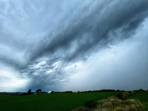
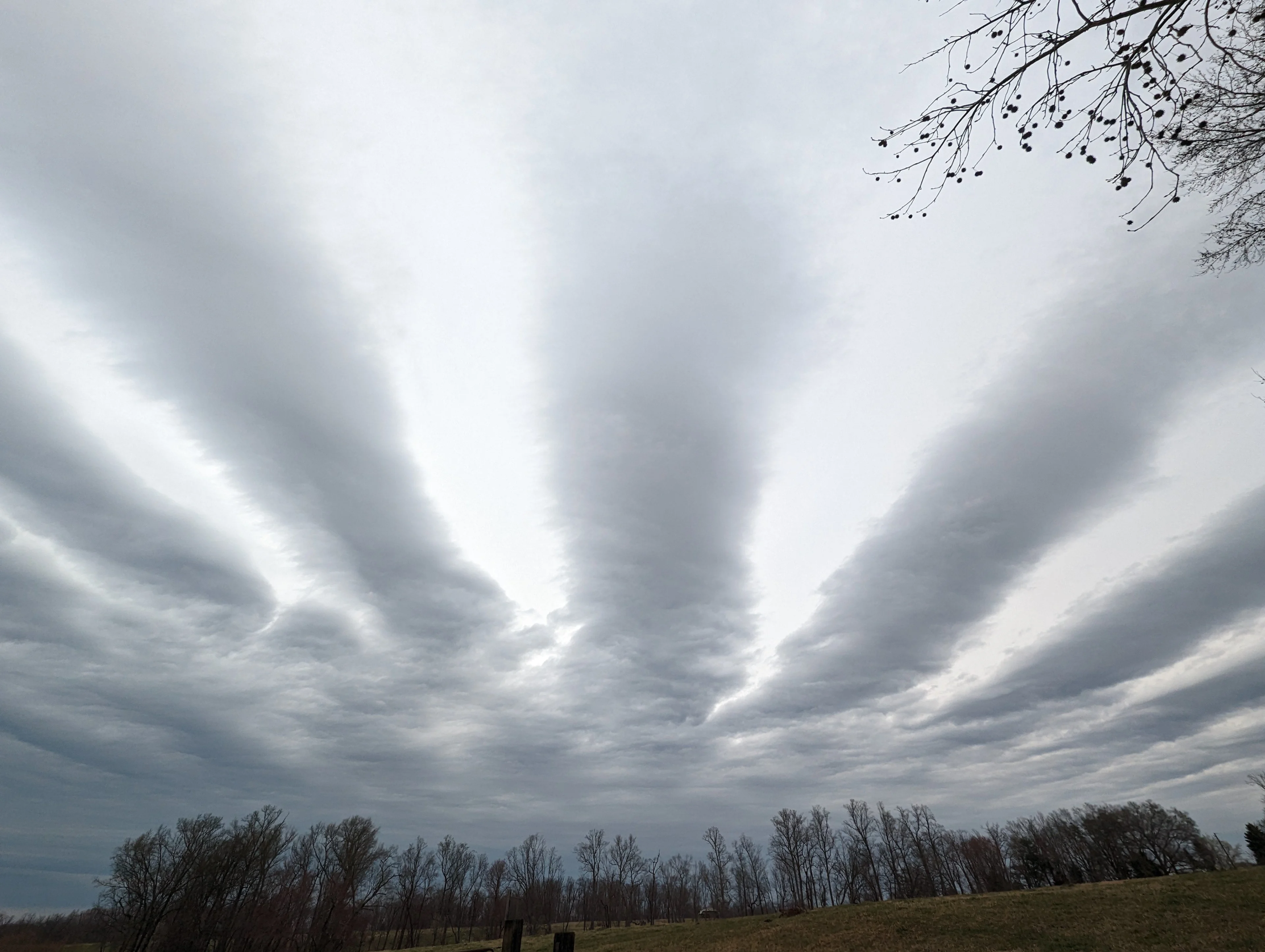
Wave clouds form dazzling ripples across the sky
Winds don’t blow in a straight line as they race above our heads. Winds twist and turn as they zip around the jet stream, and they’ll rise and fall as they encounter storms and mountains in their path.
That rising and falling motion often leads to wave clouds forming downwind of mountain ranges. Wave clouds are similar to the ripples that result from stones jutting up out of a stream. Winds blowing up and over a mountain range continue oscillating up and down as they flow away from the rough terrain.
Wave clouds ripple in the sky over Reidsville, North Carolina, on February 20, 2023. (Dennis Mersereau)
Every time the air ascends the crest of one of these atmospheric waves, the rising air cools down and its moisture condenses into a cloud. The air warms up and dries out as it sinks lower again, only to repeat the process when it encounters the next wave a short distance away.
The end result is an impressive collection of sharp, rippling clouds that march overhead like strings in an endless tapestry of grey and blue sky.
These wave clouds are a mainstay in the skies downwind from mountains, most commonly popping up in the Alberta foothills and east of the Appalachians in the U.S. Mid-Atlantic states. They can turn a satellite image into a frameable work of art, for sure, but they’re quite the sight from the ground, as well.
WATCH: Amazing time lapse of wave clouds marching across the sky
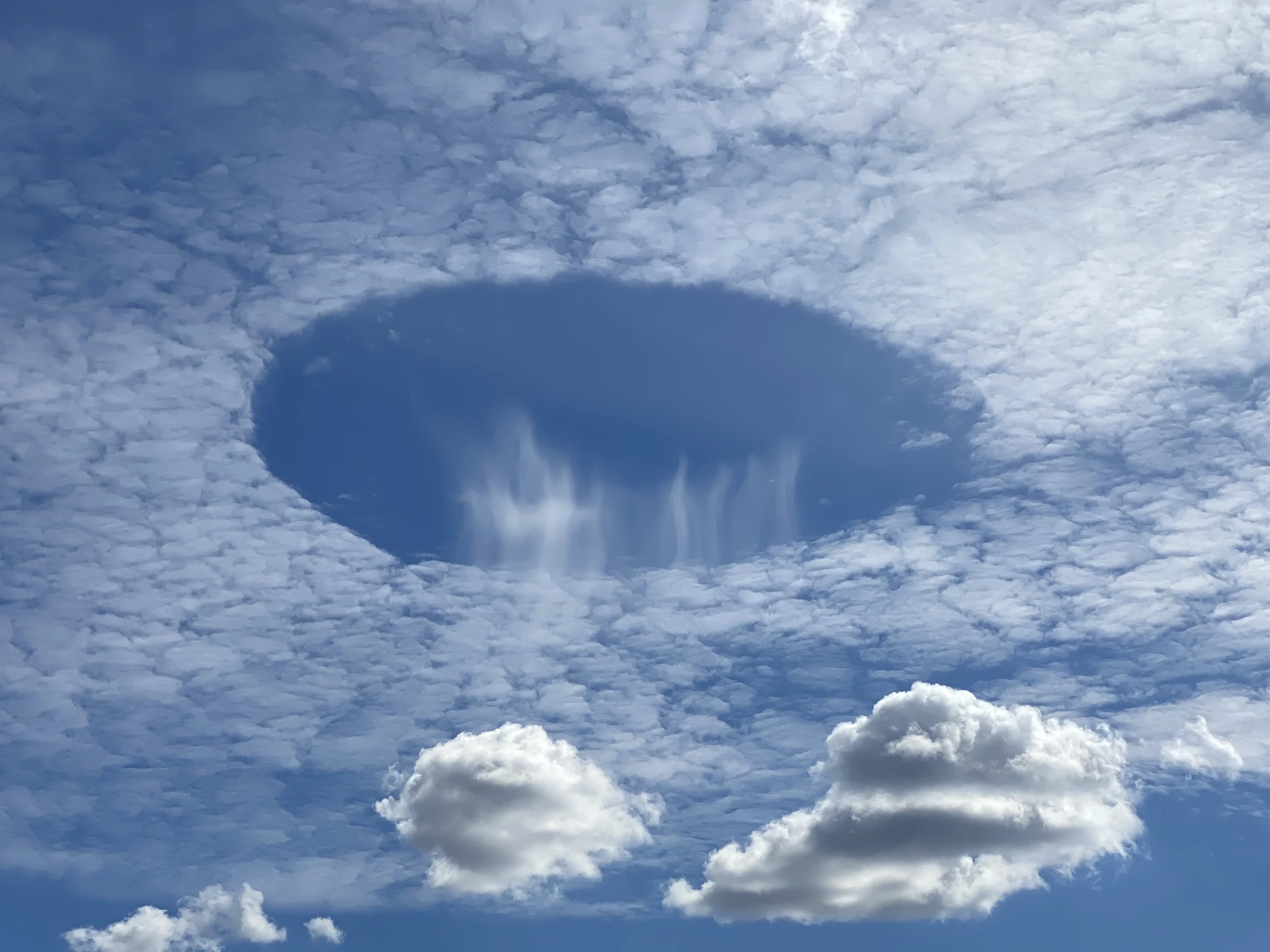
The sky appears to spring a leak with fallstreak holes
Sometimes it’s the conspicuous lack of a cloud that creates a memorable sight.
Most folks have probably seen a fallstreak hole at least once. A fallstreak hole, sometimes called a hole punch cloud, occurs within a thin deck of clouds made of supercooled water droplets.
If something disturbs this cloud deck—usually an airplane punching through on descent or takeoff—the supercooled water droplets suddenly freeze into ice crystals, triggering a domino effect of clearing that spreads out from the source of the initial disturbance.
Ice crystals precipitate out of the clearing in the cloud deck, leaving behind a mere wisp within a growing hole in the clouds. Multiple fallstreak holes can fill the sky when conditions are right.
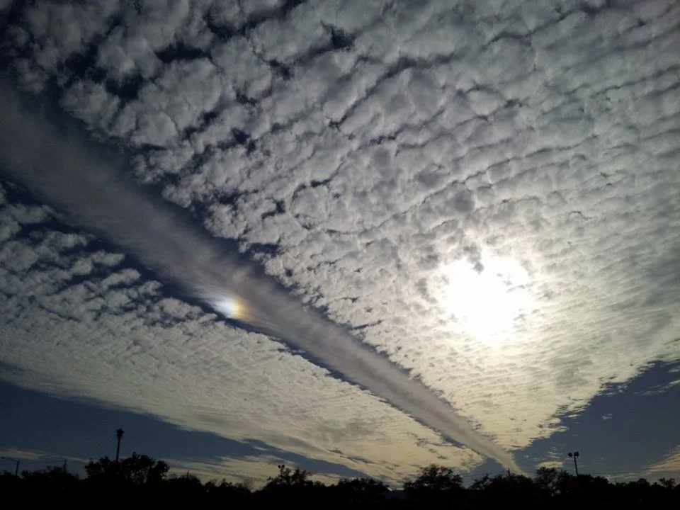
A sundog within a dissipation trail formed by an aircraft flying over Mobile, Alabama, on February 7, 2014. (Dennis Mersereau)
A plane flying level through such a cloud deck can leave behind an impressive dissipation trail in its wake, creating a long fallstreak hole that can stretch from one horizon to the other.
The incredible scene above occurred in the skies over Mobile, Alabama, on February 7, 2014. A sundog formed in the dissipation trail left behind by a cruising commercial jet, leading to an unforgettable mid-afternoon sky.
Asperitas clouds look like the ocean from below
A sky filled with clouds is a study in textures. Lumpy, jagged, smooth, towering, and wispy clouds are a common sight. But sometimes conditions are right to fill the sky with a fabulous display of rolling, crashing clouds that look like you’re staring up at the surface of the ocean from the sandy depths.
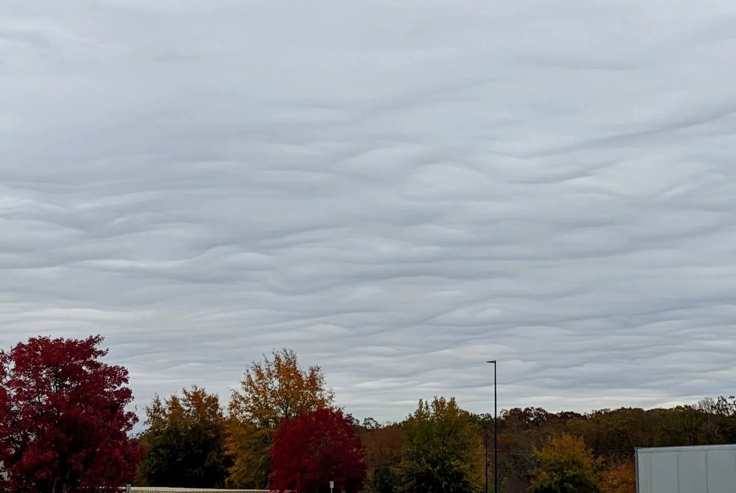
These oceanic lookalikes are called asperitas clouds, formerly known as undulatus asperatus. It’s the newest cloud type recognized by the International Cloud Atlas, earning a distinct classification for its unique appearance.
Meteorologists continue to debate exactly how asperitas clouds form. They’re most common in the wake of thunderstorms and cold fronts, developing atop colder and more stable air hugging the surface. Undulations between the top of this stable layer of air at the surface and layers of air above may lend asperitas clouds their trademark appearance.
Oceans host vast blankets of cloud streets
Clouds are more than just blobs of condensed moisture—they act like the atmosphere’s fingerprint on an active day. The atmosphere is a turbulent fluid that’s always sloshing in every direction around us. A sky full of clouds is the closest we’ll ever get to actually seeing the wind in all its glory.
A hulking low-pressure system that grows larger than an entire continent is one of nature’s purest displays of raw power. We get to see these mammoth structures when clouds wrap into the centre of the storm and reveal a pinwheel of winds that stretches for thousands of kilometres.
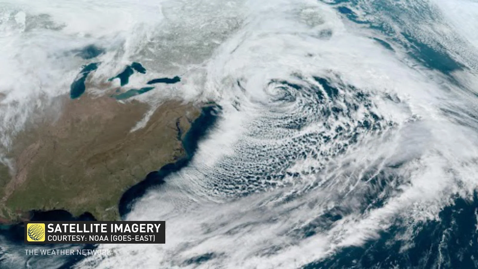
But it’s not always winds flowing into the centre of the storm that are the most interesting.
Cloud streets are common on the southern side of vast low-pressure systems as they swirl off North America and into the western Atlantic Ocean. These sprawling fields of cumulus clouds bubble up when cold air sweeps over warmer ocean waters below.
MUST SEE: Rare 'cloud streets' stream across Lake Superior
The temperature difference between the chilly air and tepid water creates convection—much like we see over the Great Lakes during lake-effect snow. Puffy cumulus clouds form as moisture condenses in the rising air. The sky around each cloud remains clear as the air dries out as it sinks back toward the surface.
These individual clouds organize into neat rows in the blustery winds behind the front, creating those mesmerizing patterns of cloud streets we see so often off our shores during the fall, winter, and spring.
WATCH: Rare clouds tower over Nova Scotia like crashing waves
Rope clouds race across steamy oceans every day
Plenty of the awesome clouds that grace our skies happen over the open waters where only a handful of lucky boaters get to witness them close-up.
Thankfully, high-resolution satellites give us all a front-row seat to these spectacular formations with updates arriving in our pockets every couple of minutes.
One such formation is the rope cloud, a narrow, smooth band of clouds that can grow hundreds of kilometres long as they race across warmer waters.
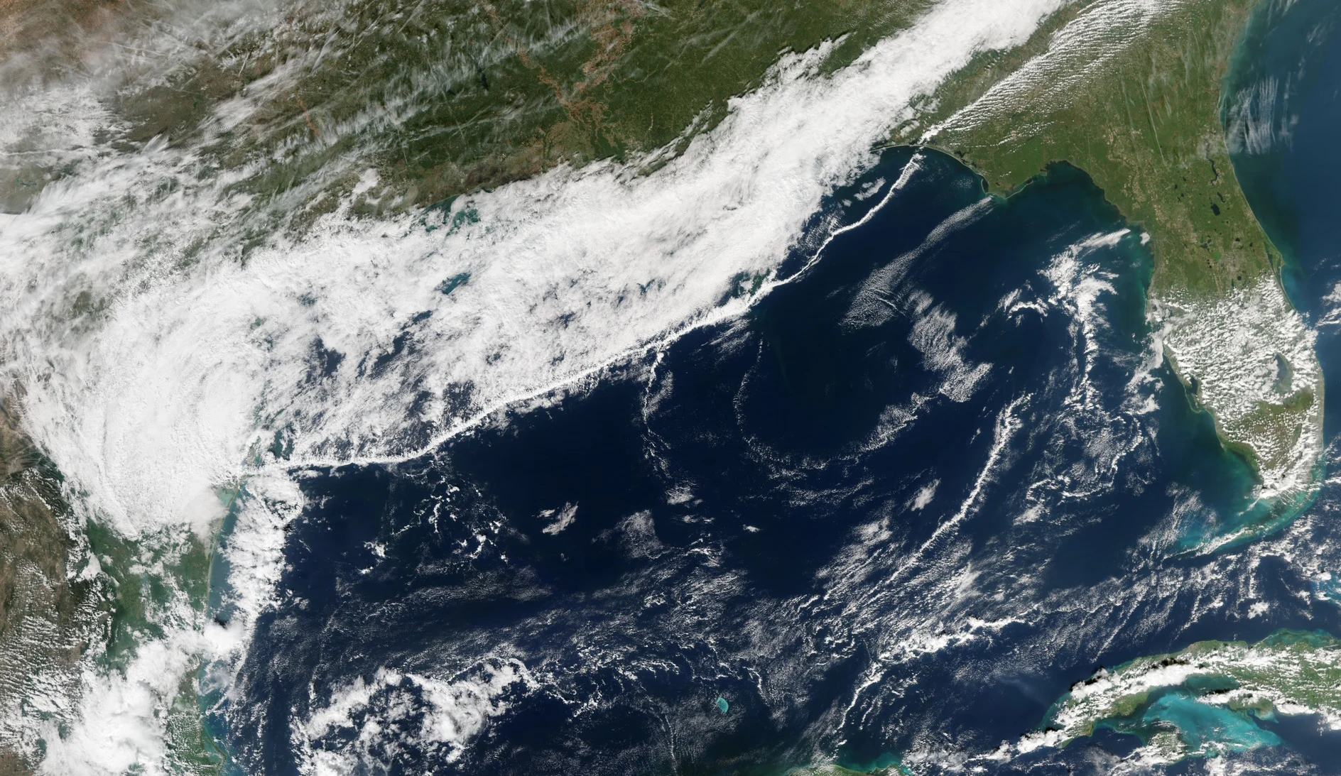
A dramatic rope cloud along a cold front over the Gulf of Mexico on November 12, 2015. (NASA)
Rope clouds over land are often called roll clouds. These ominous-looking features form in a similar manner to shelf clouds, those startling appendages to the bottom of thunderstorms we often see during the spring and summer months.
Rain-cooled air racing away from the base of a thunderstorm runs against unstable air in its path, forcing that air to rise and condense as it’s scooped skyward.
We sometimes see roll clouds over land with the passage of a cold front or a thunderstorm outflow boundary, but minimal friction over water provides ample opportunities for roll clouds to flourish.
Actinoform clouds are strange spokes lurking over the Pacific
If you’ve ever had a chance to take a long look at a high-resolution satellite image of the entire western hemisphere, you’ve likely seen actinoform clouds—possibly without realizing it.
DON'T MISS: Trying to predict the weather? These eight clouds will help
Actinoform clouds join asperitas clouds as one of the newer additions to our vocabulary. In fact, we didn’t know this specific type of cloud existed until the launch of the first weather satellites back in the early 1960s.
There’s a good reason these clouds went unnoticed until we plunked cameras into orbit.
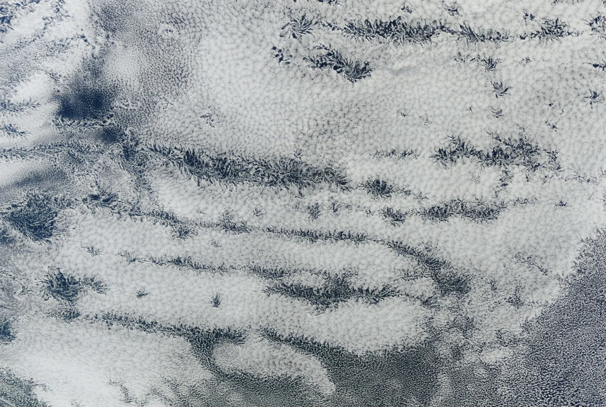
Actinoform clouds blossom over the southern Pacific Ocean on June 28, 2012. (NASA)
These clouds typically form over the chilly waters of the southeastern Pacific and southern Atlantic.
From the surface, actinoform clouds look like rather unassuming lines of broken cumulus or stratus clouds. But peer at these clouds from above and you’ll see tremendous swaths of intricate swirls and fractals pulling on the clouds, covering hundreds and even thousands of kilometres of water.
A classic actinoform formation looks similar to a bicycle wheel, with spokes of clouds dancing around a central ‘hub,’ making each formation look like pinwheels, chains, or even patterns similar to window frost that forms on a frigid morning. There can be hundreds of these clusters at a time covering immense swaths of open ocean.
As with any new discovery, meteorologists are still studying and debating exactly what creates actinoform clouds, and why they seem endemic to the very cold waters of the southern hemisphere.
Thumbnail image courtesy of Ryan Borza in Edmonton, Alberta.