
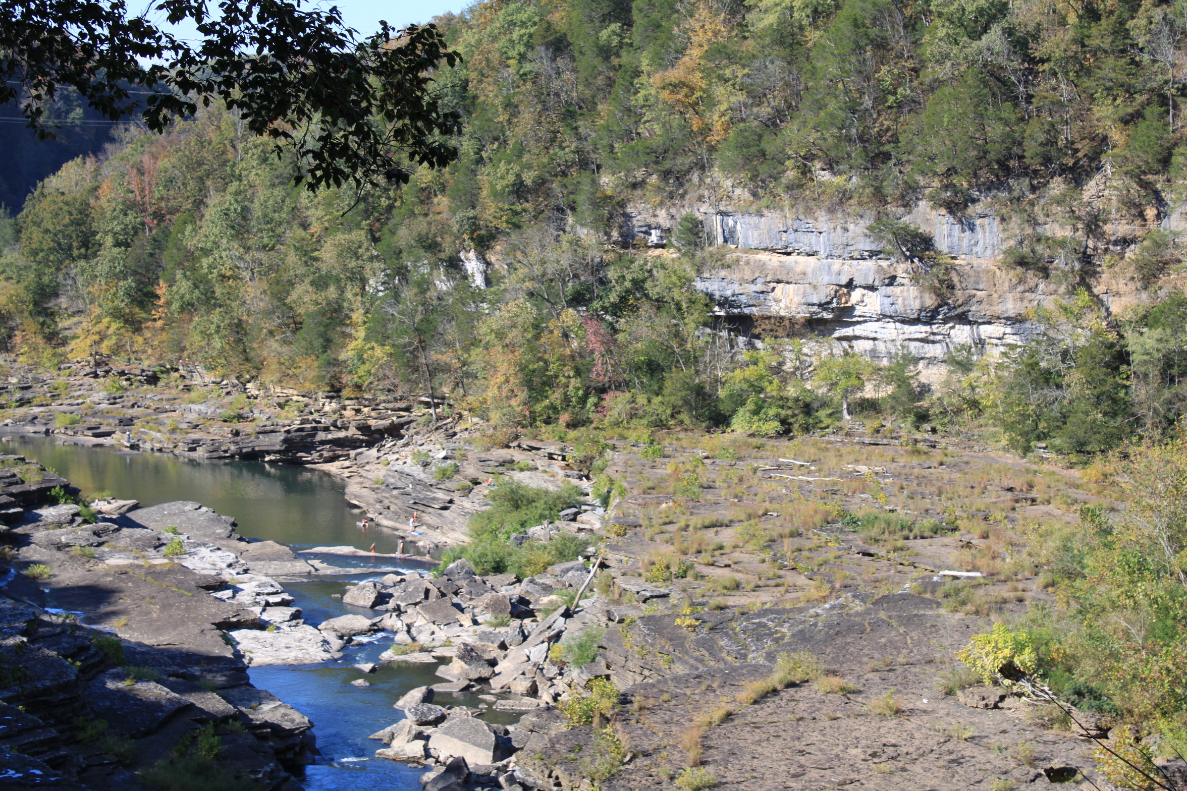
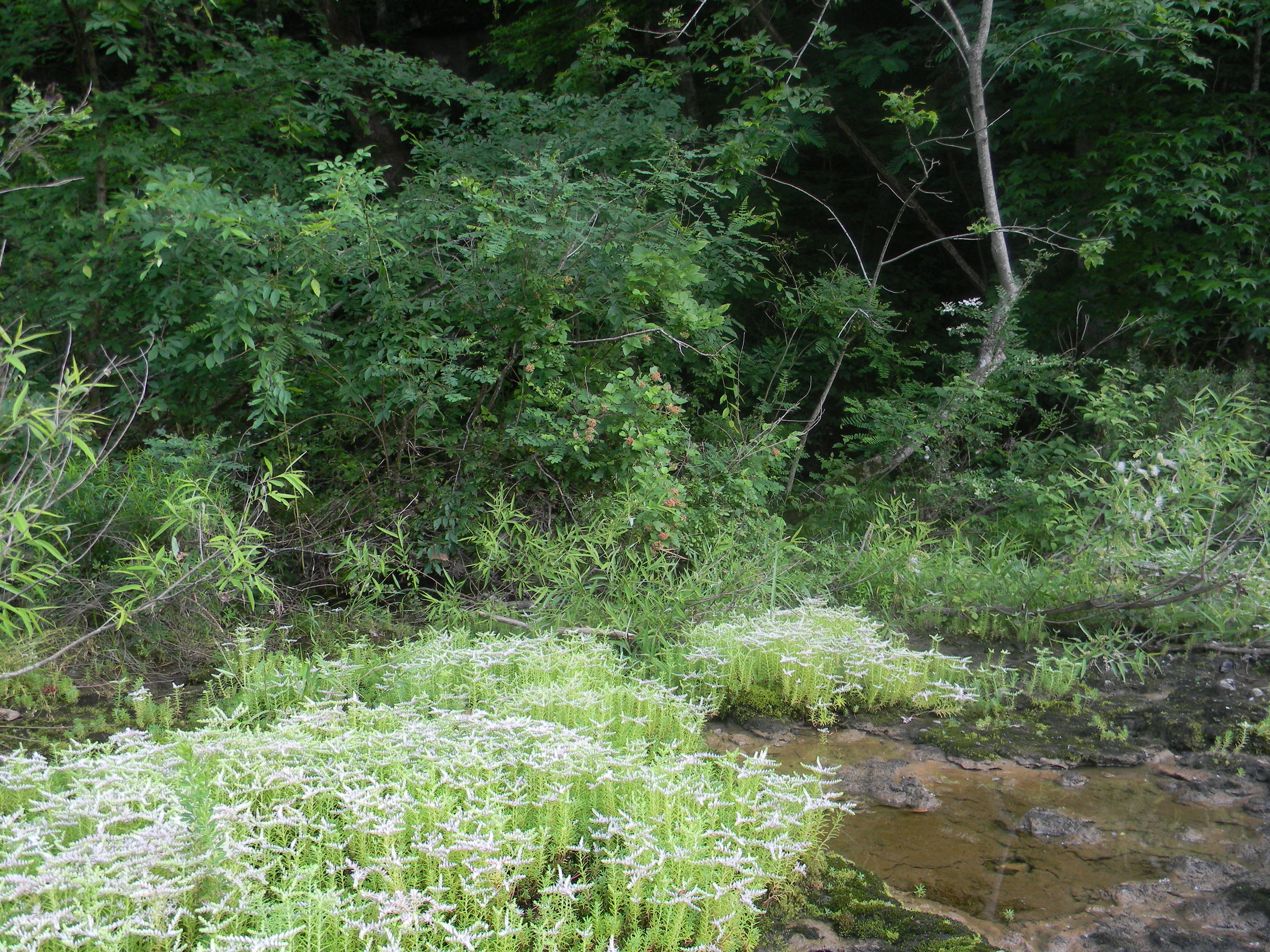
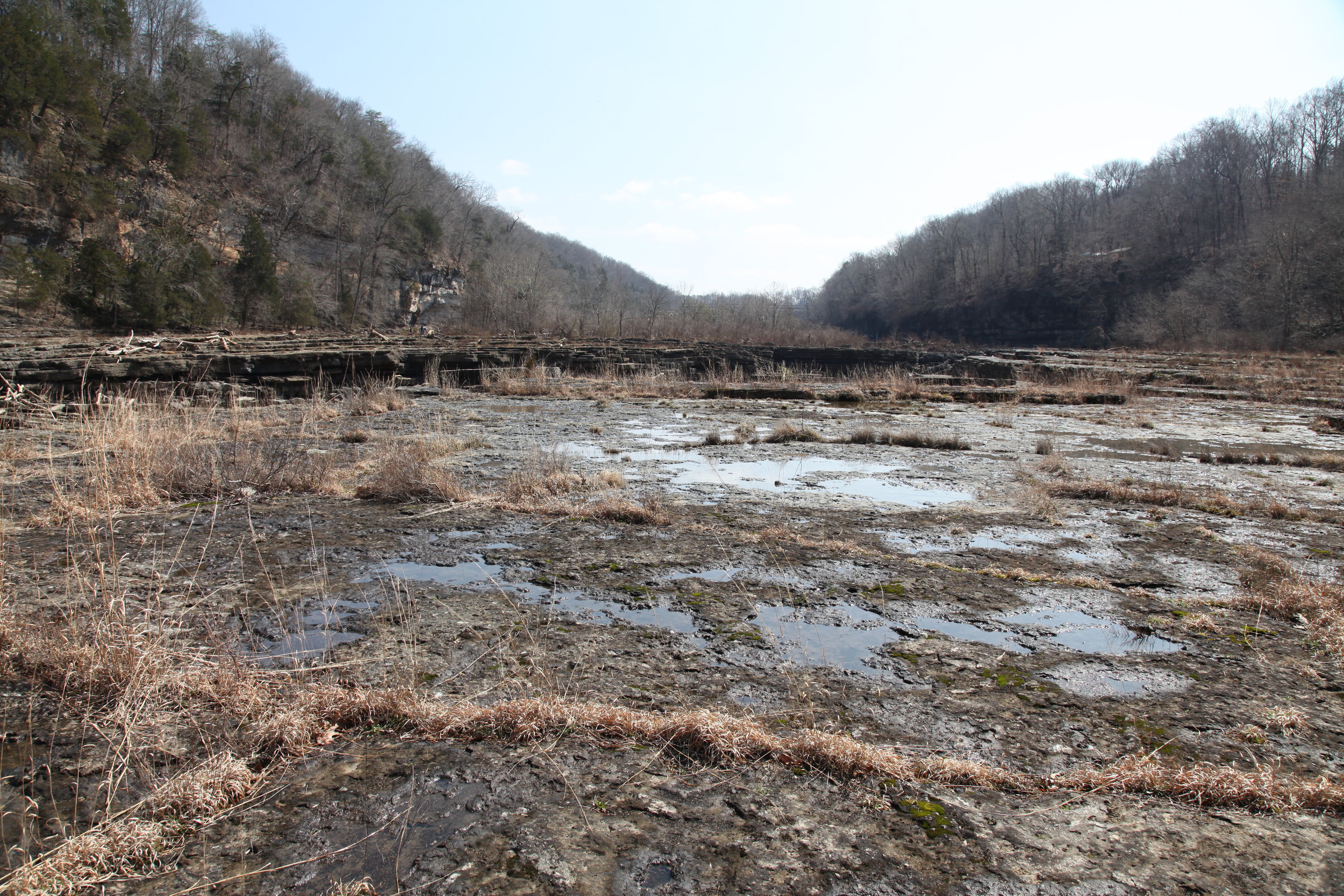
Interior Plateaus Limestone Riverscour Glade, Rock Island State Park, White and Warren counties, Tennessee. Credit: Dwayne Estes.
In the previous blog post describing the Southeast's super diverse grassland communities, I described the sandstone cobble bars referred to by ecologists as Cumberland Plateau Riverscour. This blog post is dedicated to a related but entirely different community, Highland Rim Limestone Riverscour Glade.

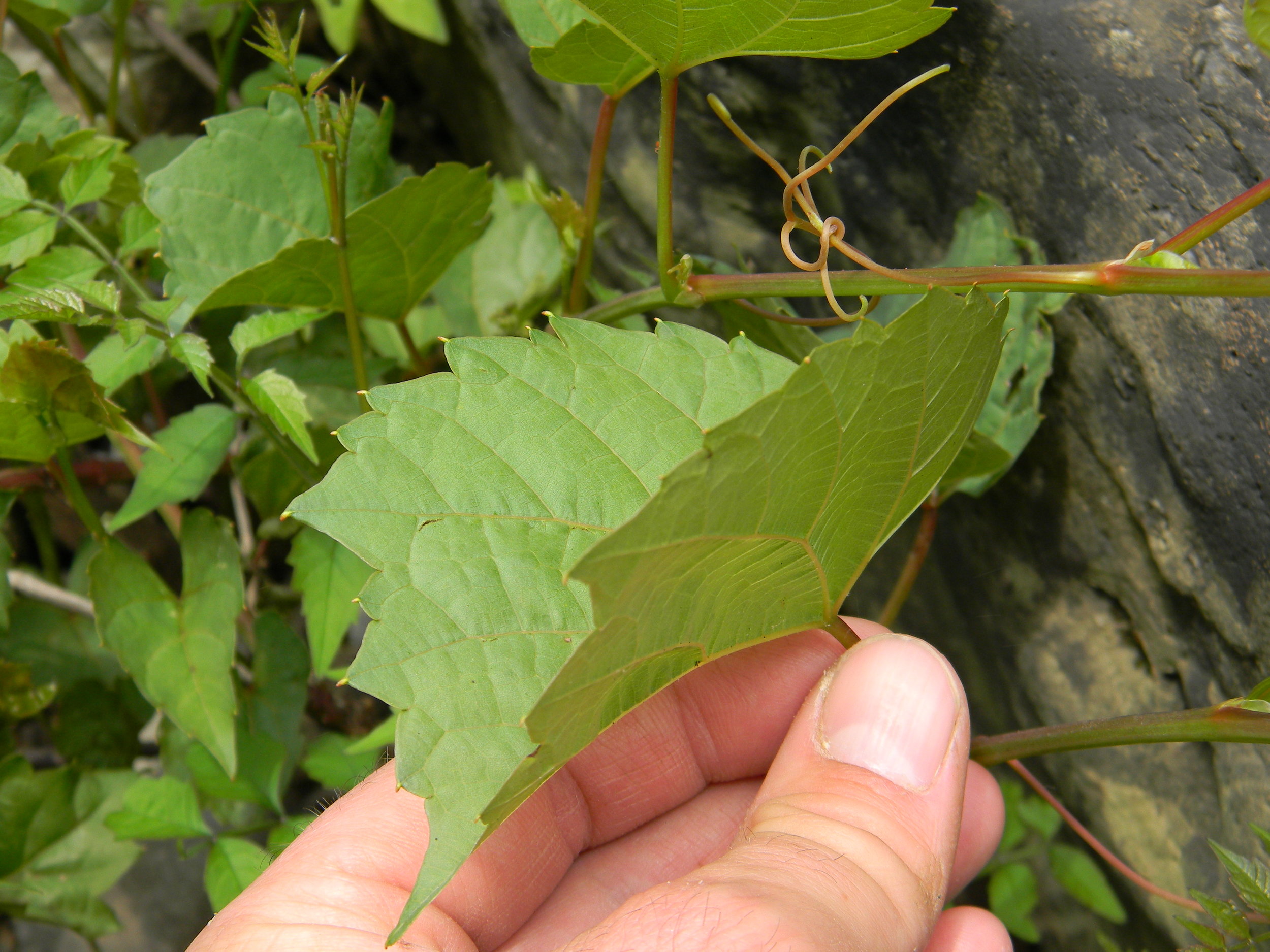
This photo shows the two factors that maintain this unusual grassland, soils thin to absent and high degree of flooding (note the driftwood).
This community is a type of glade, which is a rocky grassland/shrubland community that is found along just a few rivers in the Interior Plateaus ecoregion of central and east-central portions of Tennessee and Kentucky, southern Indiana, southern Ohio (?), and historically northern Alabama.
You may be wondering, "where is the grass?" Unlike most "typical" grasslands which have more grass cover, in this grassland type, the grasses and other herbaceous species characteristic of prairies, savannas, and barrens, are restricted to thin cracks in the limestone bedrock. This community also differs from most "typical" glades in that it occurs alongside rivers. Therefore, it is maintained by two factors. First, its extremely shallow soils and high exposure of bedrock makes it an edaphic grassland. Secondly, due to its position alongside streams it is also subjected to scouring effects of periodic floods.
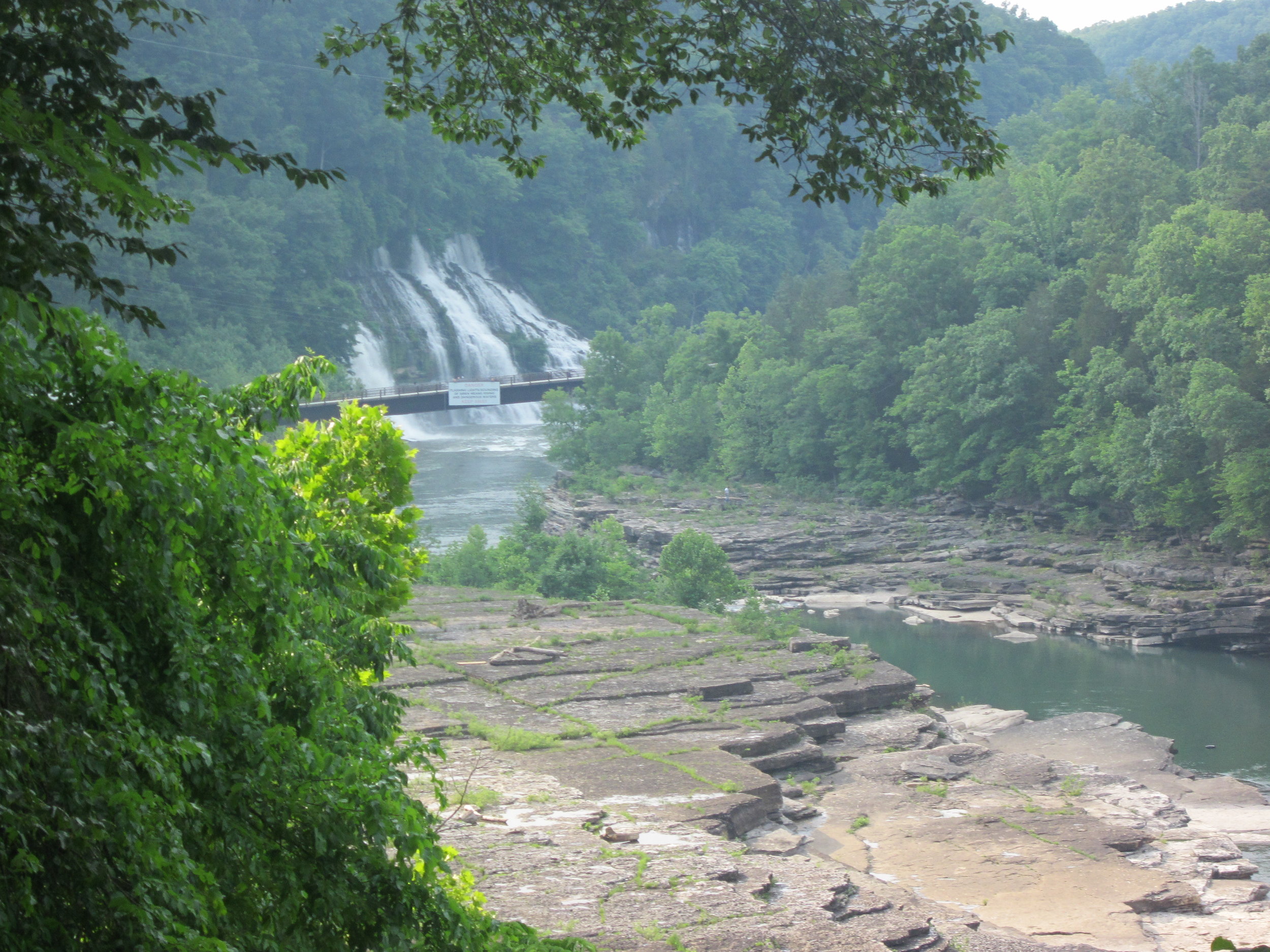
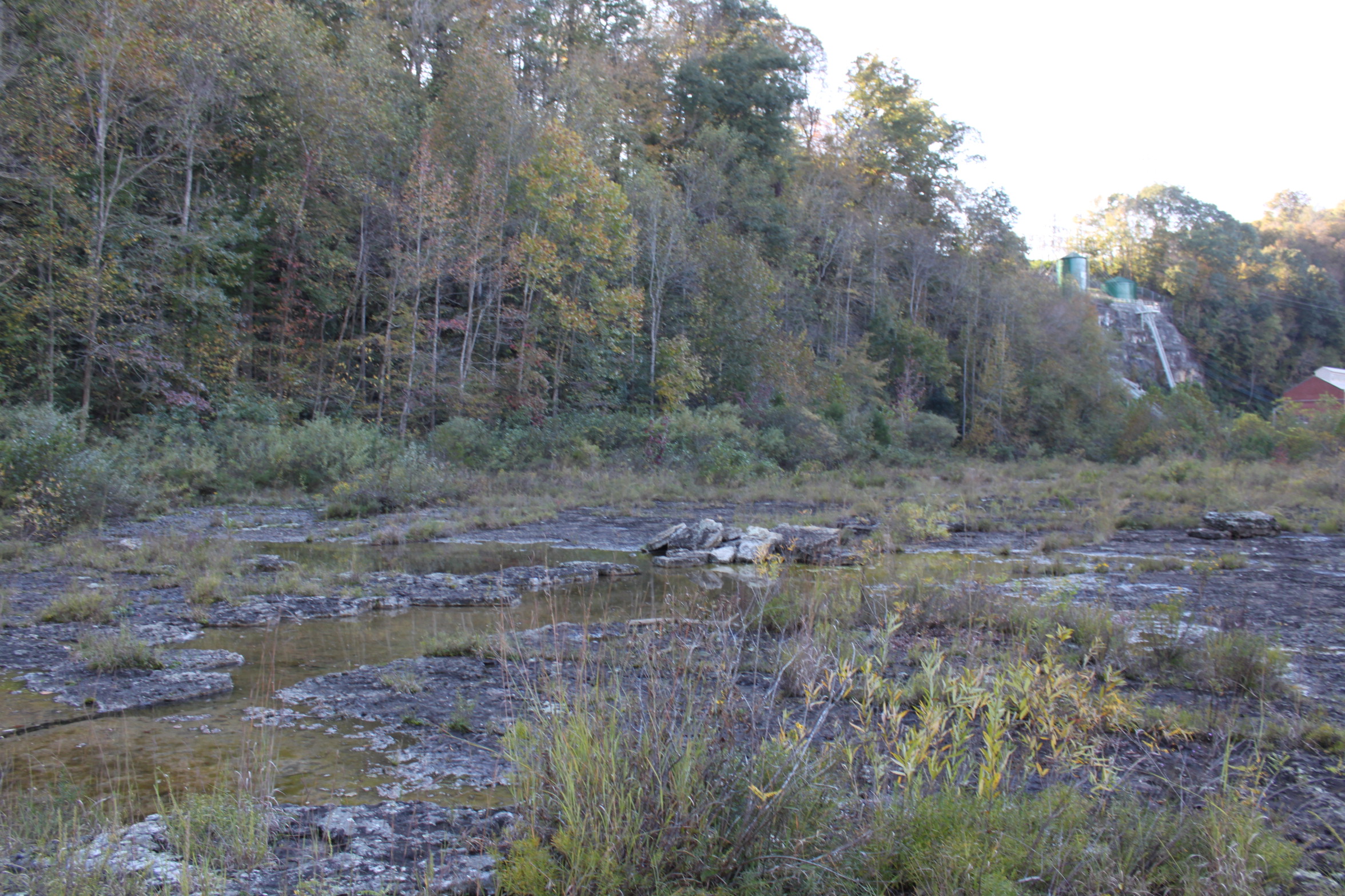
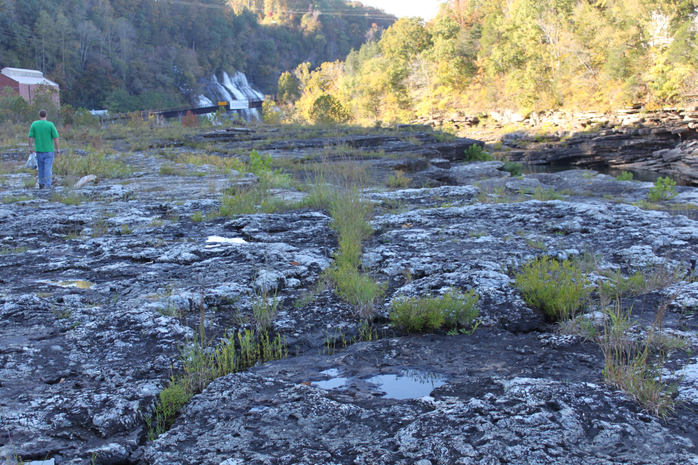
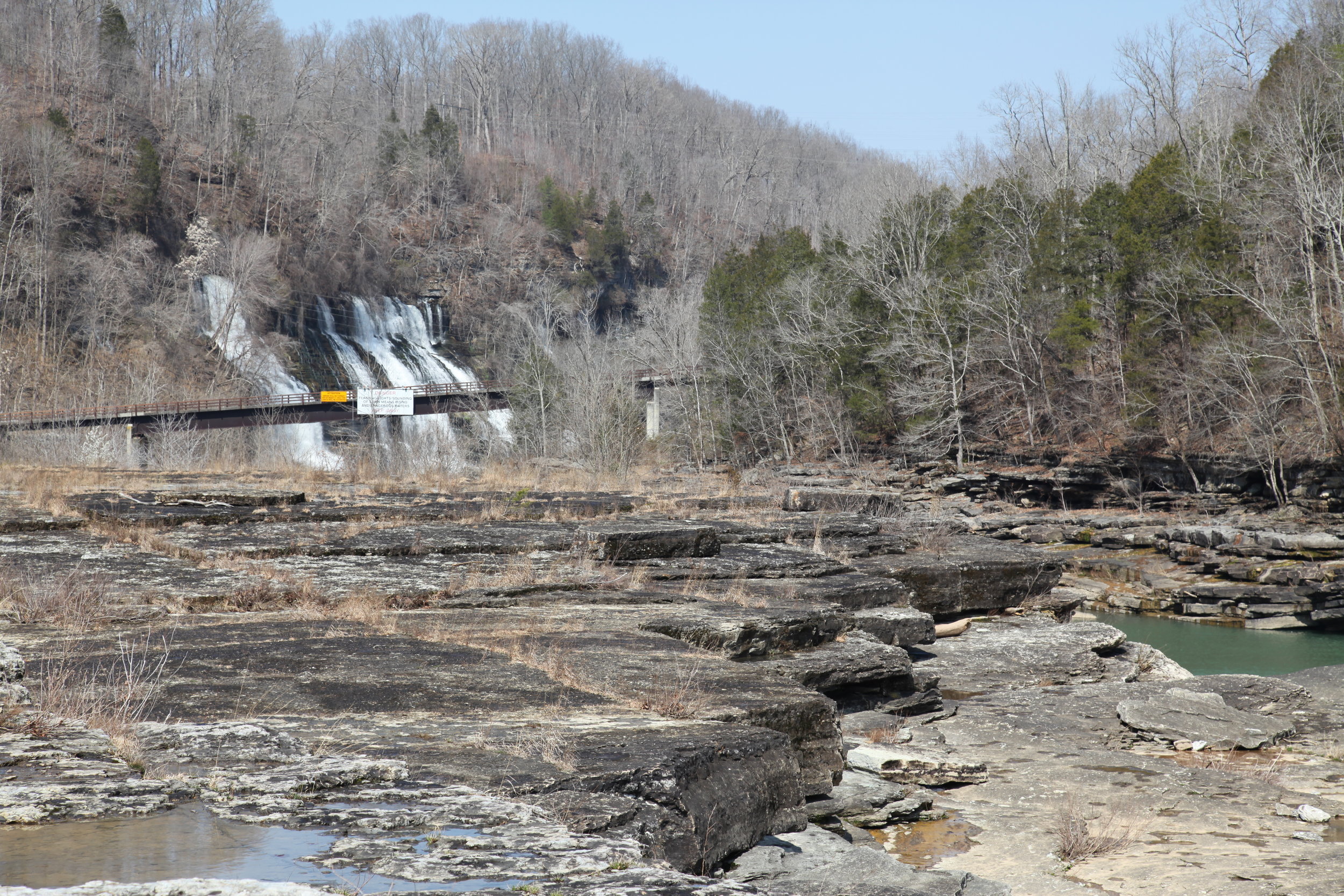
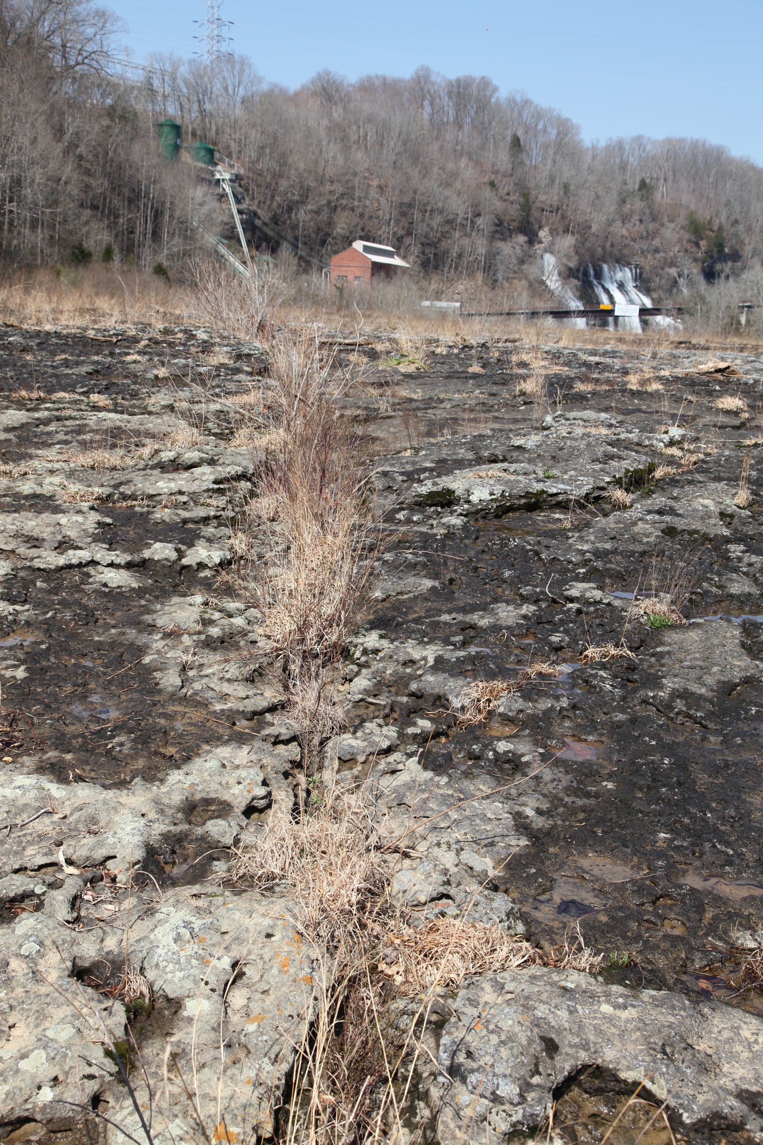
The best example of Interior Plateaus Limestone Riverscour occurs at Rock Island State Park on the Caney Fork River in White and Warren counties, Tennessee. It may have been more common historically in small thin glade strips farther down the Caney Fork River but Center Hill Lake has impounded most of the lower portion of the river. Just a half-mile upstream from Rock Island is Great Falls Dam, so this natural gem is literally sandwiched between completely altered sections of river.

Google Earth image of the best Limestone Riverscour Glade complex probably in existence in the southeastern U.S. At lower right is Great Falls Dam. In upper left (out of scene) the river flows around a bend and then the impounded waters of Center Hill Lake are reached. This is a glimpse at what the original riverbed in this section looked like. The best glade is located at far left on the south side of the river. The northern half of the river is in White County and the southern half in Warren County, TN. Source: Google Earth.
When I first visited Rock Island several years ago I was blown away not only by the biodiversity of this community, but also by the abundance of rare species. Not long after, I introduced one of my graduate students, Mason Brock, to the site and we decided he would begin to study the riverscour communities of the Caney Fork River. The Caney Fork originates on the Cumberland Plateau and drops about 1,000 feet in elevation and enters the Interior Plateaus ecoregion. Along its length, it features three distinct types of riverscour: sandstone cobble bar barrens, sandstone glades, and limestone glades.
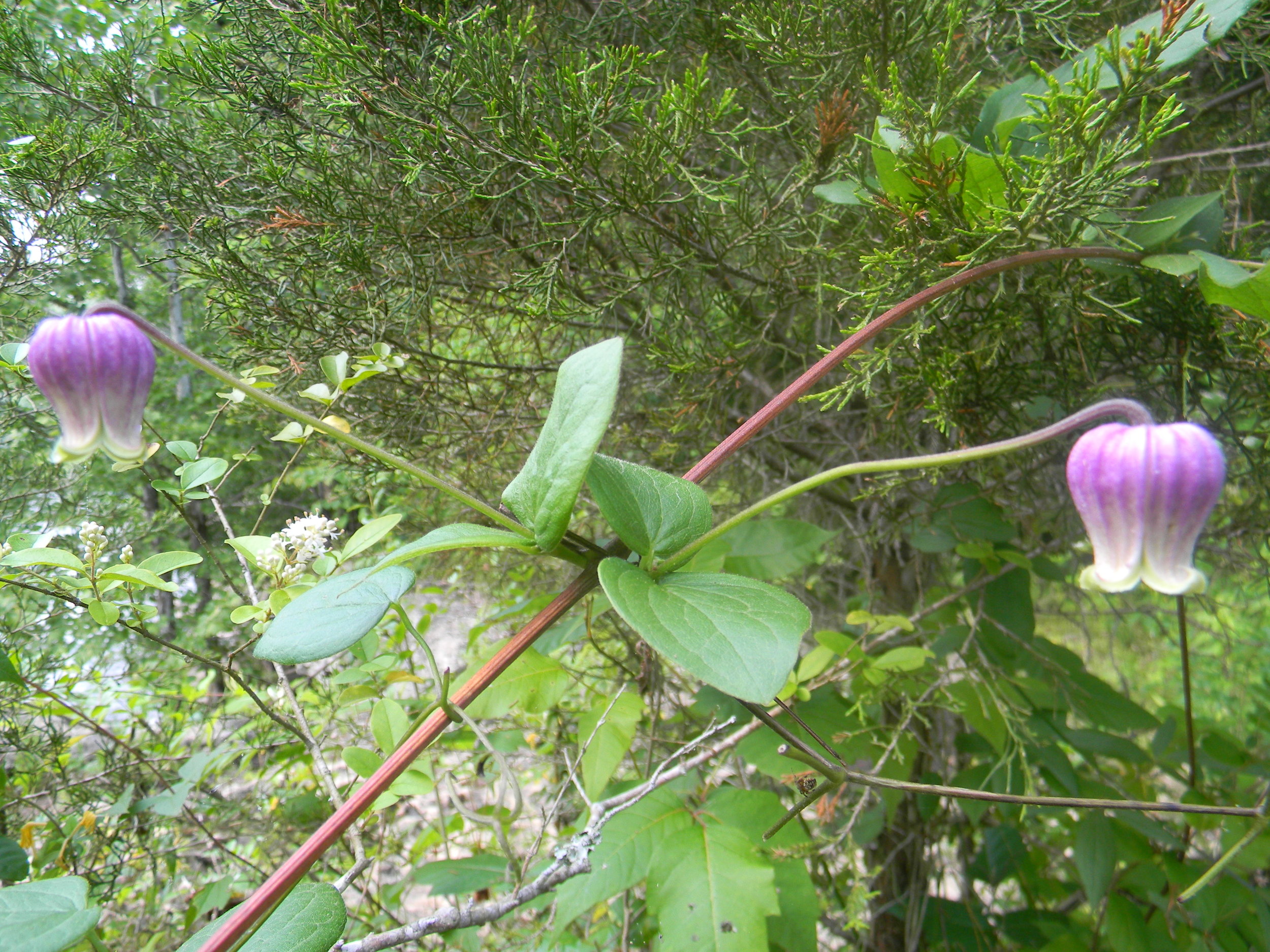
Undescribed species, the Cumberland Leatherflower (Clematis sp. nov.), on limestone scour at Rock Island State Park, White Co., TN. Credit: Dwayne Estes.
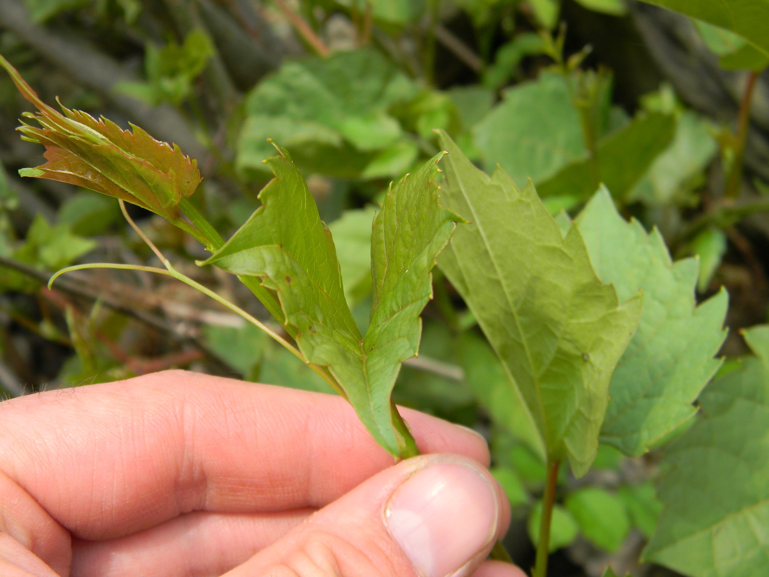
Mason studied all three types and found that the limestone scour communities were very different floristically from the sandstone sites. However, a number of uncommon species were found on both sandstone and limestone scour. One of the more notable species that occurs on both the sandstone and limestone sites is an unnamed species that Austin Peay graduate and SGI research associate, Devin Rodgers, and I will be naming soon. It is to be called the Cumberland Leatherflower and is a type of Clematis. It is unique in the region for having long flower stalks and leafy bracts located near the base of the leafstalk.
The large flat glade at Rock Island is divided on its surface by numerous cracks, and the area between the cracks is largely devoid of plants. Within each of the cracks, a number of species compete for space, including such prairie indicators as big bluestem (Andropogon gerardii), Indian grass (Sorghastrum nutans), and little bluestem (Schizachyrium scoparium).

Limestone Riverscour Glade, Rock Island State Park, Warren Co., TN. The cracks in the bedrock are densely packed with a small form of big bluestem (Andropogon aff. gerardii) which is also dominant on sandstone cobble bars of the Cumberland Plateau. This big bluestem may be an undescribed species or variety unique to riverscour. Pringle's Aster is common in these cracks along with Little Bluestem (Schizachyrium scoparium), Bushy St. John's-wort (Hypericum interior), False Dragonhead (Physostegia virginiana var. praemorsa), Aromatic Aster (Symphyotrichum oblongifolium), and Carolina Willow (Salix caroliniana). Credit: Dwayne Estes.
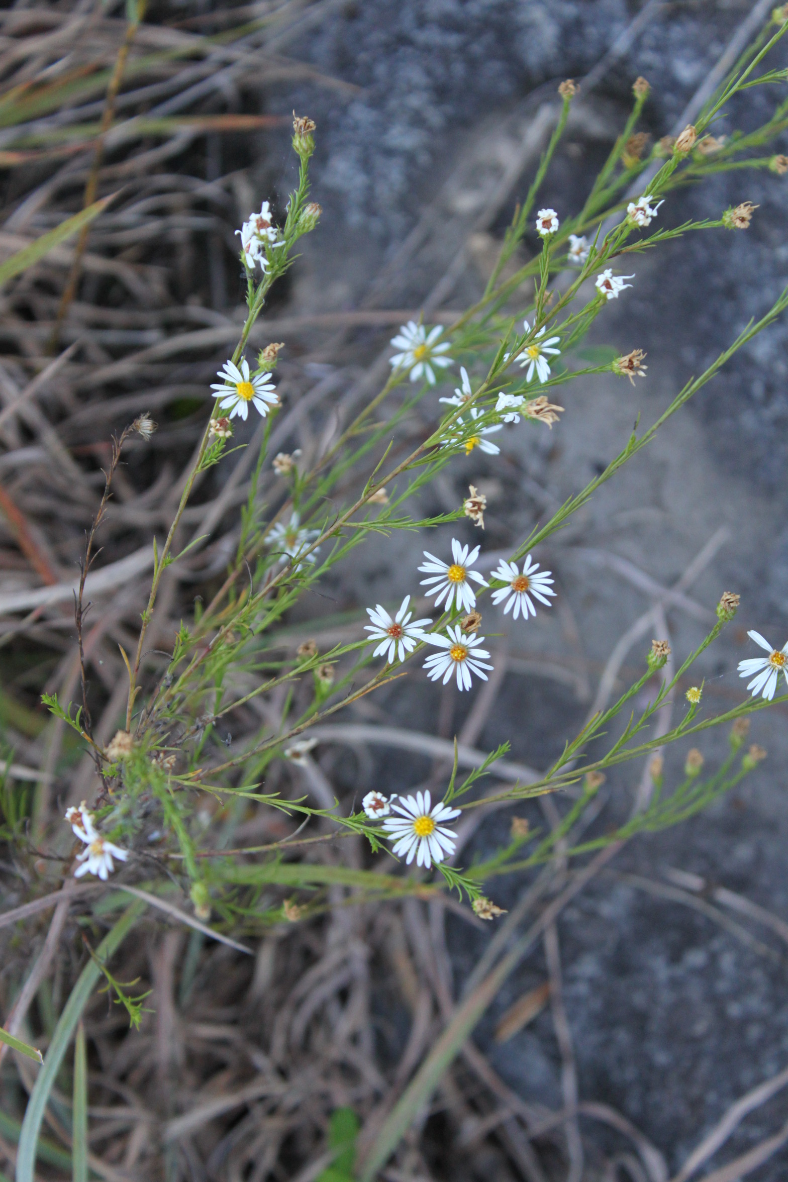
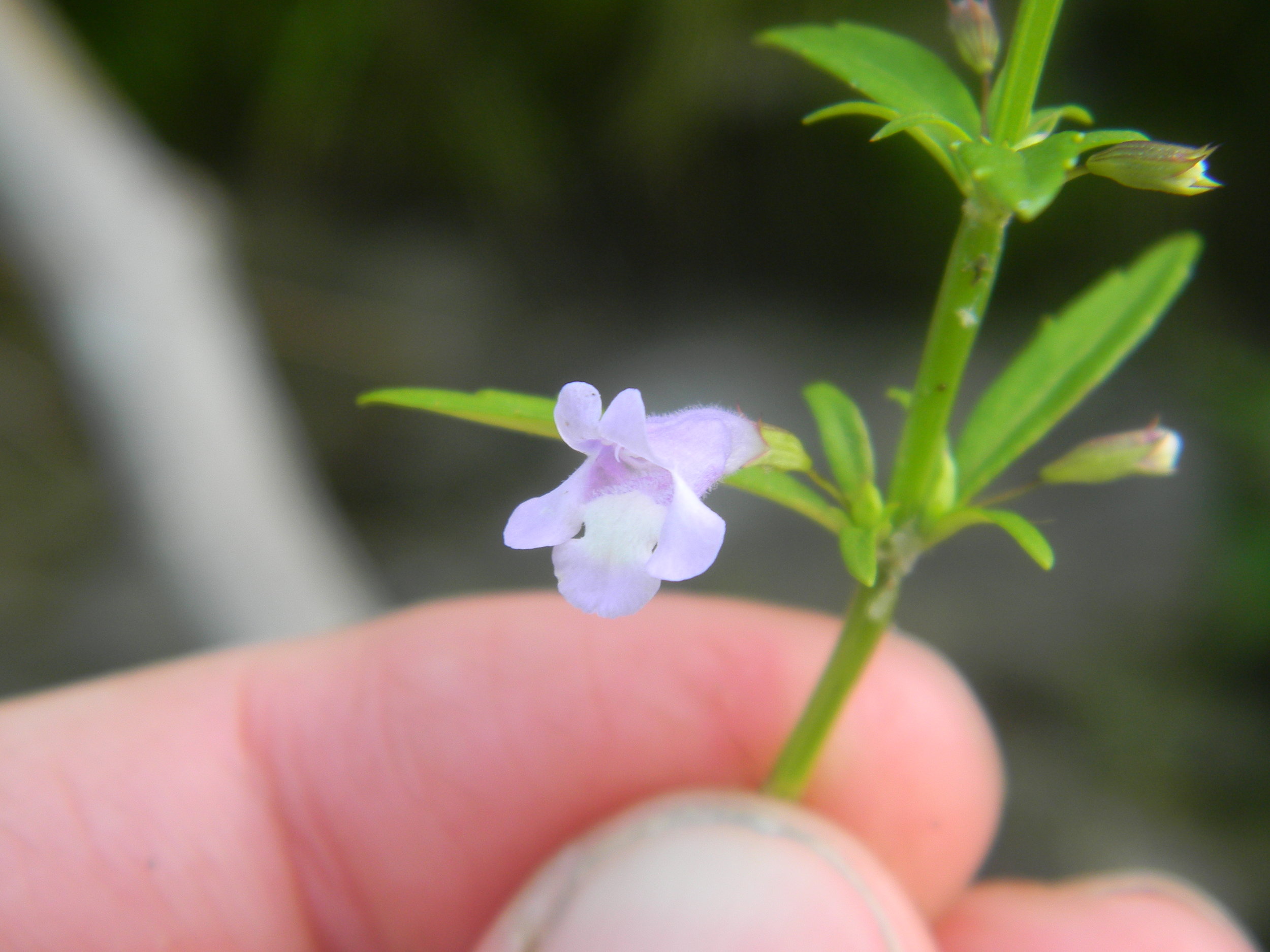
Pringle's Aster (Symphyotrichum pilosum var. pringlei is known only from this single site in Tennessee. Credit: Dwayne Estes.
Numerous rare or uncommon species occur in the cracks, including white prairie clover (Dalea candida), Pringle's aster (Symphyotrichum pilosum var. pringlei), blue wild indigo (Baptisia australis), Shining Bluestar (Amsonia illustris), and stiff goldenrod (Solidago rigida). In fact the aster is the only place in all of Tennessee for what is mostly a northern/Midwestern aster.
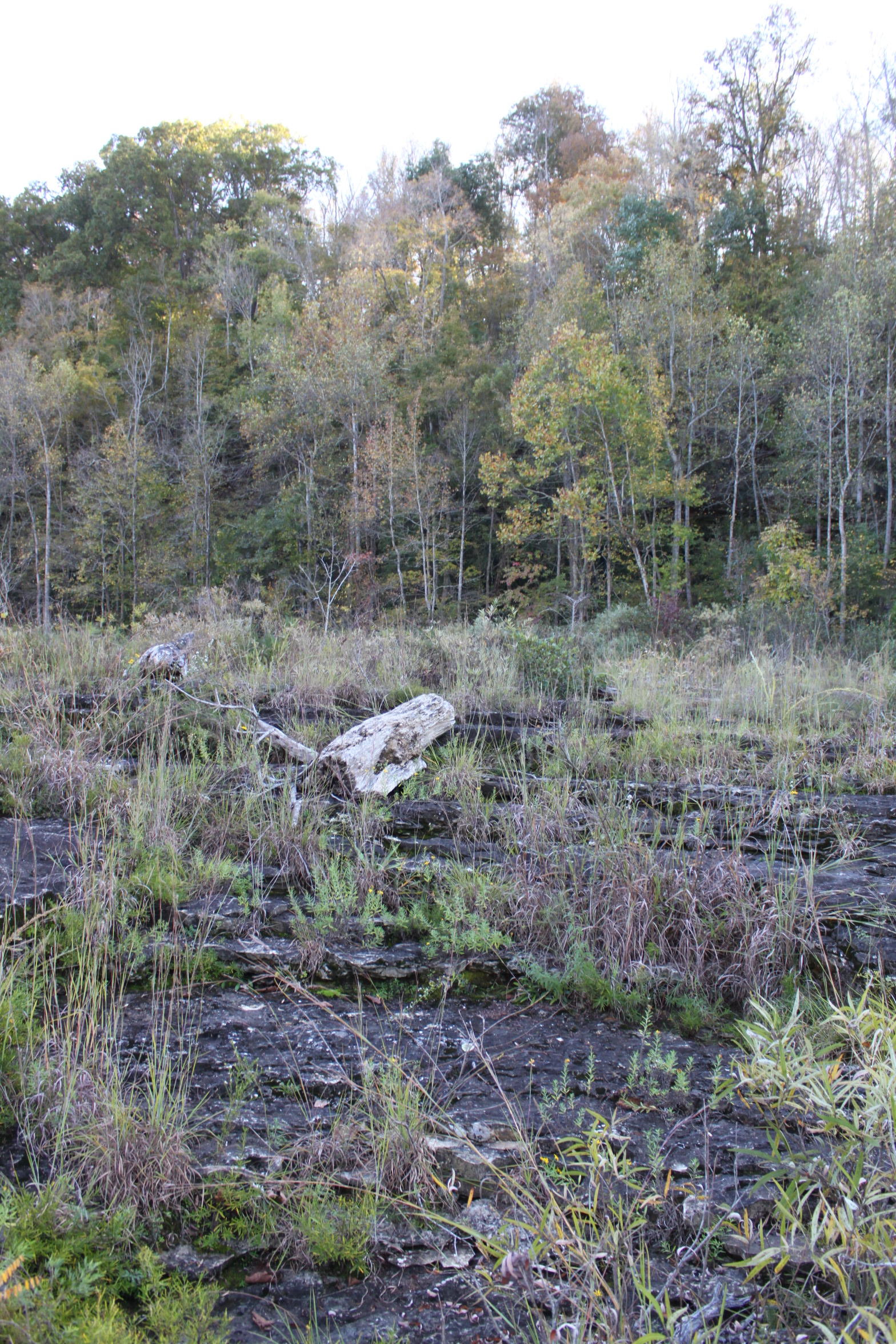
Water from both rain and floods often pools on the flat limestone bedrock creating small ephemeral wetlands. Many typical species of marshes and open wetlands are found in the cracks that are adjacent to these wet pools, including many sedges, rushes, and even a couple of beakrushes (Rhynchospora glomerata), the last of which is uncommon in calcareous habitats. Small-headed rush (Juncus brachycephalus) has been reported from these wet limestone glades in the past but has not been seen in more than 40 years. Other rarities include shining ladies-tresses (Spiranthes lucida). Widow's cross (Sedum pulchellum) grows in abundance in the spring when moisture is abundant.

Pools of water on the open Riverscour Glade add another dimension which provides habitat for dozens of species of wetland plants. The back edge of this glade also provides habitat for calcareous shrub wetlands. Credit: Dwayne Estes.

Maidenbush (Phyllanthopsis phyllanthoides) grows in limestone riverscour habitats in central TN. Photo credit: Ketona Dolomite Barrens, Bibb Co., AL by Eric Hunt.
Closer to the river where the rocks have been broken and form a bouldery bank along the water, several other rarities were found. Most notable perhaps is the Maidenbush (Phyallanthopsis phyllanthoides). This rare shrub of the spurge family is most common west of the Mississippi River in the glades of the Ozarks and Ouachita Mountains of Arkansas, Missouri, and Oklahoma. Prior to finding it on the Caney Fork River, it had only been documented to occur in three other areas east of the Mississippi River: on dolomite barrens along the Little Cahaba River (Bibb Co., AL) and on sandstone cobble bars of the Locust Fork and Mulberry Fork of the Warrior River (two different rivers in Blount Co., AL).

Map showing the distribution of Maidenbush (Phyllanthopsis phyllanthoides). Source: http://bonap.net/MapGallery/County/Phyllanthopsis%20phyllanthoides.png.
The day I first stumbled across the Maidenbush was a day full of discoveries. Growing nearby on the bouldery riverbank was the endangered rock grape (Vitis rupestris), a species with a very similar distribution as Maidenbush that previously had not been seen in Tennessee since the 1880s except for a population found just a couple of years earlier near Clarksville, Tennessee along the Cumberland River by Sunny Fleming, Tianita Duke, and myself.

Limestone Riverscour Glade along shore of Cumberland River below King and Queen's Bluff in Clarksville, Tennessee. This glade is home to numerous rare species including the endangered rock grape (Vitis rupestris) and prairie grasses such as big bluestem (Andropogon gerardii), little bluestem (Schizachyrium scoparium), and eastern gamagrass (Tripsacum dactyloides) line the upper edge of the glade. Credit: Mason Brock. Some of the species found here are known in Tennessee otherwise only from Rock Island State Park about 100 miles to the east, including rock grape and Midwestern Silky Dogwood (Cornus obliqua).
Limestone scour glades are one of the rarest plant communities in eastern North America. This is due in part to the fact that over the past two centuries damming of rivers or dynamiting of riverbeds to improve navigation has eliminated some of the best sites.

Specimen of Orbexilum stipulatum in the Ravenel Collection, University of South Carolina Herbarium. Credit: University of South Carolina Herbarium.
The Falls of the Ohio River, long known as a navigational hazard and as a major landmark to Native American tribes and the earliest French and English explorers, was an area of extensive limestone scour near present-day Louisville, Kentucky. It was considered to be an important crossing place for buffalo and Native Americans. Orbexilum stipulatum, one of the relatively few extinct plant species known from eastern North America according to expert Wes Knapp (North Carolina Natural Heritage Program), was discovered at the Falls of the Ohio presumably in limestone scour glades by Dr. Charles W. Short in the 1830s. He made several herbarium collections from the site which he deposited at numerous institutions where they are still preserved to this day. Unfortunately, the species has not been seen since the days of Dr. Short.
Another species at the Falls of the Ohio that is only found at a few other sites worldwide is Short's Goldenrod, named for Dr. Short who was the first person to collect it. Dr. Reed Noss, SGI's Chief Science Advisor and Professor Emeritus of the University of Central Florida, discussed this species in his recent book Forgotten Grasslands of the South. He noted how this species is associated with dry rocky glade-like habitats associated with former buffalo traces. Outside of the Falls of the Ohio, it occurs at the Blue Licks in the Kentucky Bluegrass and on limestone riverscour grasslands along the Blue River in Harrison Co., Indiana.

Falls of the Ohio State Park, Louisville, Kentucky, used to be an important crossing place over the wide Ohio River. Buffalo traces from the Midwest crossed here leading south into the Bluegrass and Pennyroyal Plain of Kentucky. This is the site from which Charles W. Short collected the now extinct Orbexilum stipulatum (Source: http://www.arrowssentforth.com/2011/03/falls-of-ohio-state-park.html).
One of the most notable areas of former limestone scour was the Mussel Shoals (often incorrectly spelled Muscle Shoals) along the Tennessee River in north Alabama. The Shoals were formed by a very hard layer of rock known as the Fort Payne Chert. The Mussel Shoals were also an important crossing point on this major river, in fact, it was here that General Andrew Jackson crossed on his way southward to battle the Creek Indians in the Battle of Horseshoe Bend. The Shoals were a major navigational hazard where the river fell over 100 feet over a distance of more than 15 miles. This important landmark was drawn on some of the earliest maps of the southeastern U.S., apparently first appearing on French maps drawn about 1720. Perhaps it was in this riverscour habitat that the single record of Virginia Spiraea (Spiraea virginiana) ever reported from Alabama was collected. The Shoals were inundated following construction of Wilson Dam in 1918.

The red oval highlights the section of the Tennessee River (then referred to by the French as the Cusatees River or the Thegalegos River) on this 1720 French Map. Note within the red oval the river splits and a couple of islands are drawn within it. The shape resembles an eye. This is the Muscle Shoals (or Mussel Shoals). Note just south of the Tennessee River there is the inscription "All Level and Good Ground." This area evidently contained a large grassland immediately south of the river that is gone today.
In coming years, SGI will continue to lead efforts to document what's left of these rare riverside limestone glades and their unique flora. We are planning expeditions to the Little South Fork of the Cumberland River and Buck Creek in Kentucky and to a few other streams in the Mid-South. If you know of similar sites elsewhere across the Southeast we'd love to learn about them.
Contributed by: Dwayne Estes