Lake Harris, Lake Wilson, Lake Nerine and Park Pass Glacier – An Exploratory Alpine Traverse Connected by the Routeburn and Rockburn Tracks
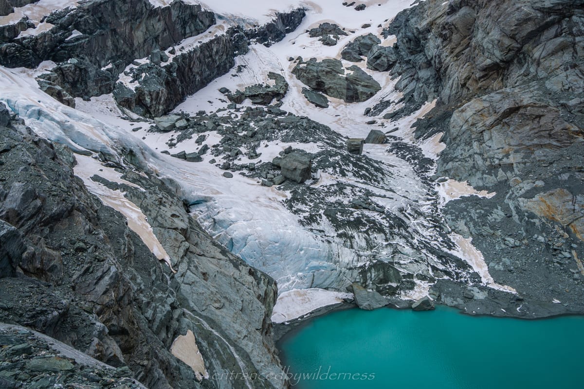
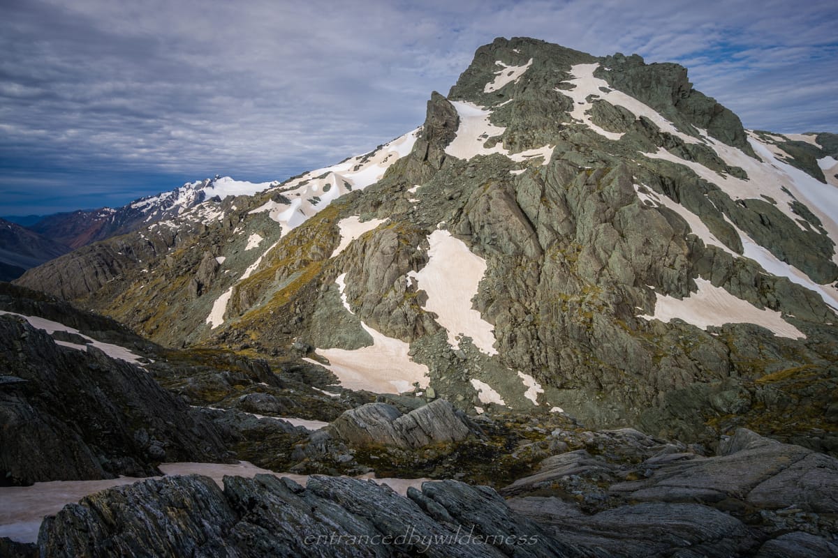
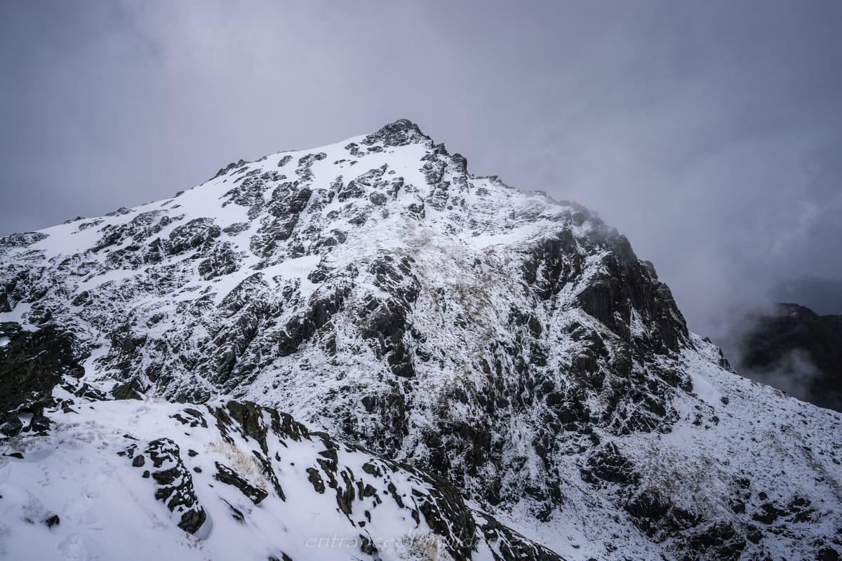
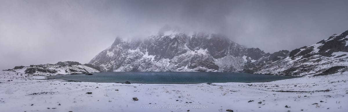
The best view of Park Pass Glacier's terminal face
Map of Route
Hike Planner
Use the hike planner PDF below for more logistics and route information on the Serpentine High Lakes Traverse – including route notes and a GPX file.
If you intend on using information in this blog to complete the hike yourself, please consider a small donation to fuel the motivation to write more of these detailed visual posts.
(Note: This blog is large and to save space, images are in sliders. When viewing images – Click on an image to zoom in, but note that captions only show on non-zoomed images)
04/01/2020 – 09/01/2020
Introduction
The Idea
I was eager to get on trail and spend several days in the wilderness more than ever. I hadn’t done a proper multi-day trip in ages, and my mind was clouded with excitement. The idea for this hike came an overnight trip in the Routeburn North Branch Valley, and staring up at the Serpentine Range and North Col, wishing I was up there.
That evening in my tent, I consulted my topo map. I discovered that by connecting the Routeburn Track and the Rockburn Track (on the Five Passes Route), connected by the Serpentine Range, a large loop trip could be made. This trip passed some of the more major lakes in the region, along with a glacier I have always wanted to visit. I decided to make it my next trip a week later. I couldn’t find a name for the route, and therefore, named it ‘The Serpentine High Lakes Traverse’.
Final Preparations – One Week Later…
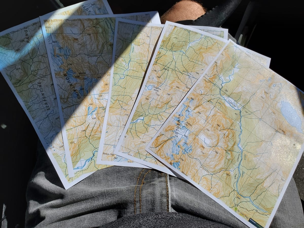
The first step of my journey was to print off some paper maps for backup in case my phone failed for whatever reason. YHA Lakefront Hostel in Queenstown charge 30c for a laser colour copy, and is usually where I go for printing before trips. Getting on the trail early wasn’t a priority, as it wasn’t really going to be a big first day, so I was pretty lax about timing. With an hour and a half of driving, I reached the Routeburn Shelter carpark. 44
Printed maps for backup
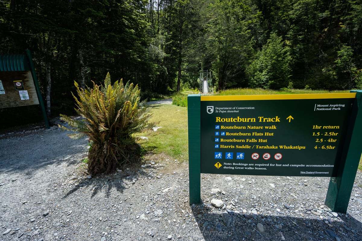
Day 1 – Routeburn Carpark to Valley of the Trolls
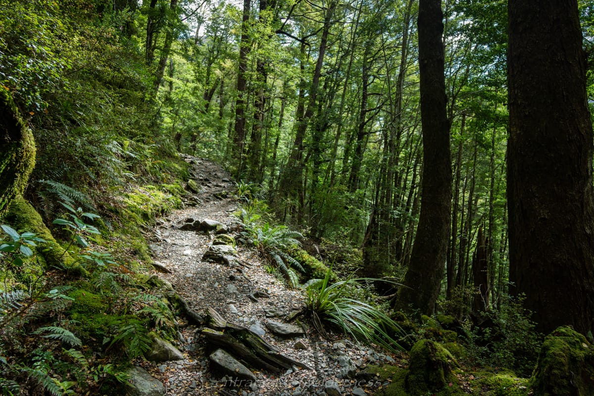
Start of Routeburn Track
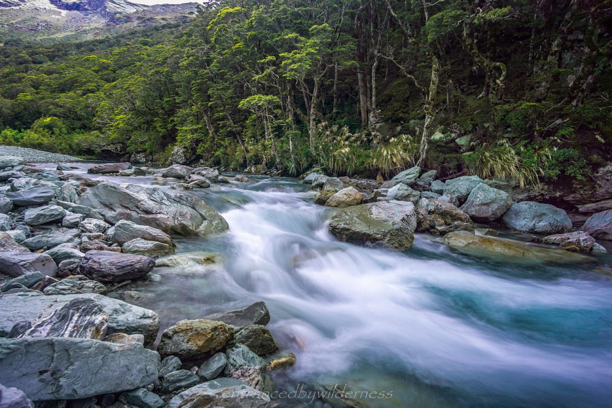
Setting off on the Routeburn track, my adventure began. I was not unfamiliar with the Routeburn track, and this was perhaps the third time I would reach as far as Lake Harris from the Glenorchy side.
A late start on the hike enabled me to hike with fewer people on trail. The Routeburn track is quite popular, and it was only the first few kilometres that had a significant amount of people.
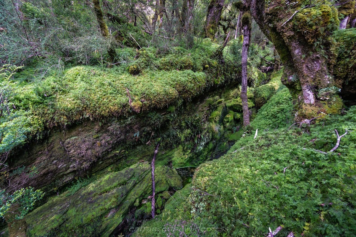
This was definitely the greenest I had experienced the track, as there was a lot of rainfall in the prior weeks. Routeburn Flats was totally different compared to the other three or so times I had seen it (more yellow).
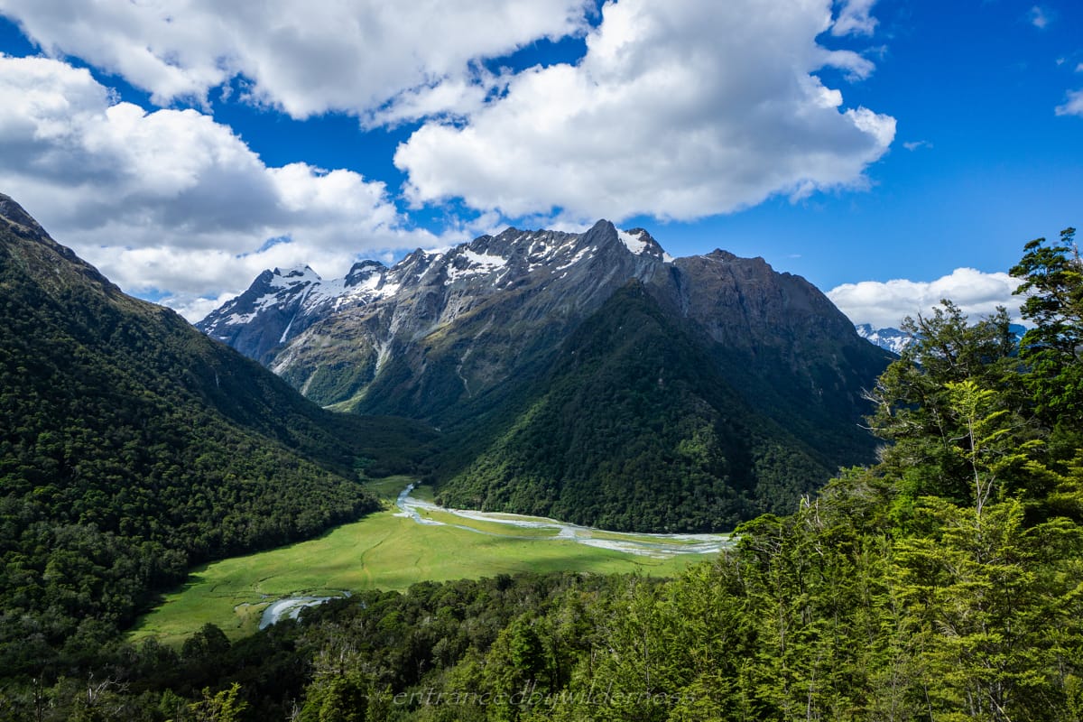
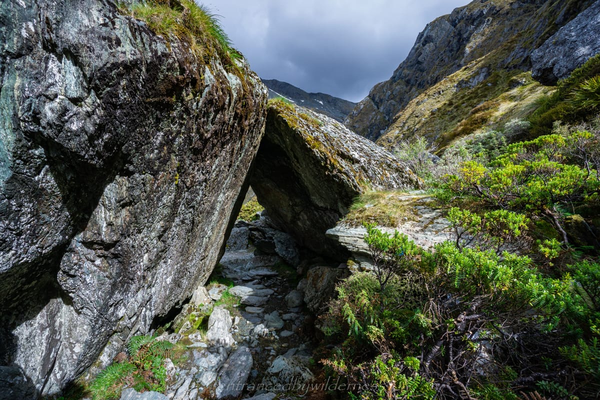
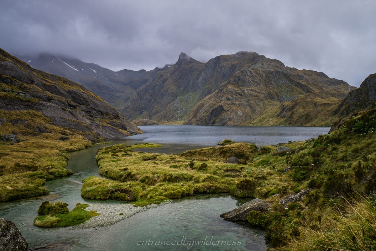
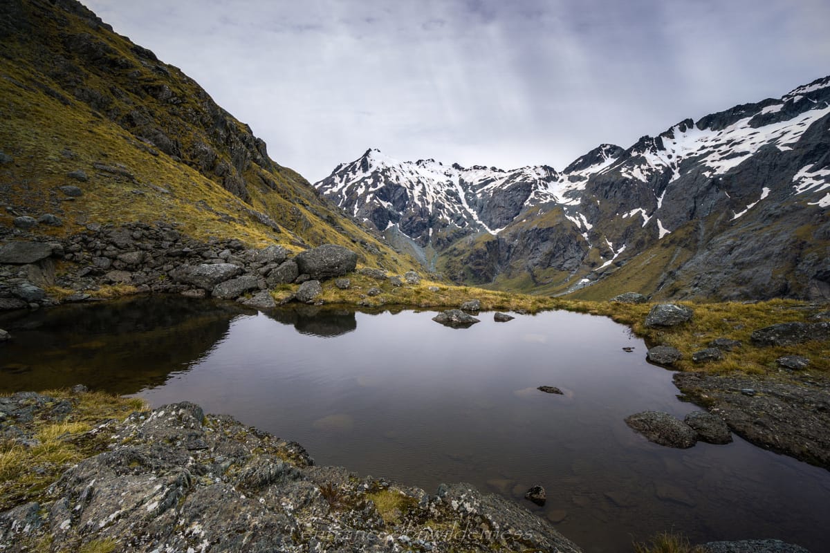
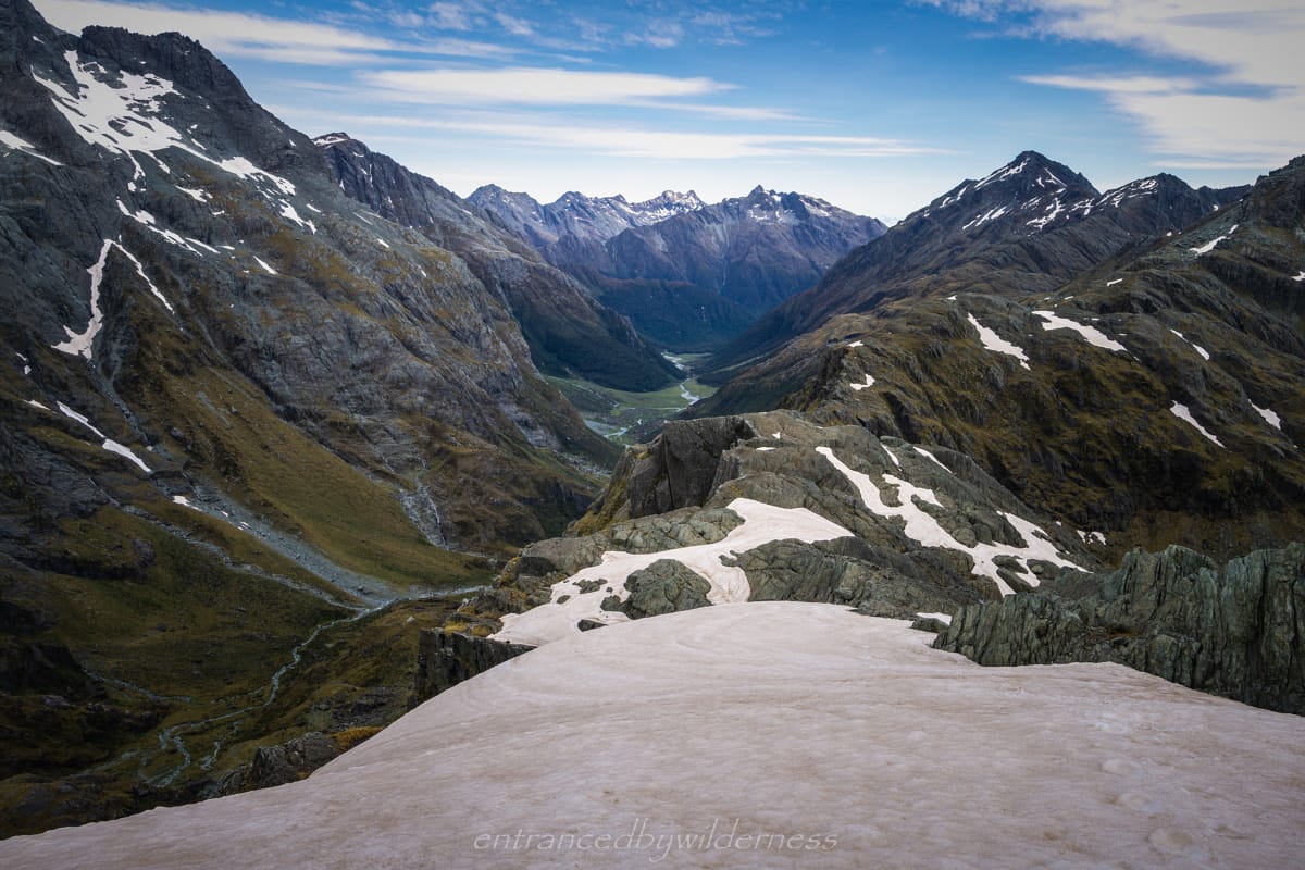
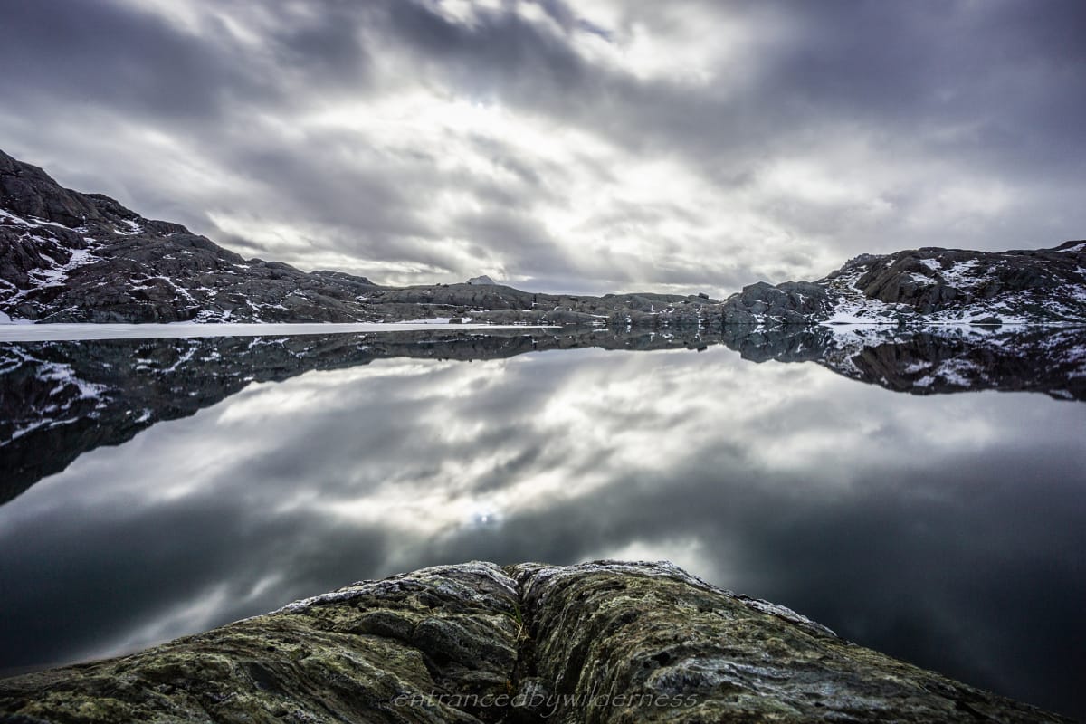
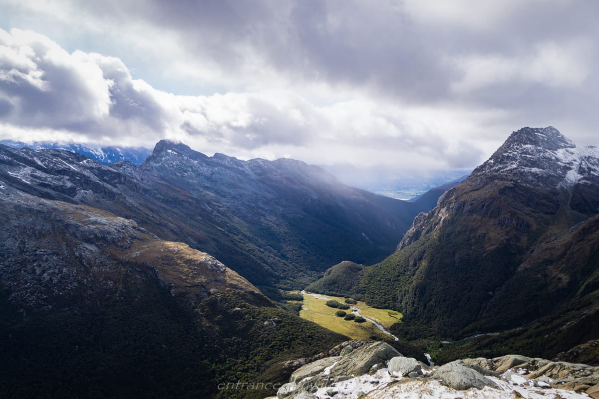
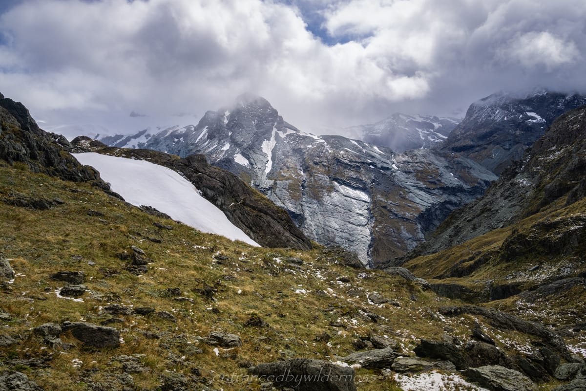
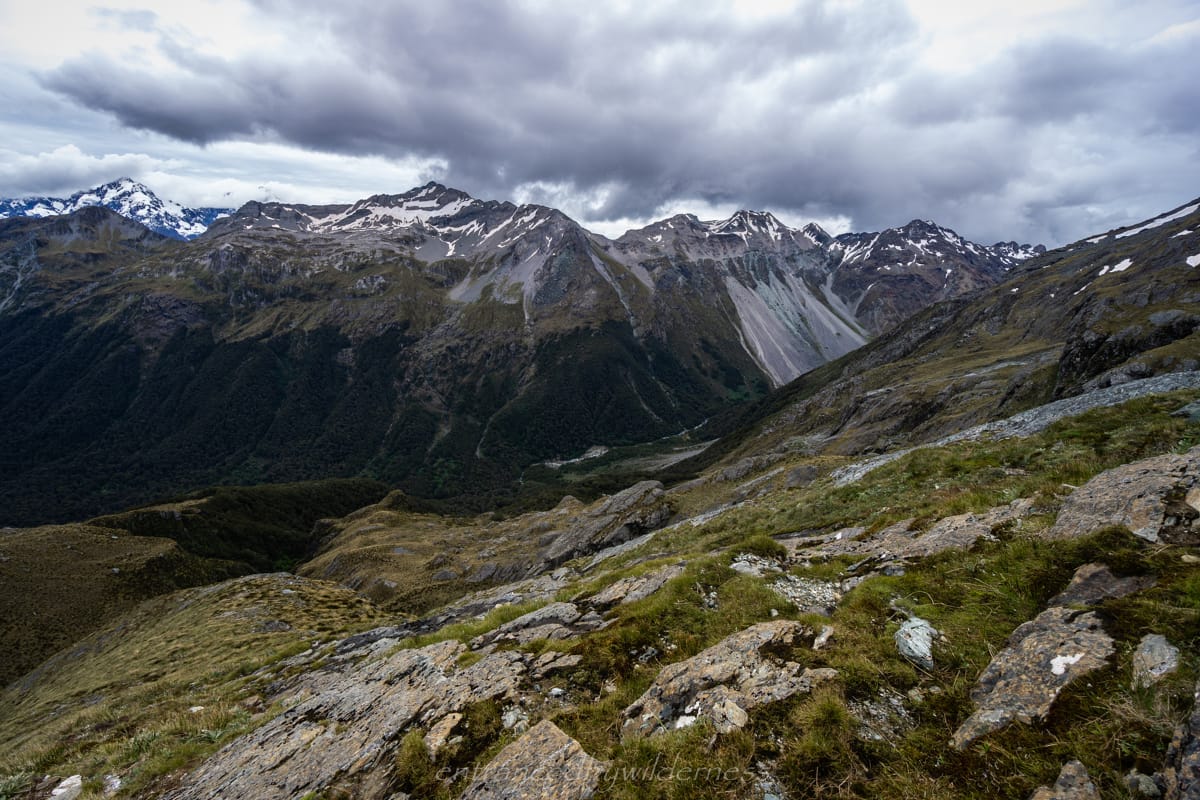
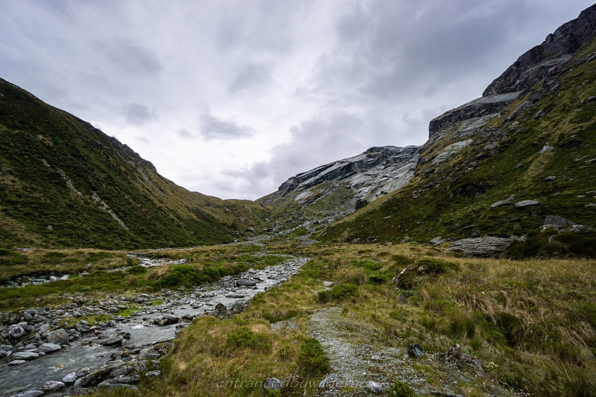
Once I ascended to 1220m, Lake Harris came into view, and I was almost at the highest point of the Routeburn track. Lake Harris is a pretty stunning lake, and it was nice to be able to see it from a different side.
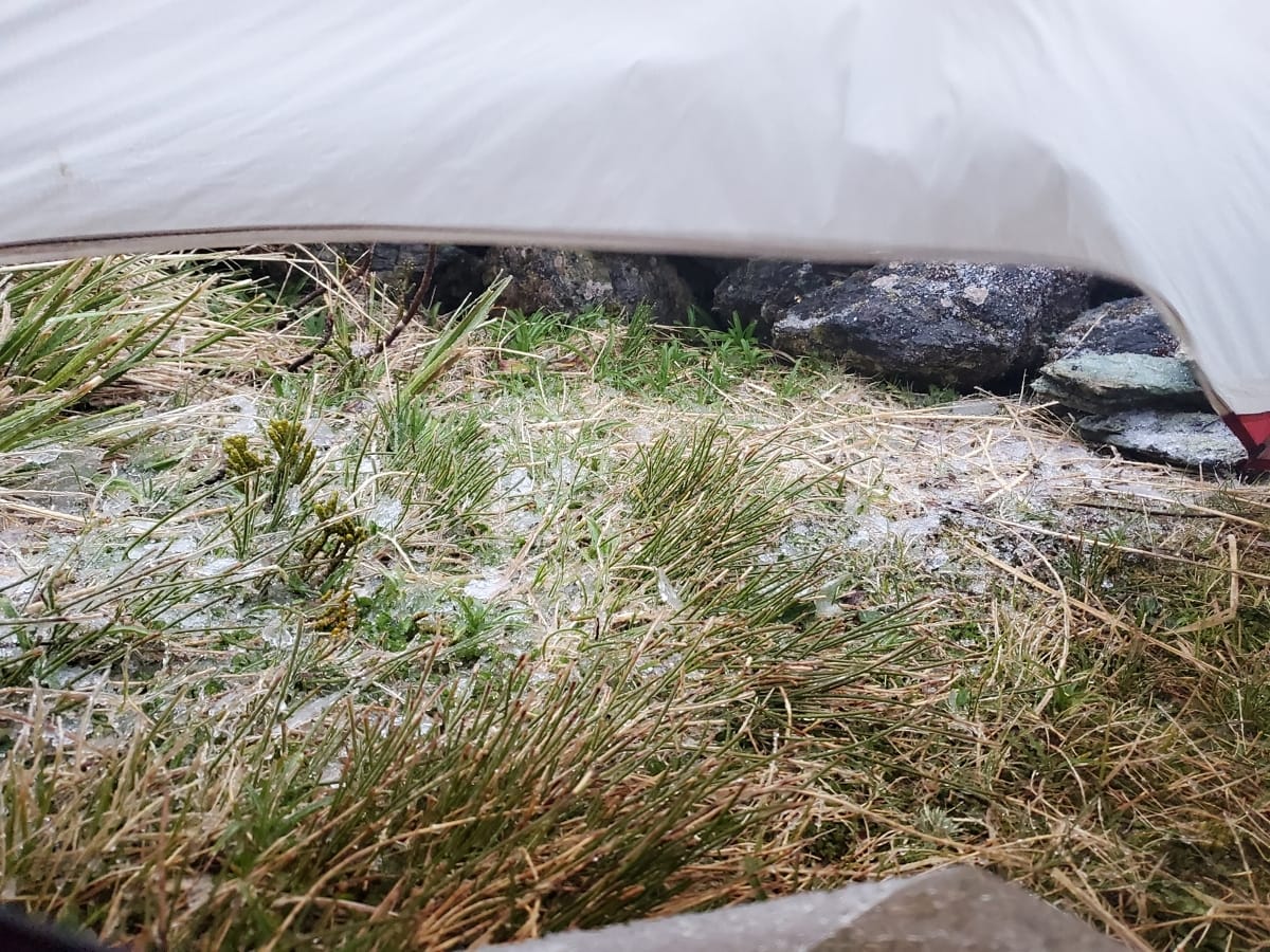
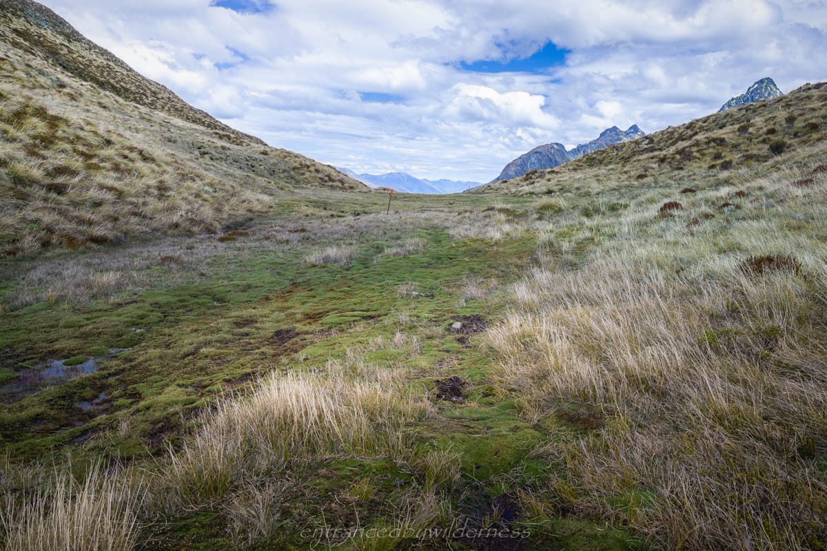
When I passed the southern edge of the lake, and reached the saddle, it was time to veer to the right side. Here, I’d follow the western side of the lake into Valley of the Trolls. The weather grew dreary at this point and rain began to fall, which I had expected from the forecast. It was time to find a tent site as soon as possible. It also grew darker, as the time was around 8pm.
Luckily, after dodging the pools of water in the marshes, I found an almost flat spot towards the far left side of the valley and quickly set up tent. The wind was hindering my speedy process, but I managed to get it set up with only some wetness.
The day ended up taking roughly 4 hours of straight hiking. There were a couple of other tents in the valley, and I suspected they were doing the whole Routeburn track, and wild camping outside the regulation range of 500m.
The weather was looking better this morning, and the day was forecast with ideal conditions. However, a large storm was due early the following morning, so I needed to ensure I had suitable shelter to hunker down in. My prediction was that I’d try to make it all the way to Lake Nerine, but using North Col as an earlier backup location.
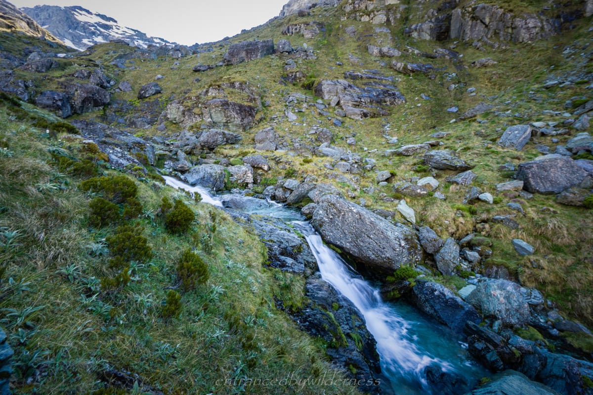
The first challenge, was getting out of Valley of the Trolls up to above Lake Wilson. This was a fairly straightforward route up along a small stream towards the east side of the lake. I met an Australian hiker here who had camped by Lake Wilson. He said he was even snowed on briefly!
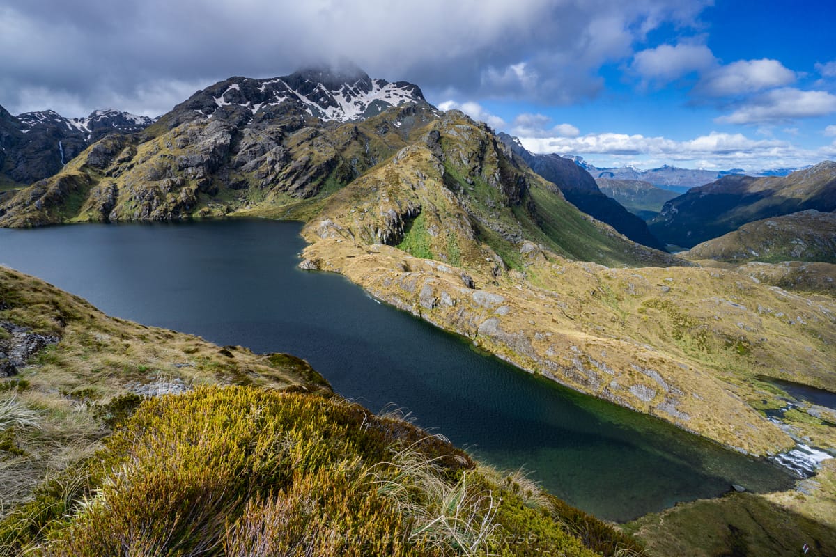
Once above the snow, I had breathtaking views of Lake Wilson. The lake is even larger than Lake Harris, and more rugged with its location nestled about 100m below where I was standing. It would have been nice to reach here the night before to camp, but I had started too late. I continued to sidle around Mt Erebus, and headed toward Peak 1807.
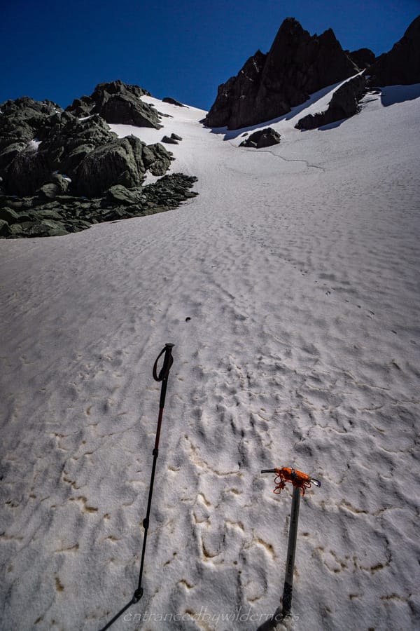
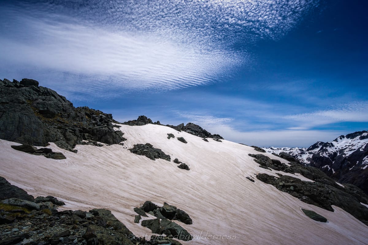
Here, the challenge was high. I changed out to my crampons and ice axe / hiking pole combination, and off I went. I had fairly fresh legs and ascended the steep snow slope slowly, but surely without issue.
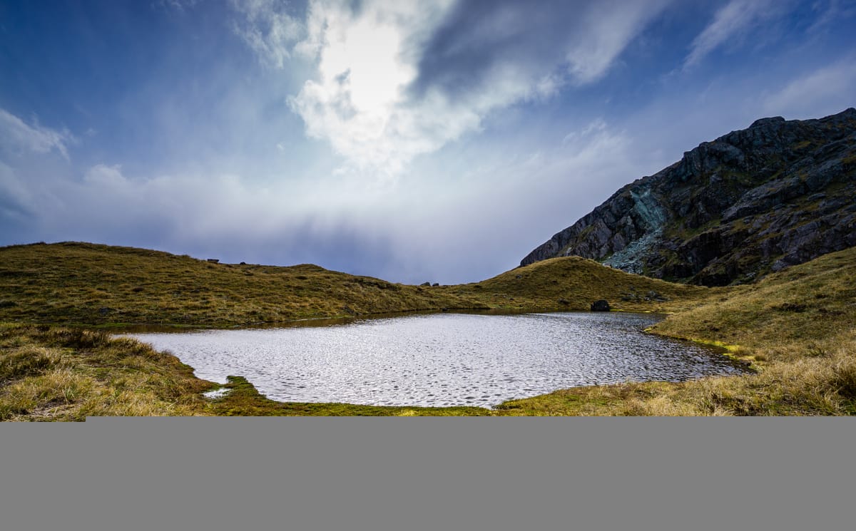
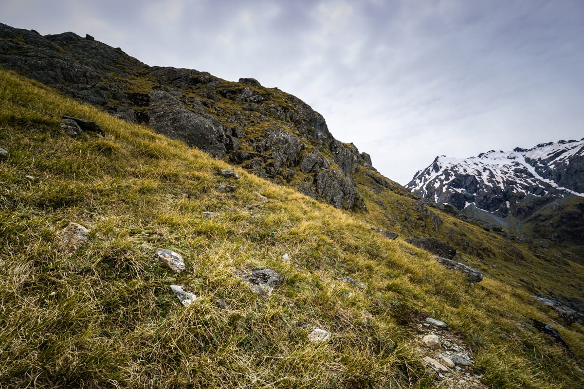
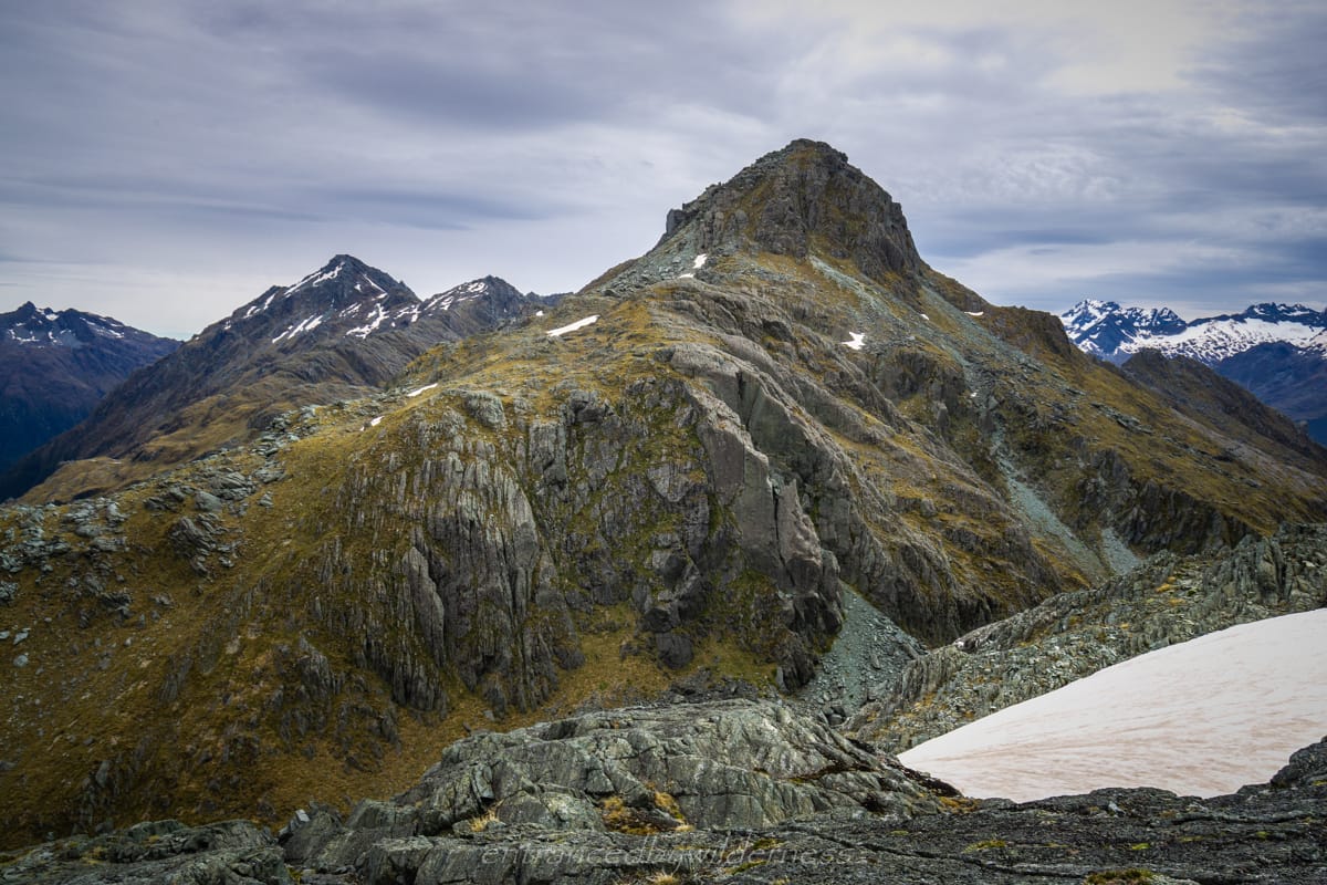
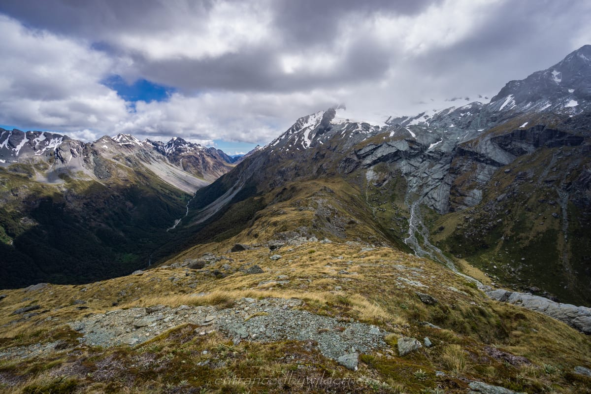
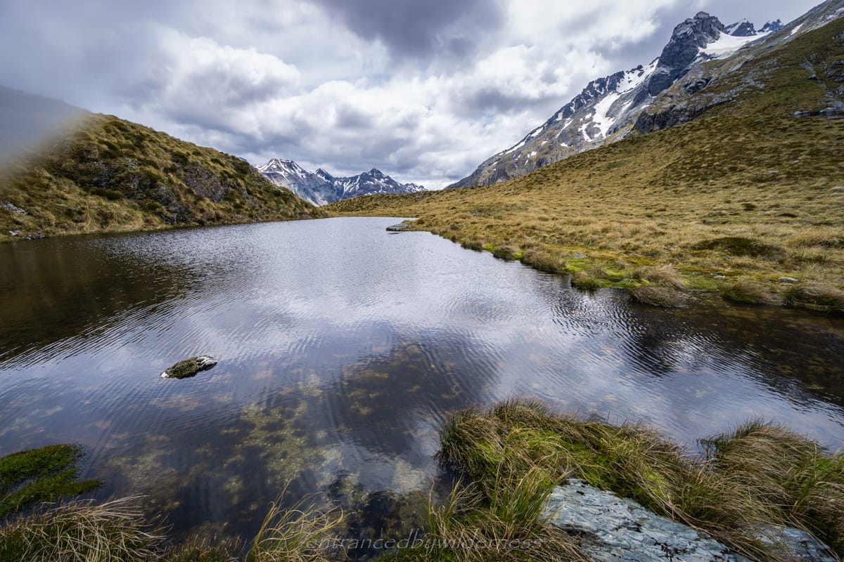
Near the top of Peak 1807, I had some lunch after the big climb, and marvelled at the panoramic views before me of the Humboldt Mountains. I had started the Serpentine Range section, and would now attempt to stick to the main ridge all the way to North Col. The next section all the way to the pass at elevation 1410 was a fairly straight forward descent with no major obstacles. At 1410 there was a nice tarn with a potential tent site, yet it was quite exposed.
After the tarn, there was a decision to make – head up higher under Peak 1605 and sidle from there, or sidle from where I was near 1400m. I chose to just go from where I was, as the contours ahead didn’t appear too sinister. It proved to be more challenging than expected though, due to the bluffy nature of the coming terrain. I found myself having to head higher to avoid a cliff section above the 1400 contour directly west of Peak 1605, but it wasn’t overly problematic.
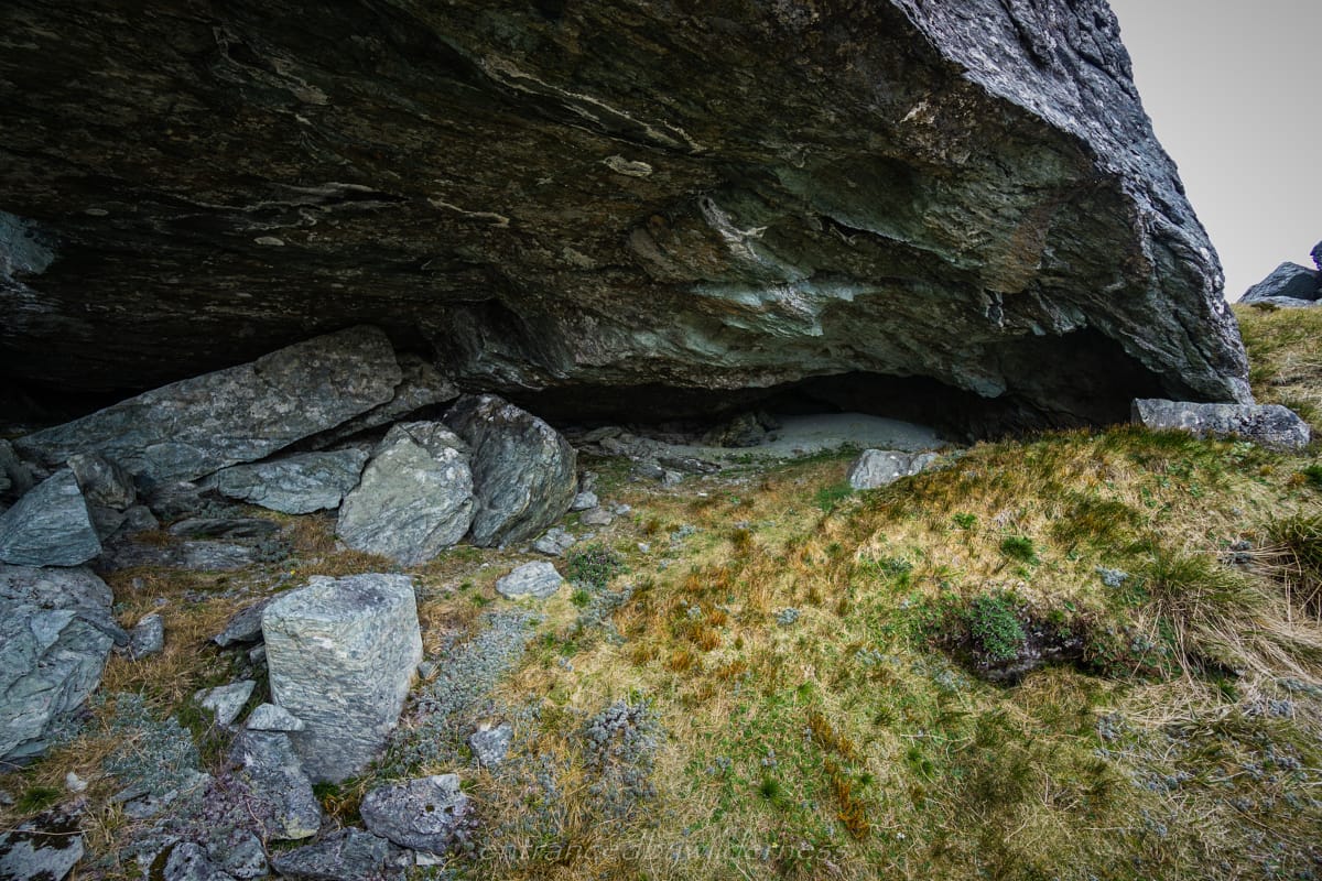
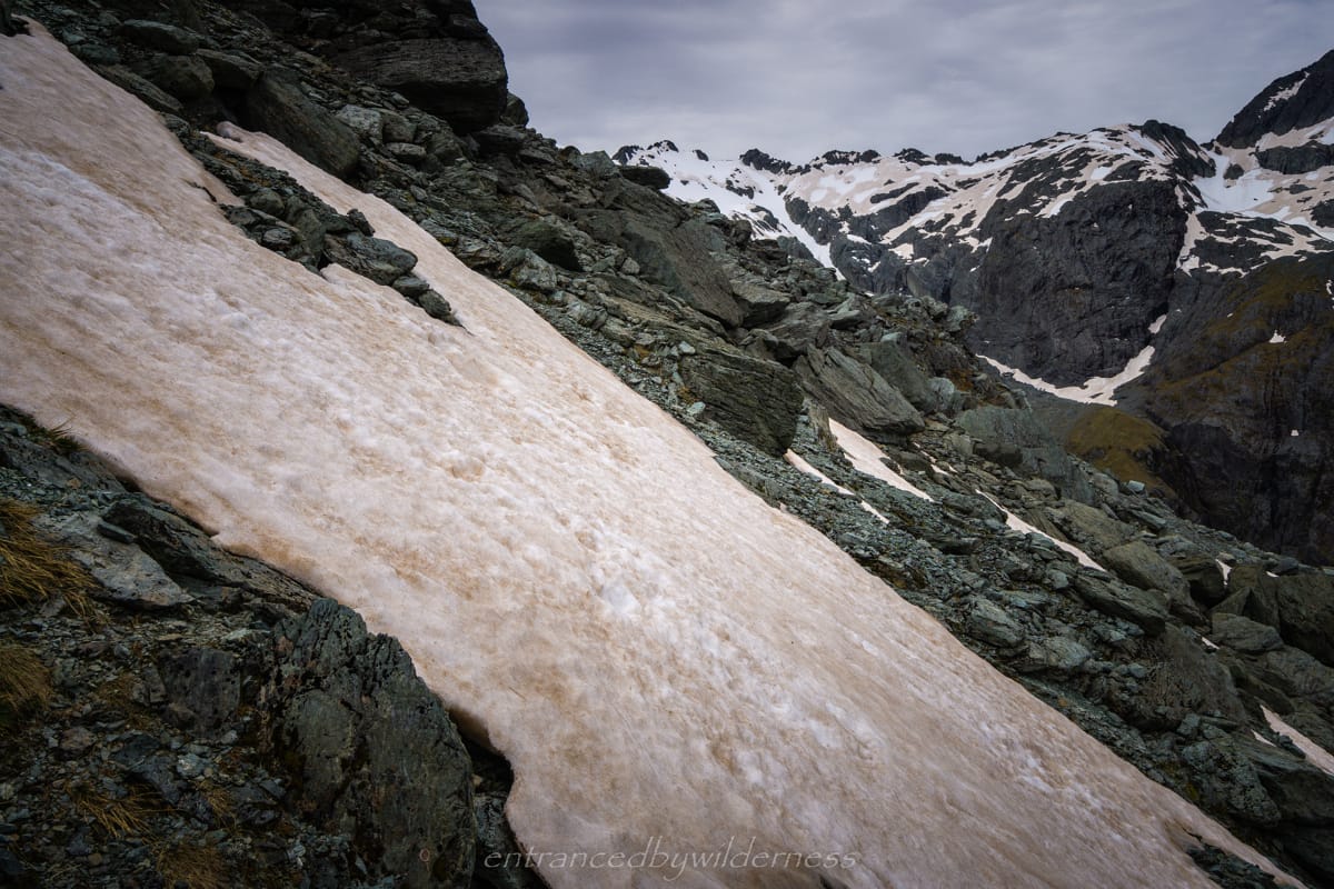
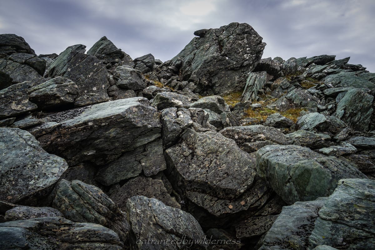
I came across a rock bivvy at around 1500m that could be used in an emergency (marked on map). From here, it was mostly rocky boulders, snow grass and a few snow patches, but nothing hard. Eventually, I reached the tarn below Peak 1550 after navigating down the west side of a steep snow grass slope. It wasn’t an overly interesting tarn, and there wasn’t really any tent site options, so I moved on quite fast.
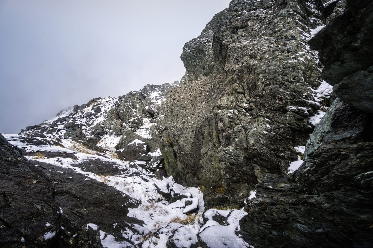
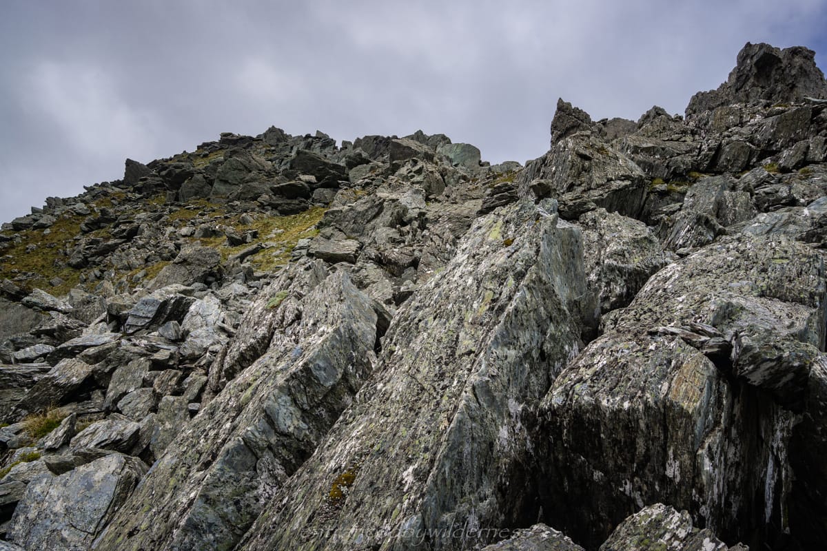
The next section was quite challenging. Getting up to Peak 1550 required heading due east for a while and getting onto the gentler sloping ridge line. However, I decided to climb a steep chute up for a shortcut. It was a little difficult, but nothing too hard.
The ridge had narrowed significantly in this next section, and there were fewer options for countering tricky terrain. This was most notably apparent on the small ‘bump’ between Peak 1550 and Peak 1555. There is a sharp drop heading down into the low point below Peak 1555, and it is not obvious which route to take from this side. Luckily, I felt I chose one of the ‘better’ lines down, but it required much patience and slow ‘reaching’ foot and hand holds to lower myself down this tricky section onto the snow below.
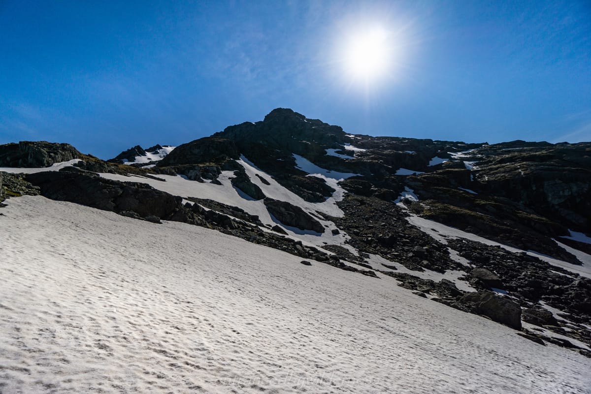
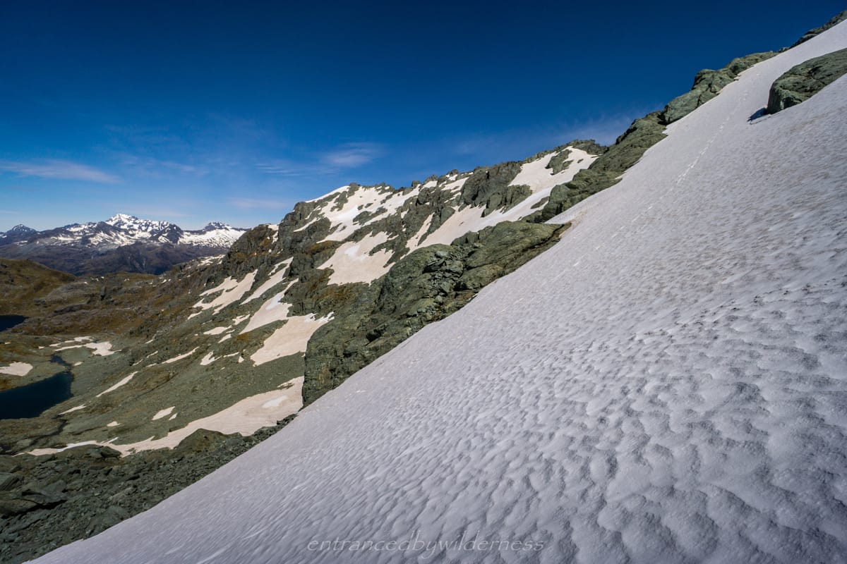
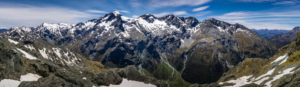
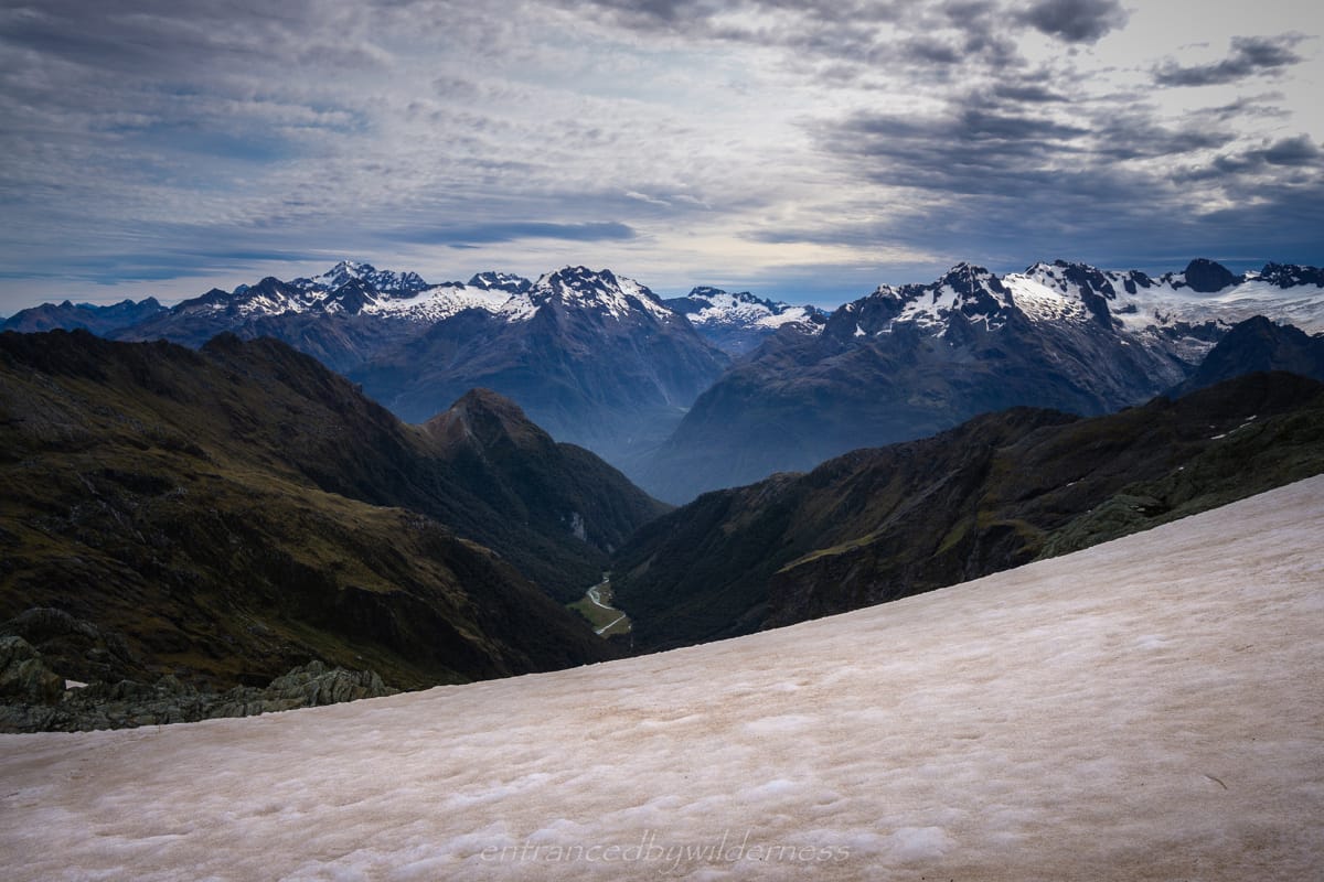
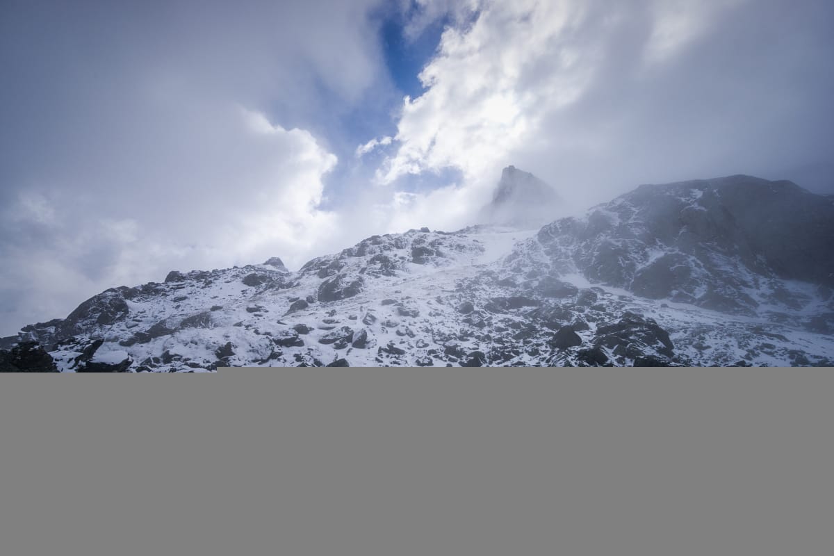
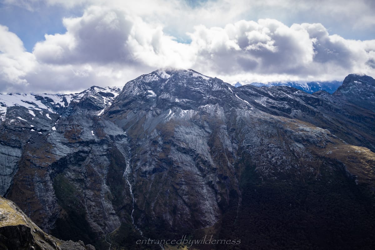
The final section before North Col awaited. Most of this next section was snow cover, so I had attached my crampons and had the ice axe at the ready. However, it was all fairly straightforward, and on a gentle slope. There were amazing views on either side and it was awesome! With the Serpentine Range (that I was on), the far away Darran Mountains off to the west, and the Humboldt range encroaching closer on the east, there was nothing short of epic views all round!
I had intended originally to climb Peak 1796, but was exhausted after the long day, and wanted to camp. After climbing up to the 1700m contour, it was time to start the descent to North Col. I feared this could be challenging, but it was actually fairly straight forward. There was actually a cairned route which made navigation much easier.
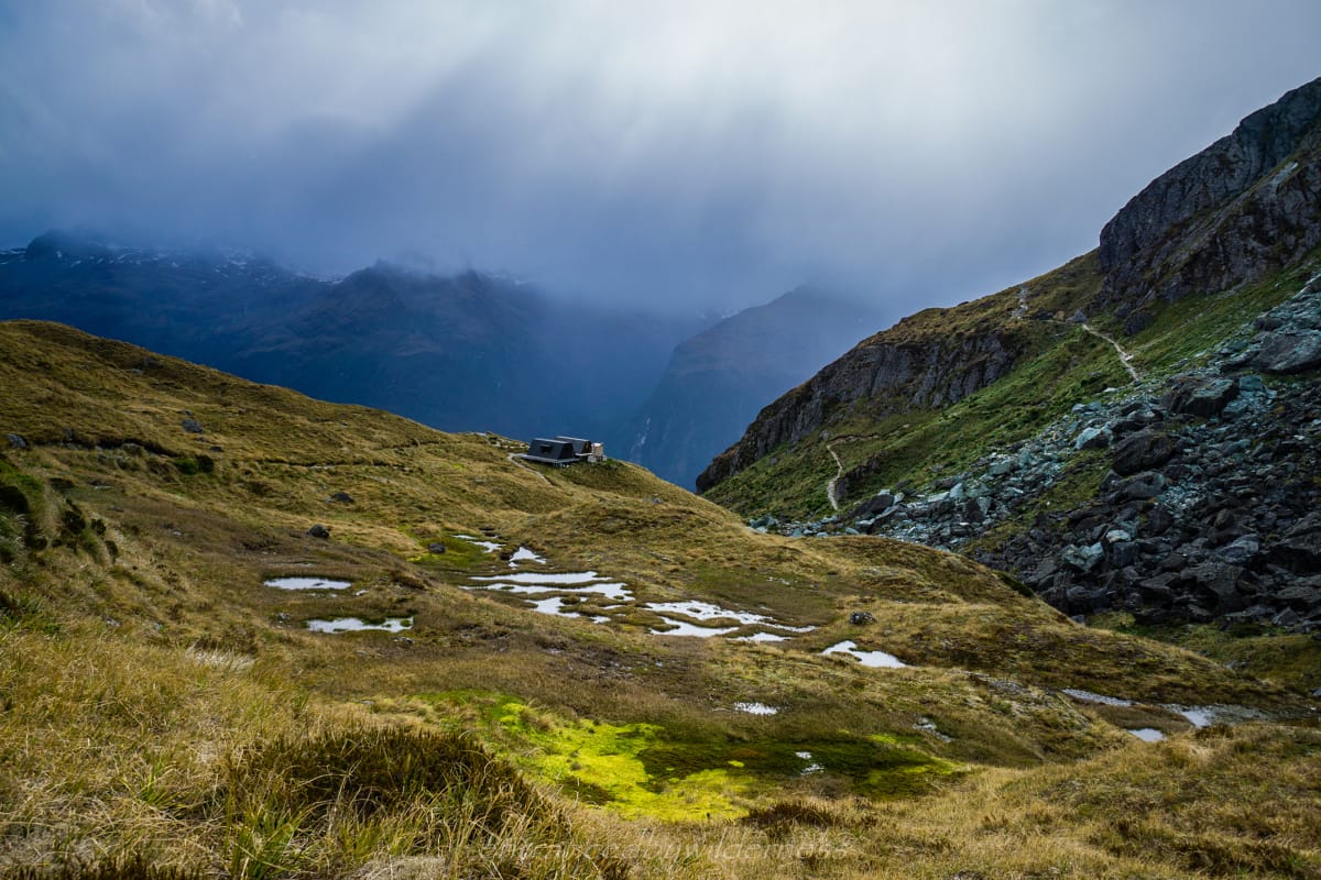
It was around 7pm when I arrived to North Col at 1600m altitude. There were still over two hours of light left and I potentially had time to get to Lake Nerine. I was weary though, and decided to see if there was anywhere ideal here.
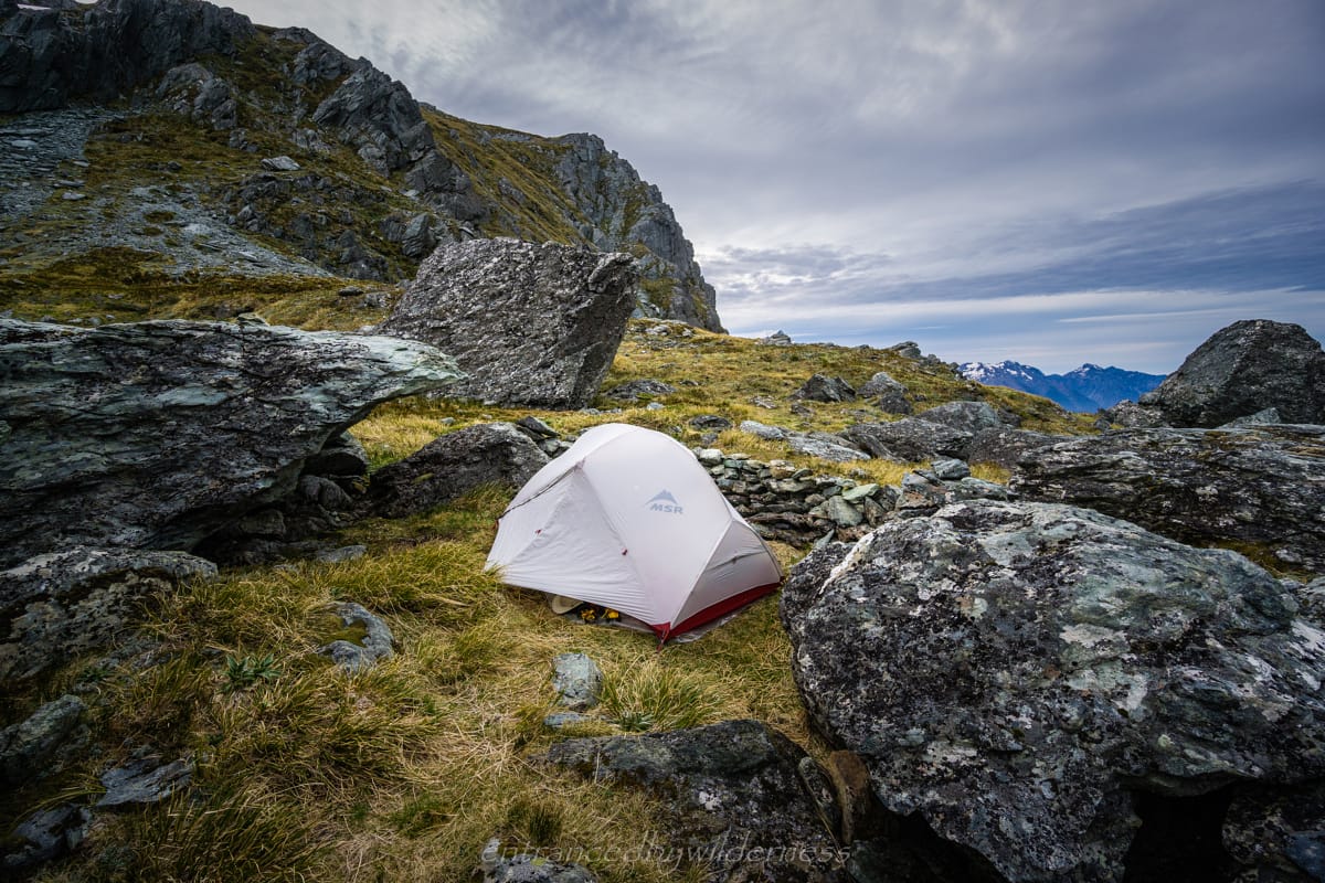
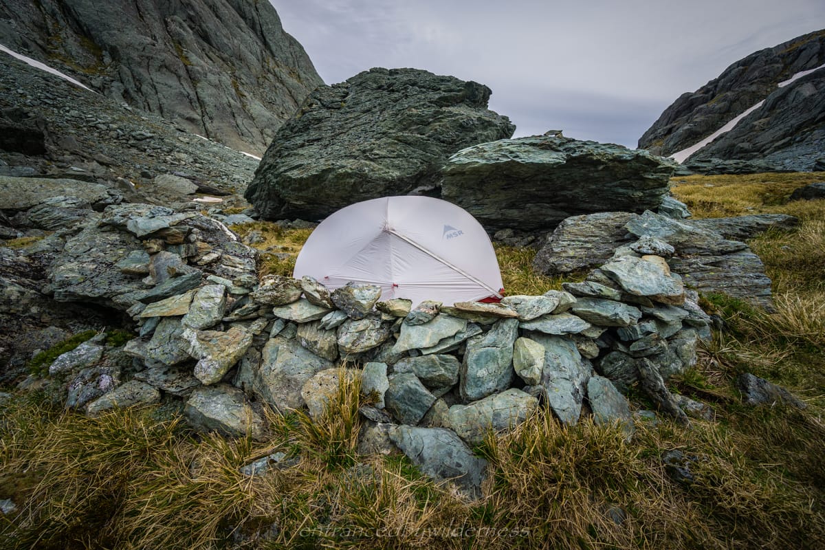
It turns out there were two decent locations to set up a tent. This first I found was on the western side, with a huge boulder as a weather block to the east side, and a decent rock wall built on the western side. However, it was very uneven ground, and not ideal for my tent size. After pondering for at least 10 minutes, I made the call to stay there due to the oncoming storm and being prepared for it. It wasn’t perfect, but I had set up my tent the best I could. The weather remained fine throughout the evening and I chilled out with dinner and an audiobook.
The storm arrived at 2am. It was getting windier and the air temperature dropped noticeably. ‘Thuck chink, thuck chink’ noises started becoming apparent, as I glanced outside and noticed shards of ice falling! ‘Yikes’, I thought to myself!
The nights action was unforgettable. At first, all was calm, and there was barely a flutter of the tent from the nearly still air. However, that all changed around 2am, when the storm showed itself and began its onslaught. The storm only grew stronger in intensity as time went on, and peaked in the early hours of the morning. At times, I was using myself to support or re-lengthen the poles, which were integral to my tent withstanding the onslaught!
As time went on, it became more apparent that my worn out tent fly was indeed not keeping water out. I made a mental note to at least spray it with waterproofing liquid when I got home. Water was now being thrown into the tent on the west side, and a lot of my gear was getting wet. Luckily, I was still warm the whole time.
Gear Drying and Burning the Hours
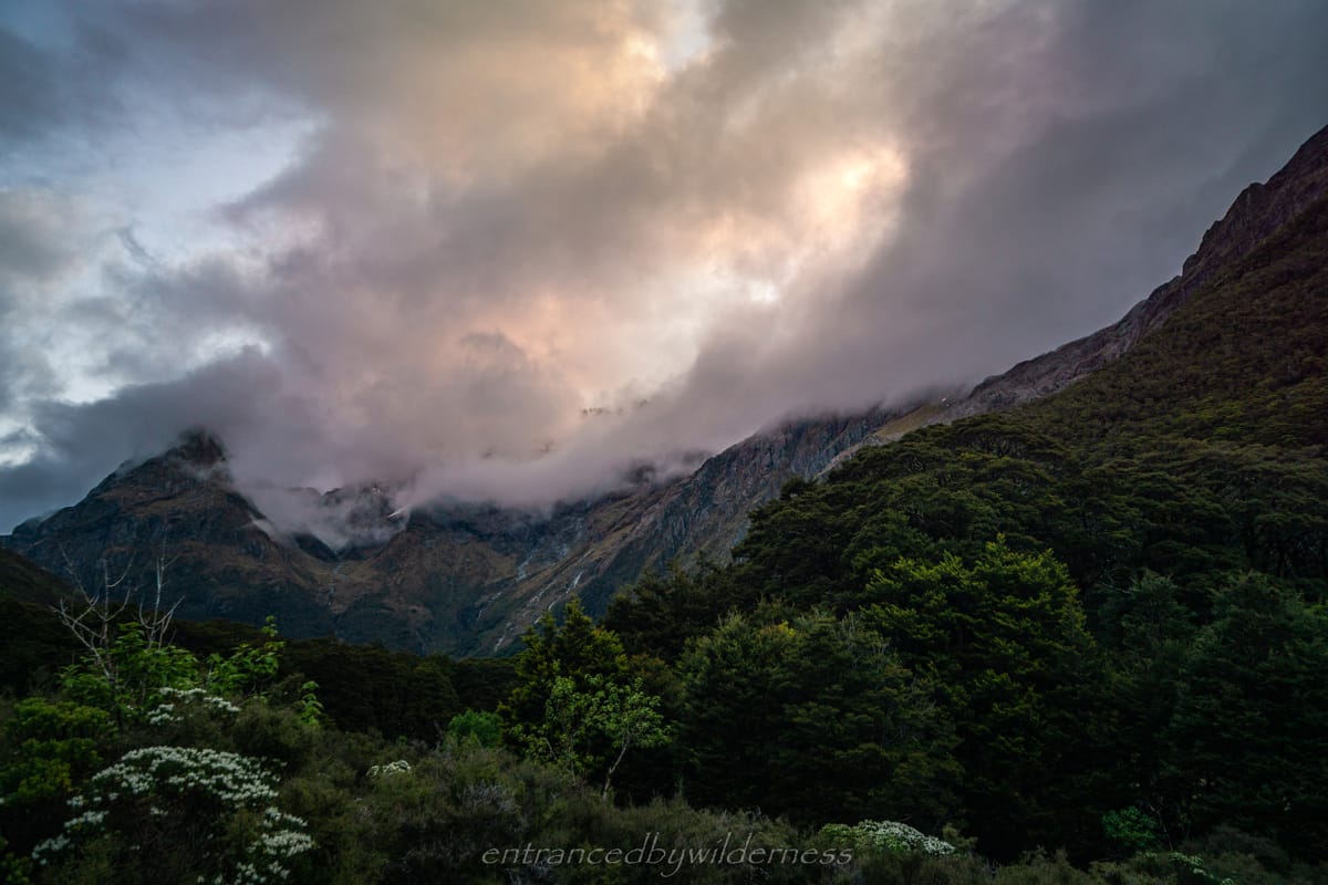
The briefly weather cleared in the early afternoon, and drying time was utilised before nightfall set in. The temperature was very low and dropping. Conditions were still looking ominous, with low clouds covering the peaks above me. There was definitely no way I would attempt leaving today. It was an evening of movies and audiobooks again! Glad I packed the extra power bank!
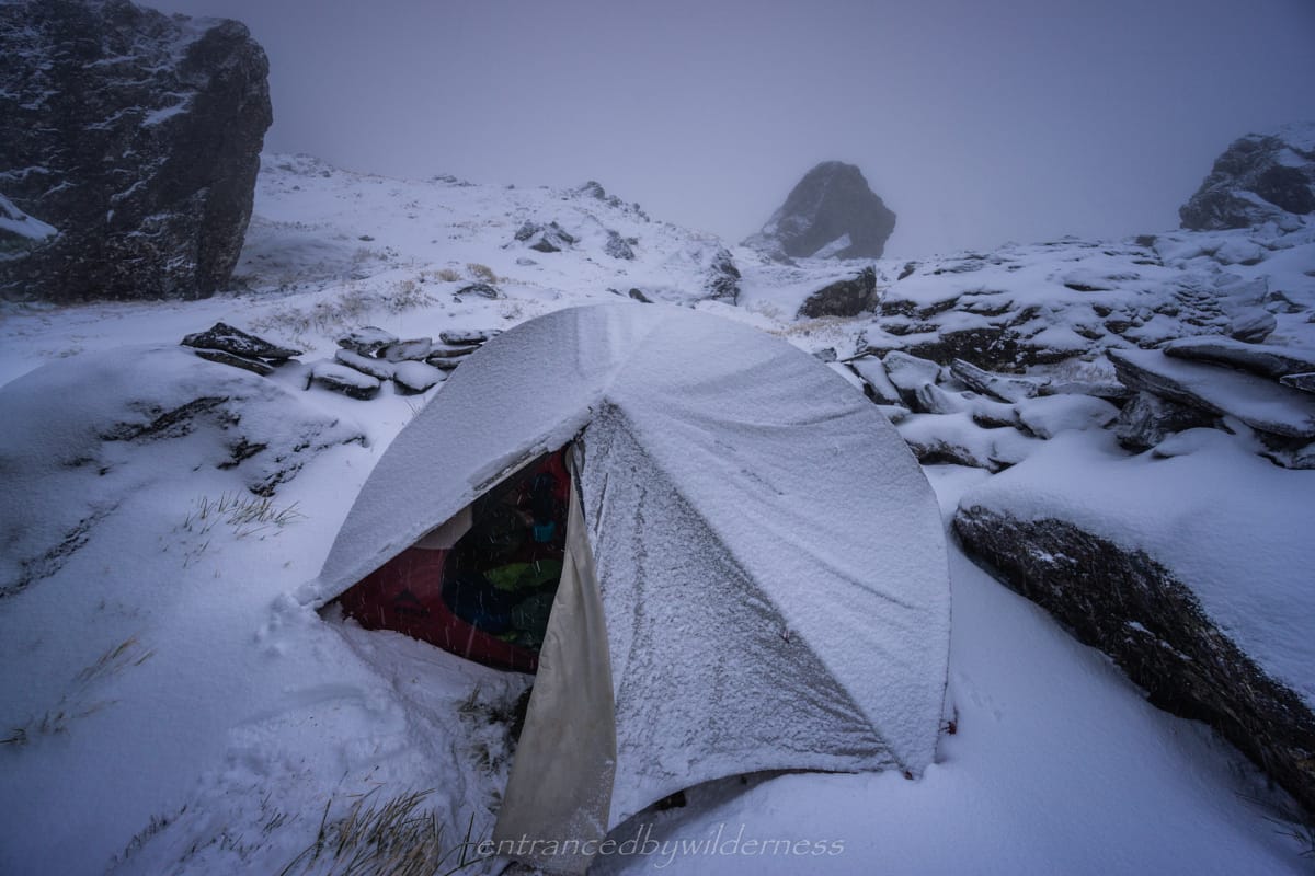
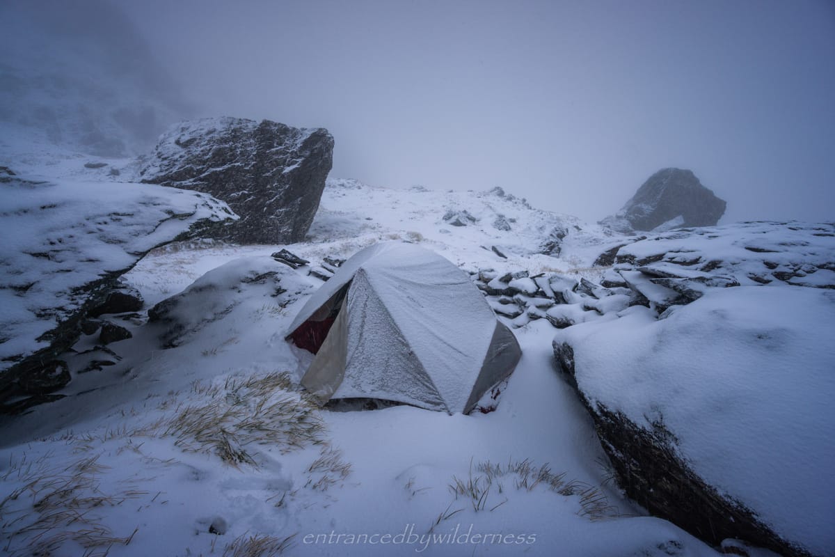
I was awoken again in the early morning, but this time in a MUCH calmer manner! Heavy snow was falling outside. ‘That was not expected’ I thought out loud, peering through the fly. It was quite exciting, and it felt good to have such a range of conditions in such short time.
The snowfall lingered all morning, but it did ease at points where I was able to go out and view the spectacular new scenery before my eyes. ‘Was I still at North Col?’, ‘It is January and summer right?’ are just two of the many questions rolling through my mind.
I recalled that after the storm rolled over, the forecast was predicted to be clear for several days. There was a clearing above me, with even some patches of blue sky. Now, I had the difficult question before me – do I stay another night here to be safe, head down Routeburn North Branch, or make the call to head for Lake Nerine tonight. However, it didn’t take long to make the decision to head out and continue on. I LOVE and am very experienced in snow hiking, and there wasn’t enough snow to worry me about avalanches. Onward to Lake Nerine!
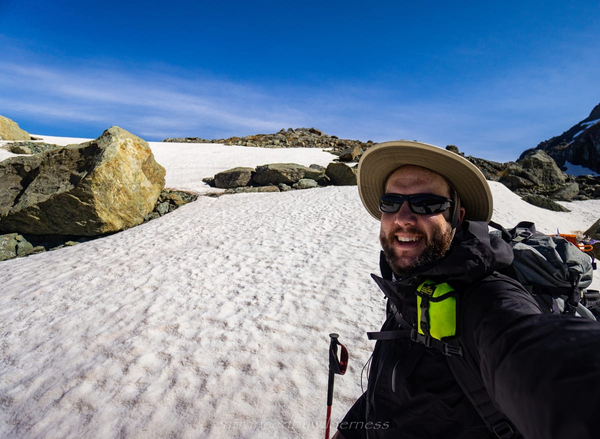
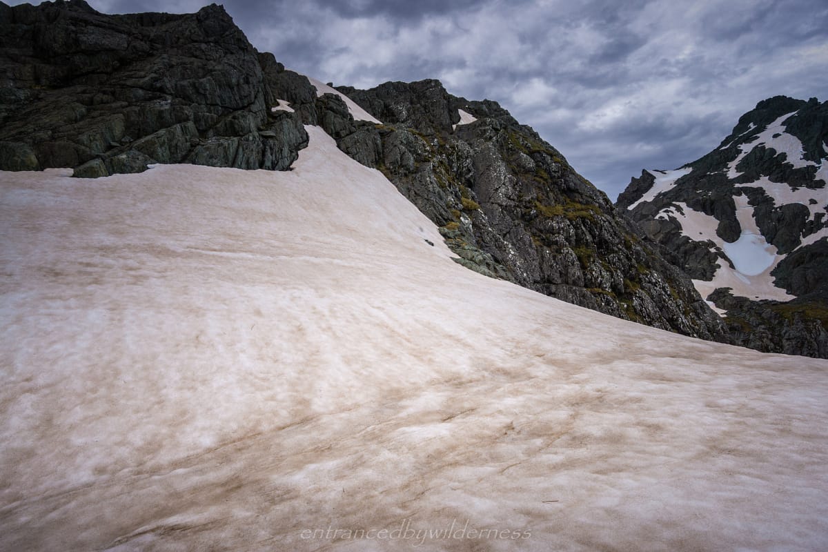
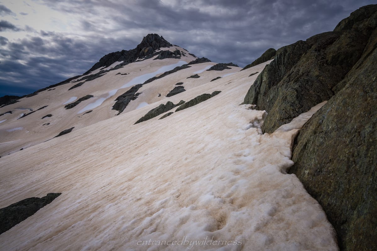
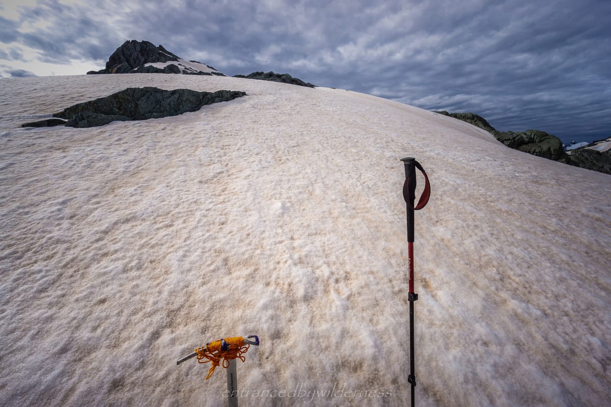
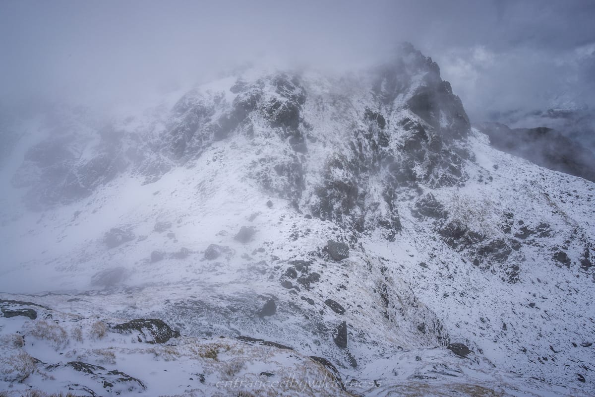
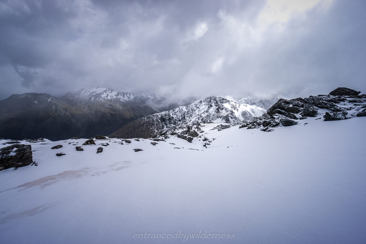
After packing up my tent, exposing the only patch of yellow in the whole area, it was time to head up the western side of Nereus Peak. It was fairly straightforward – aim for the small gully under the western face and sidle around from there on the gentler slope. The snow was lightly falling at this time, and it made for the most pleasant hiking conditions! With open patches of view around, and some low clouds. The views were amongst the best I’ve seen!
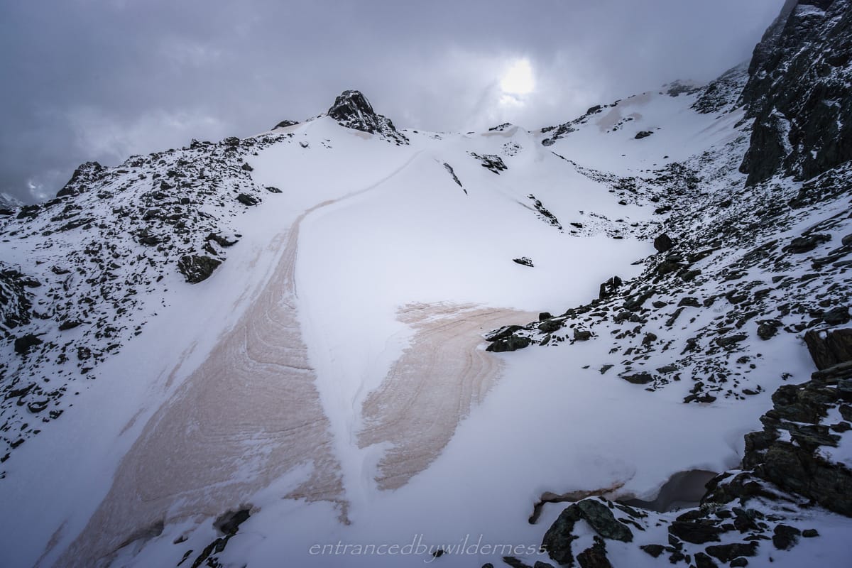
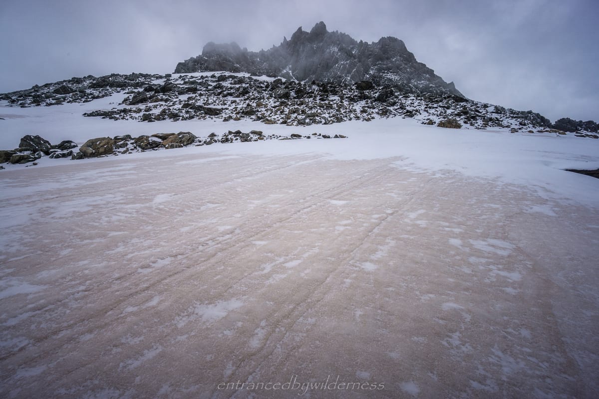
You could really see the Australian bushfire ash fall in the snowpack here. The pink/orange hue was distinct in the grey and white landscape. I was nearing my first view of Lake Nerine, and I needed to choose a route down.
The contours looked forgiving in the area, and I just decided to head over to the cliff edge for the view and head down the ridge on the western side of the lake. This turned out to be a poor decision. The route I chose was extremely hard, as the ridge heading down to Peak 1580 is full of giant boulders – as big as elephants! I found the ridge itself is too steep to consider without prior knowledge of a route.
In hindsight, I would have descended off Nereus Peak much earlier in a more diagonal fashion to the pass at 1560m to avoid the giant boulder section. The maze of rock hopping through huge boulders to reach the pass was tedious, and I needed to backtrack a few sections. Perhaps there is an easier cairned route that I missed, but it’s hard to tell sometimes. Alas, I was almost there!
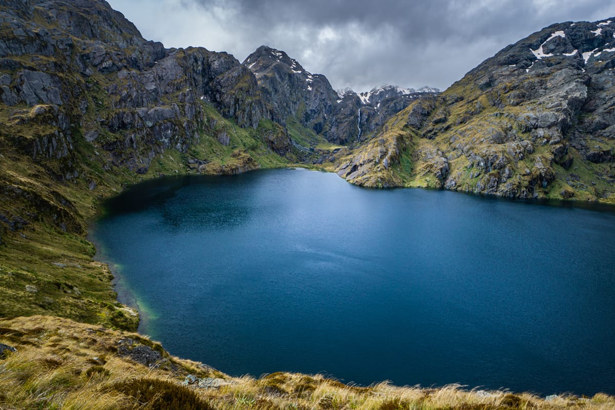
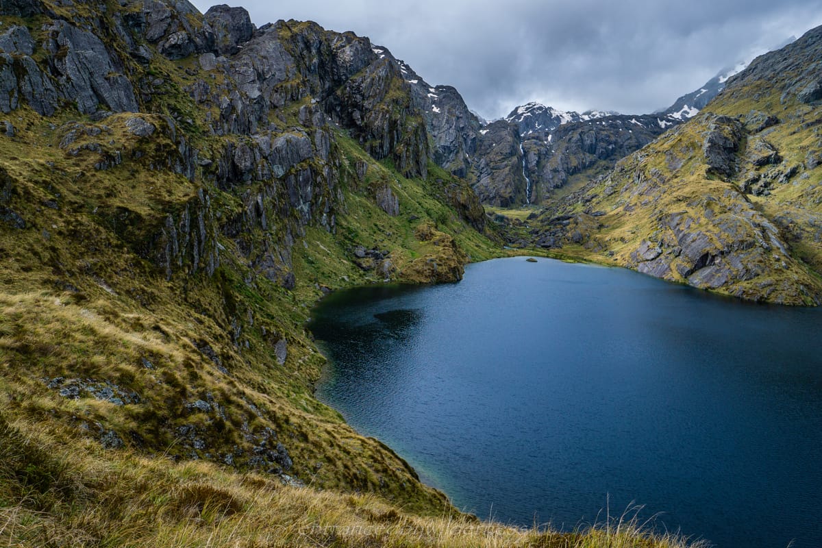
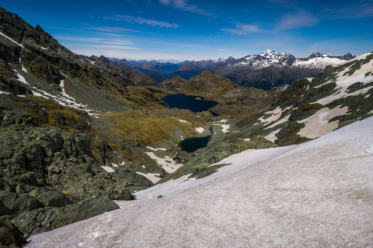
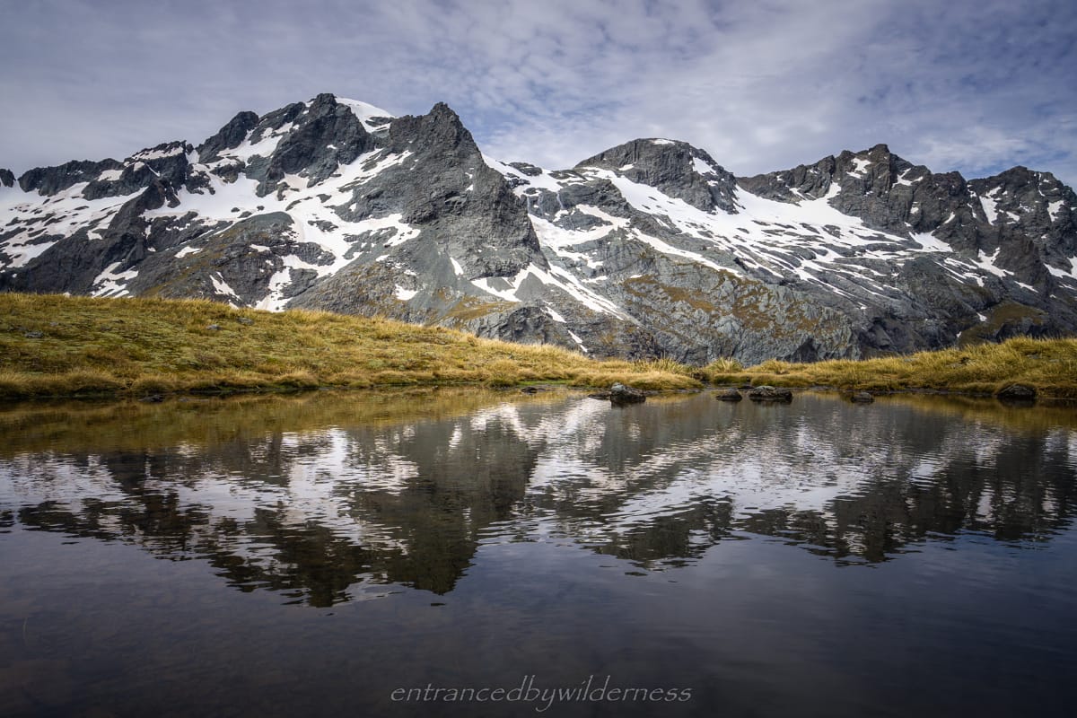
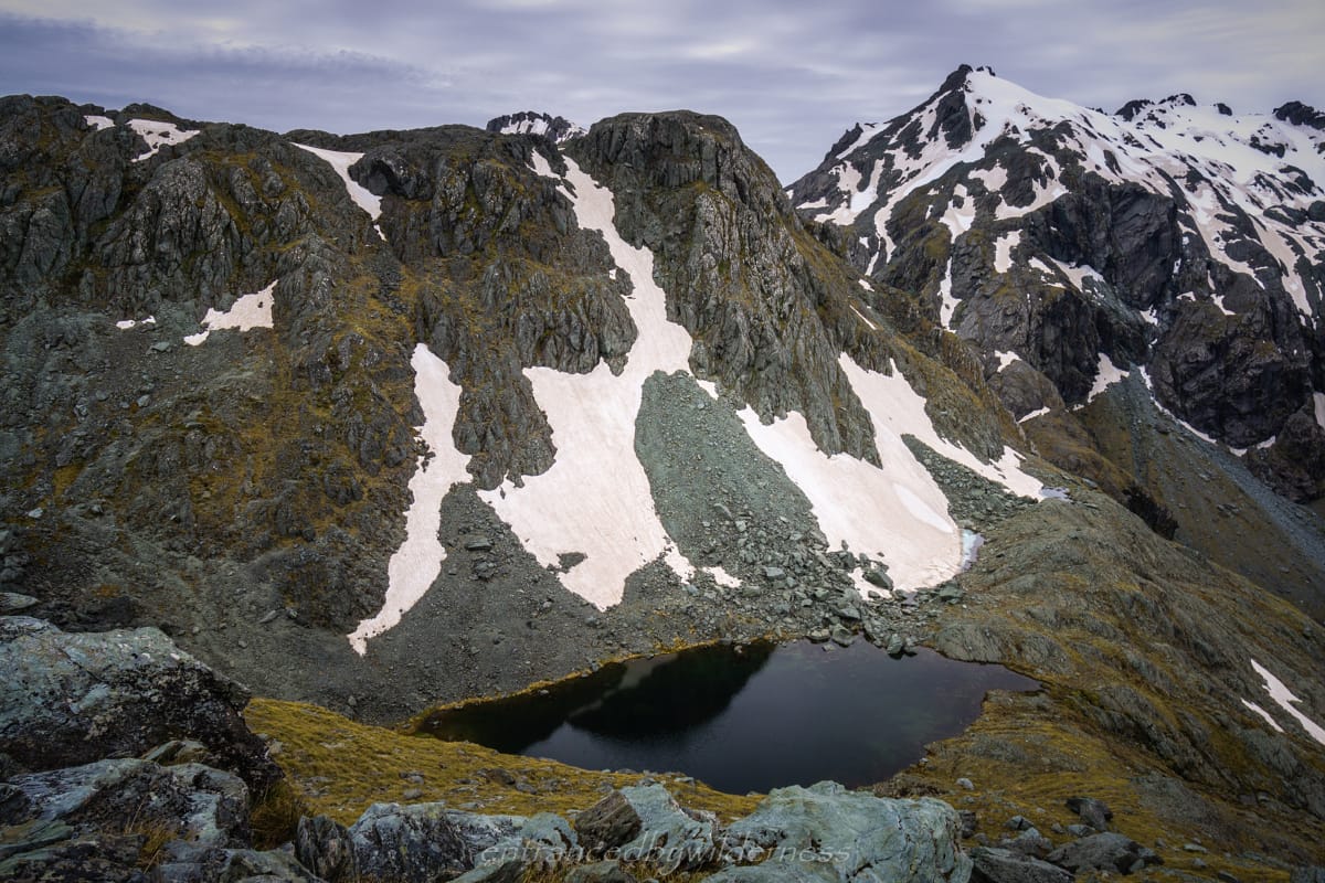
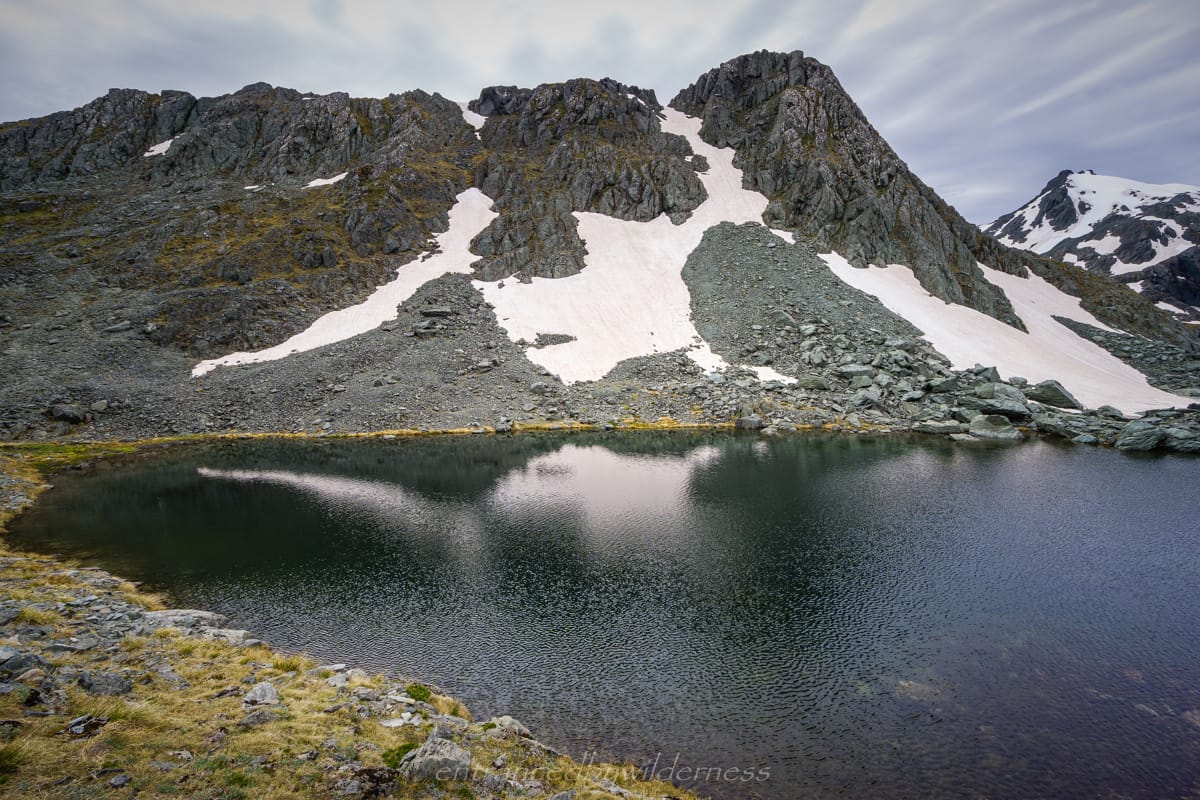
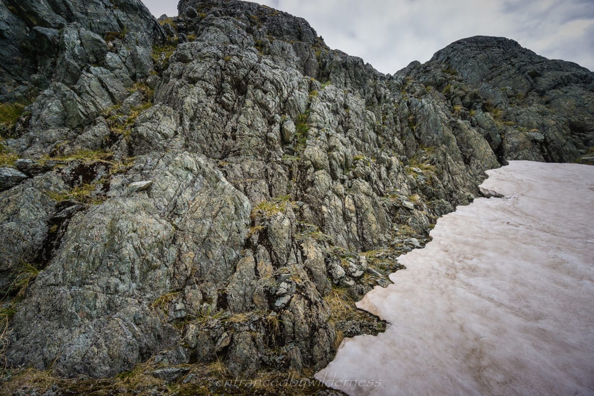
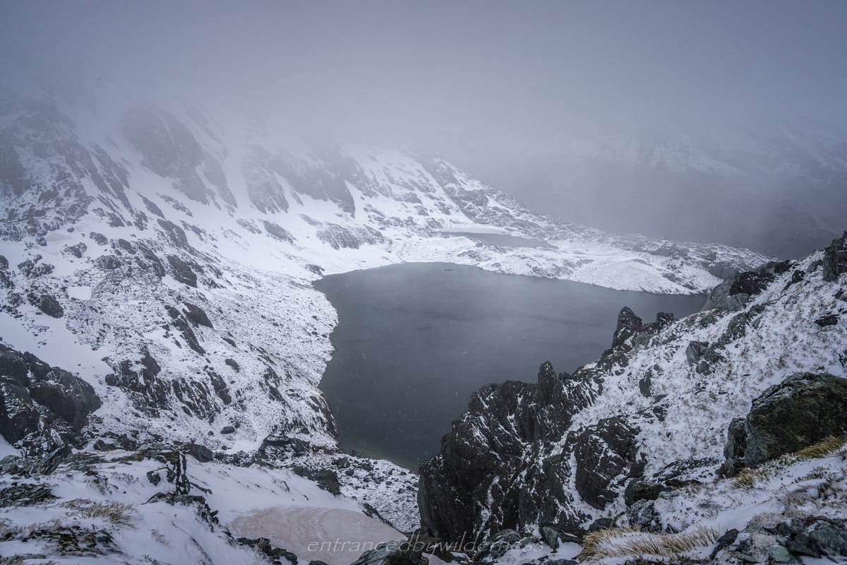
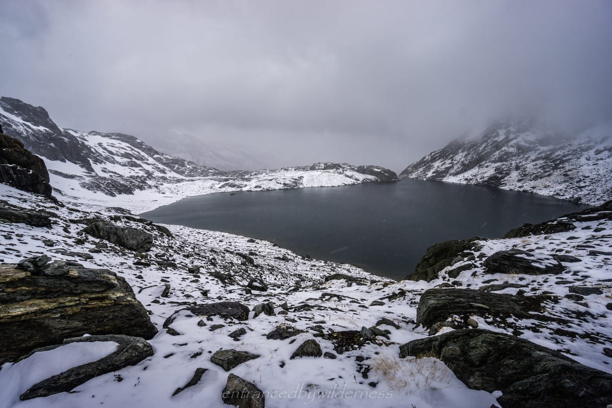
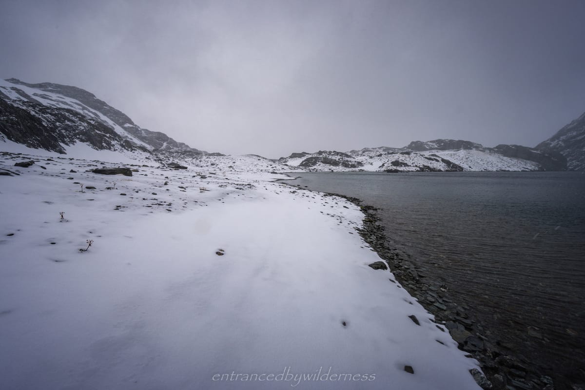
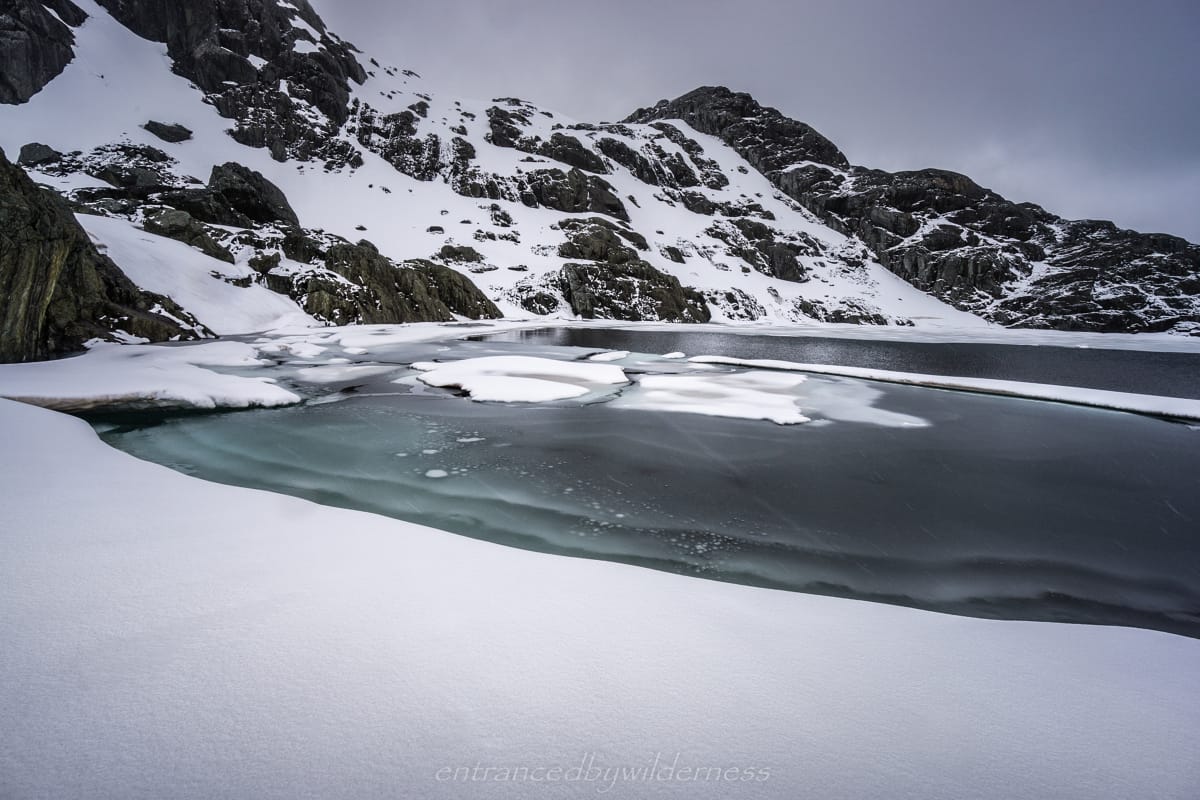
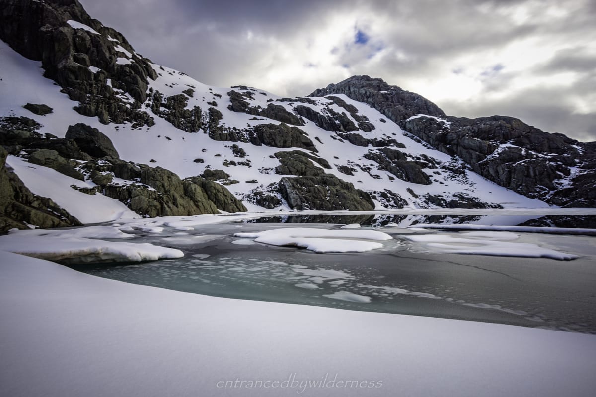
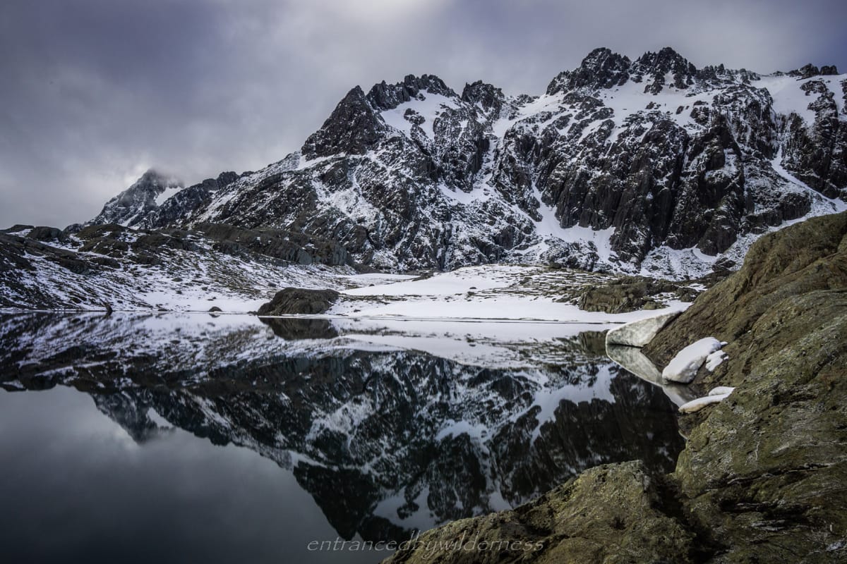
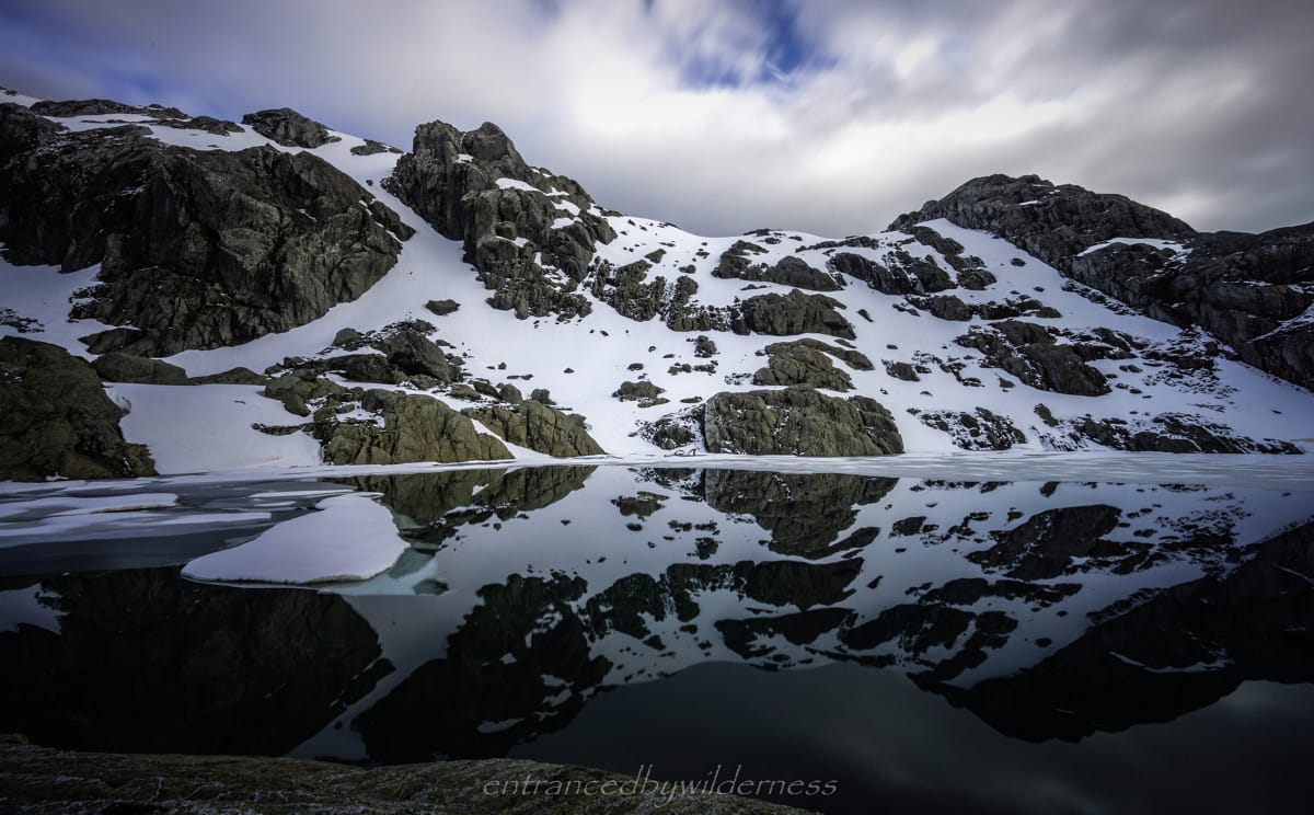
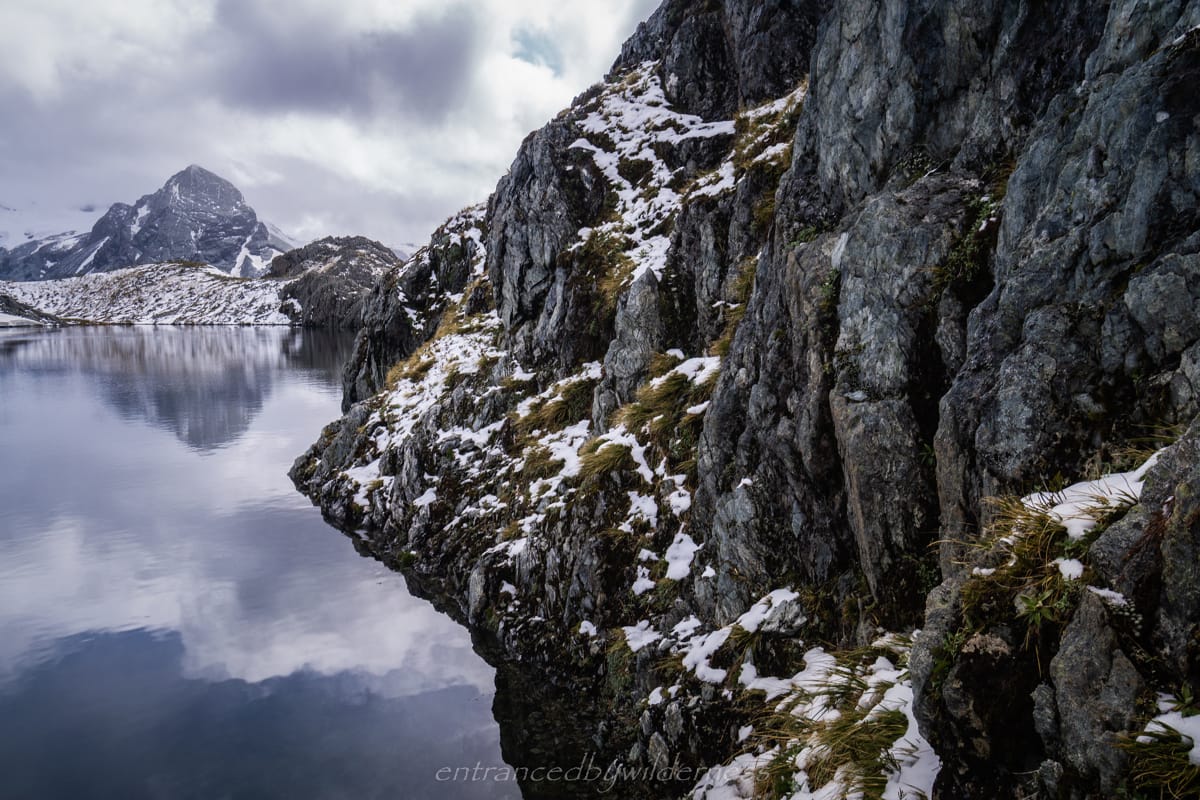
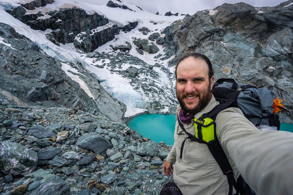
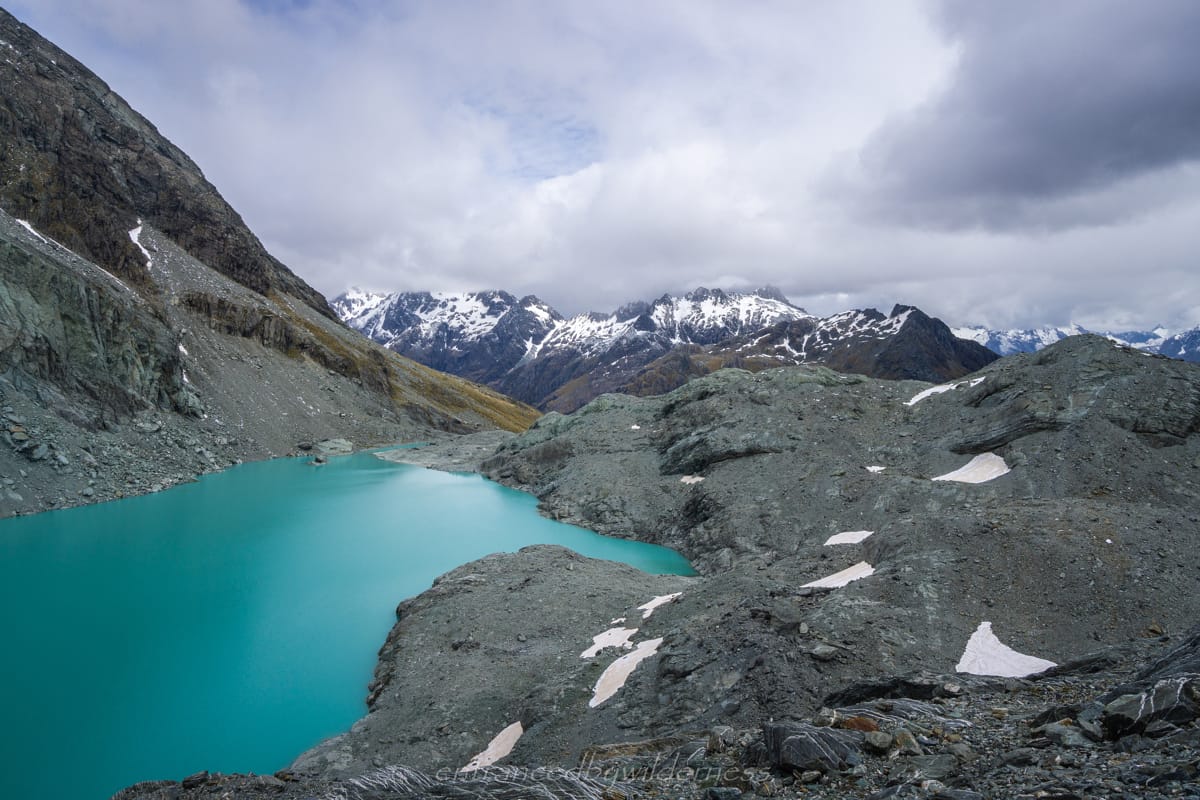
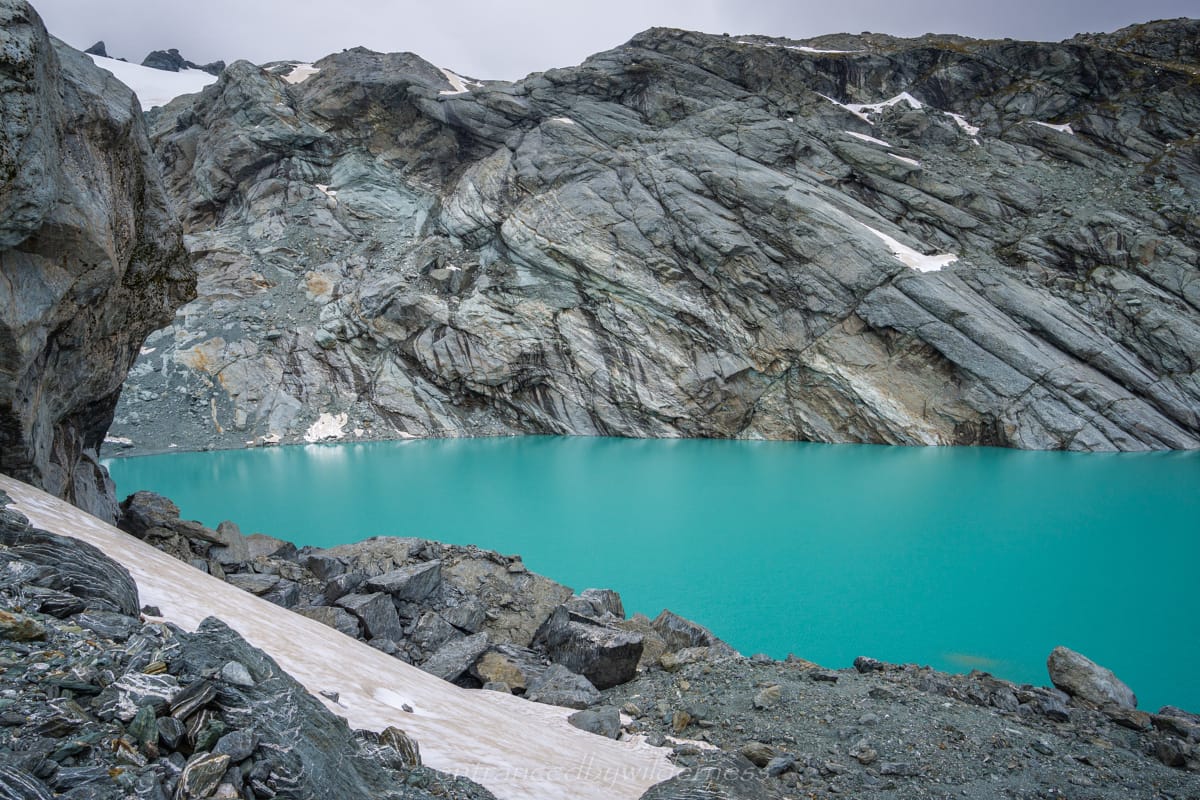
Once at the lake, I marvelled at the sights before me. It was STUNNING. Looking from the northern side of the lake with Nereus Peak as a backdrop, the cathedral-esque peaks become a stunning backdrop. Exploring further, there is the smaller lake behind, which I named ‘Little Nerine’. This lake had a lot of snow cover and even some ice – it was just amazing views everywhere it seemed!
It was only just after midday, but camping here for me was essential. It was snowing a little harder than before, and I wanted to get the tent set up as soon as I could. There is a lot of open exposed area here, and with snowfall, finding a suitable site was limiting. There was some reasonable spots near the smaller lake that were not as snow-covered, yet quite exposed. I ended up snow camping on a slab on ice with a small wind wall built between the two lakes.
The weather did not really get significantly worse thankfully. Just consistent light snow or rain for most of the day. However, it got COLD really fast. After setting up the tent, I craved the comfort of my sleeping bag immediately. I thought at first it was just because of the snow, but it was the air temperature. It then occurred to me that it might be the nature of the ‘bowl’ shape of the valley, with the cold air being pushed down on to me. It was definitely at least a few degrees below zero here, and it was around 2pm in peak Summer!
Day 5 – Lake Nerine to Park Glacier and Rockburn Valley
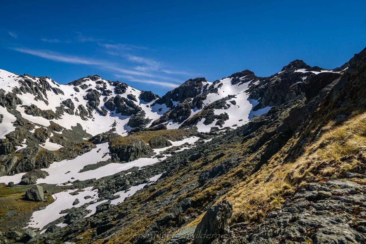
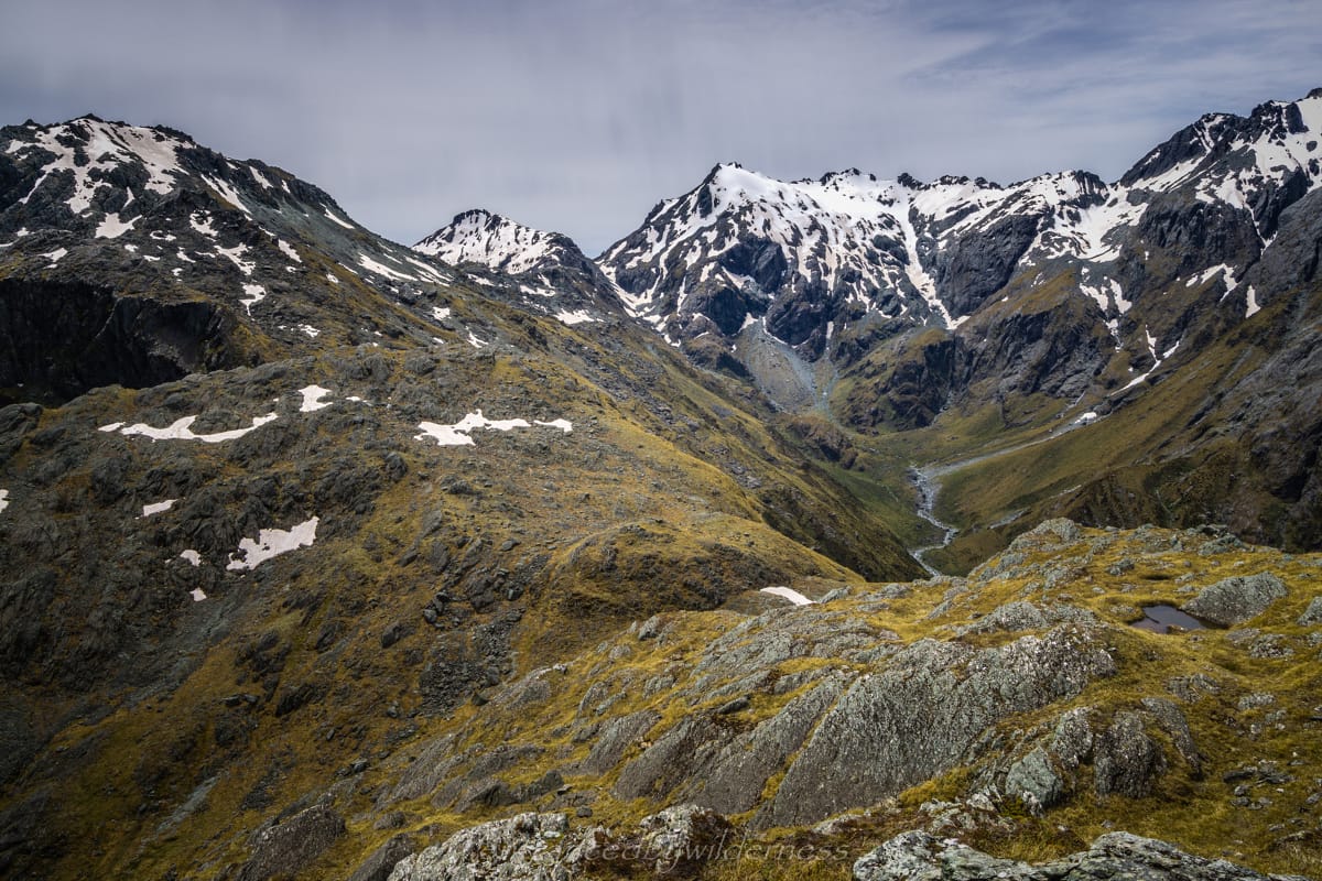
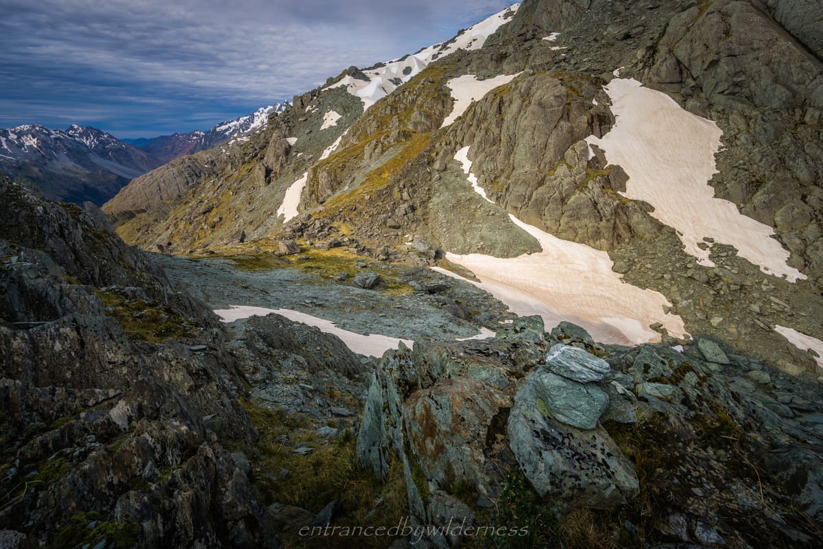
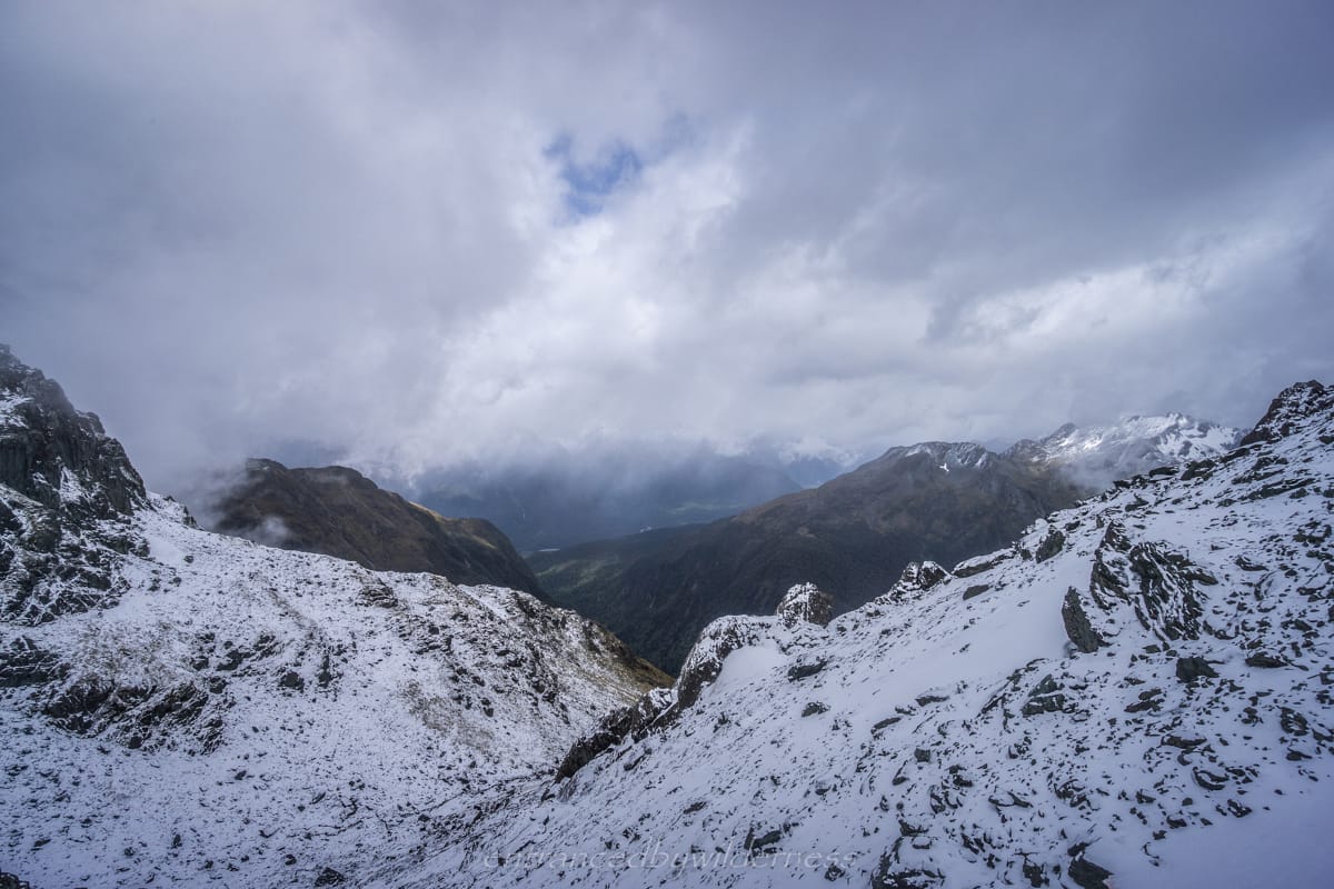
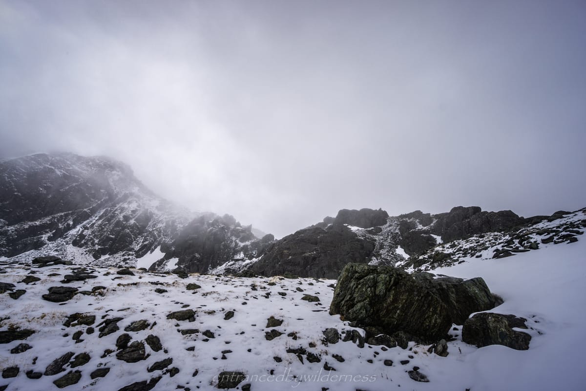
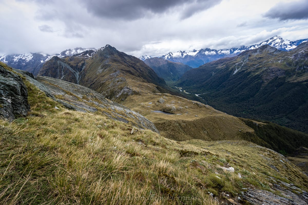
The cold and wet weather had passed! It went on much longer that forecast, but I felt I was cautious enough and wasn’t really ever caught out in troublesome weather. Today, it was time to do the short final ascent on the Serpentine Range up to around 1600m, and then follow the main ridge all the way down to Park Pass.
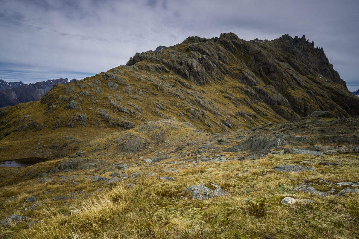
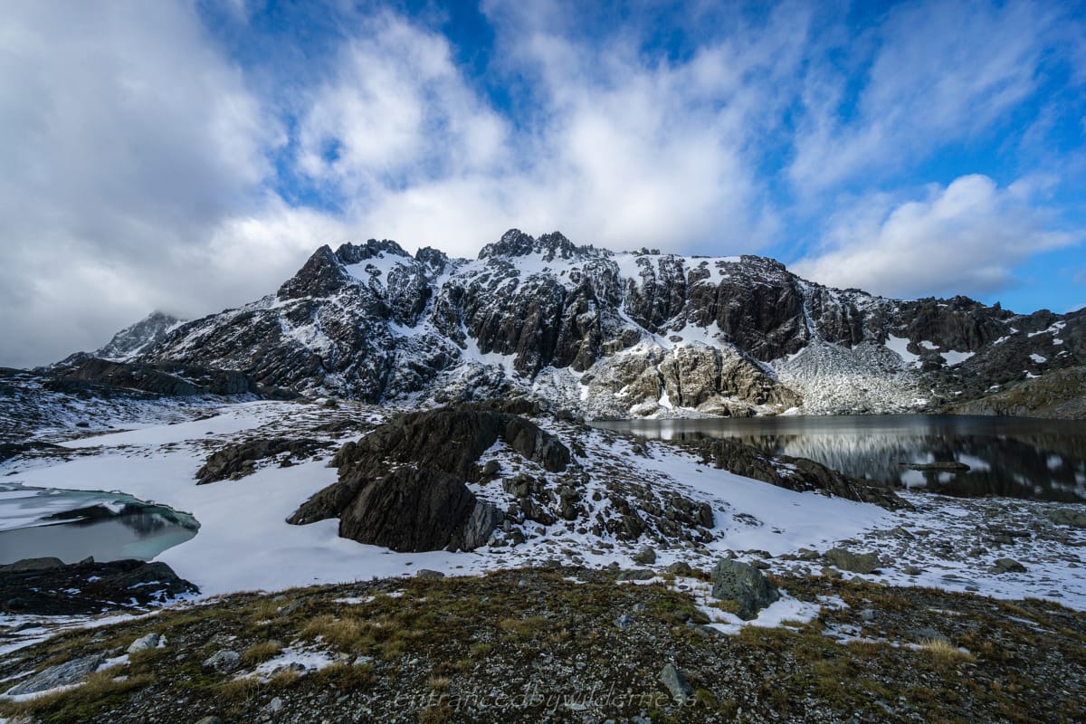
I decided to climb up the left side of Little Nerine. There was a rocky section in the middle, but it wasn’t too challenging. Once at the top of the ridge, I bumped into another crazy solo hiker. He was an Australian guy in his late 60’s to early 70’s. Doing a similar trip to me, except he was heading down to the Hollyford valley from North Col (he had organised a pick-up there). We chat for a bit before setting off. I totally did not expect to see others’ here, let alone an elderly man (yet clearly fit!).
For the next section, I was somewhat following footprints from the other hiker. The expectation was that he’d choose a better angle, as he was coming uphill and it’s easier to route find. Well, that wasn’t the case, as I was following his tracks around the southern side of a large lake at the base of a rock wall, inches above the water. I’d have definitely just gone around the lake, or over the top of the rock wall to avoid this. There was a steep snow chute as a final snow obstacle before the ridge descent, but it wasn’t hard to navigate over.
I had noticed cairns at the top of the descent, but lost them quickly. Looking back, I think they drop elevation faster than the route I went. In this next section, I found myself sidling around to the main ridge heading to Park Pass. This was mostly easy, but toward the end became more bluffy and the need to hang on to snow grass due to steepness became essential. Eventually, i made to a collection of boulders, and the start of the easy ridge.
I ended up stopping for lunch just before Park Pass. The day was warm, which was very welcome after some extremely cold and wet days prior!
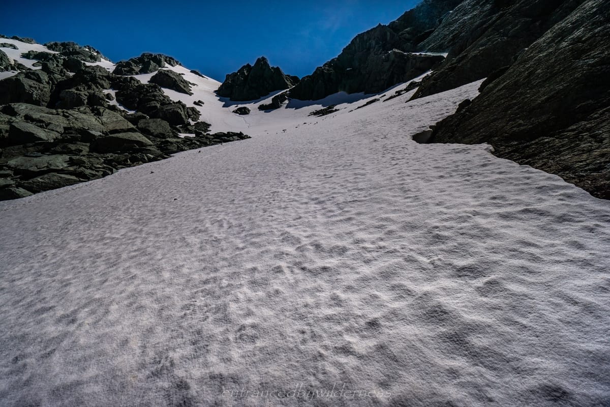
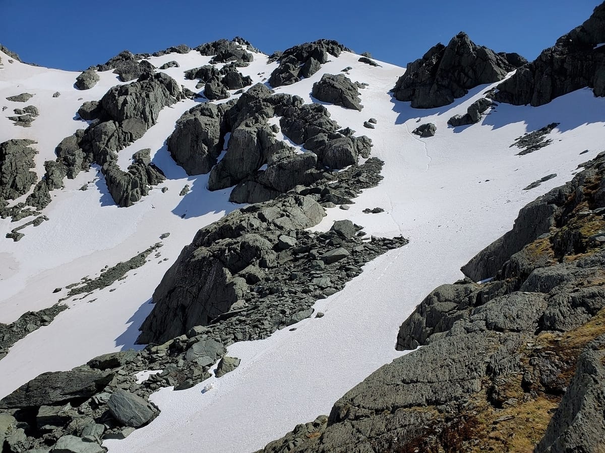
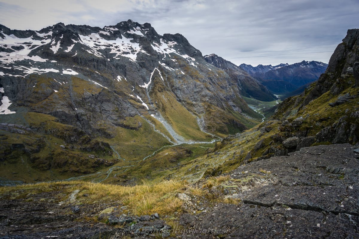
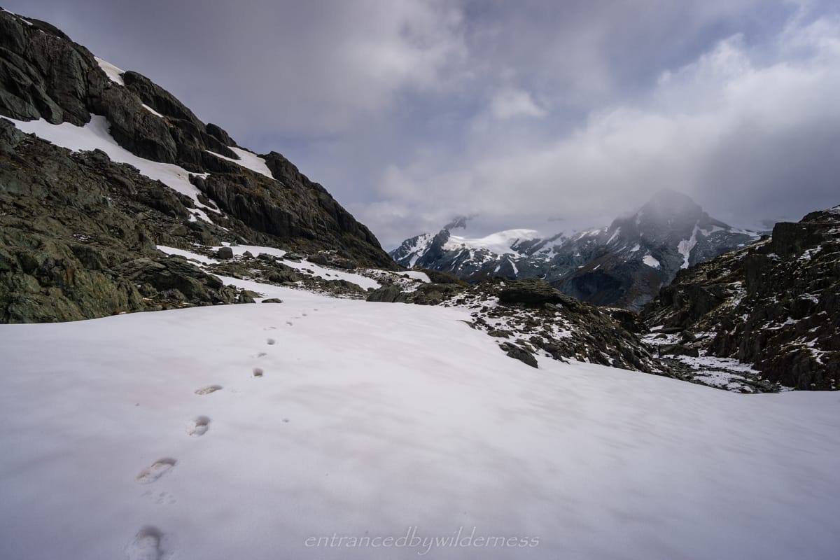
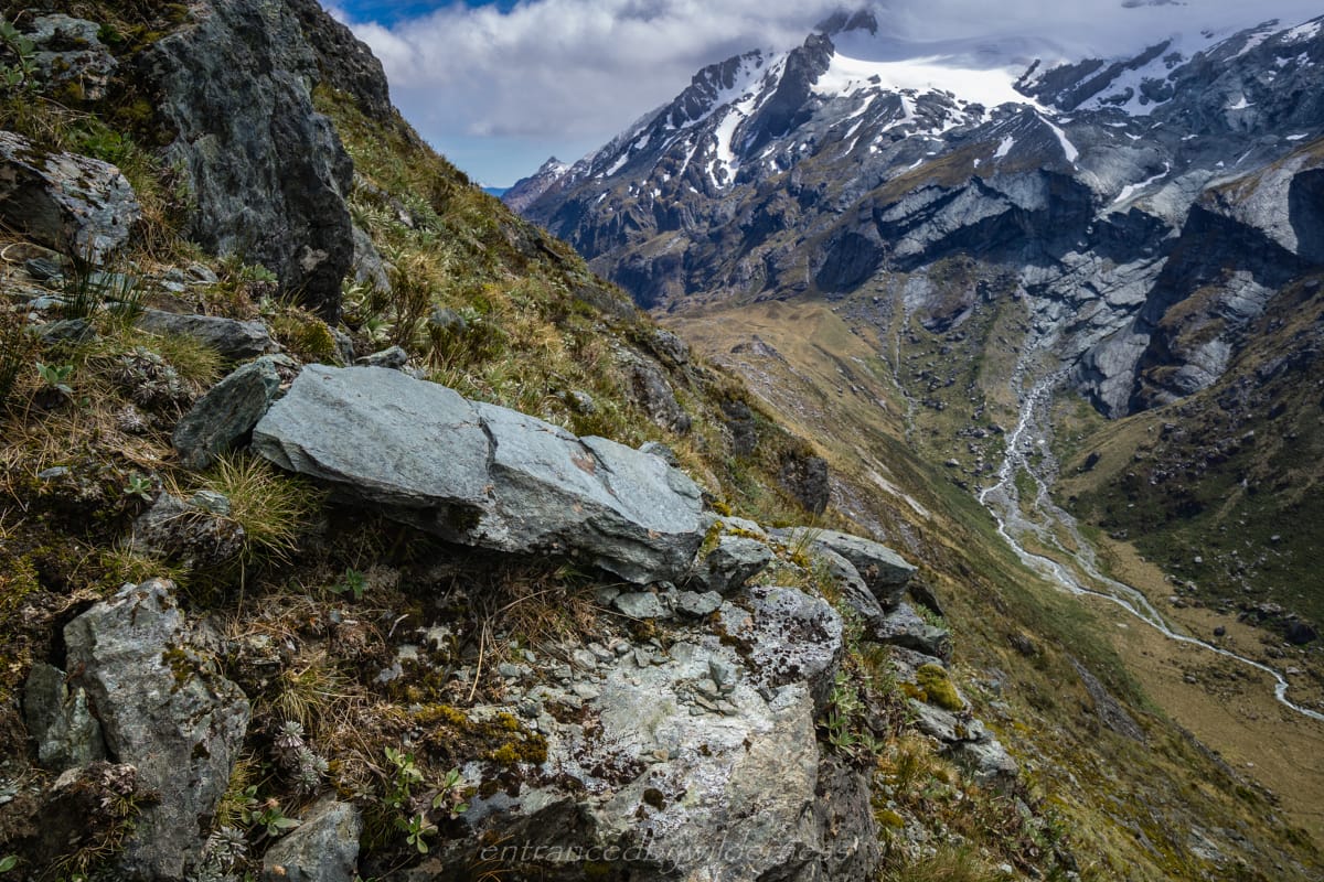
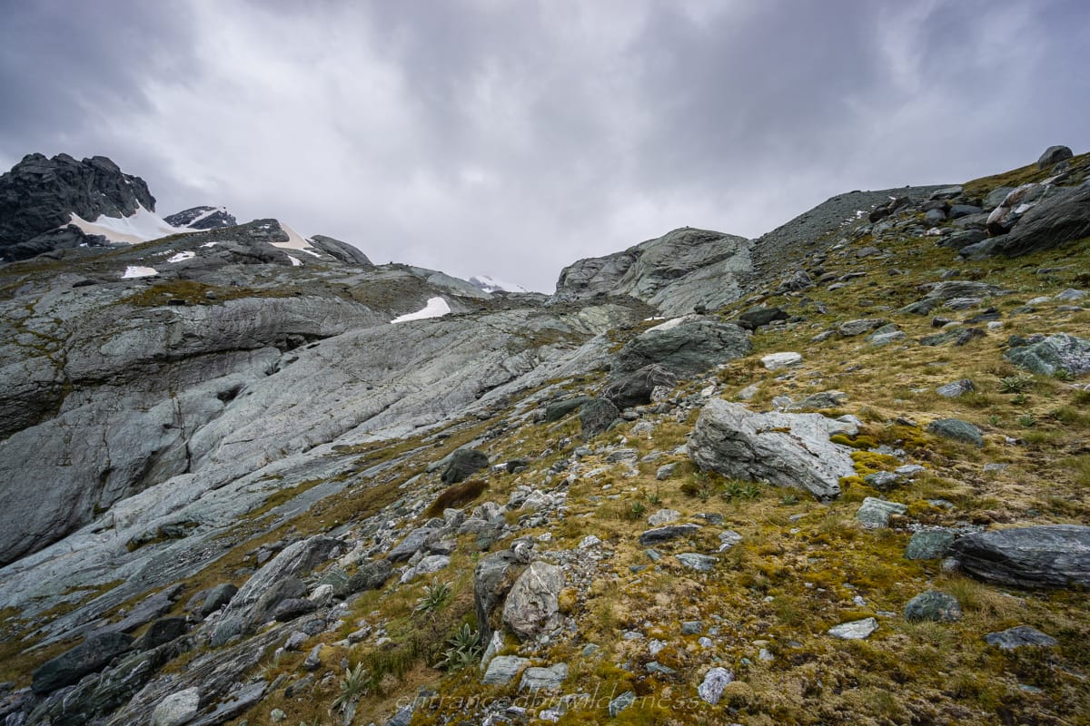
After reaching Park Pass, it was time to climb the spur towards Park Pass Glacier. There is not many options here to climb, and I needed to ascend beside a small cliff, and then get on the cliff and ascend the spur following a cairned route.
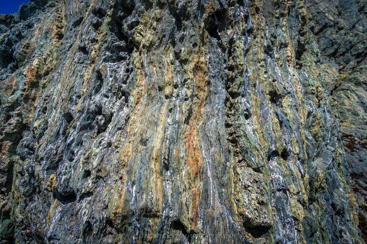
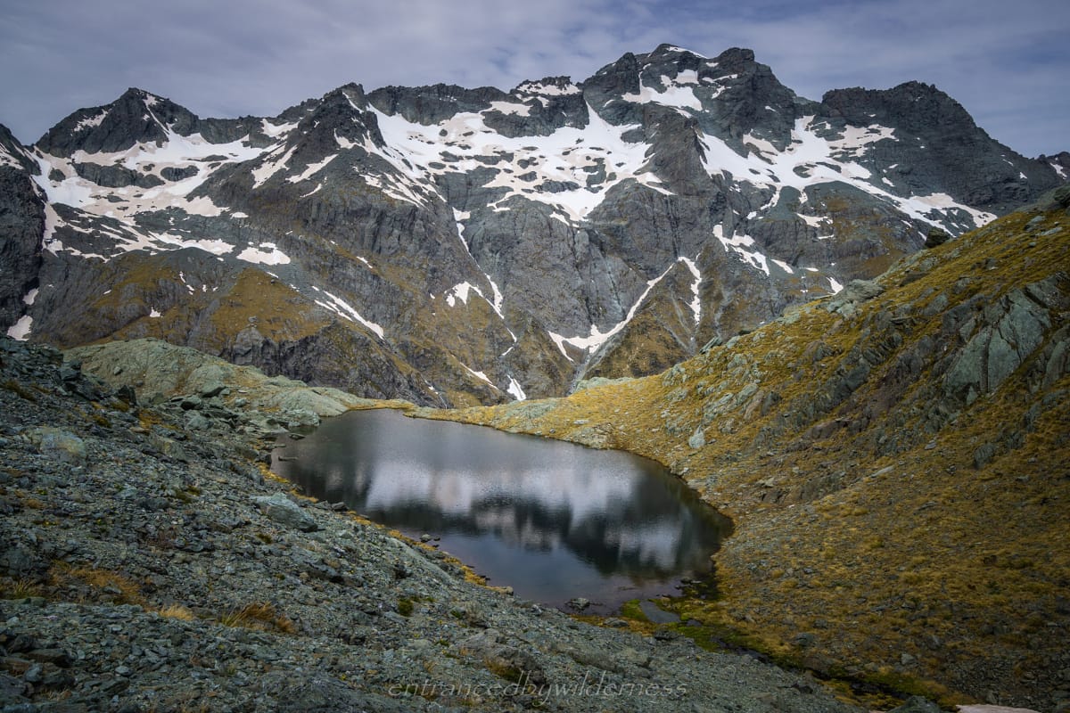
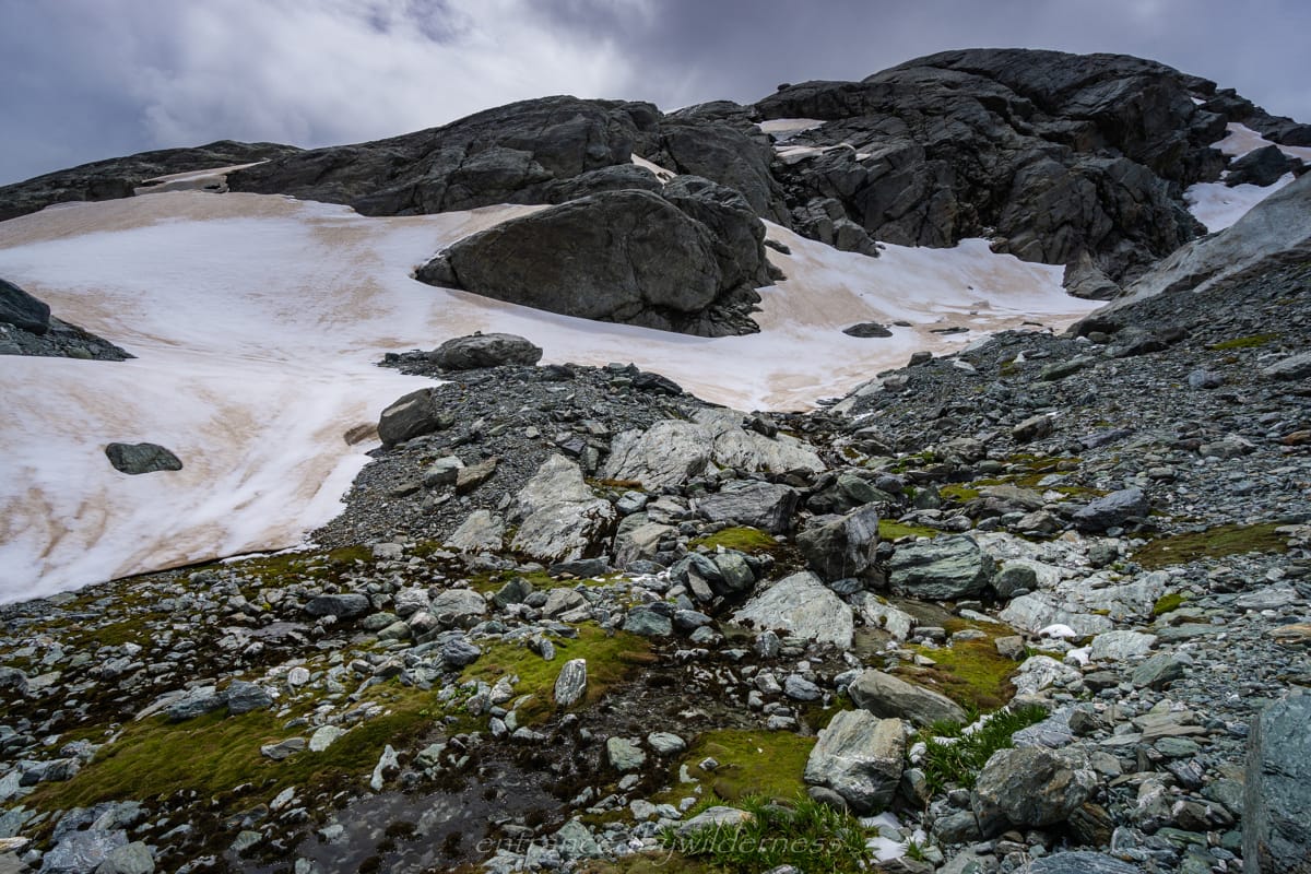
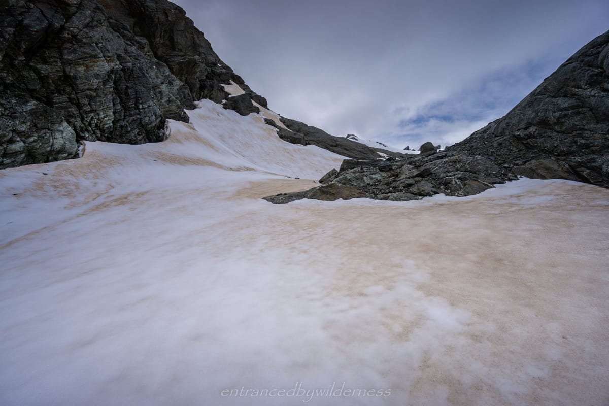
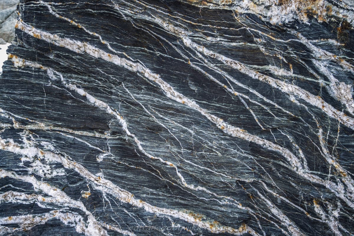
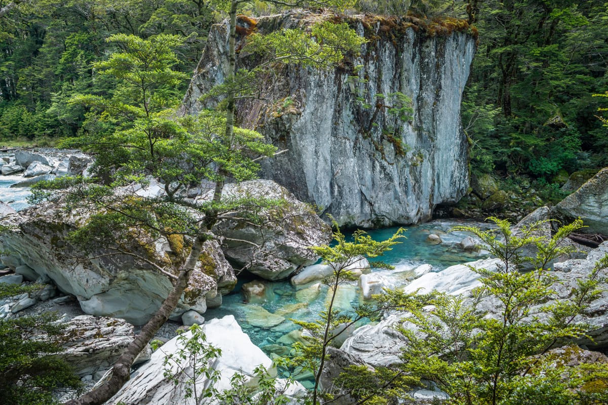
My initial climb up, I ended up going a little too far, where it got steeper, but still managed to climb up onto the spur. The rest of the climb up was straightforward and I ended up following the small stream for a while around the back of Peak 1588. It should be noted the glacier has retreated much further than topo maps indicate (NZ Topo/LINZ is more accurate than the DoC version though – which doesn’t even show the lake!). Once near the top, there was a few snow patches to cross before reaching the moraine hills. The exposed rock here had some amazing surfaces and colours.
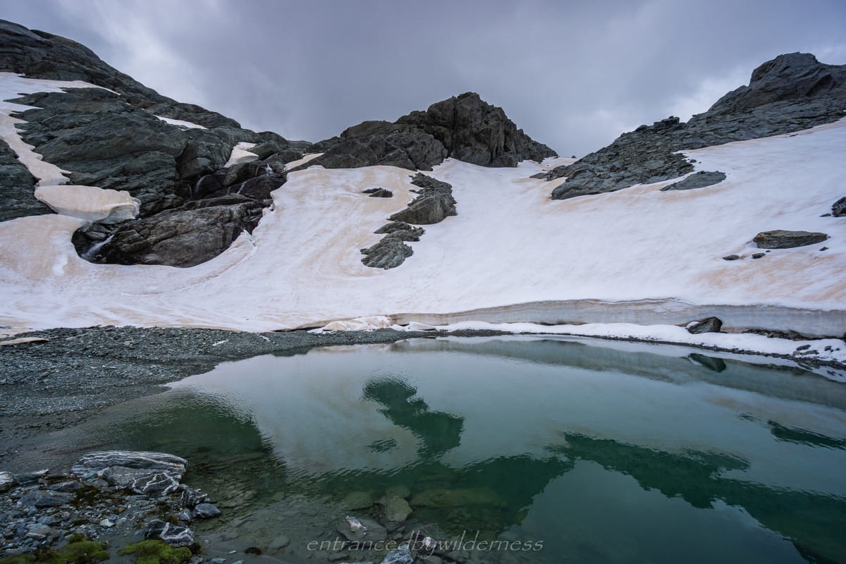
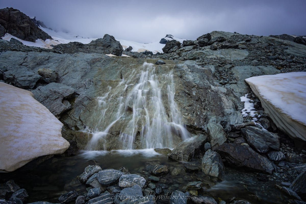
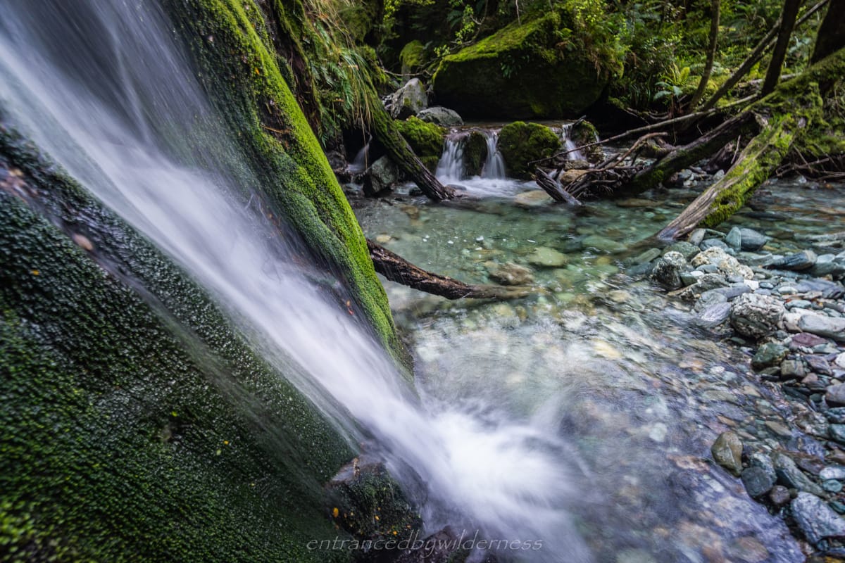
Wandering around the base of the glacial section, I came across small tarns and even some small waterfalls. I decided to head to a higher vantage point to see the terminal face of the main glacier feeding the lake (about where the letter ‘a’ in Park is, on the LINZ map). The view here is AMAZING! When you can look back to where you were in the morning and see how far you came, it makes you feel good!
I was suddenly thinking about a glacial lake swim. Getting down to the lake is possible from a lower point, but it was a little loose and not ideal from my higher position. I didn’t have a lot of time spare, so I decided to just head down after an hour up top exploring.
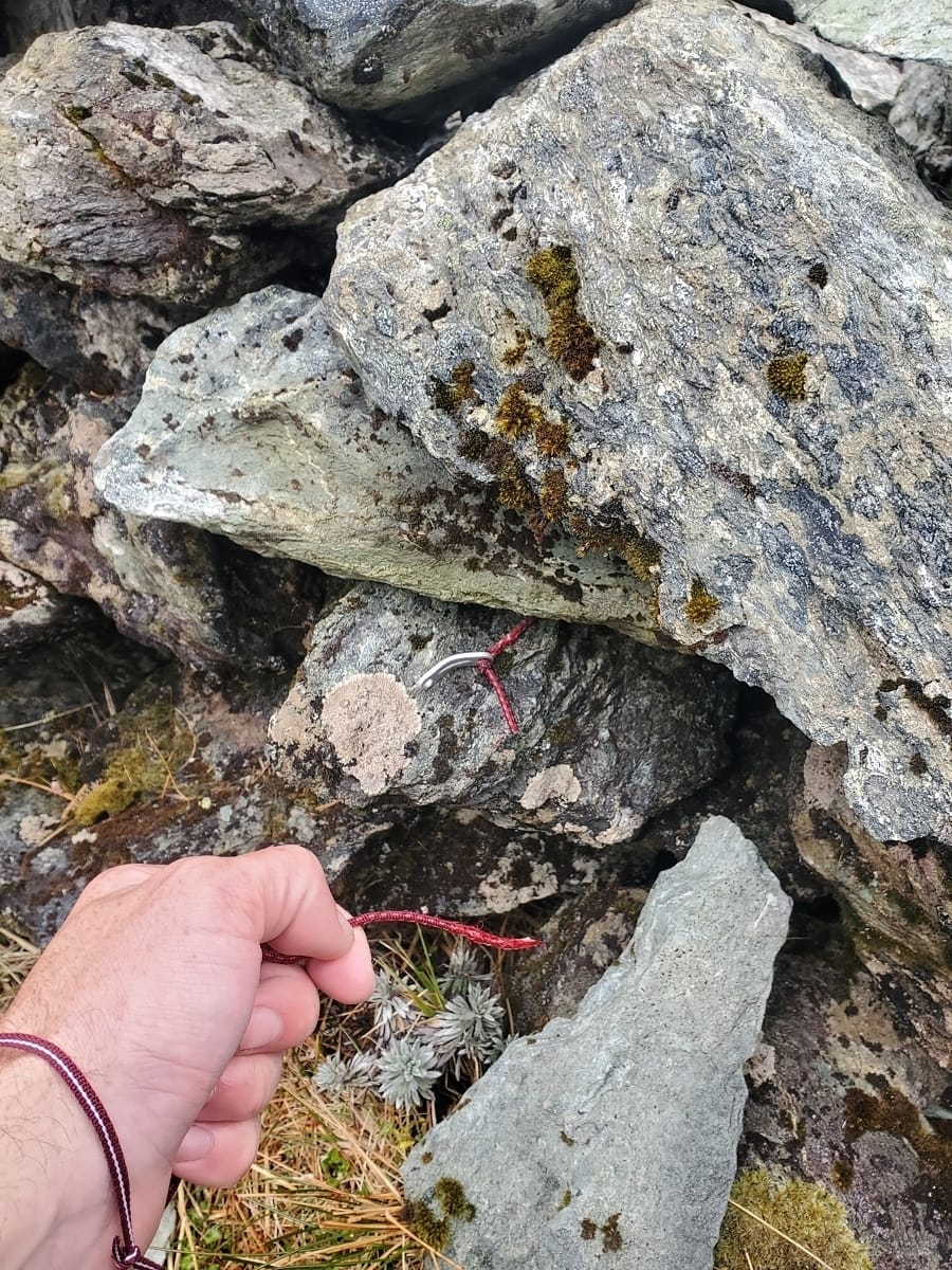
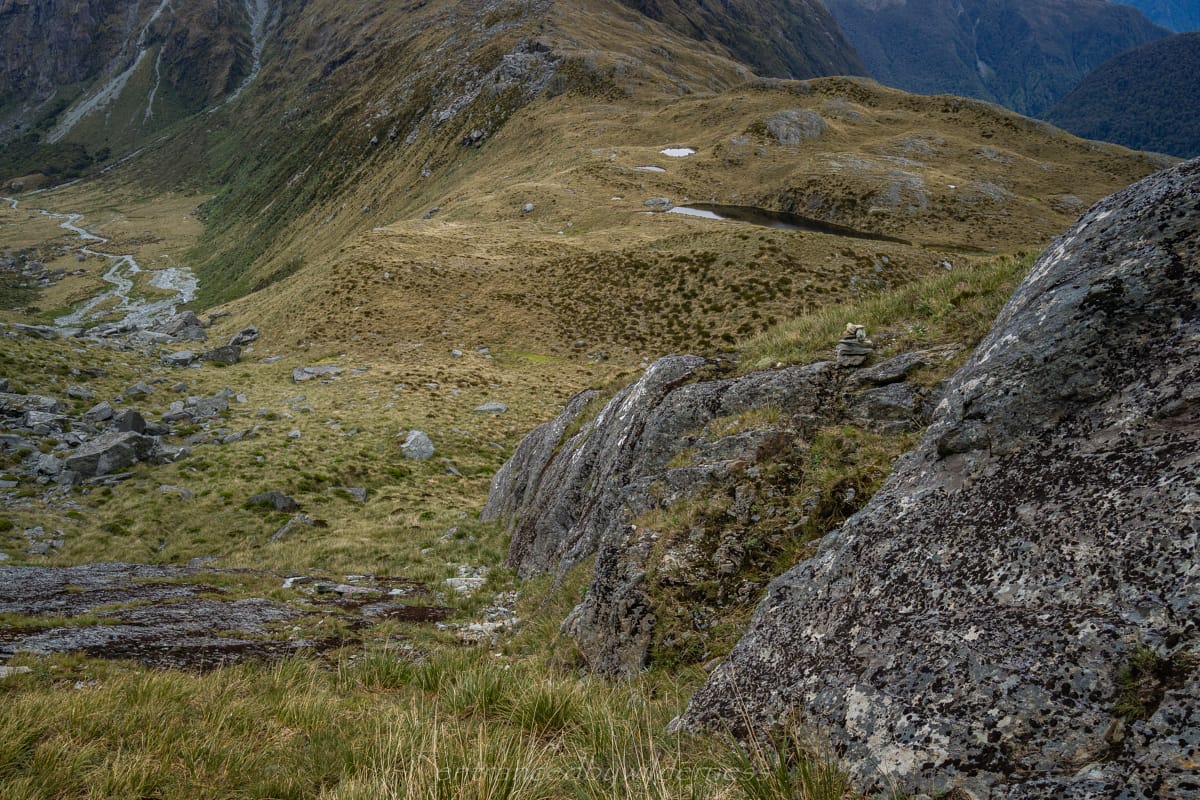
On the way back down, I found it much easier, and stuck to the far right (looking downward) of the spur. Once I dropped below 1300m, if you veer straight across to just past the start of the cliff section (to get up on the spur from Park Pass), there is a small notch with a cairn on top that I didn’t notice on my way up. Keep an eye out for it (see photo).
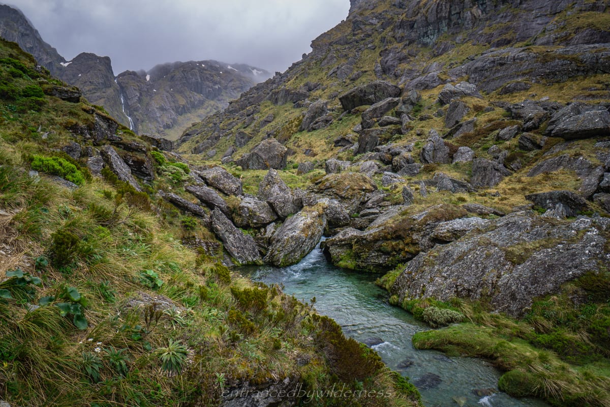
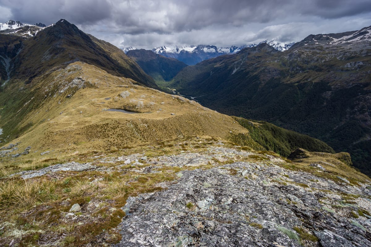
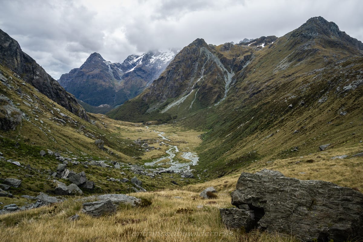
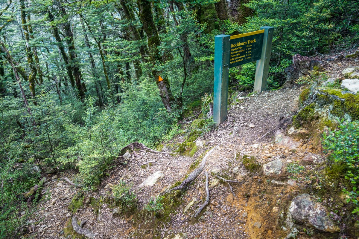
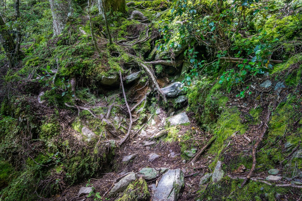
Now back on Park Pass, I needed to head down into the Rockburn Valley. I decided to just head straight off from where I was, well away from the main track heading down. I passed the famous rock bivvy, where a few people were setting up their camp doing the popular Five Passes loop. Following any sense of trail after the rocky bivvy is futile, and generally, I just follow the river down the valley.
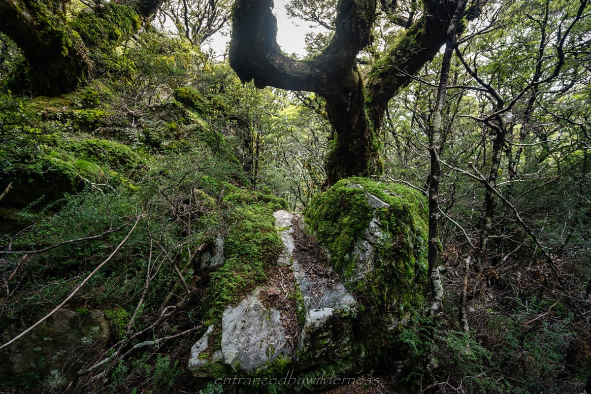
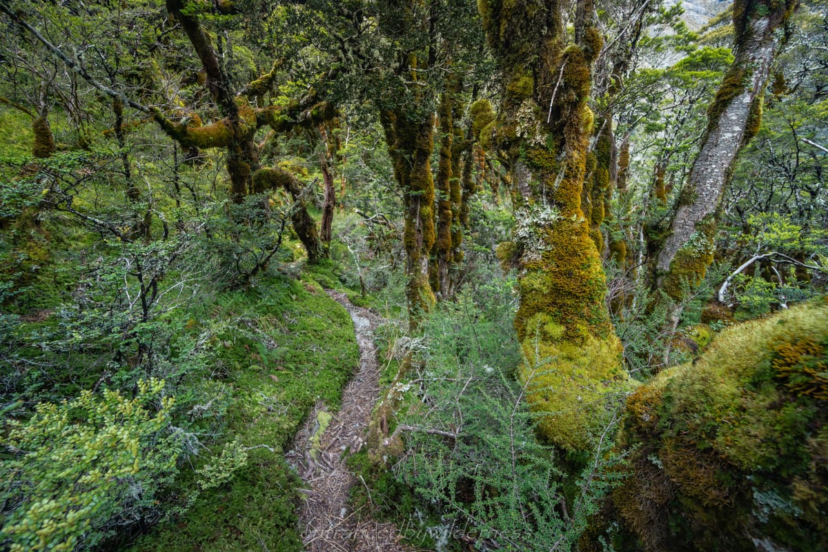
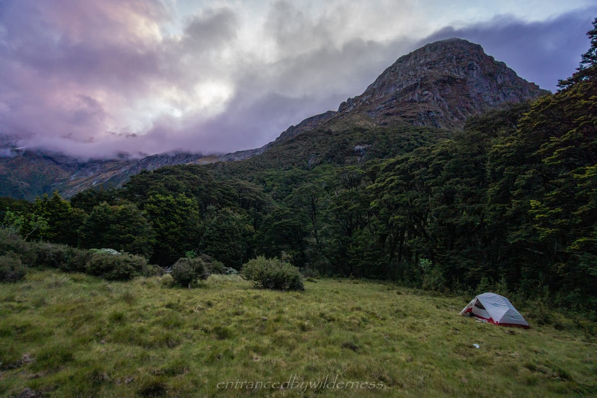
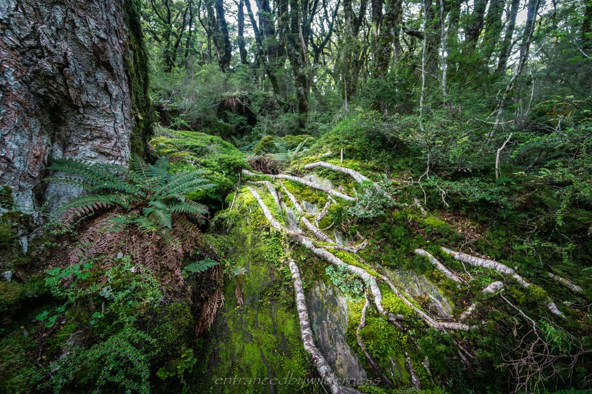
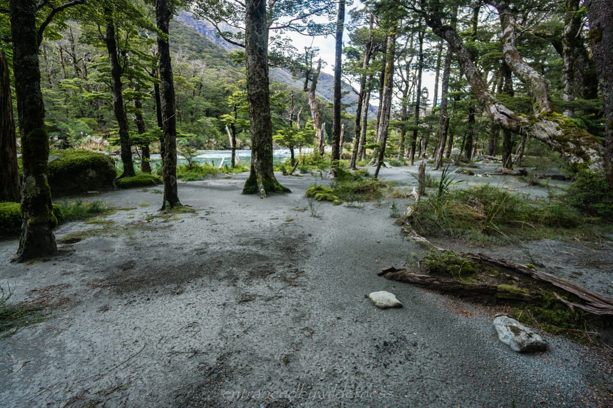
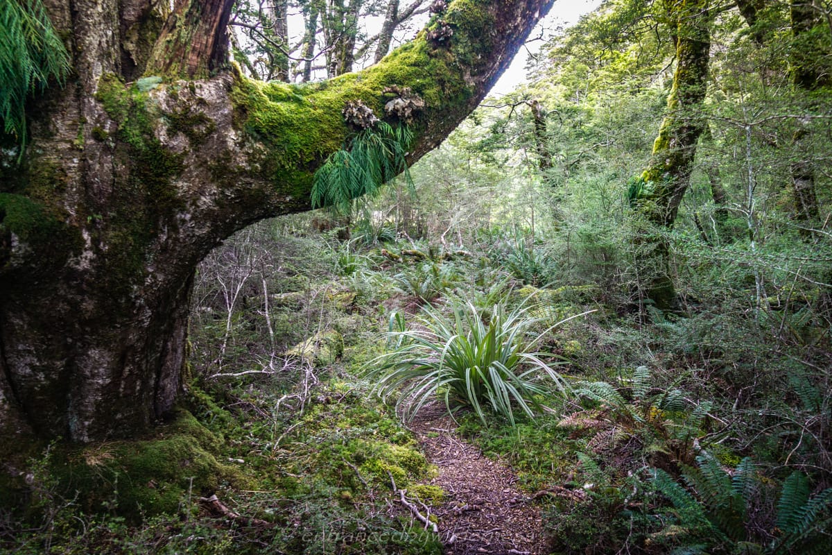
I did want to make a side-trip up to the small lake above, and north-east of the forest section near the 1000m contour, before dropping off into the lower valley. I didn’t have enough food and time in the day, so I just ended up not going. The forest section here is quite beautiful at this time of year. I ended up camping at the base off the drop off, to the left of trail in a clearing at around 810m with views of Minos Peak and a waterfall.
Day 6 – Rockburn Valley to Routeburn Shelter Carpark
It was the final day, and I was almost entirely out of food. I ate almost everything I had left for dinner and breakfast, leaving two muesli bars and a small about of chips for the final hike.
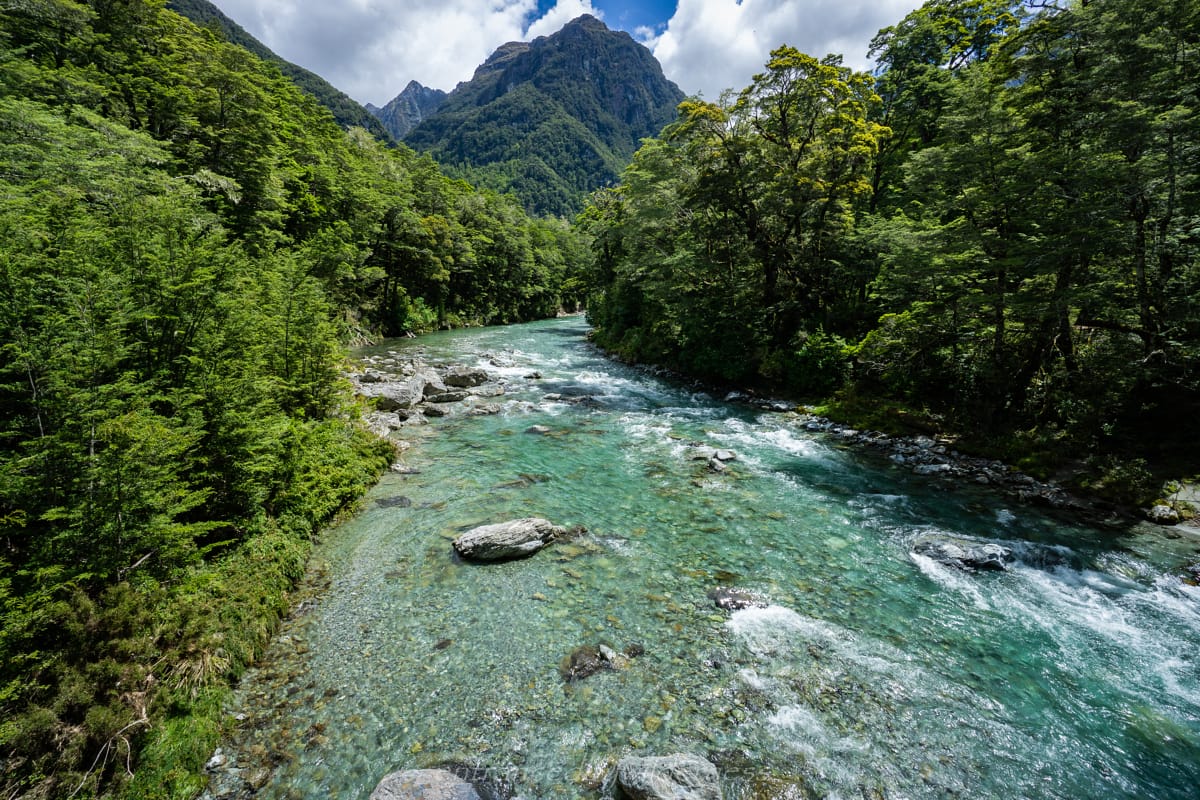
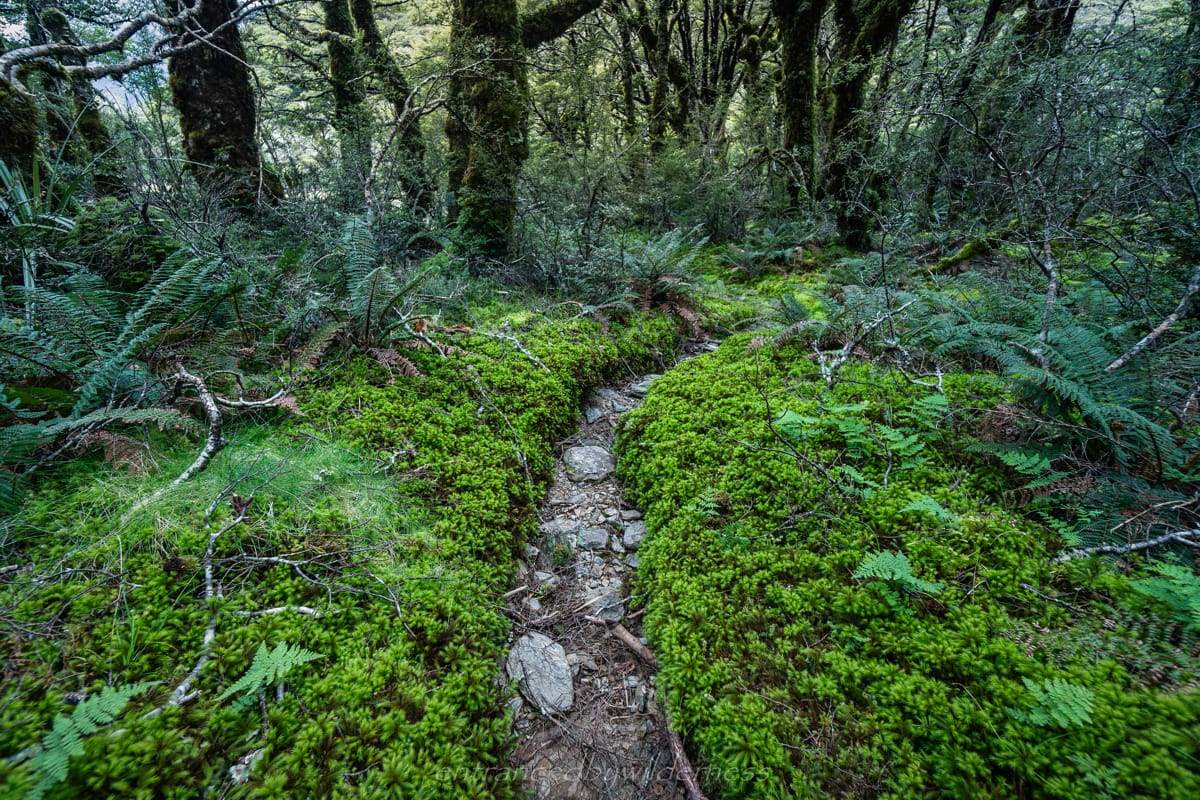
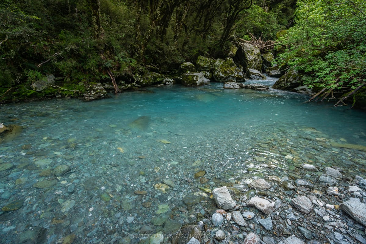
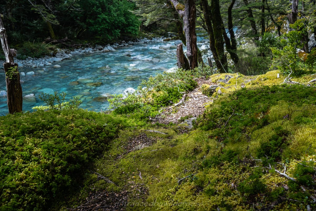
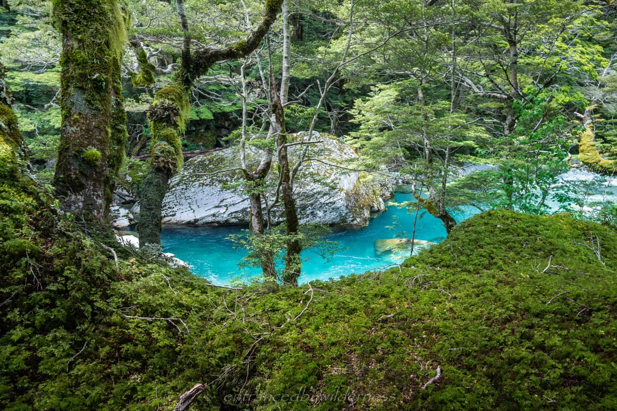
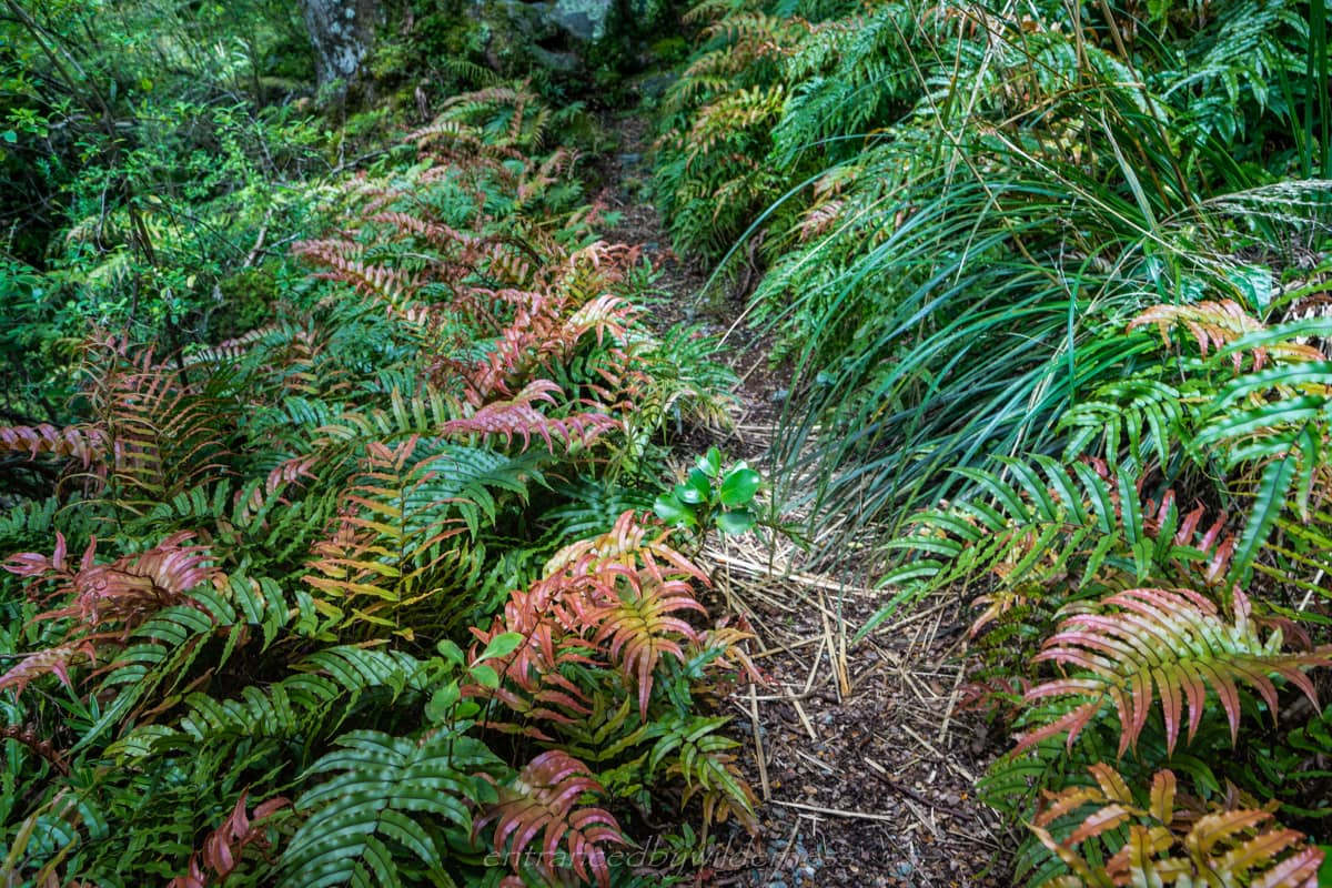
The next section of the Rockburn track is very pretty and lush with established trail. There are a few places to camp along the way, which I had been tempted to reach the night before. The Rockburn is one of those amazingly blue rivers in New Zealand, fed by glacial run-off and pristine waters.
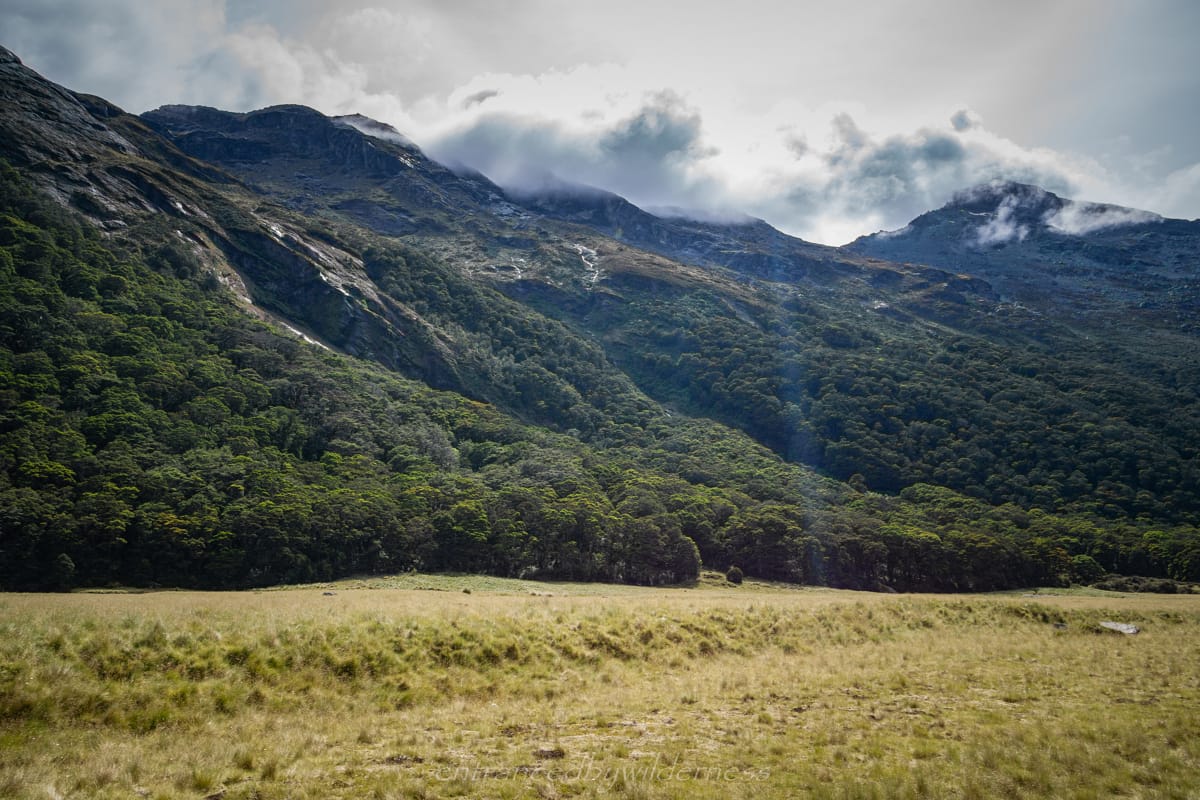
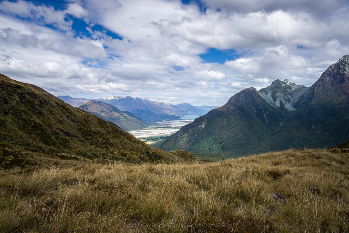
My final obstacle was the ‘dreaded’ Sugarloaf Pass. Now I have nothing really against this pass, other than it is a tedious slog, full of boggy mud and not overly interesting! However, it was an essential access point between the Routeburn and Rockburn valleys, and I am grateful for its presence. There are some good views on the pass, especially looking out toward Glenorchy and Lake Wakatipu.
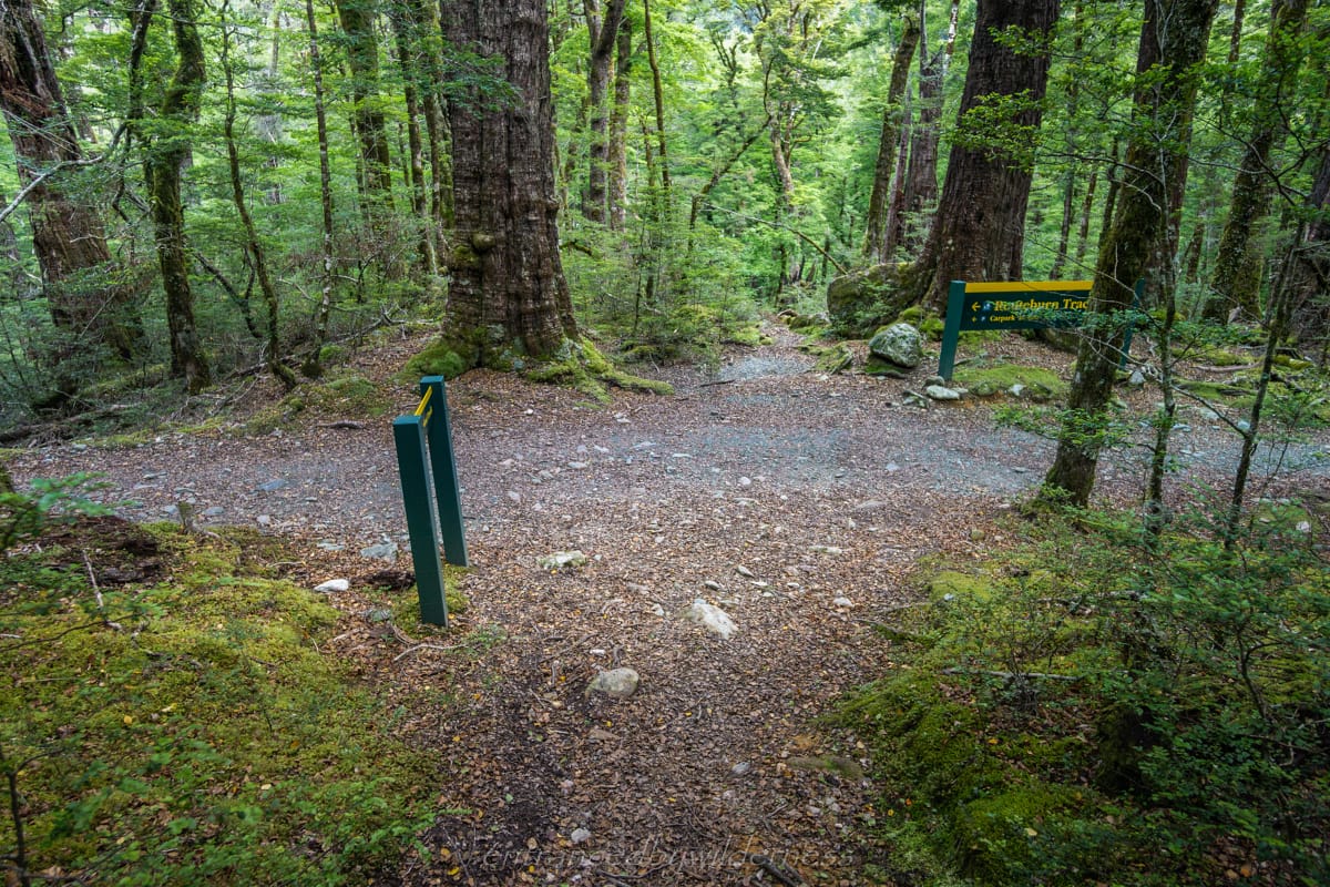
After several hours, with tired legs and muddy shoe, I arrived back on the Routeburn Track. The circuit was now complete! I ended up reaching the car just after lunchtime. Now it was time for tradition, and head STRAIGHT to the Glenorchy pub for fish and chips or a burger!
This was an awesome trip overall and I thoroughly had a blast. The trip went accordingly to plan, in that I completed the route I had intended, and it took around the predicted time i thought, perhaps a little longer due to waiting out a day.
What would I change?
There were a few sections I wish I had photocopied some of Moir’s Guide (or other online resources) for route descriptions when route finding was difficult. However, this is always going to be the case. A lot of times these sections aren’t well described (which is the point of why i write these detailed posts).
If I were to do it again, I think I’d like to see what is like it in reverse. I feel like most of the bluff and cliff sections were harder when I was descending. This might just be the nature of descending being harder in general though.
I’d like to extend the route further (if I had more food) and add in Lake Unknown via Park Pass Glacier, and come back down via Theatre Flat.
Did I achieve any personal goals of objectives?
One of my goals was to take on these more adventurous routes with confidence in tough situations, and having flexibility to change plans and consider safety. I feel like I am meeting these personal goals, and when I look back at my videos and decisions, I feel quite pleased with myself.
I took on the opportunity to risk camping in a heavy storm, and prepared sufficiently for it. Although at times, the storm scared the crap out me to where I needed to support my tent from strong wind and rain, I felt in control and safe. I had exit routes planned, and I had my PLB for dire circumstances.
Gear List
I was quite pleased with my gear choices for this trip. Changing out to my boots instead of trail runners because of the ongoing technical terrain and need for crampons was a great move. I had warm enough clothing, and generally made use of all gear taken. I could have brought an extra day of food though. Click the button below for my gear list.
In order to support the travelling and hiking community, I spend many hours per week or month to adequately document all information and advice for prospective visitors, accompanied by a (hopefully) entertaining insight into my personal experiences. This service is, and will remain, free. However, running a non-profit website and spending time creating content comes with financial and personal costs.


Great story and photos…one day looks like an awesometrip. ive climbed in the darrens, this looked great