
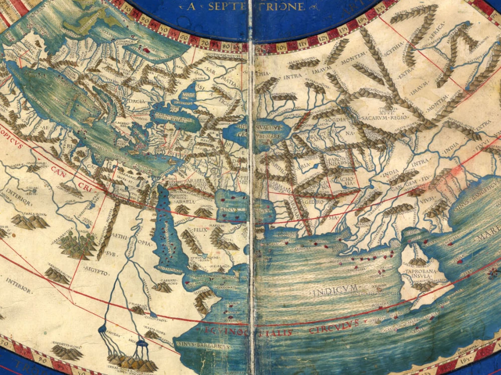
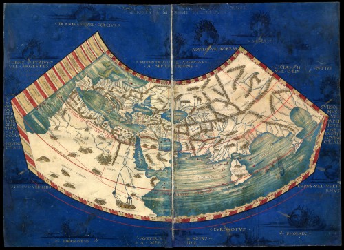
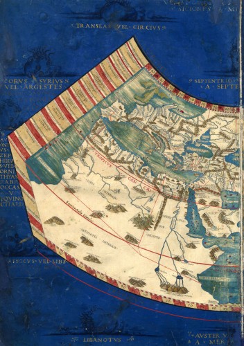
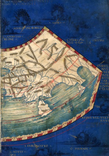
Antique map of Ptolemaic World by Ptolemy 1478


[No title]
Item Number: 20921 Authenticity Guarantee
Category: Antique maps > World and Polar
First available printed Ptolemaic world map based on the work of Nicolaus Germanus. Engraved under supervision of Conrad Sweynheim. Published in Rome by Buckinck.
Copper engraving, printed from two plates.
Sheet size: 41.5 x 57.5cm (16.3 x 22.6 inches)
Verso: Blank
Condition: Old coloured, outer area of the map in an attractive dark blue colour, 14 MANUSCRIPT windheads (two of them are faded), MANUSCRIPT names of the windheads in gold, minor repairs at the edges of the map (at the backside), small repair at the lower centrefold with a small area (1 cm) repainted. Very nice copy.
References: Shirley (World), 4; Karrow, 32/1; Nordenskiöld, 197; Shirley (Brit.Lib.), T.Ptol.2a
From: Claudii Ptolemaei Alexandrini philosophi Geographiam Romae. Rome, 1478.
"The new copper plates engraved at Rome for the 1478 edition of Ptolemy's 'Geography' are much superior in clarity and craftsmanship to those of the Bologna edition. There is evidence that work on the Rome edition had been started in 1473 or 1474, and several of the plates may well have been engraved before those printed at Bologna in 1477. The printing was carried out by two skilled printers of German origin: Conrad Sweynheym and his successor Arnold Buckinck; the publisher was Domitius Calderinus. Many consider the Rome plates to be the finest Ptolemaic plates produced until Gerard Mercator engraved his classical world atlas of 1578." (Shirley)
"Until the 1477 edition was definitively dated, this edition was thought to be the oldest engraved atlas. It was printed by Arnoldus Buckinck, and is thought to be the only known book with his imprint. At first the engraving was supervised by a German, Conrad Sweynheym of Main (d. 1477). His method of using a printingpress for the copperplate maps, together with the fine engraving, produced an excellent result. The text was edited by Domitius Calderinus of Verona; he collated various Latin manuscript in the translation by Jacobus Angelus with an ancient Greek Manuscript, which had been emended by Geirgius Gemistus (d. 1450). Calderinus was a careful worker, and his edition had been much admired for the correctness of the text, the fine typography and the brilliant engraving. Christopher Colombus owned a copy of this edition, which he annotated. The run of the edition is not known, but it is considered to be scarce, and is therefore rare and important. ..." (Nordenskiöld)