There’s a constant interplay between wild and domesticated, and between native and imported plants.
Some wild plants can be hard to keep out of gardens – including daisies, dandelions and buttercups, and may be tolerated up to a point. Other wild plants have historically been cultivated to assume more garden-appropriate forms. Now, by contrast, it’s precisely some plants’ wild, hedgerow character that makes some people want them in their gardens – because the plants that have co-evolved with our insects are more hospitable to them, so this is a way of promoting variety of life.
Meanwhile, some cultivated or non-native plants imported for gardens have escaped into the wild, and flourished there- sometimes precisely because they are unattractive to local insect and animal life, so have less exploitation to withstand. And finally – another twist — wildflower patches in wild places have sometimes been deliberately sown as such.
Towpath hollyhock: garden escapee
Flower array, Trap Grounds. Natural growth, or a wildflower bomb?
Some plants seem to straddle the line between wild and cultivated. Thus valerian. Even people who don’t set out to grow wild flowers sometimes judge this an attractive garden plant. Though wild, red (as opposed to white) valerian is a c.1600 import from southern Europe, now naturalised in Britain.
There’s lots of valerian along Oxford river banks. Also lots of two flowers which grow profusely in wild forms, but – in the case of the rose especially – are usually found in other forms in gardens. That’s the rose and the iris.
Species of rose and iris grow wild around the globe. Roses were cultivated in England during the middle ages, and some varieties were already being imported from the east: the red rose of Lancaster possibly had eastern European ancestry; the damask rose is reputed to have been brought by crusaders.
From especially the later seventeenth century, systematic gardening, botany and plant importation flourished together. By the later eighteenth century, there was a significant commercial garden-plants sector, catering to the middle classes. As Britain’s global power and global markets waxed, there were further imports of both trees and plants. The Royal Horticultural Society was founded (1804), and from its Great Spring Show derived, in 1862, the first Chelsea Flower Show.
Garden roses as we know them now mainly descend from late eighteenth century imports, Chinese cultivars. By contrast the garden iris has only about a century of breeding history behind it. Modern irises have been hybridised from many originals, from the US to Siberia.
Henry Phillips, a popular early nineteenth-century horticultural writer, cropped up in some research that I did earlier this year. I checked what he had to say about roses and irises. in his Sylva Florifera – a book about the fashionable new garden accoutrement, the shrubbery – he noted the spread of roses from China across England, commended them as effective when dotted among shrubbery, and commended also native shrubs (unrelated) the guelder rose, rose elder, or ‘snowball tree’, and the rose acacia. In his book on Floral Emblems, he associated the wild ‘dog rose’, eglantine, with simplicity, and yellow irises with the passion of love. Other types of rose symbolised beauty, England, innocence and elegance, though the yellow rose was a symbol of infidelity, ‘terrible to lovers’. He recognised that irises might come in many colours, saying that that’s why the ancients associated them with the rainbow.
There are various varieties of wild rose in England, some of which may have escaped from gardens, and some of which are cultivated but then sold as wild roses. I wouldn’t pretend to be able to know what I’m looking at in any given case (even my photos of ‘roses’ may include some things that the more botanically-minded reader will know are not roses: feel free to say!) But what’s certain is that, scattered around the hedgerows of Oxford are many things that I take to be wild roses, some of them probably dog roses, others possibly not. And the yellow iris more identifiably flourishes by the side of streams and pools.
My photos were taken, in the case of roses between 4 May and 13 June 2020; in the case of irises, between 10 May and 22 June 2020, in places across Oxford. The individual pictures simply show flowers that caught my eye at the time.
Iffley; River Park (by Grandpont); Fiddler’s Ait
Burgess field; towpath, towpath
New Hinskey; Aston’s Eyot; Aston’s Eyot
Towpath; towpath; canal, with swan’s nest
They simply follow the water, I guess, but sometimes it seems that yellow irises have a special affinity for secret places, expressing all that passion away from too many prying eyes.
Kennington pools; by balance pond, Boundary Brook; Trap Grounds
Daisies and wild roses, by Longbridges Nature Park
Those who advise on urban landscapes sometimes talk about these landscapes being more or less ‘legible’, which I take to involve clarity in the relationship between the place and its surroundings, and perhaps in relation to its history and formation (the latter is surely easier to clarify for those on foot who can potentially read descriptive notices, but even large street signs can help to inform).
The Botley Road used to be legible. It was an open country road, with meadows on both sides. An 1848 map of these meadows, made just before enclosure, was reproduced in Salter, Oseney Cartulary II, Appendix, and, conveniently in an Oxford Archaeology report (figure 15). It’s thought to show how the land was parcelled up for haymaking between those with common rights before Lammas (1 August), when the meadows were opened to cattle. (Interestingly, many of the parcels were leased by the solicitor/brewer, James Morrell).
‘Fairs and circuses….[also] used these larger open spaces’. St Giles Fair used to move there after closing in the centre of Oxford, and Butlin’s set up a semi-permanent funfair there during the Second World War.
Now, by contrast, the traveller — by car, bus, bicycle, or foot — experiences it as an urban route, characterised by ribbon/strip development, though brightened by tree planting. It’s far from obvious, though it’s the case, that it’s still surrounded by great open spaces on both sides, or that it traverses multiple streams of the Thames. It’s because it lies in the floodplain that the spaces around it remain relatively undeveloped. A photo from Air Experiences looking south from Godstow over Port Meadow towards the Botley Road — the straight line cutting across the shot in the distance — dramatises its continuing vulnerability.
Botley Road environs 1878/1955-61. Some development, but not much in the floodplain (nls.maps.uk)
This is not immediately attractive territory for a ‘walk’ – not only because of its urban, strip character, but also because of the way that the land is divided up. It is possible (with a bit of willingness to improvise in the face of obstacles) to cross the land that runs behind the built-up strip to the south, at least across terrain west of Osney island. This is mainly meadow land, plus Oatlands Road recreation ground. But to the north, the land behind the road is broken up to serve a variety of functions. Boundary security and unbridged streams make it impossible to traverse. Getting the lie of the land in this direction has to involve a lot of dipping in and out. Still, even if it’s not a ‘walk’, it’s an interesting space to explore.
Botley Road, from 1878 OS map, with watercourses highlighted (nls.maps.uk)
The VCH tells us that the medieval Botley causeway was short. For those heading out from the city, it branched off to the south where Binsey Lane comes in from the north (between the T and the H of St Thomas on the map above), passed over the Bulstake stream by ford, and proceeded to Hinksey ford or ferry. Oxford archaeologists (in the report cited above) recently tried to trace the track of that causeway from cartographical and other evidence. It seems roughly to have followed the course of the modern Ferry Hinksey Road, and then the footpath which heads towards the Fishes beyond that. Following the building of Bullstake bridge, originally in the sixteenth century, it became possible to extend the Botley causeway due west, toward Botley village by a more direct route. But it remained a causeway: ‘a Causey of a Mile in Length, across the Meadows abovementioned, which consists partly of Terra firma, and partly of Stone Bridges over the different Branches of tne Thames’ (as the 1764 Pocket Companion for Oxfordput it). This causeway was too narrow to support carriage traffic. An act of 1767 directed that the route be turnpiked. In 1769, the passage of the first coach along the new route was celebrated in the local paper. It seems that several of the bridges were renewed in this context.
The road still crosses many bridges, though now one less than is shown on the 150-year-old map. If one moves from the station, at the eastern margin of the map fragment above, and heads out westwards, first one crosses Osney Bridge, over what’s now the main course of the Thames. The current bridge replaced another which collapsed, while people were crossing over it, against a background of flooding, in the late nineteenth century.
Next to be crossed is a stream that I’ve seen described as Osney Ditch. It has only a short-lived identity of its own, branching out from the Bullstake stream to the north and heading for the Thames to the south (on a modern map it doesn’t seem to arrive there, but perhaps it does underground). Once crossed by a ford, this has been since the eighteenth century been stradded by an impressive, seven arched bridge — too impressive, one might think, for the small flow that runs through the middle arch. But I dare say this was once generally boggy ground, and is still flood-prone. The VCH calls this St Frideswide’s bridge, appropriately since it lies right by St Frideswide’s parish church — but though the church, and parish, have taken the name of a venerable local saint, they’re both late nineteenth-century creations, responses to the extension of settlement around this road.
Next to be crossed is the Bullstake stream, a simpler bridge for a more impressive watercourse — perhaps more effectively channelled? This was once a navigable stream — and, once a bridge was erected here, initially in the sixteenth century, it offered clearer passage than the current course of the Thames, since that passed by Osney Mill. Interestingly, though Osney Lock helped to make ‘our’ Thames more navigable from the 1790s, the 2nd series (1888-1914) OS map still shows a ‘wharf’ alongside the Bullstake stream. The stream can still be navigated in a punt. Where the wharf was is now Prestwich Close, named for the professor of geology who picked up on local concerns about the difficulties of safely disposing of sewage in this watery, flood-prone neighbourhood, and helped to secure the extension westwards of the city’s mains drainage.
What’s marked on the OS map as ‘Seven arches bridge’ is no longer distinguishable — or at least, we failed to distinguish it. This was another device to carry the road over boggy ground.
Finally one arrives at the Seacourt stream, which has given more prominent modern local features — the Tower, the Park and Ride — its name. Once this was the Botley mill-stream. Had the late eighteenth-century bypass canal-planners had their way, this or something close to it would have marked the course of a canal carrying traffic that might have started on the Severn-Thames canal. It doesn’t now look like much, though on the OS map the mill and its watery and built apparatus are all arrayed.
This stream marked the old county boundary — it was also the ‘Shire Lake’, so what’s beyond was once Berkshire. That was an attraction for those who wanted to defy Oxfordshire law enforcement, like the organizers of a bare-knuckle boxing match in 1828.
Follow the pylon line south from near the Seacourt stream and you’re crossing a not-very-distinguished-looking nature reserve towards Hinksey Meadow, broken by the odd discrete parcel of land, and Oatland Road Recreation Ground (on land bought by the City Council in 1937). From here you can walk on open ground, between the ring road and the railway line, to North or South Hinksey, or cut across to the Thames by the railway bridge, or at Grandpont, or at New Hinksey, or head on down in the direction of Kennington – not easily accessible from this direction, though. You need footbridges to cross the streams, but so long as you find them you can wander freely.
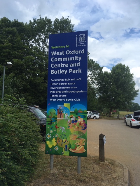
To the north there are two sets of allotments, ‘Twenty pound meadow’ and ‘Botley meadow’ – the first probably among the city’s earliest (‘Osney’ allotment) — both figure in my Allotments post. Also a relatively early recreation ground, now Botley Park, bought by the city in 1922.
Hidden away behind Botley Park is Tumbling Bay (the name is also given to a path and café within the park). A ‘tumbling bay’ is a device to improve the navigability of a river: it discharges water from the river, controlling this flow by means of weirs. There’s a ‘Tumbling Bay playground’ in the Olympic Park in East London, presumably with similar origins. The Botley Road Tumbling Bay was once one of the city’s open air bathing spaces, formally abandoned, like other such spaces, in 1990, but still clearly identifiable – inhabited, when I dropped by, by a young mother with a stroller and a cavorting child, an angler, a swan and a duck family.
This tumbling bay intercepts the course of the Bullstake stream, the artery through which some river traffic passed before the late eighteenth-century planners organised the river around an alternative route south — and made it possible for their successors to coopt this stream as a bathing place. Now, diminished as it is, it cuts off movement to the north – except that, by returning to the Botley Road, you can access a bridge via Binsey Lane. Take this and you’re en route to Medley and Binsey.
Mary Prior, in her book Fisher Row, describes the stretch of ground to which you gain access by Binsey Lane as ‘a wild, amphibious region, where a boat was an important piece of equipment’ (pp. 124-5). Modern large-scale maps suggest that it’s been to some extent tamed, at least at its southern end, by a gridwork of drainage channels, but in the north, streams run along all the hedges and when there are floods, much though not necessarily the central portion of the farmland disappears beneath the waters. Medley (or Midley) was once reckoned an island, as was Cripley (or Cropley), across what’s now officially and formally The Thames. Travellers could ford or sometimes ferry across these streams, and farmers navigated them by punt. Even around the Port Meadow section of the Thames, at the end of the eighteenth century, the towpath was still underdeveloped, and boatmen had to carry their horses back and forth across the stream to find a footing.
Yet it is now farmland. Medley Farm has a café and gives visitors a chance to pick their own fruit and veg. The farm has existed since the late eighteenth century, replacing a whimsical grand house — whimsical because the land flooded in winter — which in its day also offered entertainment to boaters.
The inn at Binsey, once a ferry inn, is an old landmark, and still a favourite port of call for walkers across Port Meadow (crossing by the bridge south of Medley), now adjoined by swish self-catering accommodation.
Two features of the route between Binsey and the rainbow bridge link to Port Meadow represent functions redistributed from downriver. The Medley sailing club became a resting place for sailing boats when they moved north from Folly Bridge to ease congestion there. Bossom’s boatyard remained until 1945 in the hands of the Fisher Row Bossom family; it was established here in 1830. Early Bossoms here lived in boats, perhaps because the land itself was too often flooded to provide an attractive base. The firm now specialises in boats called ‘river launches’. Their latest line is the Windrush line – named after the local river, one assumes, and not the famous emigration ship.
There’s more natural landscape to both south and north than is apparent from the Botley Road, but it is, of course, very much a human and not just a natural landscape.
Revised to include information from and a link to the recent Oxford Archaeology report, completed in the context of the Flood Alleviation Scheme, 2017. Also to add material on the causeway before and after turnpiking, which I collected while working on the More Commodious Entrances post.
Among uses to which land around the Thames is now put, farmland and pasture, parks and nature reserves, and sports grounds loom large. In terms of acreage, allotments come below all these, but still, they’re dotted around the floodplain. Of 35 allotments currently supported by Oxford City Council, ten are in or around the Thames floodplain. North to south, starting to the west of the Thames, that’s Upper and Lower Wolvercote, The Trap Grounds, Cripley Meadow, Osney St Thomas and Bullstake Close (locally these are known as Twenty Pound Meadow and Botley Meadow), Spragglesea Mead, Cowmead, both in New Hinksey, and Redbridge by Kennington; then, alone on the east of the river, Fairacres Road in Iffley Fields – built on land reclaimed from the river. (Note the recurrence of the ‘mead’ element in allotment names, suggestive of the lands’ former use – and actually that seems to be generally the purpose these grounds formerly served, whether or not this history has been preserved in the name).
Floodplain allotment: Osney St Thomas/’Twenty pound meadow’
Allotments are not clustered in the same way along the Cherwell, perhaps because more of its banks have been colonised by university, collegiate and other educational institutions, though Summertown and Marston Ferry allotments are both close by; Marston Ferry abuts a floodplain field.
After floods in 2007, the Oxford and District Allotments Association, dealing with the aftermath of damage, estimated that 40% of city provision was in the floodplain.
Other allotments are located along streams which feed into the Thames or Cherwell: thus, Court Place Farm in Marston is by a brook or ditch, on a narrow bank of gravel and sand; Eden Drive (by the John Radcliffe Hospital) on the Headington Hill tributary, and a handful of allotments — Town Furze, Fairview, perhaps Barracks Lane, Elder Stubbs Charity and East Ward — on different parts of the Boundary Brook. Brasenose Farm lies by some watercourse whose ultimate destination is unclear to me. Kestrel Crescent lies across the Northfield Brook. Streams and ditches not widely known may be familiar to plot-holders: South Ward allotments adjoin a stream running down from Boar’s Hill called the Barleycote stream, once used to cool beer, which was accordingly said to be served from the ‘Barleycote Arms’.
Court Place Farm allotments, with brook//ditch and plantation
This watery theme isn’t surprising. Allotments need water, so placing them by a water source is advantageous to them, as well as possibly representing a good use for land less usable for other purposes. Some of these allotments have no mains water connection, relying instead on rainwater catchment and wells. Of East Ward (on the Boundary Brook), it is said (this seems to be a story about the past): ‘There was no mains water. Some of those near the brook cut steps down to collect water from it. One enterprising fellow with a plot bordering the middle ditch rigged up a hand pump to get what water he could from it.’ Some sites congratulate themselves on having recently installed mains water; Botley Meadow, by contrast, boasts of having recently dispensed with it, now drawing water from Botley Brook (with advice from a hydrologist plotholder) — and, following. this example, the Oxford Federation has now identified ‘water harvesting’ as an action point.
Some sites have longer and shorter histories of making do. Spragglesea pumps water out of Eastwyck Ditch. Wolvercote Common ‘on the Oxford floodplain’ relies on wells, as does Marston Ferry. The Cripley Meadow allotment website, which expects members to manage on rain and well water, provides instructions in how to dig a well. ‘The water is never far below the surface at Cripley, so digging a well is not too difficult. A depth of five feet will be sufficient.’
Allotments beyond the floodplain may have access to culverted streams not visible on the map, or be watered by springs. Several allotments on the slopes around Headington report water in the neighbourhood, for better or worse. The St Clements allotments in Pullens Lane claim to be ‘lush and fertile’ because they’re just above the spring line (though they also have mains water). At Bartlemas Close, it’s reported that there are apparently streams running beneath, and that some plotholders have found wells ‘to their advantage’. At Risinghurst, water perhaps runs down from Shotover, though this is reported more as a problem than an advantage.
Water can’t always guide location. Allotments need to be placed where they serve the local population. But dependency on mains water can itself cause problems. The spring 2020 newsletter of the Iffley allotments, on the slope up towards Rose Hill, carries many injunctions about the need to economise on water.
Of course being on the floodplain or some other form of watery region can pose challenges. Of Wolvercote Common it’s said that though it floods that’s ‘rarely during the summer growing season’. Spragglesea gets flooded (though the angelica is reported to thrive on it); Cowmead has been inundated. Osney St Thomas (Twenty Pound Meadow) often has problems with flooding, and had an especially bad time in 2007. Looking through the gate of Bullstake Road/ Botley Meadow on a walk, we had the impression that some of the huts were perched on stilts.
The allotment movement had its origins in the late eighteenth century, when agricultural labourers’ real wages were falling, and poor rates were rising. There were concerns that labourers were becoming immiserated, and losing moral fibre. Philanthropists thought that if they could give labouring families access to small, low-rent plots of land, they might better provide for themselves, and find a productive use for their energies. But, the theory was, these plots should be small, so that they weren’t tempted out of the workforce altogether: the example of Ireland suggested that peasant economies weren’t conducive to national progress. Nor of course did employers want to see the supply of labour diminished.
Early allotment provision was small-scale and haphazard, depending on the good will of local landowners (or alternatively, their fear: enthusiasm for providing allotments shot up after the ‘Swing Riots’ of 1830). It’s sometimes suggested that allotments compensated for access to land lost at enclosure, but, though that’s a way the case for allotments was sometimes argued – as a reparations story – only in a minority of cases did this provide the immediate context for their creation. Around Oxford city, this may hold true in two instances of mid-nineteenth century enclosure: Botley Meadow (though what was done in the short term with land set aside in the enclosure award is obscure), and the Elder Stubbs allotments, near Brasenose Wood. In the latter case, some continuity is embodied the persistence of a body of charitable trustees, but allotments were set up on the current site only during the First World War, so again, the line of continuity is blurred. Otherwise Oxford allotments – like most across the country – were some way post-enclosure.
By one means or another, allotments did multiply, if unevenly across the nation. By the 1890s (Martin Gaskell reports) some 400,000 allotments had been created. At this point, a move was made to enable the filling of gaps, by means of a statute empowering local authorities – when demand was evinced — to draw on rate income to acquire land for this purpose, and let it out at sub-market rents. During the next twenty years, more than 100,000 new plots were established on that basis.
Outside cities, these new powers and responsibilities were assigned to county councils (which came into being in 1889). The first allotments at Marston, Headington and Littlemore were provided by the county council, at a time when all these places lay beyond Oxford city limits. Allotments at Mill Lane, Old Marston, were already in operation by the 1890s.
Through the First World War, much thinking about allotments continued to emphasise their role in rural economies. That was the context for A.W. Ashby’s Allotments and Smallholdings in Oxfordshire, based on a survey undertaken in 1913-14 but not published till 1917. Ashby looked at what small parcels of land were available where, who was cultivating them, with what ends in view and with what success. His view was that ideally, smallholdings and allotments should provide engines of growth for their proprietors, allowing them to accumulate capital and move on to better things. However, on the whole, he found that, although small holders and allotmenteers might be hard-working and in their way ambitious, they did not aim at more than self-sufficient small enterprise. Round about the city of Oxford, he reported, some allotments were, in this spirit, dedicated to market gardening, which was not so common elsewhere in the county. Thus at Headington ‘a large quantity of peas and other vegetables, with strawberries and other small fruits are grown….for sale….by people who make a business of market gardening and higgling’. Peas were similarly grown at Cowley and Littlemore. But sharp seasonal fluctuations in demand in the city, where the university closed down each summer, made life hard for small producers. By contrast, current allotment rules don’t allow commercial exploitation. The Osney and Botley allotment website cites the act: ‘Under the Allotments Act 1922, allotment plots must be used for the production of fruit or vegetables for consumption by the plot-holder and their family, and/or of flowers for use by the plot-holder and their family’.
From an early date, an alternative – originally a small stream of — discourse focussed on allotments’ potential as adjuncts to the lives of urban and industrial workers. By the later nineteenth century, urban populations were growing much more rapidly than rural ones, so their needs attracted increasing attention. There was some consonance between demands for the provision of more open spaces in towns and the call to give townsfolk access to small plots on which they could grow vegetables. Oxford City provided allotments before it opened the first city park (off the Cowley Road) – though the availability of Port Meadow, Christchurch Meadow and latterly the University Parks gave it some alibi for foot-dragging in respect of parks. The first temporary allotments were created in 1890, permanent sites quickly following. In parallel, Cowley Recreation ground opened in 1892.
Cripley Meadow – glimpses from the footpath by Fidder’s Island(with Castle Mill flats)
The first allotment sites in Oxford were to the south-east, along the floodplain, and in the east — areas where the working population was concentrated. Thus at Osney St Thomas, Botley Meadow, Cripley Meadow and East Ward (north of the Cowley Road). Outside the city (as it then was) they were to be found at Pullen’s Lane, Headington; at Old Marston and Barton Fields.
Not all allotments were (or are) on city land. Brasenose, Corpus, Magdalen and Oriel, the Warneford Hospital and the Morrell family have all at some point been allotment landlords. In 1943, it was reported that more than half of the land then in use as allotments (a much larger area than usual in the context of war) was private land.
Overall, it seems that the pattern of Oxford foundations had this shape:
The graph is rough and ready: it’s based on imperfect information; it doesn’t capture the expansion and shrinkage of sites, or in more recent decades, a pattern of subdivision, in which what had been viewed as one allotment (if perhaps spread over more than one location) split into separate entities: in recent years, the official number of allotments has grown by that process, rather than by brand-new foundations.
For all its imperfections, the graph suggests what’s evident from the more detailed record, that, as elsewhere, both world wars, by putting pressure on food supply, encouraged the extension of small-scale garden provision — in the latter case, under the slogan ‘Dig for Victory’. Phil Baker and Wendy Skinner-Smith estimate that Oxford plot numbers increased from circa 1600 in 1914 to circa 4000 in 1918. Even the University Parks were dug up, along with large areas of Cutteslowe Park. Oriel Cricket Ground and the Oxford (Southfield) Golf Course provided plots. In 1943 (against a background of significant local population growth in recent years) there were possibly as many as 8000 plots. Some of these sites were formalised as allotments after the wars. After the First World War, they were seen to have a role in supporting returned servicemen. So the Trap Ground Allotments were set up at this time, when the Oxford and District Federation of Allotment Associations (ODFAA) was also founded. Lenthall Road, Iffley/Rose Hill was formalised after the second world war.
The 1930s also saw new foundations, reflecting on the one hand the growth in Oxford’s working population (especially to the east, in association with the new car works) and on the other the economic pressures of that decade, that made household self-provisioning look attractive both to individuals and to policy makers.
Of course, housing development also put pressure on land. The interwar and postwar expansion of housing accordingly followed a complicated dance with allotment provision. Allotment land was sometimes built upon (e.g. a part of East Ward allotments became the Boundary Brook estate), but conversely new housing increased demand (so the establishment of the Fairview estate was followed by the creation of Fairview allotments). Some built-over sites were relocated. So, allotments at Weirs Lane were built over by early council housing, but allotments came and went on other sites around the Abingdon Road. Similarly, the postwar construction of the Donnington estate displaced allotments which were then recreated at the bottom of Fairacres Road (where what had been a turning space in the river was reclaimed using soil dug out in the making of Blackbird Leys); this new site in turn was scaled back when new houses were built at the bottom of the road.
Future site of Fairacres allotments, from 2nd series OS (1888-1914). (nls.maps.uk) This part of the allotments remains squelchy.
Growing affluence and new consumer lifestyles reduced allotments’ appeal in the 1960s: the point at which brand-new foundations cease. It was at this juncture that large sections of the once very extensive East Ward allotments in Cowley were surrendered for development; another part was later developed as a nature park. The Trap Grounds fell from use and became overgrown. In Cutteslowe, a disused section of allotments was taken into the park. Later this was adapted to provide a ‘semi-natural wildlife area and community woodland.’
Cutteslowe 1945, showing scale of wartime allotments. Current allotment site in red. Map from Google Earth; data from The Geoinformation group.
Both in Oxford and nationally, there were signs of change in the 1970s and 80s — associated with inflation, the early green movement, and the increasing involvement of women. In 1989, Oxford City Council joined in discussion, producing a menu of ideas about how allotments might improve their fortunes (with the implicit threat that if this didn’t happen, they would have little case against losing their land to development). Overall, the City Council has been been given credit for successfully working with the Oxford and District Federation of Allotments in this period, with the effect of maintaining allotment provision better than in many parts of the country.
Cutteslowe 2003, many plots ovorgrown; 2009, significant recovery. Map from Google Earth; data from Geoinformation Limited and Infoterra Ltd & Bluesky.
Nonetheless, as elsewhere, substantial recovery in allotments’ fortunes has been chiefly a feature of the twenty-first century. In relation to any given site, the energy of particular individuals tends (no doubt rightly) to be credited. Still, the shift has been so widespread that deeper forces must be at work.
At a national level, a 1998 Select Committe Inquiry into the future of allotments sparked the establishment of an Allotments Regeneration Initiative, launched in 2002, with support from the charitable, voluntary and local government sectors, and funding from a mix of sources (including Big Lottery money). Reflecting wider interest and effort, in 2007 the Oxford City Council committed substantial sums to a programme of improvement, chiefly fencing and plot salvaging: this provided an encouraging context for those striving to improve the fortunes of particular sites.
Nonetheless, had there not been such people on the ground ready to exploit the moment, these initiatives wouldn’t have achieved much. Change in the gender and ethnic mix of plotholders may have been a factor; concern about the environment and the slow-down in the economy. A new generation (not necessarily meaning a young generation) perhaps brought new orientations and organising skills. From around this period, there are repeated reports of successful grant-seeking to improve facilities, and of efforts to recruit and retain plot-holders, along lines that had been discussed earlier. The Council’s never-ending quest for building land must have helped to concentrate minds.
Still, given that elements of many of these grass-roots changes had been manifest earlier, the scale and character of the shift in allotments’ fortunes remains striking (if uneven across sites, because of differences in their circumstances and in the vigour of leadership from time to time).
Although demand for sites has increased locally, as nationally, yet by national standards, Oxford remains well endowed in relation to demand, with some 2700 plots. Though there are often waiting lists, turnover is said to be sufficient to allow new applicants to be absorbed before they’ve waited too long. In June 2020, the ODFAA website listed 14 out of 35 as having plots available.
Glimpses of East Ward Allotments, the Trap Grounds
The alert reader may have noted that many of my photos — indeed, all of my early hotos — have been taken through fences or at a distance. Allotments face security challenges — especially theft of tools — so aren’t usually open to non-members. Initially, I depended for information on the websites that many of them maintain. Also on a survey, which Lorna Robinson of Oxford Brookes undertook in 2008 on the basis of conversations with plot-holders on seven sites and a questionnaire to another 100, with a focus on sustainable development and community benefits. More recently — since completing the main run of the blog — I’ve been given the chance to step inside some allotments. Phil Baker and Wendy Skinner-Smith also kindly gave me a copy of the informative history of the Oxford and District Federation of Allotment Associations that they compiled for its centenary in 2019. This includes reports from most of the affiliated sites on their history and current state.
An allotment is usually about 250m squared (though they’re conventionally measured in perches, also called poles or rods — probably the last context in which that old measure survives). They come in different sizes, and may be split to accommodate new members. There’s usually a requirement to keep the allotment in good order, and to join in occasional communal work days. Allotment associations generally have constitutions. The City Council requires them to elect committees. They’re invited to send representatives to city/ODFAA liaison meetings.
Though allotment holders often have purely personal motivations for investing time and energy in allotments — health, company, saving money – Lorna Robinson found that most of those she questioned were also interested in their possible wider benefits, and allotment websites bring out that angle too: thus there’s much interest in organic gardening; supporting wildlife, and educating the young (primary schools quite often have plots).
Buccaneering spirit: the Jolly Roger flies over a Twenty Pound Meadow shed
Barracks Lane Community Garden – though marginal to my concerns inasmuch as it stands well above the floodplain, up the incline from the Cowley Road – is interesting inasmuch as, representing a variant on the allotment model, it’s been deeply shaped by themes that are shaping contemporary allotments too. Established thirteen years ago on a dilapidated Council car park, and since extended by taking in other waste ground, it’s always been too small to host many allotments, and in any case there are other allotment sites nearby (East Ward; the Links). Instead, in consultation with local people and community groups, it’s been developed as a garden for common use, with herbs and fruit trees, which people can tend or learn to tend, or consume, but where they can also meet for other purposes: to enjoy the space, colours, scents and sounds of a garden; to organise playgroups or hold yoga sessions, play in the sandpit or cook in bread, pizza or tandoori ovens.
Barracks Lane Community garden: reclaiming waste land
Herbs, huts, ovens (Jabba the Hot)
It’s a hotbed of collective and fringe forms of educational activity: a Forest School; work-sessions that bring together more and less able-bodied children; sessions supplied for young unaccompanied migrants. Once it was a magnet for small grants of various kinds, but now many of these funding streams have dried up, and the Council too has had to cut support. Had it not been for the enthusiasm of its founders and their successors, it could never have taken root; had it not been for the enthusiasm of its users, it could not have blossomed. But any such enterprise needs some income to fertilise it. In straitened times, it’s more of a challenge to sustain the common resource that in turn sustains diversity of collective life.
By and large, Oxford allotments are in good heart. In relation to those in floodplain settings more particularly, some concern has been expressed lest better management of flooding open up scope for new building — affecting, for example, the land on which New Hinksey’s Cowmead allotments now stand. The Flood Alliance has seen reason to try to allay these fears. It is, they say, an integral part of their plan that there should remain land open to flooding. That’s one among other functions that allotments can perform.
Fairacres Road allotments: view from the west, looking up Fairacres Road
Martin Gaskell’s article, referred to in the text above, is ‘Gardens for the Working Class: Victorian Practical Pleasure’, Victorian Studies 1980.
Extensively revised to incorporate information from the very informative ODFAA centenary history. Also to add information about Barracks Lane Community Garden: thanks to Kate Jury for showing me around.And to Margaret Thompson, for the tour of Fairacres Allotments.
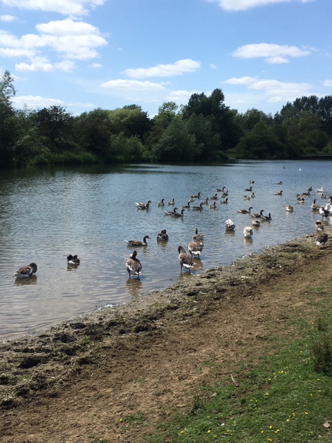
In my part of the river, geese look like the dominant water-bird species. A gaggle of them usually hang around the Riverside Centre by Donnington Bridge, attended by a submissive raft of ducks (raft, team and paddling are apparently the group words for ducks). Geese (the same or different geese?) can also be seen mixing in with the horses on the field across the river.
There are goose colonies at other points on the rivers too: on the Thames around Iffley lock, Christ Church Meadows, Oxpens Meadow and Port Meadow; on the Cherwell around Wolfson College and the Cherwell Boathouse. They’re said to spend more time on land than in the water, but aim to have access to water. Apparently they like open spaces where they have a good chance of seeing predators in time. The two together perhaps help to explain these choices.
Geese at Iffley Lock; on the Cherwell; on Port Meadow
The geese themselves are a mixed bunch. They include Greylag geese (brown bodies, white backsides, orange bills) and Canada geese (black and white heads with black ‘chinstrap’ markings). The RSPB notes that these two are often found together. It pronounces them ‘semi-tame and uninspiring’ (you need to be wilder in manner to appeal to the RSPB). Then there are white geese, descendants of domesticated geese, bred for colour. The RSPB doesn’t recognise these as wildfowl at all, though in behaviour they seem just as wild or tame — ‘semi-tame’– as the rest. They all interbreed and there are many hybrids.
White and other geese
Mixed geese
Wolvercote commoners were once allowed to keep poultry and geese on Port Meadow. We’re told in the Towpath Walk in Oxfordthat geese from Wolvercote and The Trout at Godstow used to be led to the river each morning by goose boys and goose girls. I guess these were bred from Greylags. Canada geese (as the name suggests) are by and large an introduced species. James II brought them in to liven up royal parks. Other big landowners also thought them decorative. Hunters encouraged them as game birds.
Geese numbers have exploded as they’ve adapted to urban environments. The RSPB suggests that there are 40,000 breeding pairs of Greylag geese in Britain, plus another 40,000 younger birds and 80,000 from Iceland who come for the winter, a total of almost 230,000. In the case of Canada geese, we have an estimate of growth: it’s suggested there were 2200 to 4000 birds in 1953, increasing tenfold by the end of the twentieth century; the RSPB thinks that now some 62,000 breeding pairs are permanent residents. Together with young birds and others who migrate south from Scandinavia in winter, that makes for a winter population of perhaps 190,000. So almost half a million wintering geese. The white geese, not being reckoned as birds for this purpose, don’t seem to be numbered.
All these geese are said to be creatures of habit, hanging around the same places. Migrants similarly tend to return to the same places, though hanging loose on local settled gaggles.
Of Canada geese, it’s said that they form unstable pairs from a year or so old, but don’t settle down with a mate until their fourth year, then remaining broadly faithful for life, though other dalliances have been recorded. They nest March to May, and incubate eggs for a month. After that they go through a period of moult, when they can’t fly.
They eat mainly grass, up to 3lbs per bird per day, though will eat insects if grass is scarce. They’re happy to scrounge bread from people, and will apparently raid rubbish bins, though I haven’t seem them do that. They live around 10-12 years, though have been known to survive two or even three times as long.
In July, I noticed a lot of splashing going on among goose groups on the river. Looked like some sort of courtship/family/territorial stuff. According to one source: ‘The flapping of wings, as if attempting to take off from the water, is a universal goose sign of “back off, bud.” Conversely, the wing flapping is also a sign of greeting’. Whether the geese knew which was which was hard to say, because all participants stayed pretty much in place.
.Studies seem mostly to focus on one or another variety of goose, yet much of the behaviour described seems comparable. Flocks are said to be characterised by complex social relationships. Pairs cooperate within groups, and protect their young in ‘agonistic encounters’, which encourages enduring bonding. But younger birds may also hang around together, and form subgroups. To what extent the groups we see mixed-age, and to what extent teenage gangs?
There seems to me something almost military about geese. In the case of Canada geese, the neat ‘chinstrap’ headgear reinforces the impression. But I’m also responding to the apparently purposeful way in which little groups of them will patrol bits of river. Groups on the water look like loose squadrons, massing for operations. Which however never materialise.
Ducks mostly seem happy to blend in with goose crowds. They don’t make much impression on the casual observer, in terms of having distinctive behaviour patterns of their own. Like geese it’s said (though I don’t see geese doing this so much) duck couples tend to isolate in the rearing season. One of the pair may guard the brood while the other goes off foraging. The babies are nicely camouflaged for shallow rivers.
Swans are another matter. Swans seem generally much more couple-y than geese, but also more widely distributed along the rivers. One gets the impression that each pair likes to have its own territory.
A report, in the Friends of the Trapgrounds website, on the behaviour of two pairs of breeding swans that I saw on the Castle Mill Stream Walk re-inforces that impression. We had seen a swan on its nest, with a patrolling mate, and another pair with cygnets, along a short stretch of the canal.
It was subsequently reported that the second male had died, apparently protecting his family from some predator, such as a fox. There was concern that the first male might now harass the second family. Apparently he already had form at picking fights. Or perhaps he would take his family north to the trap grounds? Or the widow swan might take hers elsewhere — perhaps Worcester lake?
I have twice come across swan couples with their brood in obscure corners: Kennington Lakes, the abandoned bathing place at Tumbling Bay.
As a friend has observed, birds must have quite different mental maps of towns from ours, treasuring some of the parts we know least.
There are also some gulls on the Thames, though not in great numbers. They skim and dart over the water, snatching small insects. On a chilly, windy day, this can be quite exhilarating to see.
I’ve seen swallows at the same game at the Wolvercote end of Port Meadow – in this still photo, they’re invisible, but in the video version, you can see them darting around.
I’ve also seen herons on the ait at Fiddler’s Island (noted in the Castle Mill Walk post), and on the Thames between Binsey and Godstow: carnivores, intent on the hunt.
My neighbour, a kayaker, says she sees kingfishers on the water, flashing low down under the branches.
Revised because, having written this, I continued to look at goose flocks and decided I had underestimated their diversity: differences of colouring were not gender differences but species differences. I’ve now checked that out, and revised the text accordingly.
An ‘Oxford City Water Walk’, outlined in an online guide, this makes for a pleasant, interesting and varied walk. We began it at Gasworks railway bridge (now a footbridge), where the Castle Mill stream enters the Thames, followed the mill stream towards Port Meadow, and then looped back to the start. Without having intended this, but as a result of detouring to avoid narrowboats where people were isolating, we did the top loop of the walk in the reverse direction to that set out in the guide. And rather than embarking on a new westwards loop at the end of the walk, we retraced our steps — because that final loop was the most familiar to us. So this was a (partly accidental) variant on the prescribed walk.
Mill stream and walk route on 1878 OS map (nls.maps.uk)
Castle Mill Stream is thought to have been a medieval construction, like Osney mill stream which lies just to the west (there was once some conflict over water between the religious houses which ran the two mills). On older maps of the city, it’s the Cherwell and the Castle Mill Stream which hold the city in their embrace — the Osney Mill Stream (our Thames) lies too far beyond the settled area to figure. Castle and Osney Mill Streams shared the name ‘The Isis’.
Now Castle Mill Stream exits inconspicuously into the Thames between St Ebbes’ redeveloped housing and Oxpens Meadow. We tracked it back, crossing Oxpens Road and along the side of the new Westgate shopping centre, heading towards the castle.
Meeting on Gasworks Railway Bridge. The Stream up from Oxpens.
The stream forms the boundary between two old city parishes; the compact St Ebbe’s to the east and the sprawling St Thomas’ to the west. St Thomas parish once extended all the way to Botley to the west and Medley to the north. Old St Thomas’ High St, at the city side of the parish, runs across the stream. This High Street is strangely orphaned in that it’s no longer the focus for a community, and its church and neighbouring charity school, which once stood at its end, have been severed from it by the Oxpens road (at this point named Hollybush Road). Surviving older buildings along the street suggest that this was a working community but with prosperous members. The red brick house was built in the 1790s for a brewer from a family of bargemasters; he also built a set of almshouses alongside.
St Thomas High St, and at corner with Fisher Row.
As the almshouse provision suggests, there were plenty of poor working people living here too, in houses which have largely disappeared, though some model working-class housing survives in Osney Lane, parallel to the High Street.
Model housing in The Hamel
Before it reaches St Thomas’ High St, the stream splits into two. The two together form the water system of the mill, leaving between them a little artificial island, Wareham (weir-ham) bank. The back stream disappears among the backs of houses; the walking route follows the main stream to the site of the old Castle Mill, which continued in operation until the twentieth century.
Back stream; by Castle Mill weir
Thence it heads NNW, tracking the route of Fisher Row, once home to fishermen and later boatmen and workers on the wharves, whose family lives and occupational histories have been carefully reconstructed by Mary Prior.
Grass on site of old Middle Fisher Row; weir between streams; old malthouse
Hythe Bridge Street marks the hythe, or landing place, where goods brought down from upriver were unloaded. Initially this was river traffic – grain, stone – but after the canal reached Oxford, the canal basin and wharves were located immediately adjacent, in what’s now a car park, and on the site of Nuffield College.
Above this street, the river and the canal run for a while in parallel. Here we veered off eastwards into the district of Rewley. Once there was more railway track here, alongside the ruins of Rewley abbey. Now it supports a good deal of new housing.
What’s left of Rewley Abbey (with new housing behind). From Castle Mill Stream path
Ducking under the low bridge by which the railway crosses the Sheepwash Channel (alongside the battered remains of the older railway swing bridge), we emerged by the Thames.
Looking back along the Sheepwash Channel; the Thames above the Botley Road
At this point we left the city environment behind as we headed north along the ait, a narrow sandbar, a beautifully shady place on a sunny day, dotted with wild roses, with the fields that occupy the western part of the floodplain across the river to our left, and Cripley meadows allotments to our right.
On the ait
We almost missed a heron, poised on a tree branch, looking for prey, which then flew off, disgruntled by our presence, I think.
In the first picture, the heron is hard to spot. But it’s there
At the bottom of Port Meadow, by the moorings, we reached the point on the Thames where the Mill Stream first branches off, and turned to follow it south, past paddling children, ducks and ducklings.
Where the Mill Stream branches off
Upstream from where the bridge now stands, where there’s now a cross-Thames bridge, a weir once obstructed traffic, until 1937. It seems there was never a pound lock here — a modern lock with two gates — only a flash lock: a gate in the weir that could be raised to allow boats to ride through: a challenge to river traffic, though punters could see it as sport. The weir contributed– it was suggested, when it was finally removed — to keeping the river above shallow and sometimes impassable. The practice seems to have been to circumnavigate it by cutting through the Duke’s Cut, above Wolvercote, to join the Oxford canal, head towards Oxford, then, if necessary, rejoin the river via the Sheepwash channel. Still, this would only have wored for smaller craft.
If they made it thus far, boats heading southwards down the Thames, towards where we stood, had to choose at this point whether to head down the Mill Stream, to the wharves around Fisher Row, or to proceed the way we had come, towards Bullstake Stream, or later Osney Mill Stream (the modern Thames), and either way towards the wharves around Folly Bridge, or indeed on down river. In the early days of the post-medieval trade revival, boats more often made the first choice; later, more often the second.
New life
The path south, back along the mill stream, runs along the canal, which at this point parallels the Stream, passing along the back of what I remember as Lucy’s Ironworks, now relocated in Thame and Dubai, and replaced by apartments, and then along the back of Jericho, once an area of wharves for coal and other goods which came down the canal – wharves which endured beyond the closure of the canal basin, closing only in 1992, and now — after long delay — also the subject of redevelopment. Until the nineteenth century, this was also meadowland. Jericho was constructed (among other things to house workers for Oxford University Press) on what were once known as Great and Little Bear Meadows.
Jericho moorings
And so back to Hythe Bridge St, thence (in our version of the walk) to retrace our steps to Oxpens Meadow and the Gasworks Bridge.
The walk starts on former meadow land, runs through an old commercial and industrial-riverine suburb, and then (had we done it in the suggested order), a later, canal-side industrial district, then loops through common land and back down a section of the Thames with a strikingly rural feel about it, before reentering the town. This edge of the town became urban between the sixteenth and the nineteenth century, but it remained physically close to rural and pastoral spaces.
Of course the pastoral and urban once came together close to the route of the walk, near our starting point, at ‘Oxpens’ itself: the name links to a cattle market which operated between 1932 and 1979 on what’s now part of the FE college. Before that – for a preceding century — cattle were sold from pens at Gloucester Green, now the bus station (though it’s of interest that the very detailed 1876 OS map of Oxford shows cattle pens by the Osney Lane railway footbridge, so the ox pens seem to antedate the market).
In effect, the network of streams at this edge of the floodplain define islands within islands. A large island is defined by the whole of the Mill Stream’s loop to the east of the Thames. That island is in turn divided by the Sheepwash channel into two smaller islands, north and south. There is an early reference to the northern part as the ‘isle of Cropley’ (as in the modern Cripley allotments), presumably because the slightly raised land stood out above flood waters. The southern part has sometimes been termed Osney island: it includes the ground where Osney Abbey and Osney mill once stood (across the river from the latticework of streets that forms New Osney, what we tend to think of primarily as Osney now). Then within Osney island, Wareham bank forms one more, tiny island of its own.
Here is another large subject, with a technical dimension too: of interest to historians, urban planners, engineers, public health specialists, sociologists, economists… So this is no more than an attempt to identify some elements of the topic for those who (like me) come new to it. I’m especially concerned with the visible marks that water management has made and continue to make on the landscape. But it will probably help to put a few frameworks for understanding in place first.
Why, what and who
People trying to manage water have had a variety of aims in mind. These include improving navigability and more generally the hospitability of watercourses to traffic; harnessing water as a power source; maintaining or improving the capacity of water to support fish or other life; facilitating the consumption of water – for, for example, drinking, washing or bathing, or supporting agricultural or industrial processes; making sure that unwanted water gets drained away; and that it carries other forms of waste with it. One of the challenges was and is that one aim may conflict with another: so, measures designed to improve navigability may adversely affect the usability of water as a power source. These functions have historically not mattered equally or in the same ways to country and town. The potential for conflict over use has encouraged the development of collaborative governance arrangements, cutting across the rural/urban divide.
Human efforts to manage water have created complex waterscapes. The tendency over time has been for forms of watercourses to proliferate, different systems being created to serve distinct purposes. To start with, there’s a natural flow (or accumulation) of water. Humans intervene to channel this water, or to divert it through ditches or culverts. They locate, and facilitate the exploitation of new water sources, like springs or underground flows that can be tapped by wells; they store water in reservoirs, and devise artificial systems – conduits, pipes – for its distribution; finally, relatively late in time, they identify health reasons for distinguishing between drains carrying off different forms of waste – notably distinguishing simple water drainage from the drainage of human waste.
Who manages these diverse water systems so as to meet these diverse purposes? A 2008 document that set out the ways in which flooding in and around Oxford should be dealt with in future mads it plain how many different bodies and agencies were involved at that point, including the County Council, the City Council, the Vale of the White Horse District Council, the Environment Agency, Thames Water Utilities Ltd and Network Rail. The Environment Agency’s ‘River Basin Management plans‘ are presented as attempts to coordinate the concerns and activities of diverse ‘organisations, stakeholders and communities’.
Logo on lock house, Osney; Thames Water bill ‘for the supply of water and wastewater services’
Some of these bodies are of relatively recent creation (the Environment Agency was formed in 1996, and subsumed the National Rivers Authority, which not that long before had taken over responsibilities from the Thames Water Authority). Others have precursors whose history stretches far back, notably the City and County Council stand in a fairly direct line of descent from bodies which have existed for centuries. Some functions now performed by private companies were once performed by local authorities – but local authority action in turn was in some instances preceded by the efforts of private companies, esp in the field of water supply. Historically, there were official bodies involved in water management with special jurisdictions of their own, cutting across other boundaries; these included commissioners of sewers, the Thames Commissioners, and the canal trust. As we go further back, there were fewer overarching bodies and more particular ones – such as manors and religious foundations, who had to sort out their differences among themselves by negotiation or in courts of law (if not by direct action)
I’ll discuss some of the manifestations and legacies of water management systems under three broad headings: navigation; water-supply, and drainage. These won’t cover the whole terrain, but should make it possible to survey a large part of it.
Navigation
There was apparently once some trade on the Cherwell. Charles I hoped to circumvent Roundhead blockages by making the Cherwell more usable for traffic. But that didn’t come to much.
The Thames has the more important history as a commercial river. But it too ‘in its pre-modern, unimproved state was characterised by an irregular geography of multiple streams, pools and shallows, and a regime of intermittent floods and droughts’ (Stuart Oliver, 2013).
In the late Saxon period the construction of mill dams and flash locks made the Thames navigable as far as Oxford. But in the middle ages boats became larger, and the focus was on bringing grain into London: the combined effect was to focus activity on the stretch between Henley and London. That trade too dwindled. When it revived in the sixteenth century, in the Oxford region initially the focus was on bringing goods down river from the west, to wharfs around Fisher Row. According to Mary Prior (Fisher Row) some pioneering ‘boatmen’ were recruited from among fishermen there, others from those who lived in the watery area north of the Botley causeway, where, as she puts it ‘a boat was probably more use than a cart’.
From Oxford downriver, the Thames was harder to navigate, not least because obstructed by multiple mills and weirs, exploiting the slightly faster flowing water on the steeper gradient. So when trade revived on the lower Thames from the sixteenth century, now with a new emphasis on carrying (Newcastle) coal up-river, goods initially reached Oxford by secondary trade, presumably meaning switching to smaller boats, or on to waggons.
There were reasons for the city fathers to try to improve communications, so in 1606 they backed the establishment of the first of a series of umbrella commissions, including members from the city and university, alongside representatives the four counties bordering the Upper Thames, along the lines of a commission of sewers. These commissioners proceeded to establish pound locks at Iffley and Sandford.
Iffley pound lock, weir and house that replaced mill house
The initial point of locks was above all to reconcile millers’ need to part-dam the river with travellers’ wish to move through it. Flash locks were movable sluices, which allowed part of the apparatus of the weir to be raised so boats going down stream could ‘flash’ through on the released water, while boats travelling upstream could be winched up. (There were sometimes winches on site, but some boats carried their own winches). Pound locks – essentially locks as we know them – were more demanding to construct, but safer for boaters, and didn’t waste so much water. (After a flash lock had operated, boats might have to wait for days for enough water to accumulate to carry them through).
Locks and weirs today often mark the site of former mills. In the case of Oxford mills this applies at Godstow; there was once a weir at Folly Bridge, and there remain locks at Osney, Iffley and Sandford on the Thames. There remain weirs by what was once Castle Mill, and in Weirs Mill Stream.
Weirs on Castle Mill streamSluice controls: Castle Mill Stream, Cherwell
Trade to London was carried in larger boats, called barges, which used wharves around Folly Bridge. Mary Prior tells us that these were a different set of men from the Fisher Row boatmen, though some lived around Fisher Row: some moved to Oxford from Abingdon; they were few in number, they had more capital, and sometimes they lived in large houses on St Aldate’s.
The initial Oxford river commission wasn’t superseded, but it was later joined by a succession of commissions with a larger jurisdiction, who took a general view of what was needed to improve navigation on the Thames – the subject of continuing complaints. In the eighteenth century, it was said to take an unnecessarily long eight days for barges to travel from Oxford to London, longer if the river flooded (as it was prone to do in winter) or dried up (as it was prone to do in summer). At this time, it became normal for barges to be drawn by horses instead of men, and towpaths had to be upgraded to accommodate them.
A new set of challenges arrived with the advent of canals. From the 1770s, planning began for a canal to link the Severn to the Thames – and thus the West of England and Bristol to the south Midlands and London – as well as for a canal from the Midlands to Oxford, the ‘Oxford Canal’. Though neither was completed till the late 80s, thinking about what to do about remaining challenges on the Thames was quickly prompted, and continued through the 1790s. Some backers of the Severn and Thames Canal wanted to by-pass Port Meadow and the complex and difficult area around Folly Bridge: ‘one of the most intricate and difficult Points of Navigation to adjust on the whole River. The Division of the Water into so many Streams; the Embarrassments of divided Property, Bridges, Wharfs, Mills, and other Buildings, near so large a City, presents a Choice of sufficient Difficulties, in Addition to the Want of a proper Depth of Water’. They proposed a further canal to run along the hills by Cumnor, presumably along or adjacent to the Seacourt Stream. Such a canal would have by-passed Oxford entirely.
The Thames at Port Meadow, with heron
This was not to the taste of the city fathers, who set to work trying to improve conditions around Port Meadow and Folly Bridge. In general, this involved building more pound locks – including one at Osney, facilitating travel past the mill; also deepening the channel and improving the towpath. The Oxford gaoler, Daniel Harris, offered to superintend the works, employing convicts for that purpose. The loss of America, to which prisoners had previously been transported, had resulted in more serious offenders being sent to gaols, including the Oxford Castle Gaol: Harris thought he could kill two birds with one stone by occupying these prisoners in creating new local infrastructure around the river and canal.
Among other things, the prisoners first brought into being the canal basin and attendant wharfs, where the Nuffield car park and Nuffield itself now stand — at the eastern end, occupying part of the old Castle ditch. (There’s an impressive painting of a looming early warehouse, 1792. And Oxford University Images includes a photograph of the coal wharf in the 1930s, looking from alongside New Road towards the castle, and another from the other side, from Worcester Street, looking towards St Peter’s).
Former entrance pillar for canal wharves
Prisoners also worked on river improvements, though not they alone. Work improving navigation further down the river, around Folly Bridge, stretched over several decades, and ultimately involved the creation of a new navigation channel, the building of a pound lock and the reshaping of Folly Bridge island. (There are good illustrated accounts on both the South Oxford Community Centre and the Thames Smooth Waters websites).
The effect of the work on the river was that the Oxford stretch of the Thames was saved for navigation (though presumably there would anyway have been some flow of waterborne trade from the river to the town itself, by whatever route).
John Bowles’ 1790s map of the Thames ‘with a table of all the locks, wears, and bridges thereupon; shewing the tolls payable at each and their distance by water from one another’ offered an overview of the improved river.
Certainly all problems were not immediately overcome. Some of the same complaints continued to be made through the nineteenth century. From the 1840s, the advent of the railways decreased interest in river trade. Still, in the short term, the effect was to spur interest in further improvements to help river traffic compete. In 1866, new ‘Thames Conservators’ were given powers to buy out mill and fishing rights, so that they could deal more decisively with those obstructions. And dredging was undertaken to make it possible for steamers to go up and down all the way to Oxford, and not just lower down the river.
All this effort has left a legacy in the ‘improved’ form of the river, which we may take for granted but which was not the work of nature alone.
Another legacy lies in the pound locks – at Godstow, Osney, Iffley and Sandford (there’s no longer one at Folly Bridge).
Osney pound lock
What there are around Folly Bridge are mementos of the old wharfs. The Head of the River pub was once the Folly Bridge Wharf, a timber wharf. The Thames Smooth Waters website has a great photo of a lifeboat being launched from there. (Another photo shows the lock, on the southern side of Folly island, between the old toll house — now Salters’ office — and the Hertford College Graduate Centre, also a former wharf). The building was later sold to Salter’s as a boatyard, and later still became, as it is now, a pub.
Once Folly Bridge Wharf, then Parker’s Wharf, then Salters’ Boatyard now a pub – with a crane
Former wharf sites: St Ebbe’s, Grandpont
Other wharves are commemorated in names. Thus, the Baltic Wharf housing development in Grandpont (once the site to which Baltic timber was brought from London for local house-building). Then, across the river in St Ebbe’s Friars’ Wharf (the Friars being Franciscans, long gone when the wharf was built), and the Wharf House, once perhaps an office for the wharf, then a tavern, now housing in the island between the two busy roads that head from the station area towards St Aldate’s.
Water supply
Rivers were not the preferred source of drinking water, or water for other household uses. For centuries, Oxford residents chiefly relied on wells, which tapped underground water sources. Why wells were (in many cases) healthier was not clearly understood, but there was an ordinary aesthetics of good water. Inasmuch as different wells drew on different water sources, water varied by well. In his late seventeenth-century Natural History of Oxfordshire, Robert Plot commented on some of the distinctive features of particular wells’ waters.
From the early middle ages onwards, some institutions arranged to bring water from distant sources through aqueducts and pipes: religious communities, hospitals and colleges all did this. In the early seventeenth century, a ‘Carfax conduit’, fed from the hills of North Hinksey, served as a central distribution point for a series of institutions.
When, in 1787, Oxford Paving Commissioners decided to remove the conduit as an obstruction, Lord Harcourt bought it and took it to Nuneham Courtenay, as a piece of decorative stonework. There it apparently still stands. A new waterhouse by Carfax replaced it, but its yield petered away.
North Hinksey, early seventeenth-century Conduit House: spring end piping water for Carfax Conduit
This was not how ordinary householders obtained their water, or not in the main. Those who tapped the pipe without permission were threatened with prosecution, which suggest that some did that.
Experiments in piping water to individual households, on a commercial basis, began in Oxford at the very end of the seventeenth century, when the city leased to an entrepreneur the right to establish pumps and a cistern by Folly Bridge, to supply water to various parts of the city for use in fighting fires, and also to sell to private households. But too few signed up to make the venture pay. In 1808 the corporation accepted that it would need to run the works itself, and modifications to the system continued to be made until the later nineteenth century. ‘The water remained unfiltered, however, and there were five sewage outfalls and a gasworks upstream; in 1851 most inhabitants of Oxford still preferred to rely on wells, and only 340 of the 4,585 houses in the city took the city water supply.’
By this point wells were being joined as consumer water sources by pumps and drinking fountains. A Victorian Cast Iron Pump still stands beside the south door of the University Church on the High.
Fountains were sometimes also placed by churches, or provided by way of philanthropy. A fountain stands beside the door to the Carfax Tower, once part of St. Martin’s parish church. An 1885 water fountain, a gift from the mayor to the City, survives at the corner of Southmoor Rd and Walton Well Road.
Not only humans but horses needed water. I remember horse troughs as a common feature of suburban high streets from my own childhood in the 1950s. Oxford’s most notable fountain is the Victoria Water Fountain at the Plain (1899) commemorating Queen Victoria’s Diamond Jubilee (and replacing the toll house that once stood here). It incorporates horse troughs.
The pipes that piped water to institutions, homes and drinking fountains were commonly made of lead, so potential sources of lead poisoning. When OPT restored the Victoria Water Fountain in 2009 they couldn’t restore the drinking water through the old lead pipes. It’s striking that lead was still in use at that date, given that doubts about its use in water piping had been raised much earlier in the century
Contagious forms of disease did more to prompt innovation. Human beings had long since developed ways of responding to plague. Through the eighteenth and nineteenth centuries confidence grew that means could similarly be found to reduce mortality from ‘fever’ (typhus) and the newer disease of cholera. Two Oxford doctors, Ormerod and Acland, in 1848 and 1856, attempted to map the incidence of fever and cholera (in Ormerod’s case) and cholera (in Acland’s).
Ormerod, in traditional terms, linked badly affected areas with ‘filth’ and ‘stench’: unclean houses and drains, but also smelly bones. Acland (perhaps influenced by recent work by the physician John Snow in London — or more general discussion to which Snow contributed) zeroed in more specifically on ‘water supply and drainage’ (though he also considered the effects of elevation, climate and moral factors). He saw drainage as the key problem: too much sewage was flowing through open channels and being discharged into the rivers. But this was especially a problem for places which drew drinking water from rivers. He noted that during the 1832 cholera epidemic, inhabitants of St Clements, who drew ‘filthy water from a sewer-receiving stream’ were badly affected, whereas by 1849, when instead their water came from ‘the springs of Headington’, they largely escaped. Similarly, when, on his advice, in 1854, during another epidemic, the Governor of the County Gaol directed that the gaol kitchens should no longer draw water for soup from the contaminated mill stream, cholera ceased to trouble the gaol. Because the waterworks on Folly Bridge drew its water from the river, it too was, he argued, a source of disease.
(A local charitable activist, Felicity Skene, who tried to help victims of the 1854 epidemic, trained nurses some of whom went on the work with Florence Nightingale, and herself proceeded to work with the homeless and sex workers, has been honoured with a blue plaque).
Waterworks building, Lake Street, New Hinksey
For the city, it was fortunate that an alternative water source lay newly to hand, in the form of the lake created by excavations to embank the railway line at New Hinksey, and there a new waterworks was shortly established. Still, it remained unclear that the lake water was adequately treated before being piped out. In 1880, the photographer Henry Taunt challenged the mayor to prove that the water was safe. ‘Taunt claimed that in less than three hours of running the city water from his household tap through muslin, he had caught no fewer than 37 freshwater shrimps. These he later displayed at the Town Hall under a microscope.’ Subsequently, the company added filter beds to the site.
The trend over time has been towards bringing in water from more distant sites – developing a practice first pioneered by institutions centuries before. The tapping of the ‘springs of Headington’ to supply St Clements immediately following the cholera epidemic of 1832 has already been mentioned. According to G.W. Cox’s 1868 Recollections of Oxford, this became the source of ‘each of the public pumps in the streets of St Clements’. In the 1870s, the city constructed a reservoir at Headington (followed by another in the 1930s). By the later nineteenth century, piped-in water was becoming standard in new houses. The creation of the new reservoirs helped to make possible the expansion of the built-up area on to higher ground. Headington was largely a ‘born-piped’ suburb.
The New Hinksey waterworks was closed when the decision was made to bring in water instead from Swinford, to the north-east; reservoirs at Boar’s Hill date from the same period. Farmoor’s ‘raw water storage’ Reservoir was developed in 1974. It’s said ‘like most Thames reservoirs’ to have been formed, not by damming up a valley (which the terrain doesn’t encourage) but by making a lake. By 1967, the local water authority covered the whole of Oxfordshire and north Berkshire. The district is now a division of the Thames Water Company.
Watercourses develop to carry away water. In the countryside, they play an important role in draining surplus water from fields. Drainage and irrigation can go hand in hand. The latticework of ditches on the fields north of the Botley Road must be a human construction.
Lye Valley and Boundary Brook ditches. Woven branches support the sides of the first
Given their drainage function, it’s hard just to abolish a stream or even a streamlet: you need to find somewhere else for the water to go. Taming the fissiparous waters of the Thames has involved many centuries of human labour and ingenuity, involving both land reclamation and canalisation of watercourses. Archaeologists have found evidence upstream of Roman efforts along these lines. An excavation at Grandpont uncovered (undatable but probably more recent) evidence of former attempts to tame the Hogacre stream, involving stakes and wattlework – long before this section of it was culverted, in the late nineteenth century.
When streams get in the way of roads, or urban development, culverting offers one solution. Some of the brooks which run into Oxford from its eastern hills are now at least partly culverted: thus the Bayswater Brook and the Boundary Brook.IThe Oxford Guidance Booklet on flooding identifies and distinguishes different kinds of culvert and drain). At Milham Ford, off the Marston Road, a small nature park has been created by dint of unculverting and then ‘meandering’ a small stream.
Disculverted stream, Milham Ford Nature Park
‘Kennels’ in the middle of streets once carried water off city roads (a few such survive, eg in Brasenose Lane). Then networks open ditches which carried away water and waste. This waste discharged into the Thames and the Cherwell. Cleaning up these sewers – the word once just meant a drainage channel — was initially understood to be a matter of improving their flow, or perhaps closing them to the air, so that they didn’t emit such noxious smells.
Following cholera epidemics in 1832 and 49, and in the context of a larger public health movement, the city of Oxford set up a sanitary commission to suggest steps to take to mitigate or avert such epidemics in future. This recommended ‘the construction of a covered main sewer to a new treatment works south of Oxford, the installation of main drainage to houses, and the replacement of cesspools and privies by proper water closets.’
The city did at that point make an effort to reduce harm from the old extra-mural Trill Mill stream by the construction of a shielding wall. This stream was later partially covered – as recorded by Henry Taunt in a photograph of 1920 , and finally fully culverted – though it’s memorialised in Christchurch Meadows’ Trill Mill Walk, and now also in the Westgate Centre’s Trill Mill Lane. In its hidden form, it has attracted local explorers (including as documented in this one-hour video walk-through).
Overall, though, little was done to act on the drainage recommendations, so cholera returned to the city in 1854.
St Ebbe’s and St Clements marked out as vulnerable districts on Acland’s map
Acland’s Memoir on the choleraincluded a striking map (available in a great zoomable version), in which dark triangles marked the point at which sewage and other waste entered the Thames and Cherwell. Acland showed that it was the riverside districts to the south of the city, also among its poorest districts, that were hardest hit by the cholera. He later served on the royal sanitary commission, and campaigned relentlessly for the improvement of the water supply and sanitation in the city and its region.
As Malcolm Graham documents in detail, improvements to drainage followed especially from the establishment of an Oxford Local Board (under the Local Government Act of 1858) in 1865, with power to set standards (including drainage standards) for new housing, and from the efforts of the University Delegacy of Lodging Houses, established 1868, but spurred into more vigorous activity by a typhoid epidemic of the 1870s. The Delegacy required that existing houses meet its sanitary standards before it would licence them as fit to lodge students.
The efforts of these bodies both contributed to and benefited from the construction of a separate sewage system in the 1870s (perhaps there’s some causal connection with the profliferation of council river bathing places after that date?).
Memorial plaque by recent housing development on the Botley Road
Even so, options were limited beyond the reach of the main drainage network, which initially did not always keep pace with new housing developments. Joseph Prestwich, professor of geology, is celebrated locally for having endorsed the importance of improving drainage in connection with new housing developments along the Botley Road.
Thames Water now also runs the sewage system, and has inherited the nineteenth-century treatment plant at Kennington.
Kennington sewage plant: between by-pass, river and railway.Danger: deep water, dangerous machinery
SOURCES
I ended up reading a foolish amount about navigation challenges, partly because the story was hard to disentangle, partly because a lot proved to be available on line.
Bodleian and probably some other institutional library users can access Jeremy Sims, Minutes of the Thames Navigation Commissioners 1771-90 (2008) and the 1793 House of Common Report on the Thames Navigation.
Also Stuart Oliver ‘Liquid materialities in the landscape of the Thames: mills and weirs from the eighth century to the nineteenth century’, in Area (2013), whom I quote.
Thanks to Chikashi Sakashita, who gave me an outline of what the current Emperor of Japan (who researched the topic as a student at Oxford) wrote about trade on the Thames in the eighteenth century.He has a book in English too (Naruhito, emperor of Japan, The Thames as Highway: a Study of Navigation and Traffic on the Upper Thames in the Eighteenth Century (1989), but I couldn’t access that under pandemic conditions.
Since writing this post, I’ve discovered an excellent history of uses of the Thames since the year 1000, produced under the auspices of Oxford Archaeology, but in broad terms it tells the story I’ve told here, and I haven’t as yet used any of the more detailed information it supplies.
The 250th anniversary of the Thames Commission (1771-2012) has been marked by a special online exhibition.
Also for more detail on disease maps of Oxford, see the article by Laura Bouchard Killingworth in Portolan, the journal of the Washington Map Society.
While it’s possible to walk the whole length of the Thames through Oxford on the towpath, the same is not true of the Cherwell. Access to its lower reaches is interrupted by university and college claims.
The Cherwell between the Victoria Arms and o the Thames (1955-61 OS map, nls.maps.uk)
Christchurch Meadows walk does give public access to its lower reaches all day all year. Then the University Botanic Garden interrupts (though can in normal times be accessed separately).
Christchurch Meadow Walk
On the other side of the river here is the island of Milham, part of the grounds of Magdalen College School – the school’s stream-riven grounds necessitating its ‘iconic’ white bridges. And on the far bank lies St Hilda’s (which produced the first women’s eight, and lets out punts to students — but has had problem with flooding: the costs and benefits of its location).
Two sides of the island of Milham, from Magdalen bridge
From that point, normally, Magdalen’s water walks can be accessed through Magdalen, but this is another case of in-and-out. The other bank can be walked (though the river is masked by a fringe of trees) through Angel and Greyhound Meadow (Magdalen property but managed by the City; southern access through the car park on St Clements). But at the end of that, Magdalen Fellows Garden, normally closed to visitors, supervenes.
Angel and Greyhound Meadow as it abuts Magdalen bridge; bridge as boat store
The path has to be picked up again by King’s Mill house. This is ‘Mesopotamia’ walk: proceeding along two aits, sedimentary deposits in the river, such that the river flows on either side (between two rivers is what the Greek name means). The University acquired this land in 1865, at the time when it was developing the Parks (on land recently acquired from Merton).
Mespotamia: rivers on both sides
The walk ends at the old bathing spot, Parson’s Pleasure, and from there there’s access to the University Parks.
Parson’s Pleasure and Parks
Lady Margaret Hall cuts off that route to the north, but before that there’s a bridge – the ‘Rainbow bridge’ – across the river.
Rainbow bridge, from Marston Meadows
And on the other, east bank, a footpath can be followed along the edge of meadows and fields, across the Marston Ferry Road, to the Victoria Arms, the old Marston ferry pub.
Path to the Victoria Arms
Of Oxford’s two rivers, the Thames is more of a city river: only Worcester college spreads itself along one of its strands, the Castle Mill Stream. By contrast, the Cherwell has been more thoroughly colonised by the university and colleges. The split is more even, it’s true, in terms of sports grounds. Univ, Queens’, Brasenose, Worcester, Pembroke (and formerly Corpus) – that is, five once six — have sports grounds along the Thames and its braids; Christchurch, Merton, Magdalen, Trinity, Hertford, Exeter and Wadham, and the University’s Marston Road Sports Ground – that is, eight – lie in the Cherwell valley, though more widely distributed around the river. The effect overall though is that when you have access to the Cherwell, it’s very often because university or colleges have chosen to extend it, on their own terms (which meant a bit less than usual, during the pandemic). It’s partly because the walk is broken up in this way that I covered it in bits, over a couple of months.
Diverse controllers
Furthermore in terms of what the walker sees, though the banks of the Cherwell are mostly open ground, in the sense of not built upon (though sometimes wooded), and though they include meadows and fields, at least around Marston, much of this land is marked by its appropriation and construction for organised-leisure purposes, private or public.
So although I had only touched on fragments of this route before the lockdown, I didn’t have the same sense in walking it that I did in some other places of opening up new frontiers. This felt more like familiar, institutional territory.
The Cherwell is a shallow river, which has never borne much traffic. Accordingly – from when leisure punting first took off in the later nineteenth century — it’s been the primary home of Oxford punting.
The Cherwell Boathouse
The Thames is a very different river – and became even more different from the 1790s, when the Thames Navigation Commissioners set about improving its navigability so that it could carry freight that came not only down river but from the new canal system towards London.
That’s not to say there’s no punting on the Thames. In Dorothy Sayers’ Gaudy Night, Harriet Vane and Peter Wimsey, from the picnic spot on the Thames to which they have punted (from a Cherwell starting-point), observe seven punts and three canoes passing, with a variety of human cargo, along with several other boats (an outrigger, an inrigger, a two-pair tub, a pair-oar skiff) – some of these carrying gramophones playing ‘Love in Bloom’ (‘The Town at play’ Sayers comments) — before punting on themselves to dine at Iffley. Was this really the volume and mix of river traffic observable on the Thames in the 1930s, or a novelist’s licence?
In the eighteenth and nineteenth centuries, the Thames was both a working river and a pleasure-boating river. The VCH traces pleasure boating back at least to the seventeenth century, and says that in the eighteenth century ‘Boating picnics with music and wine became the fashion among undergraduates. A favourite row down-river was to Nuneham Courtenay, where the grand house looks over the river by Radley, a journey of some six miles. The ‘Thames’ Sweet Waters’ website collects accounts of such trips from across the nineteenth century.
According to a history of a local rowing club, in the mid to late nineteenth century, oared boaters had to jostle with ferrymen plying their trade, and with sailing boats that sailed from Folly Bridge (only later moved up river to Port Meadow). This period has been described as the golden age of the Thames. At this time, longer boating trips came into fashion — as celebrated in Jerome.K. Jerome, Three men in a boat (1889), sometimes associated with camping.
Salter’s Steamers
Though steamboats appeared on the Lower Thames from the 1810s, only in the 1870s did clearance of weed from the river make it possible for them to operate upstream. Salter’s – originally a boat-building company – began operating steamers from the 1880s. ‘Thames’ Sweet Waters‘ has a description of these in operation, from an 1891 account of boating picnic at Nuneham (note the social distancing — old-style — recorded again): ‘A big steam-boat, out of all proportion to the river, with a barge in tow, landed a crowd of picnicers on the bridge. The Oxford parties object to these common trespassers upon their preserves; but when men and women on the Thames wear light flannels and pretty dresses it makes little difference, so far as we are concerned, whether they come from Oxford or from the outer world of common men…We even watched with equanimity the two or three steam launches that puffed by, rocking us on their waves…’ As Simon Wenham, historian of Salters, describes, they also started a small-boat retrieval service, facilitating down-river travel.
It’s been suggested that the origins of ‘bump’ races lay in informal competitive practices which developed around pleasure-boating. ‘Thames Sweet Waters’ has an 1822 account (from The Etonian) which features this practice, in the aftermath of a boating party at Nuneham: ‘ it was not till .. the shades of night were gathering about us, that we recollected there were four good miles against stream to row home again. Our boats were manned in the twinkling of an eye, and we bade fair to work off the exuberance of our animal spirits by our increased exertions at the oar. We got home without any serious accident; only the hinder crew had taken us at a disadvantage and bumped us; by which our helm was completely shattered, and a couple of their oars were broken in an attempt to pass us between narrow banks….’
When rowing for pleasure increasingly morphed into rowing for sport, this was not just a development among university students. Nationally, there was a long-standing tradition of competitive rowing among professional boatmen. Only in the later nineteenth century did non-professionals begin competing for and increasingly carrying off rowing prizes in the metropolis. And of course, non-professionals in Oxford could be townsfolk as much as members of the university. In Oxford, many early rowing clubs were membership clubs, including the still surviving Falcon (founded 1869). A history of the club reports: ‘Remarkably for the era, Falcon admitted active women members. Some of them were the daughters of watermen and could handle an oar with great skill although they were somewhat hampered by their tight lacing and long skirts.’
The City Regatta, founded 1841, at its origin also featured punt races, which provided a new site for the working out of rivalries between the long-standing Fisher Row families, the Beesleys and the Bossoms. The punt was in origin a working boat — good for fishing and transporting animals, as well as ferrying goods or people.
All this provides context for Stuart Jones’ claim, in his chapter on ‘Sport’ in the History of the University, that the development of university and college competitive rowing during the nineteenth century had its democratic (as well as its aristocratic) aspects. Riding and hunting, to some extent cricket, were aristocratic pastimes. Rowing by contrast involved hard manual labour and was not traditionally pursued in public schools. Most students who rowed, in the early years as now, learned their skills as students, and – again then as now – the proportion of students who joined college rowing crews was high. Later, Jones suggests, some social bifurcation developed between races. Torpids (then rowed in the summer), were rowed on fixed seats, Eights on sliding seats, and as rowing was taken up by public schools, those who came with those skills had some advantage.
Given all the forms of boating locally practised, it’s not surprising that boat-building became an important local industry. Not only Salter’s, but Clasper, Rough and Tims were active, were active, succeeding one another at the site of the current Longbridges (Hertford) boathouse, and making competition boats among others.
‘Mooring place of the college barges’(nls.maps.uk)
The development of college rowing was associated with the appearance of college barges. These boats, moored along the Thames beneath Folly Bridge, close to where the boathouses stand now, performed some of the same functions as boathouses. Local survivors include the Queens’ barge by Medley, the Corpus barge, moored by the Kidneys, and the St John’s barge at Sandford, while others have been moved elsewhere.
Last of the college barges
There was an OUBC boathouse from 1882, on the site of the current Univ boathouse. The first college boathouse was built in 1937.
Pleasure boating in narrowboats – another feature of (non-pandemic) modern river – is largely a late twentieth century development. The Towpath Walk in Oxfordtells us tells us that the British Waterways Board based an experimental hire fleet by Wharf House in Jericho in the 1960s, testing the viability of this fledgling leisure enterprise. The Thames can take much larger boats than the canal.
Among other smaller boats, canoes were clearly already around in Dorothy Sayers’ day, and more recently have been joined by kayaks. The long-established Falcon rowing club, among several others, offers instruction and services to children and adults.
Other days, June 2018: children practising capsizing, or else a mass drowning
The Donnington Bridge area is crowded with club bases.
Moving up-river: City of Oxford Rowing Club; Riverside Centre and Sea Cadets
Falcon Rowing Club, Sea Scouts and Corpus Barge
These include bases for the Sea Cadets, founded in the mid nineteenth century as the Naval Lads Brigade, and linked to the Navy, and also the Sea Scouts, an early twentieth-century offshoot of the Scouts – with some links to the Navy. These organisations join with others in inducting Oxford children into the art of messing around in boats. I’ve failed to establish when either first appeared in Oxford, but the Scouts were clearly already operating some time before the Second World War.
The pandemic first stilled, and then changed the balance of traffic on the river, removing steamer traffic, barge traffic and training eights. In conformity with regulations, single-crewed forms of boat were the first to reappear. In June, some motor craft, and two-person boats, often inflatables, began to be seen. Lone boaters often seemed to be enjoying the quiet river.
Watercraft return to the Thames, May 2020
Bring your own
Organised sport
Sport initially connoted hunting. War was the ‘sport of kings’, though by the early eighteenth century that term had been extended to ‘chasing’: ‘war without its guilt’. Recreation was the term applied to other games, including cricket, arguably the first organised sport along lines we would recognise (competitive, supra-local).
In Oxford, horse-racing was practiced in Port Meadow, on an annual basis from the early eighteenth century. The VCH reports that ‘ A German visitor to Oxford in 1710 gave a vivid description of the meeting, at which he arrived by boat; it lasted for three days, nearly everyone in the city appeared to be present, and the 2½-mile pearshaped course was thought better than Epsom. Side shows, beer stalls, and foot races formed part of the programme at the race-meetings. There were smockraces, the women wearing petticoats and low-necked shifts, the men breeches without shirts…. By 1865 there were more financial difficulties and the race committee was involved in litigation with the freemen over the right to use Port Meadow, so it was decided to abandon the meeting. The last race meeting there appears to have been held in 1880’ – though, perhaps inspired by this VCH report, the then-county sheriff attempted a revival a hundred years later.
By contrast, hunting and cricket were pursued on the hillier ground of east Oxford, in the Bullingdon hundred, cricket latterly on grounds at Cowley Marsh.
Some college land was being used for what we would term organised sports by the early nineteenth century: thus Magdalen ground (by Cowlye marsh), by 1829 In the second half of the nineteenth century, a proliferation of forms of university and college sport was associatws with the establishment of recreation grounds closer to the city, most commonly though not only in or adjoining the still-open land of the floodplain. When the university acquired from Merton what became the University Parks in the 1850s, parts were designated for sports and recreational purposes, 25 acres being set aside as the University Cricket Grounds.
Recreation grounds off Iffley and Cowley Roads, sporting and otherwise
The 2nd series OS map shows Christ Church cricket ground and a university Running Ground between the Iffley Road and the Thames; also the Magdalen cricket ground. Benjamin Jowett (notable master of Balliol from 1870) supported his college’s purchase of land at Holywell for a sportsground. Use of land along the rivers was promoted on the one hand by urban development in east Oxford, which reduced the ground available there (Magdalen cricket ground disappeared beneath housing, and Cowley Marsh ground contracted), and on the other hand, by the progress of enclosure, which brought riverine land on to the market. By the 1930s, almost all colleges had their own sports grounds, largely though not invariably arrayed along or around the Thames and Cherwell.
Queen’s sports ground, by the Thames; Pdmbroke sports ground, by Hogacre stream.
Now commonly referred to (at least on college websites) as sports grounds, these spaces were originally dubbed recreation grounds, and still appear under that name on maps. The same name was given to spaces the City acquired from about the same period, starting with the Cowley Road recreation ground, which appears on the OS map. (Public Health legislation in 1875 had provided that ‘Any [local authority] may purchase or take on lease lay out plant improve and maintain lands for the purpose of being used as public walks or pleasure grounds, and may support or contribute to the support of public walks or pleasure grounds provided by any person whomsoever’.) The VCH lists further such City acquisitions between 1900 and the 1950s, but doesn’t make clear which were just open spaces and which made provision for sport, though Sunnymead near Cutteslowe (acquired in the 1930s) was one which did. The National Playing Fields Association was established in 1925 to lobby for green space, though not specifically for sport; now renamed Fields in Trust, they currently own Oxpens Meadow.
The 1859 Recreation Grounds Act (an early act in the legislative sequence), which provided for the establishment of trusts to manage recreation grounds, unlike still earlier open spaces legislation specifically recognised children as a user-group, citing as its raison d’etre ‘the Want of open public Grounds for the Resort and Recreation of Adults, and of Playgrounds for Children and Youth…in the Metropolis and other populous Places’. It’s surprisingly difficult to find out much about the early history of playgrounds specifically equipped for children’s play in Oxford (or across much of provincial England), though these certainly were established in some parts of the country during the interwar period, if not before, sometimes in conjunction with Council housing. According to the VCH: ‘From 1925 the corporation has leased the Angel and Greyhound Meadows from Magdalen College as a children’s playground’ – but though it’s a playground in the sense of providing open space, there’s nothing child-centred about it. The Council now maintains 87 more obviously targetted play areas. They roughly follow the distribution of the young population, and areas of cheaper housing, so are concentrated in the eastern part of the city, and around Blackbird Leys.
Locked-down playgrounds: Botley Park and Oatlands Road Recreation Ground
The pandemic wasn’t good to organised recreation, with team sports forbidden and children’s playgrounds closed. Pandemic togetherness seems to have involved more young children being taken on walks, and instructed in pandemic etiquette (‘Keep to the left, Johnny….Wait here….Sorry!) The ban on organised sport didn’t however lead to the complete abandonment of various forms of rule-stretching disorganised sport.
Informal ball-kicking, June 2020
Nature
Sites near Oxford’s rivers exhibit a variety of ways of relating to the natural world.
The Botanic Gardens, first opened 1621 as a Physic Garden, is a site designed to allow visitors to familiarise themselves with the various classes of plant. It’s a scientific site, akin to the University’s collections – and like museums, was closed during the lockdown period.
Botanic Gardens though gates and fences
The University Parks, developed on land acquired by the University in the 1850s, are designed for leisure, sport but also display a variety of trees, including exotic trees, in the manner of an arboretum. According to the Parks website, ‘It is possible that the only trees growing here when the land was purchased were the 190 willows, 59 elms and the one oak and one poplar which are recorded in the surveyor’s report. The University Parks now boast over 1,600 trees, made up of over 250 species and varieties, several of which are vulnerable or endangered in the wild.’ The Parks also incorporates a Genetic Garden ‘to show the evolutionary processes known to occur in flowering plants’. The website provides a guide to trees in the various sections of the Parks.
University Parks
The idea that children benefit from immersion in the natural world dates back at least to Rousseau, who inspired some eighteenth-century parents to set children tending their own gardens. While the Scouts embodied, at least in origin, a relatively militaristic notion of how children might learn to operate in natural landscapes, the Woodcraft Folk (founded 1925), with numerous Oxford branches, as they currently state their objects, ‘aim … to have great fun, but also to try to develop children’s self-confidence and build their awareness of society around them. Through our activities, outings and camps we help our members to: understand important issues like the environment, world debt and global conflict; develop activities focused on sustainable development…etc.’
When Wytham Woods was acquired by the industrialist ffennell family in the 1910s, they sought to use part of it to introduce poor children from local schools to the natural world, and to aid their well being and development. ‘The number of schools and children increased year by year and by 1938 there were about twenty schools sending classes regularly to eleven classrooms. A number of the classrooms were on the main Wytham estate and a smaller amount at the Hill End camp. Over 1,000 children aged six to fourteen visited weekly from April to the end of September.’ The site was bequeathed to the university, who dedicated the greater part of it to scientific work (and leisure uses) but preserved an educational section for children
Hogacre Forest School territory – adults requested to leave childre in peace
With the late twentieth century came increasing emphasis on the need to understand, and protect the natural world systemically, with an eye to the specificity and complexity of particular natural environments. A notable shift in the management of open spaces in Oxford in the late twentieth and early twenty-first century has been towards management to promote biodiversity – already flagged in my post on flood meadows, but also characteristic of many other sites, including Kennington Pools, Kendall Copse off the Old Abingdon Road, Rivermead, Aston’s Eyot, Meadow Lane Nature Reserve, Boundary Brook, the Lye valley, the Trap Grounds, and a section of Sunnymead Park. Some of these sites were previously dumps; others have taken over disused sections of allotments (both allotments and dumps will be the subject of later posts). Oxford Conservation Volunteers (founded 1977) both organise volunteer work on such sites, and assist independent local groups. The mobilisation of local adult residents to help create, protect and maintain such sites on a voluntary basis represents a striking recent development in the use of leisure time.
Local effort at Wolvercote Common and Kendall Copse
Group of kayakers reflect the loosening of lockdown
Thanks especially to Mary-Clare Martin and Katrina Navickas for advice on the history of open spaces and playgrounds. Useful for setting context here are Keith Cranwell, A History of Nineteenth Century Organised Children’s Play: Play organisation and the out-of-school child in London (1860-1914) (2009) and Peter Clark et al eds, The European city and green space: London, Stockholm, Helsinki and St Petersburg 1850-2000 (2006). But both are metropolitan in focus. Katrina Navickas is at work on a history of open spaces in British provincial towns. But not including Oxford.
Enjoyment of rivers and the riverside, and their use as places of relaxation and diversion, is nothing new. But the decline in some kinds of older functional or commercial use has made it easier to give prominence to leisure uses. Meanwhile, the organisation of pastimes has developed over time. They have become more diversified, specialised and sometimes age-specific.
What is leisure and what is not leisure? It is possible to have fun while working. And leisure time and activities can be exploited to promote a variety of practical goals, such as obtaining things to eat (plants, fish), the improvement of health, and gaining understanding of the natural landscape – or working to preserve or improve it.
There has been a mountain of writing about this topic: on behalf of leisure organisations, chronicling their histories and current activities, and on the part of historians — more than on any other theme I’ve surveyed in this blog. Practitioners of the various leisure activities form an important part of the audience that more and less scholarly writers have in mind. I haven’t consulted specialist works, and don’t aim to offer more than a sketchy panorama, built up from basic reference works and what I can find online. Particularly useful reference sources are the Victoria County Historyand the History of the University (some academic readers will have access to the latter online).
Walking
The idea that one might walk for refreshment and health is ancient. In the eighteenth century, towns were increasingly commonly equipped with ‘walks’ (which might also be sites for social display). Christchurch Meadows walk was built up — using gravel dug up in the creation of the college — in the sixteenth century. By the eighteenth century, Merton had constructed a walk by the city walls and another, ‘a neat Terras walk,’ in its enclosed parks to the north east of the city, ‘extending for about a mile, which makes for a pleasant and wholesome walk’ with great views (or so said Sir John Peshall, in his edition of Anthony a Wood’s Antient and Present State of Oxford). This walk seems to have remained in use when the Parks were taken over by the University. ‘By the mid nineteenth century Magdalen water-walk was “much frequented.”’; around that time it acquired the historicising name of ‘Addison’s walk. Port Meadow also became a popular recreational area, with raised walks, in the nineteenth century. A walk from the Walton Well Road bridge (then called Sheriff’s Bridge) towards Medley was constructed as a public works scheme in 1860-1, and Richard Greswell, fellow of Worcester, who designed the gardens there, ‘planted it with willows and flower borders and built another walk from Sheriff’s bridge to Old Man’s bridge (on Aristotle lane). He was prevented from completing a circuit of walks and from draining the meadow properly by the opposition of the freemen.’
Christchurch Meadow Walk
This promenading kind of walking co-existed with other forms, including free-form ‘rambling’ about the countryside (the OED thinks this usage of ramble originated in the seventeenth century). It had slightly disreputable associations: when Matthew Arnold wrote about the ‘scholar gypsy’ he reproduced this ambivalence. Though the word also connoted pleasure and gained in respectability. Rambling ten miles out to the ferry and pub at Bablock Hythe is said to have been a favourite diversion over several centuries — Joan Tucker, in her book on Ferries of the Upper Thames, quotes numerous accounts.
In between the formal walk and the ramble was the informal stroll, perhaps along a specially designed route, but with an emphasis on enjoying the open air and seeing, rather than being seen. As the promenading style of walking waned in favour, this waxed. It’s hard to imagine that walking along the narrow ait in the Cherwell called Mesopotamia (acquired by the new University Parks in 1865) was ever a matter of walking to be seen, even if it was an eminently respectable diversion.
The Willow Walk from North Hinksey towards central Oxford is an example of a route which has served and continues to serve a variety of functional and leisure uses. Once a medieval causeway it came into private hands with enclosure of the flood meadows in 1853. Intended to serve as a carriage drive for the landowning Harcourts, and others they hoped to attract to the area, it was taken over by the City and opened to the public in the 1920s as a route from North Hinksey to Osney Mead. The Oxford Preservation Trust is now protective of its aesthetic qualities.
Willow Walk
Of course much walking was (and some continues to be) pragmatic and purposive, and it was for pragmatic, purposive uses that the Thames towpath was first created. The development of canals stimulated efforts to improve the navigability of the Thames. An act of parliament of 1795 authorised the Thames Commissioners to construct a continuous towpath. Its character as place of work must have reduced its attractions as a place for leisure walking – and in any case, roads had a different character before the spread of cars, so it was the less necessary to find discrete foot-paths. Still, the decline of working river traffic with the growth of railway will have reduced utilitarian use of the towpath and released it to serve as more of a leisure path.
Making the towpath a national long-distance walking route was discussed from 1948, but approved only in 1996 – though it was largely walkable before then, and a key advocate, David Sharp, published a guide to the walk in 1981. The Ramblers Association – formed in 1938 as an umbrella association for the local rambling clubs which had formed over the preceding century – boasts that Ramblers member David Sharp pioneered the Thames Path’, noting also that ‘Local authorities … adopted his recommendation that planning permission for developments shouldn’t be granted without access to the riverside.’
Walking the canal towpath beyond Wolvercote
Hard-surfacing of the towpath around Oxford in the early twenty-first century was opposed by some walkers: it’s improved its functionality as a cycle route, but, as pandemic experience has underlined, cyclists, joggers and walkers potentially compete to make the path serve their different purposes.
The pandemic towpath
Off the towpath, by contrast, the huge range of open spaces in Oxford, above all in the floodplain, has meant that walkers have been free to explore with relatively little company, ‘exercise’ providing the functional justification for their search for diversion. Though there seems to be no corner so obscure that some other walker (or jogger, or cyclist) won’t be found.
Iffley Meadows, Hinksey MeadowBurgess Field, Hogacre Common
Bathing
Parson’s Pleasure (at the end of Mesopotamia walk, on the Cherwell) and its later counterpart Dame’s Delight are probably the best known Oxford bathing places. The former has been accorded a place in Oxford’s Queer History. But the 2nd series OS map draws attention to four Corporation Bathing Places, in addition to ‘Parson’s Pleasure (Bathing Place)’. Along the Cherwell, we find one at the end of Bardwell Road, behind the Dragon School (the ‘Isle of Rhea’ bathing place). Then on the Thames, from south to north, one at Longbridges, across and up from the current Donnington Bridge; a St Ebbe’s Bathing Place, in what’s now Oxpens Meadow, by the ice rink; and one north of the Botley Road, in the continuation of Sheepwash Channel, north of what’s now Botley Park, known as Tumbling Bay.
Tumbling Bay and St Ebbe’s bathing places, 1878 (nls.maps.uk)
A map on the Dereliction in the Shires website captures most of these(it misses the one by Bardwell Road), and adds one at Wolvercote (possibly established only after the mill upstream passed out of use?). Associated web pages include some great pictures of what’s left on some of these sites. At St Ebbe’s and Tumbling Bay, these were complex constructions, with weirs at each end to allow the creation of a level bathing pool in between.
Remains of Tumbling Bay pool, with the swans bringing up their family there
The St Ebbe’s bathing place was created when this working-class suburb expanded, in 1846 (though I don’t know if that’s when the engineering was done). A swimming place at Fiddler’s Island was authorised in 1852 – it doesn’t appear on the OS map, but a photograph from 1939 shows a hut at the ‘Port Meadow bathing place’ during floods. Tumbling Bay seems to have been the next foundation, in 1853. Malcolm Graham, doyen of Oxford local historians, tells us in his thesis on the suburbs of Victorian Oxford that Longbridges was originally a university bathing place, which was leased for summer use by the city in 1884, then purchased two years later, when plans to construct a city bathing spot at Aston’s Eyot were judged too expensive. There may have been other apparatus at other sports. A photograph from 1934 (same photographer as above) is said to show the Ferry Hinksey diving board — possibly somewhere on the Bulstake stream?
There had been previously been informal swimming in the rivers. Both bathing (for cleanliness) and teaching of children to swim were promoted during the nineteenth century, and these developments, combined with the growth of the town, probably increased the use of these waters for swimming. Indeed, the creation of bathing places may have represented in part an attempt to discipline a great deal of (usually nude) wild swimming.
A memorial on the towpath near Osney commemorates a young man who, in 1889, jumped into the river to rescue two boys who had got into difficulty, and drowned himself. Though these boys hadn’t apparently intended to bathe: they were fishing.
Originally — this is Malcolm Graham again — these bathing places were limited to men. It took some female pressure to get agreement first that some days should be reserved for women, then that there should be a permanent women’s bathing place at Longbridges, following a petition in 1900 ‘from 1717 people, all but ten of whom were women.’
These bathing places flourished for about a century. St Ebbe’s was dismantled in 1938, though undulations in Oxpens Meadow are said to suggest its site; later the whole of St Ebbe’s was demolished, and the river layout changed. The Council resolved at this point to establish no more river swimming pools, because of fear of pollution, although other existing sites remained in use until 1990, when the decision was taken to close them, on health and safety grounds. But they had declined in popularity before then, and lifeguarding support had been withdrawn. A 2022 petition asking the Council to restore certain features of Tumbling Bay states however that hundreds of people still swim there every summer. Google maps continues to mark all the sites that remained in use to that point, nonetheless, and also a river site at Sunnymead, on the Cherwell by Cutteslowe.
Remains of bathing place, Longbridges
Non-river-based swimming opportunities developed only slowly. Though early nineteenth century legislation promoted public baths, these were initially for bathing rather than swimming and Oxford City did not rush to provide them. An experiment with public baths built by subscription in St Thomas’s in the 1850s lasted only just over a decade. The City got in on the act only in the 1920s. When they did appear, purpose-built swimming sites were not consistently associated with river locations: there were private ones at Bath Street, St Clements 1827 (supposedly with access for those who arrived by boat), and in Merton St in 1867. Having decided to discontinue river swimming sites, in the 1930s, the Council established a paddling pool at Sunnymead (Cutteslowe, by the northern ring road), an outdoor pool, on the grounds of the recently discontinued New Hinksey waterworks, and an indoor one at Temple Cowley. The History of the University suggests that by the 1950s, swimming in the river had fallen from favour — though Teddy Hall continued to stage a summer swimming race (originally from the gasworks to their college barge) into the 1960s. The University didn’t establish a swimming pool until 2003.
‘Wild swimming’ has risen in favour recently, The website of the Outdoor Swimming Society claims that the society has ‘spearheaded significant cultural change in the way outdoor swimming is viewed and the number of people who take part in it. Full of doers, thinkers and creatives’. This has affected Oxford as elsewhere. Daisy Johnson’s novel, Everything Under, features in fictional form a real group of women who aim to swim in the river daily throughout the year.
The wild swimming website notes that wild swimming has boomed during the pandemic, along with certain other forms of outdoor leisure, and because of the closure of swimming pools. On my lockdown walks in the late spring, I saw people swimming at Weirs Mill Stream, by the Sea Scouts hut alongside Donnington Bridge, by Longbridges boathouse, and by the bridge at the southern end of Port Meadow. A friend who usually swims daily in swimming pools has swum off Kennington Meadows and by Binsey. During July and August, the Thames from Port Meadow through to Donnington Bridge was splodged with larger and smaller groups of swimmers.
Swimmer regarded by geese, from Donnington Bridge
A June 2021 survey of people’s experience of swimming in the river revealed among other things that about a fifth of 1152 respondents had gone in the river for the first time during lockdown.
Fishing
As Mary Prior describes in her excellentFisher Row, fishing was once a commercial occupation within the city, centring on Fisher Row, near the Castle Mill (millstreams as such were often favoured as fishing places, perhaps because their structure created areas of relatively still water). This trade declined in the later nineteenth century, as can be seen by local residents ceasing to describe their occupation as ‘fisherman’.
In Lower Fisher Row
This did not mean, of course, that fishing ceased: rather that the balance increasingly tipped in favour of leisure-fishers, or ‘anglers’. In the seventeenth century, Isaak Walton, in his famous Compleat Angler, had already celebrated fishing as a sport, and moreover (more implicitly) as a reclusive activity for those alienated from turbulent politics. In 1869 there were estimated to be only about 20 Oxford fisherman but 500 anglers (Prior, p. 298).
Fishing was once a freeman’s right. Oxford freemen’s claims to exclusive fishing rights gave rise to battles (sometimes physically violent battles) both with non-freemen seeking to exploit the waters illegally, and with the Thames Conservators, who tried to control what freemen did.
The ‘free water stone’ — mentioned in various accounts of boundary-beating perambulations, and probably the boundary stone that survives on the Thames by Longbridges — seems to have marked the point above which only those ‘free’ of the city could fish. Freemen for their part had the right to fish in these waters and were not to be interfered with.
An 1861 deed for property in Blackfriars Road, St Ebbe’s, shows a ‘fishing balcony’ alongside the Thames, as well as a ‘fish pond’ in the yard of a neighbouring house, perhaps to store fish caught. (As the 1876 map of Oxford shows, Blackfriars road then ran down to the Thames, by the St Ebbe’s bathing place).
Bossom gravestone, St Thomas: the Bossoms were notable fighters for freemen’s fishing rights. Probable ‘free water stone’
Peter Bartrip tells us that angling probably, and angling clubs certainly multiplied during the nineteenth century – one attraction being that angling clubs could negotiate access rights. A Thames Angling Preservation Society (focussing on the lower river) was founded in 1838, initially to deal with poaching, later more generally to keep the river stocked with fish.
From the 1860s, there were calls for legislation to restrict fishing, to protect both sea and river stocks. Salmon and sea fishing were regulated in that decade, but coarse fishing (fishing for other than salmon, trout and char) in rivers remained unregulated until the late 70s, when angling clubs in Sheffield and London successfully agitated for the establishment of a closed season in that context too. Bartrip suggests that we should see this legislation as broadly conservationist – even if the intended beneficiaries were primarily anglers, not fish.
In Oxford specifically, an Angling and Preservation Club was founded in 1882.
Though fishing in many places required licences, there were nonetheless some areas free to all fishers. According to the antiquarian John Gilbert in the 1880s, what was by that time a culvert at Cobden Crescent in Grandpont was once ‘a once famous free fishing stream known as Backer Lake’ (lake in the old sense of ditch). Currently there are free fishing areas at Osney Lock and Iffley Lock.
Restrictive notices at Weirs Mill Stream and on Marston Meadows
The VCH volume on Oxford city (pub. 1979) suggested that fishing was at that date probably the most popular of all organised sports in the locality. It was observed that in 1965, the Angling and Preservation Society had 2500 members. It probably still looms large, though the Oxford and District Anglers Association (an element within the larger Thames Valley Angling Association) claims only ‘over 1000’ members.
Despite recent moves to abolish the closed season, as yet fishing in rivers is prohibited 15 March to 15 June, to allow fish to breed (though there is no bar to fishing on canals or lakes). In 2020, Oxford anglers were clearly poised to go, because as soon as the closed period ended, they were all over the banks. The man in the middle picture, who explained the rules to me, told me he had just caught two little perch, in the old Tumbling Bay pool.
Anglers unleashed
Interestingly, this warning notice, about needing a licence, and using permitted practices, is translated into Polish, Romanian, Lithuanian, Slovakian and Bulgarian — suggesting where the enforcement agency thinks the non-anglophone fishing population hails from.
Now revised in various ways. Thanks to Graham Harding for drawing my attention to Richard Greswell. This version incorporates some material from Malcolm Graham, ‘The Suburbs of Victorian Oxford’, Leicester PhD, (1985). Also from Peter Bartrip, ‘Food for the Body and Food for the Mind: The Regulation of Freshwater Fisheries in the 1870s’, Victorian Studies (1985). Thanks to Stephanie Jenkins for a useful exchange about the ‘free water stone’.
I think I first became aware of pollarding – as a practice, and not just a sight that I witnessed without understanding it – when I read Oliver Rackham’s History of the Countryside(1986). I must have read it soon after it came out. Despite its general title, the book is quite largely about Rackham’s special interest, woodland. His Wikipedia entry talks about his wider impact on attitudes to woodland: ‘Arising from his research on Hayley Wood in Cambridgeshire, he developed the concept of ancient woodland, rich in plant diversity and managed through traditional practices. His 1980 book Ancient Woodland, its History, Vegetation and Uses in England led to the recognition of such areas by the Forestry Commission and in planning legislation. It also helped to alter forestry industry views about woodland conservation…He argued for the preservation of traditional management techniques like coppicing, to let light in to increase in the diversity of the herb layer’.
Coppicing, pollarding
Coppicing and pollarding are allied traditional practices in managing trees. Both involving cutting back on tree growth, to the level of the stump in the case of coppicing; in the case of pollarding, at 2 or 3 metres. The object can be to limit the growth of trees; for the sake of the trees or the environment around them; to increase the production of small branches or withies (which may be used for fodder, making charcoal, in thatching, fence-making etc), and, perhaps in the past and certainly now, to foster biodiversity, in the form for example of plants, fungi, or birds that appreciate for example the ageing trunks of pollarded trees.
Laetiporus (formerly Grifola) sulphureus. It acquired the name Chicken of the Woods when all British fungi were given English names c.15 years ago. Varying views about how tasty it is.
These two shapely pollards, on Iffley meadows, caught my eye on an early lockdown walk, and were the subject of an early lockdown conversation, as a young father and I agreed, at a distance, that they were beautiful trees.
I take it that in the Oxford floodplain, pollarding of trees has been continuous over many centuries — because willows are a prominent feature of the landscape Evidence of willows along river can be found from the Roman period, though it seems that the larger tree species date only from the middle ages. They have the virtue of helping to stabilise river banks. But, unless pollarded, they become top-heavy and crack. According to the Oxford Area Flood Information Guidance Booklet, the City Council recognises its responsibility for ‘Pollarding of low tree limbs that overhang the channel and may interfere with flood flows’. The Council specifies that allotment associations are responsible for pollarding willows on their sites. Elsewhere pollarding is organised by landowners. Sometimes carried out by professionals, it may equally be the work of conservation volunteers.
Certainly the neighbourhood provides many opportunities to observe pollarding at all stages of progress, as well as the results of insufficiently vigorous pollarding.
Stump by Meadow Lane car park; newly pollarded trees from Fiddler’s Island