Haskerhorne
Haskerhorne
Haskerhoarne | |
|---|---|
Village | |
 Haskerhorne church | |
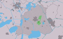
 Location in the former Skarsterlân municipality | |
| Coordinates: 52°57′10″N 5°49′45″E / 52.95278°N 5.82917°E | |
| Country | |
| Province | |
| Municipality | |
| Area | |
| • Total | 7.14 km2 (2.76 sq mi) |
| Elevation | 0.0 m (0.0 ft) |
| Population (2021)[1] | |
| • Total | 555 |
| • Density | 78/km2 (200/sq mi) |
| Postal code | 8506[1] |
| Dialing code | 0513 |
Haskerhorne (West Frisian: Haskerhoarne) is a village in De Fryske Marren municipality in the province of Friesland, the Netherlands. It had a population of around 565 in 2017.[3]
History[edit]
The village was first mentioned in 1333 as Hascherahorna, which means the bend/corner near Oudehaske.[4] In 1523, the Protestant Church was destroyed by Burgundian soldiers. In 1691, the church was replaced, and in 1915 replaced again. In 1840, it was home to 139 people.[5]
Before 2014, Haskerhorne was part of the Skarsterlân municipality and before 1984 it was part of Haskerland.[5]
References[edit]
- ^ a b c "Kerncijfers wijken en buurten 2021". Central Bureau of Statistics. Retrieved 29 March 2022.
- ^ "Postcodetool for 8506AA". Actueel Hoogtebestand Nederland (in Dutch). Het Waterschapshuis. Retrieved 29 March 2022.
- ^ Kerncijfers wijken en buurten 2017 - CBS
- ^ "Haskerhorne - (geografische naam)". Etymologiebank (in Dutch). Retrieved 29 March 2022.
- ^ a b "Haskerhorne". Plaatsengids (in Dutch). Retrieved 29 March 2022.
External links[edit]
![]() Media related to Haskerhorne at Wikimedia Commons
Media related to Haskerhorne at Wikimedia Commons


